| Difficulty | I-III |
| Length | 19 mi |
| Avg Gradient | 14 fpm |
| Gauge | Schoharie Creek at Burtonsville Ny |
| Flow Rate as of 1 hour | 49 cfsbelow recommended |
| Reach Info Last Updated | December 18, 2021 |
River Description
1: Esperance to Burtonville - 4.25 miles
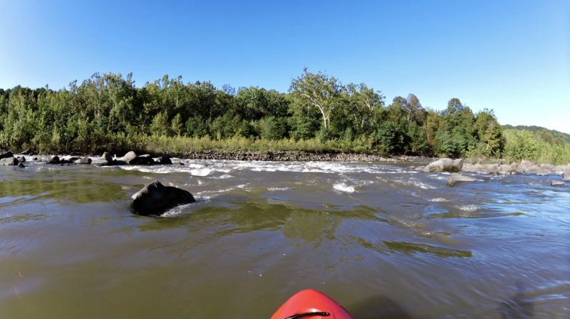
The access point in Esperance is at the end of Steuben St. There is a small dirt pulloff with enough room for around 3 cars, and a gravel path that leads into the water. This section starts with a long section of flat water, but then enters a gorge where the water picks up considerably. It ends with the biggest drops near the Burtonville Bridge. There are 7 distinct river-wide ledge drops, and two solid playspots, including a park-and-play at Burtonville.
---------------
2: Burtonville to Mill Point - 8 miles
The access point at Burtonville is the fishing access next to the Burtonville Bridge. It is a medium sized parking area with room for several cars. From Burtonville to Mill Point there is a lot of class II and some class III (especially as water levels reach 3.0cfs on the Burtonville gage). This is an enjoyable section with beautiful scenery and several sections of rapids. There are the remains of a dam below Lost Valley that provides a wave to surf. Stay river right of the island and there are often waves in the narrow channel. A quarter mile farther, under the 300 foot cliffs there are three small ledges the river drops over. Don't miss noticing the falls coming off the cliff to your left.
---------------
3: Mill Point to Fort Hunter - 6.5 miles
The access point at Mill Point is underneath the bridge. There is a small gravel 'road' leading underneath the bridge with enough room for 3 or 4 cars to park. There is a small pool to put-in or take-out. To join the main flow you'll need to paddle upstream a short way, then run the first rapids underneath the bridge.
This section is milder than the ones above, but still has some solid class II and one that approaches a class III. The first mile will have sets of class I-II, then you'll hit the narrows, a section that is class II+ even at low water levels. Watch out
...River Features
Esperance Access Point
Access PointDistance: 0 mi (approx.)

Put-in is at the end of Steuben St. near Esperance, NY. There is a small dirt pull-off with room for about 3 cars. A gravel path leads into the water.
Ledge #1
OtherClass: IIDistance: 1.5 mi (approx.)
The first of 7 ledge drops on the upper section.
Ledge #2
PlayspotClass: II+Distance: 2.8 mi (approx.)
The 2nd of 7 ledge drops on the upper section. This one is a nice play spot at most levels, with huge eddies on river-right and river-left that let you access the wave-trains down the middle.
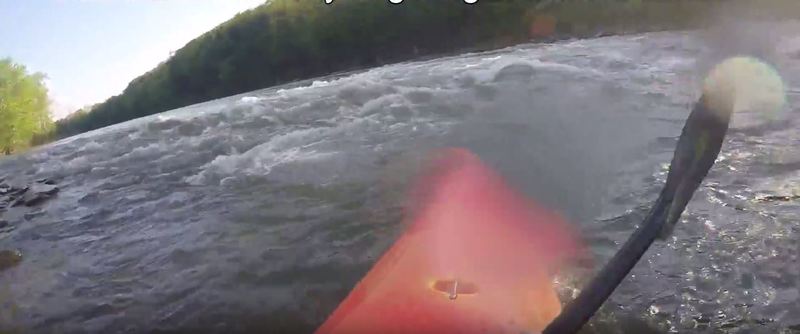
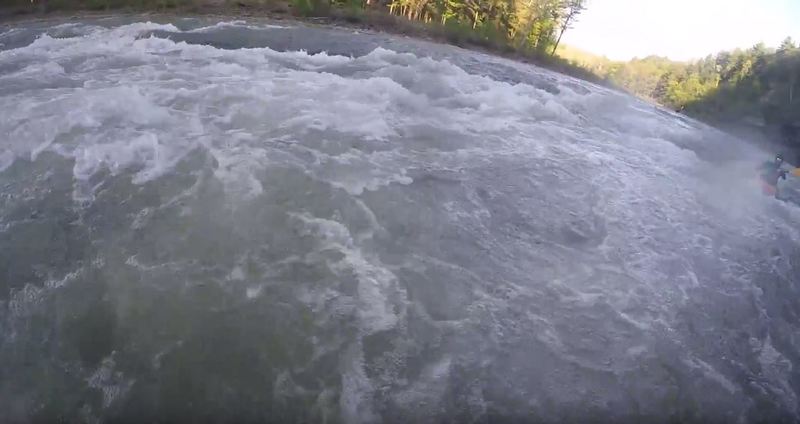
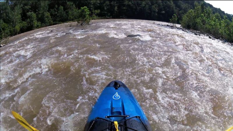
The Gorge
OtherClass: II+Distance: 3 mi (approx.)
Around 3 miles in you'll enter the gorge, a long section of bigger waves and harder water. At low levels there is a mini-ledge before the real ledge #3, don't let it fool you. Beware, the rock walls on river left are undercut in several places.
Ledge #3
OtherClass: II+Distance: 3.5 mi (approx.)
The third of 7 ledge drops on this section. This one occurs in the gorge itself and has wavey water before and after.
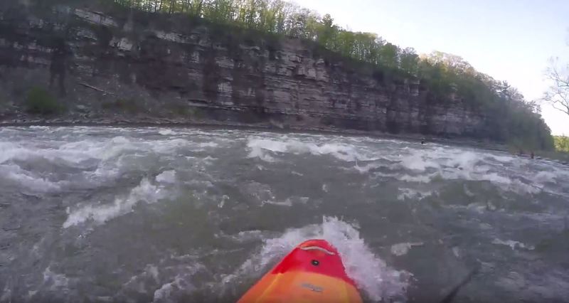
Quadruple Ledges
PlayspotClass: IIDistance: 4 mi (approx.)
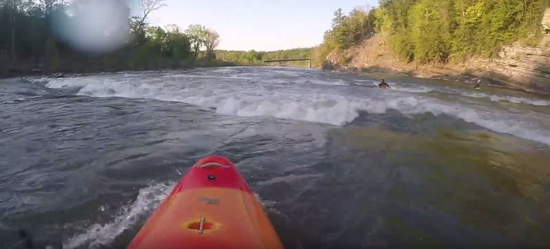
Ledges 4, 5, 6, and 7 will hit in rapid succession as soon as the Burtonville Bridge comes into view. When possible, eddy out between drops to get a clear view of the next ledge. Holes can be grabby at some levels.
Ledge Lucky #7 is a park-and-play spot, with large eddies left and right of the main waves. Park at the Burtonville Bridge fishing access and paddle up. Deep water for safe rolls.
Burtonville Access
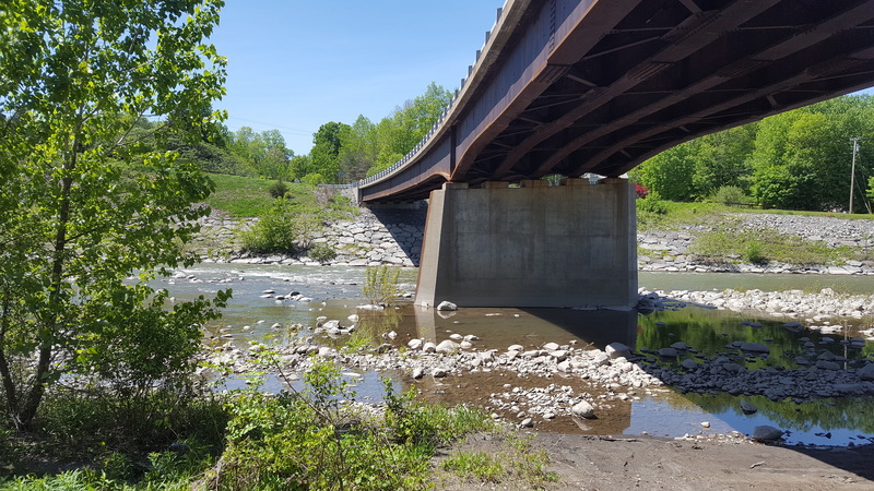
Access PointDistance: 4.25 mi (approx.)
The take-out for the Esperance to Burtonville section, or the put-in for the Burtonville to Mill Point section. It is a fishing access parking lit with space for a few cars, right next to the Burtonville Bridge.
Old Dam
HazardPlayspotDistance: 9.25 mi (approx.)
The remains of an old dam. It is reported that it might be a good play spot.
Rocky Mountain Way
RapidClass: IIDistance: 10.99 mi
Rocky and turbulent, but short (~100 yards) drop. There is a clean line just right of the rock in the center (see attached photo). Scout from the calm pool above.
When you get to the calm water at the bottom, look back upstream for a postcard view of the beautiful Schoharie Valley.
Just Left Chicago
RapidClass: IIDistance: 11.66 mi
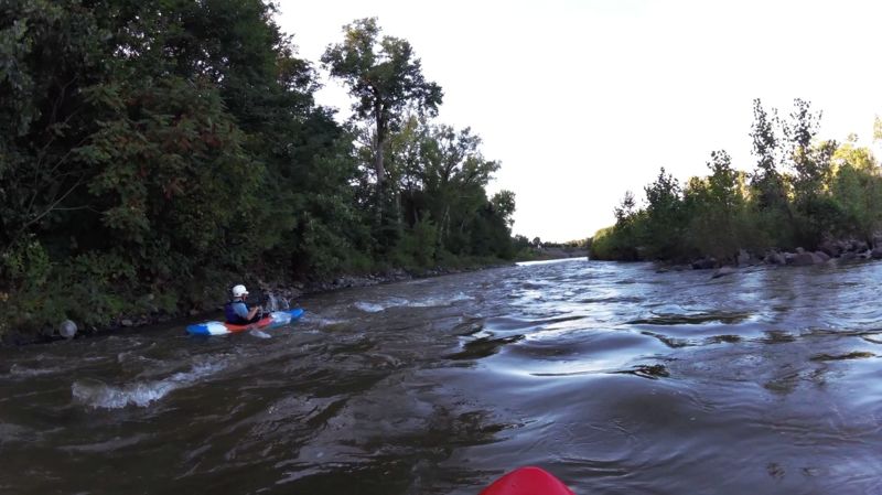
As you come to an island in the middle of the creek, you'll see a dock on river left. Take the left channel around the island near the dock. Fun little class I-II rapid depending on water level. There are a few standing rocks to practice your eddy moves. As you exit the channel, cross the creek to hit the next rapid on river right.
Right Down The Line
RapidClass: IIDistance: 11.88 mi
Stick to the right as the deeper water runs there. Fun rapid, but be on the lookout for a few big rocks. At the end of this rapid the current shifts to river left as the mill point bridge comes into view. It's strong enough at 1500+cfs to push you from the right channel to the left, so be on the lookout for any obstacles on river left.
Mill Point Access
Access PointDistance: 12.25 mi (approx.)
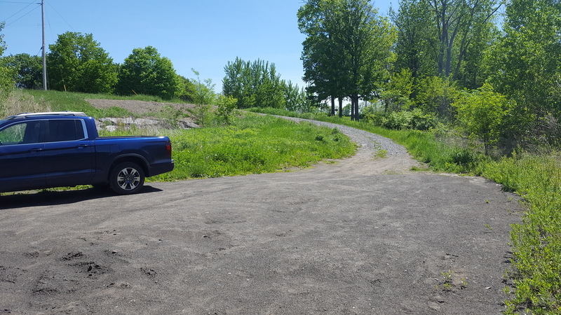
The Mill Point Access is take-out for the Burtonville to Mill Point section, and the put-in for the Mill Point to Fort Hunter section. A small gravel 'road' leads underneath the Mill Point bridge. There is parking for about 4 cars. Put-in at the small pool on river right, paddle upstream to rejoin the main flow, and run the rapids underneath the bridge.
Down On The Corner
RapidClass: IIDistance: 12.98 mi
Class II drop that ends with a 90 degree turn to river right then heads into the next set of rapids.
There are often strainers to the left of this drop, so scout from the calm water at the top, before heading down.
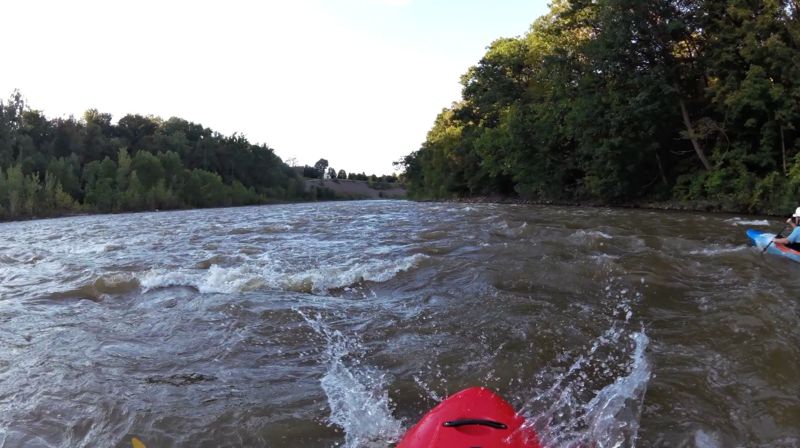
Schoharie Narrows
OtherClass: II+Distance: 13.25 mi (approx.)
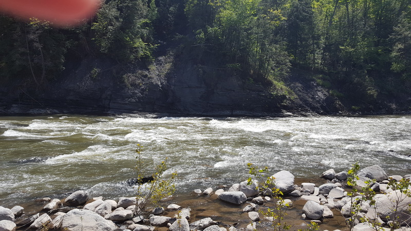
The creek narrows suddenly around a bend. The rapid is fairly straight-forward, but grabby holes can form on river left and center, so scouting from the convenient pull-off on river-right is a good idea.
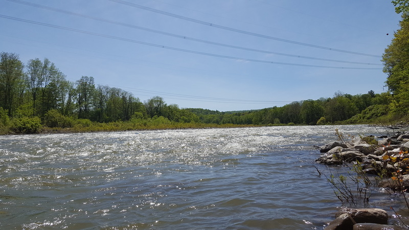
High Voltage
OtherClass: IIDistance: 14.25 mi (approx.)
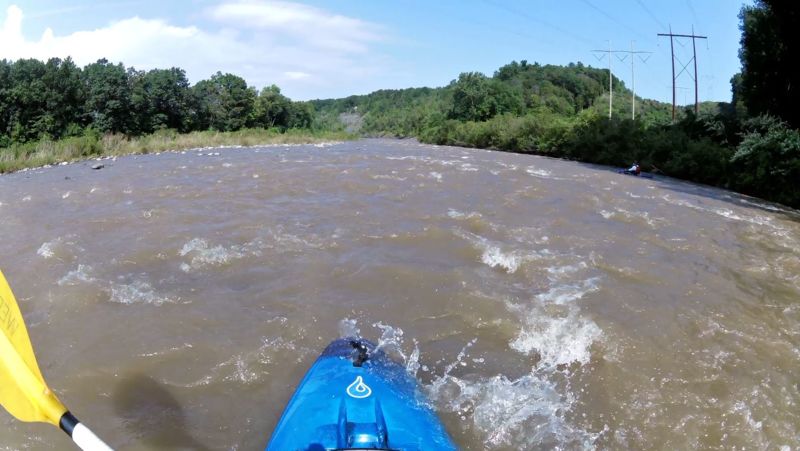
The large powerlines overhead mark the start of a long section of class I-II rapids, one after the other. There are several rock 'islands' in the middle of the creek here. In general, river-left will be the bigger waves and faster water, river-right will be shallower but milder.
Ruined Bridge
OtherDistance: 18.5 mi (approx.)
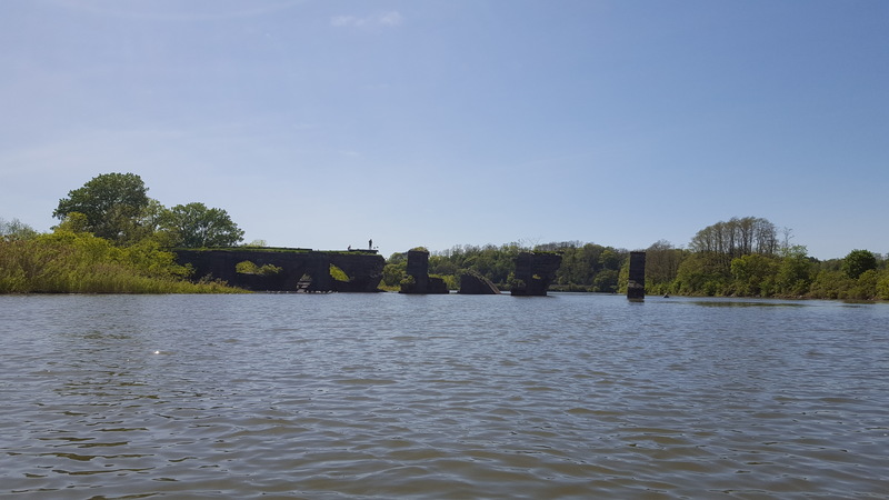
This bridge marks the end of the run. The take-out is just around the corner.
Fort Hunter Access
Access PointDistance: 18.75 mi (approx.)
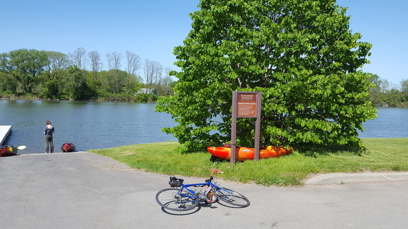
The take-out is at the Fort Hunter boat launch and park. There is a large parking lot for many cars, a playground, picnic tables, and grills.
Trip Reports
Log in to add a reportAJ
Andrew Jones
May 20, 2017
A very nice access point, with a boat dock, ramp, ample parking, a playground, picnic tables, and grills.
AJ
Andrew Jones
May 20, 2017
The creek narrows suddenly around a bend. Most of the water on this section is easy class II, but this rapid is class II+ even at low water. At this level, large holes had formed on river left and center, making river-right the safe path.