Trip Reports
Log in to add a reportOK
fun trip at lower flows - Owen Keal
Apr 12, 2026
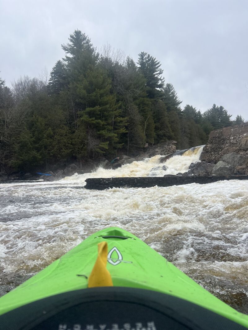
Me and 3 other people ran this section at 2.52 cfs, currently river bank was clear of strainers. I was weary of how low it was but it was actually the perfect level for us, we had 2 beginners who had their first class 3 today and this was the perfect dificulty. starting off under St. Regis falls the calss 2 was a good introductory to the scope of the river. The first falls we walked, we did not feel comfortable punching the hole on the right and could not see a line through the left side. all the class 3 below that till the broken dam was super good. At the dam I walked the left side and that was a good walk to scramble down to the river and everyone else went on the right and one boat fell in the river and somone swam 30 feet to grab it. below the dam was some baller class 3 (I could see how it might class up at higher flows) one we got to the class 2 there were the ocassional large rock with a pillow in front of it and I was yearinng for a half slice. the class one untill the george needed more water but we pushed through. once in the george the rapids were amazing. the rock walls looked blueish and pinkish and the river bed was smooth bedrock. we could see the old tannery from over 500 feet away and there is a small section of flatish water before the tannery with a slide. on the slide half the group went middle through the hole at the bottom at this level there was no issue. the other half of the group went to the far far left where they scraped their way down the slide without a problem. below this to the riverbed was smooth bedrock on all the corners and the waves were ballin. takeout at the Nicholville bridge was saddening becasue there was still more rapids below the bridge. we parked infront of the church in town and had zero issues.
K
Kate
Apr 20, 2014
A group of 6 canoeists + 3 kayakers from Ottawa, Canada ran this on April 19, 2014 at ~3.2 cfs. Lovely day, some snow patches up in the trees, but river banks free and clear of ice and no strainers, etc. Lots of friendly locals, curious about our river run. One local advised us to use an alternate take out a short drive down river from the bridge at Converse Road. Rather than parking @ the bridge (across from an old church), keep driving down river (up over the hill) a few hundred meters to a park with picnic tables, bbq stands, etc. That way you get to run the last few rapids after the bridge, and the river banks are less steep for the take-out.
DH
Dave Howlett
Apr 27, 2013
That strainer above the Nicholsville Bridge (reported below) is long gone now.
CL
Charles Leduc
May 24, 2002
For a free, detailed map of the St Regis (section known as Silver Staircase, from the falls to Fort Jackson), go to www.cartespleinair.org.
The map is in French however (English to come), under 'Canot-Cartes' (Canoe, Maps).
Other river maps you may want to distribute are welcome too.