Rocky Fork Creek
McCoppin Mill Rd (below Rocky Fk Lake Dam) to Paint Creek
| Difficulty | II |
| Length | 9 mi |
| Avg Gradient | 10 fpm |
| Gauge | Rocky Fork Near Barretts Mills Oh |
| Flow Rate as of 54 minutes | 25 cfsbelow recommended |
| Reach Info Last Updated | April 18, 2012 |
This lovely class I-II stream is a gem of central Ohio. The stream is mostly flat in the upper stretches, but with swift current. Be on the lookout for strainers. I am not very familiar with this upper stretch, as many boaters put on below at Barret's Mill Road or at Browning Road.
If paddling the upper stretches, there are two old mill dams that must be portaged. The first is just downstream of the Highway 753 bridge and the second is just downstream of Barretts Mill Road. Check them out first on the map and from the road!
A good put in is on river left, just below the bridge on Browning Road. The landowner (Highlands Nature Sanctuary) has been very kind and co-operative with paddlers, allowing them to park on his property on the downstream side of the bridge. It is critical that paddlers be considerate! Do not park on any cultivated land, don't block the driveway or any cars and do not litter. Be as low key as possible. Such kindly land owners are our best friends! Please leave as few vehicles here as possible as this area is frequently used for hikes for patrons of the sanctuary. Permission can usually be gained to park here at the office near the old 7 caves off cave road. Be aware that it's a privilege extended to us to use this site and not a right.
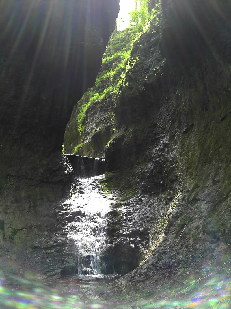
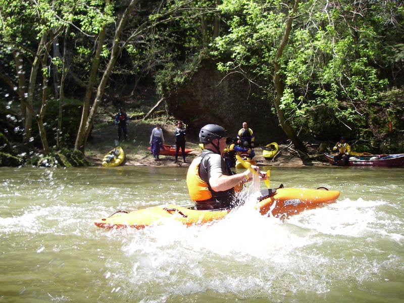
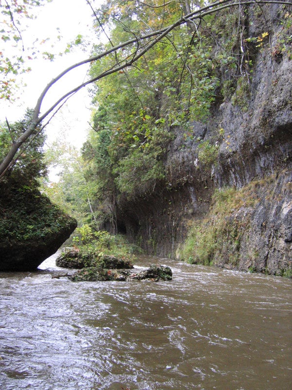
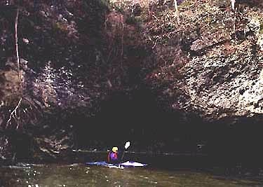
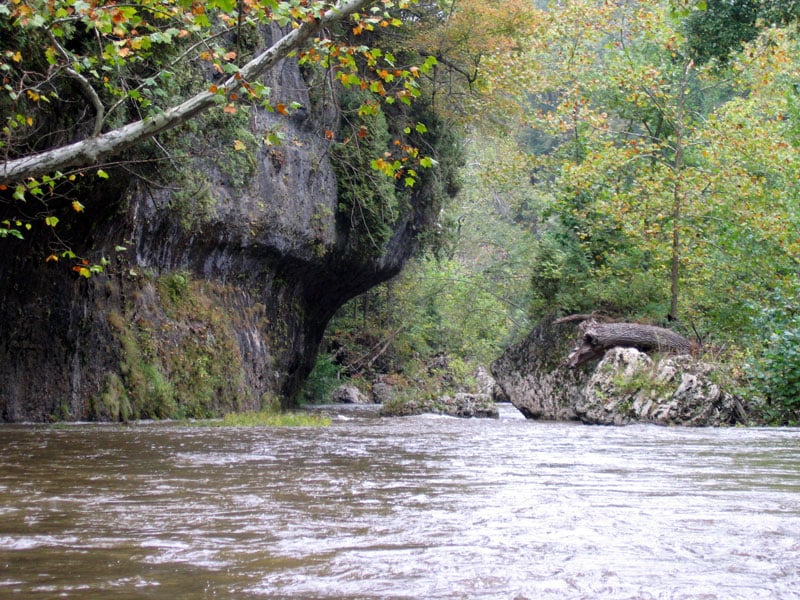
From Browning road, the stream continues to be fast moving with small ripples. Many places exist for the newer paddler to practice eddy turns and ferries, but again, be on the lookout for strainers. Shortly after the put in there is a small ledge which can provide beginners with surfing practice. After this ledge the gradient begins to pick up slightly and the scenery changes from low banks and pasture land to higher banks and eventually limestone cliffs. In the region of the 7 caves the cliffs are spectacular, rising sharply a hundred feet or more over the river. Most folks won't believe they are still in Ohio. Bring a camera.
There are a co
...
The old mill and dam is just upstream of the put in.
There appears to be a large turnout on river left, where boaters can park and access the river. The land may be private, though public land surrounding the reservoir extends very close to here.
As you pass under the bridge for Hwy 753, stay close to shore and prepare to portage a dam.
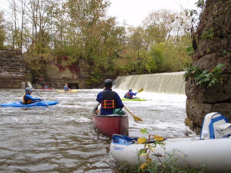
Be prepared to portage a dam just beyond Barrett Mill Road. This is also a common put in spot. Park on river left and launch below the dam.
Alternate acccess. Check with the Highlands Conservancy about parking here. Leave plenty of space for hiking groups to park.
Boaters can take out on river right under the bridge or just downstream. Carry up to parking next to the highway.
Several rapids start just downstream of the the Rapid Forge Road bridge..
The old rest area is now private property but the land owners continue to allow public access from the river. Be considerate and ask permission.
Jun 2, 2020
Ran this over the weekend. Flow was only 147 and it was a nice leisurely float through the gorge. If the water was any lower we would likely have had to portage in a few spots.
Jul 17, 2013
My family and I used two inflatable kayaks (Sea Eagle 330 and 370) to go from just below Barrett Mill dam on Rocky Fork to SR 41 on Paint Creek in Bainbridge. The flow on Rocky Fork was at 150 CFS during our entire run. At that flow I got stuck once in a 3-4 foot section and felt myself scrape over a rock about 5 other times. Paint Creek was at 390 CFS. Same as Rocky Fork, we got stuck a couple of times and hit a few rocks. I am sure my inflatable kayak and my 210 lbs has a deeper draft than most other kayaks. My wife’s boat rarely had any trouble. She and my youngest son did get stuck at the section labeled as “Chutes (Class III, Mile 2.5)” on the Paint Creek page. The flow on the left was fun with plenty of water but not enough water was flowing over the ledge and they missed the left. Luckily, they managed to wiggle over the ledge without getting dumped sideways. The ledge listed on the Paint Creek page as “Falls (Class III+, Mile 6.0)” was the most fun of the day and worth all the paddling in the couple of flat miles leading up to it. We used what was referred to as the “sneak line” on the right and it was clearly the biggest rapid of the day. We intended to use the Church parking as our take out location but they now have it gated. We instead took out on the South side and parked along the access road but very near SR 41 since there are a couple of houses at the end of the road. Once you approach the area one will notice a couple of spots along this section where fishermen have created trails down to the river. Taking out there would be a bit more trouble at higher water levels since the water is flowing fairly fast at the SR 41 bridge. Other than the fast flow near SR 41 the river only offers paddling after the 6 mile ledge for the next 1.5 miles.