Rocky Fork Creek
McCoppin Mill Rd (below Rocky Fk Lake Dam) to Paint Creek
Jun 2, 2020
Ran this over the weekend. Flow was only 147 and it was a nice leisurely float through the gorge. If the water was any lower we would likely have had to portage in a few spots.
Jul 17, 2013
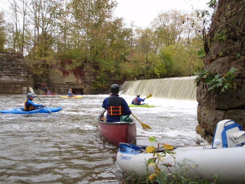
My family and I used two inflatable kayaks (Sea Eagle 330 and 370) to go from just below Barrett Mill dam on Rocky Fork to SR 41 on Paint Creek in Bainbridge. The flow on Rocky Fork was at 150 CFS during our entire run. At that flow I got stuck once in a 3-4 foot section and felt myself scrape over a rock about 5 other times. Paint Creek was at 390 CFS. Same as Rocky Fork, we got stuck a couple of times and hit a few rocks. I am sure my inflatable kayak and my 210 lbs has a deeper draft than most other kayaks. My wife’s boat rarely had any trouble. She and my youngest son did get stuck at the section labeled as “Chutes (Class III, Mile 2.5)” on the Paint Creek page. The flow on the left was fun with plenty of water but not enough water was flowing over the ledge and they missed the left. Luckily, they managed to wiggle over the ledge without getting dumped sideways. The ledge listed on the Paint Creek page as “Falls (Class III+, Mile 6.0)” was the most fun of the day and worth all the paddling in the couple of flat miles leading up to it. We used what was referred to as the “sneak line” on the right and it was clearly the biggest rapid of the day. We intended to use the Church parking as our take out location but they now have it gated. We instead took out on the South side and parked along the access road but very near SR 41 since there are a couple of houses at the end of the road. Once you approach the area one will notice a couple of spots along this section where fishermen have created trails down to the river. Taking out there would be a bit more trouble at higher water levels since the water is flowing fairly fast at the SR 41 bridge. Other than the fast flow near SR 41 the river only offers paddling after the 6 mile ledge for the next 1.5 miles.
Apr 16, 2012
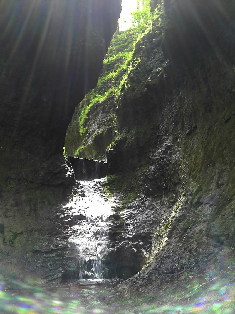
There is one side stream to the Rocky Fork that has some nice waterfalls. This does get enough water to boat when it rains.
Jun 2, 2011
Paddled the entire length of this creek. Note that there are TWO mandatory portage mill dams. I knew about the one at Barrett Mills, but was NOT expecting the one at OH 753. The portage at OH 753 was strenuous to say the least. I would recommend skipping the upper portion and putting in at Barretts Mills as suggested by others on this page, thereby avoiding both dams. The interesting scenery is all downstream of Barretts Mills anyway.
I would also suggest getting input from the folks at Rocky Fork State Park as to whether they are planning any water flow changes at the lake dam in the time frame you are planning to paddle the creek. I watched the USGS gauge, it was reading 600cfs when i left my house. In the hour that it took me to drive there, they had apparently restricted the outflow from the lake, because the flow was down to less than 125 cfs. This made for a rather slow bumpy trip.
Final note: right before you reach the arch, there was a brand new (leaves still green) strainer completely blocking the river left channel (only channel available at low flow). A short portage was required on river right over and under a jumble of logs. At higher flows, this jumble of logs would be blocking the river right channel, so the portage might be a bit more challenging.
Oct 15, 2009
at the put in
Jan 8, 2007
There is a river wide strainer to the left of the last island (just prior to the last rapid) - its clearly visible from about 50 yards upstream allowing plenty of time for action to be taken. The river right channel has been blocked by debris for some time so this necessitates a portage at higher water. Word has it that at minimum you can limbo under the log but at 400 cfs it's touching the river surface or below the majority of the way across. There is a small eddy on the island just above it to make a short portage but the water can be moving swiftly here so be careful. The area under the log is mostly clear so it is possible to swim underneath it if you get blindsided by it.
May 18, 2006
I spoke with the Army Corps of Engineers about how to obtain a special release from Rocky Fork Lake. I had always heard that for $50, any group could get together and get a release scheduled. This is not true at all...or not any more at least. Here is the info that I got...
The Nature Conservency owns the majority of the land throughout Rocky Fork Gorge. Due to some form of mussles that are living in this stream, The Conservency does not want the lake releasing water into what was originally a natural flow only streambed. So the two groups have worked together to come to an agreement. There are three weekends per year that Rocky Fork will release water. If I recall correctly, these dates are in March, May and October and are specifically for recreational paddlers and beginner clinics through Outdoor Adventure Club in Dayton and a club out of Columbus. There is no longer any way to obtain a special release. The remainder of the year, Rocky Fork runs under natural flow only.
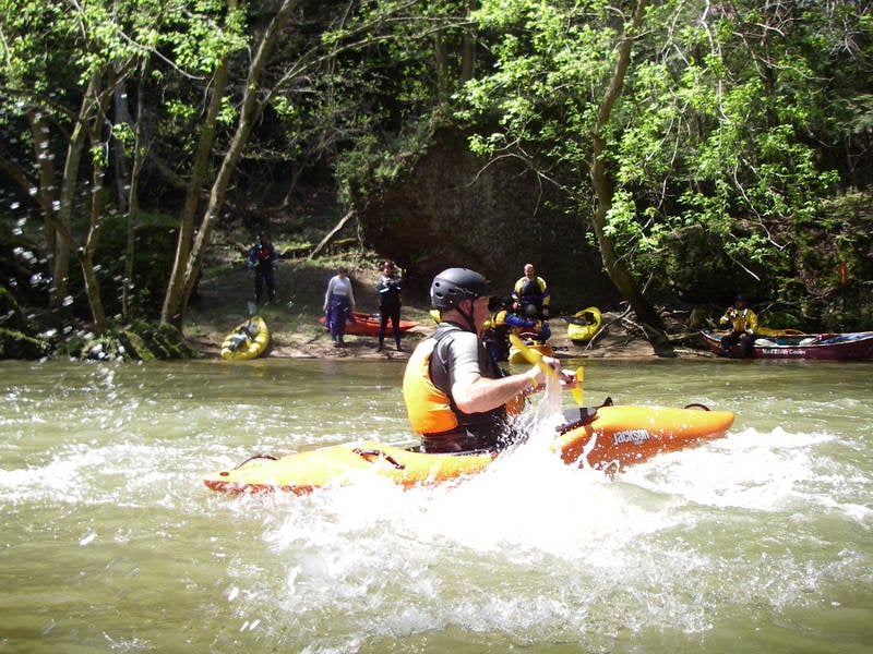
This is a beautiful stretch of class I-II stream and is certainly worth the time and effort to paddle it. Just dont expect much in the way of whitewater. The scenery is, at points, absolutely breathtaking and is extremely unique to Ohio. Its great for beginners and the nice pools offer up opportunities to work on obtaining a roll.
Be sure to bring a camera on this stretch of stream...you will want it! And once you are off the river, take the time to visit 7 caves and make a full day out of your trip into the farmlands of Ohio....there is very little else around there other then Rocky Fork lake and Paint Creek lake which are about 10 minutes apart.
Apr 23, 2006
USGS reporting for Ohio was offline this day. Bridge gauge on Browning Road was around 5'.
Oct 8, 2005
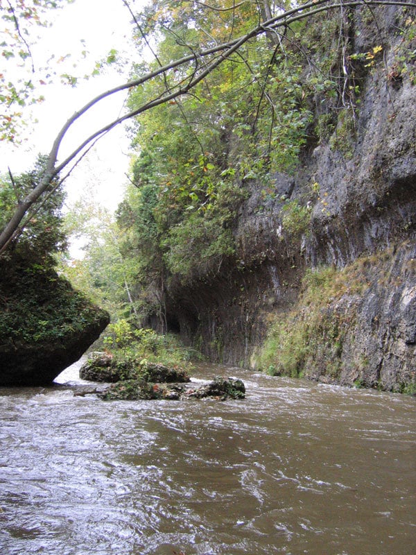
Nothing more than a few class 2ish wave trains at this level, but the scenery is worth it.
Rapids never get above class 1 or easy 2 at this level, but wow it's gorgeous.
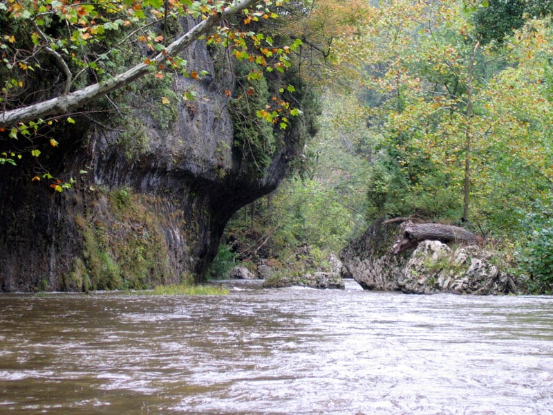
There's miles of stuff like this.
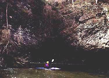
Shot upstream from eddy inside the natural arch.
One of the prettiest spots to paddle through in OH, if you ask me.
Random paddler going through the arch, to give a sense of proportion.
Jan 1, 1900
The Creek actually goes under an arch - almost a cave, before opening up to the high cliffs of the 7 caves region of Rocky Fork