Sandusky
2. Former Ballville Dam to Don Miller Memorial Park(Haunted Hydro Section)

| Difficulty | II(III) |
| Length | 0.7 mi |
| Avg Gradient | n/a |
| Gauge | Sandusky River Near Fremont Oh |
| Flow Rate as of 25 minutes | 174 cfsbelow recommended |
| Reach Info Last Updated | August 2, 2025 |
The Ballville Dam was removed in 2018. In its place stands an ice control structure that also serves as a large debris catcher. This structure now marks the starting point of a short, enjoyable, and beginner-friendly stretch of river.
The Maumee River is only 30 minutes away and has a fun 5 mile run or Park and Play at Turkyfoot.
The Upper Sandusky River at Tiffin is only 15 minutes away and is usually more fun. Tiffin also has Park and Play at Huss Street .
The put in is street parking infront of the AEP Ohio building: 1408 Oakwood St, Fremont, OH 43420
Parking is located in front of a gate along the roadside, which was installed to prevent vehicles from accessing the riverbed. This access point was originally used for heavy equipment during the dam removal. Simply park near the gate, walk around it, and follow the trail down to the river. GPS Coordinates for the Gate Access Point: 41.327051341108934, -83.13359784968422
Before the Ballville Dam was removed, it played a critical role in breaking up upstream ice before it reached downtown Fremont. To prevent future ice jams, an Ice Control Structure was constructed just downstream prior to the dam’s removal.
Today, this structure doubles as a highly effective debris catcher—particularly for trees floating downriver. Credit where it’s due: local authorities have done an excellent job of cleaning debris off during low water conditions, ensuring it remains functional and safe.
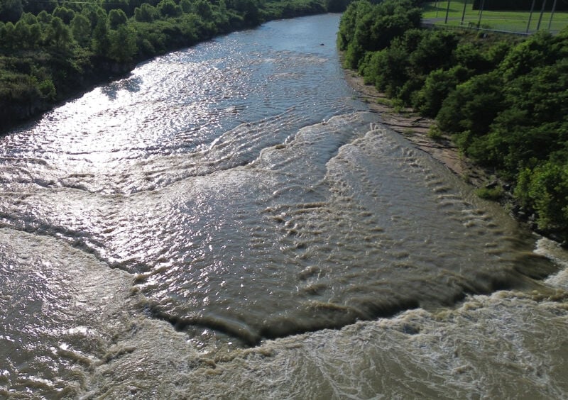
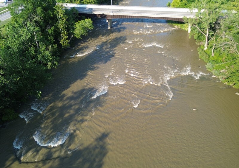
Dam. What Could Have Been.
What remains here appears to be the remnants of the Ballville Dam. The river left side seems to have portions that act like a small low-head dam—though it’s unclear whether this is part of the original structure or a natural ledge the dam was built on. The river right side has a much gentler gradient. I haven’t investigated it much, so more exploration is needed.
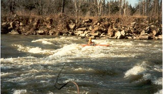
That said, there are surf opportunities at the right levels if you’re willing to experiment. Just keep an eye out for changes in flow and always scout before you drop in.
On any other river, this would just be called Surf Lab. But in Fremont, things are… different. Here, the Haunted Hydro casts its shadow over the river, and the waves brew strange energy.
Welcome to Paddler’s Cauldron—a place for experimentation. Throw in odd lines, unusual angles, and a pinch of nerve. Stir it all together and hope you conjure up the perfect surf. Or at least survive the spell you cast.
Whatever you do, don’t forget: around here, the river doesn’t just test your skills—it tests your soul.
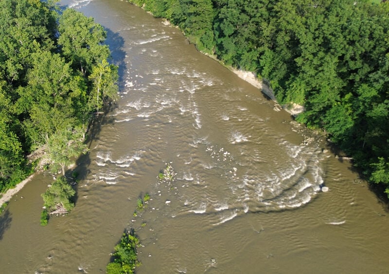
What is the Haunted Hydro, you ask?
It’s the old generator house that once powered by the dam. Active from 1911 to 1943, is was supplied with water from the Ballville Dam via a large steel pipe along the left bank. After decades of silence, it was resurrected in 1989—not as a hydro plant, but as a haunted house. Every fall, it still comes alive with screams and fog, becoming one of the most iconic haunted attractions in Ohio.
It looks promising—you want it to be good. It should be good. But when you finally drop in… it just doesn’t hit. Like a haunted house jump scare that had all the right setup, but somehow falls flat.
This is the whitewater equivalent: all bark, no bite. A wave with potential that never quite delivers.
Boo...😔...Hope you enjoyed the ride—because it’s all snooze from here.
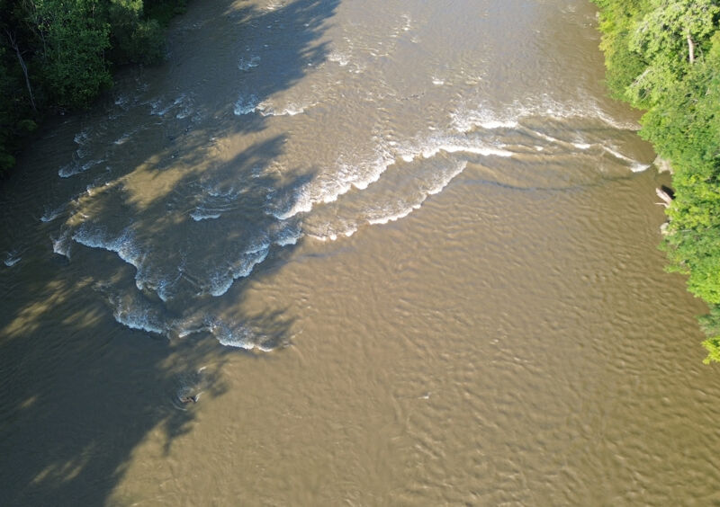
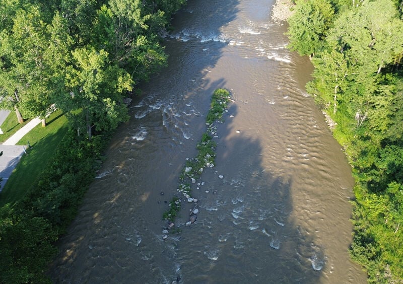
Pay your toll by catching one last surf opportunity.
As you approach the bridge, the river serves up one last playful wave—your last chance to show off before the run ends. Miss it, and the troll gets your style points. Catch it clean, and you just might earn safe passage… for now.
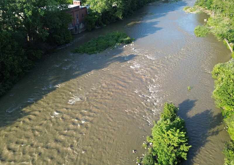
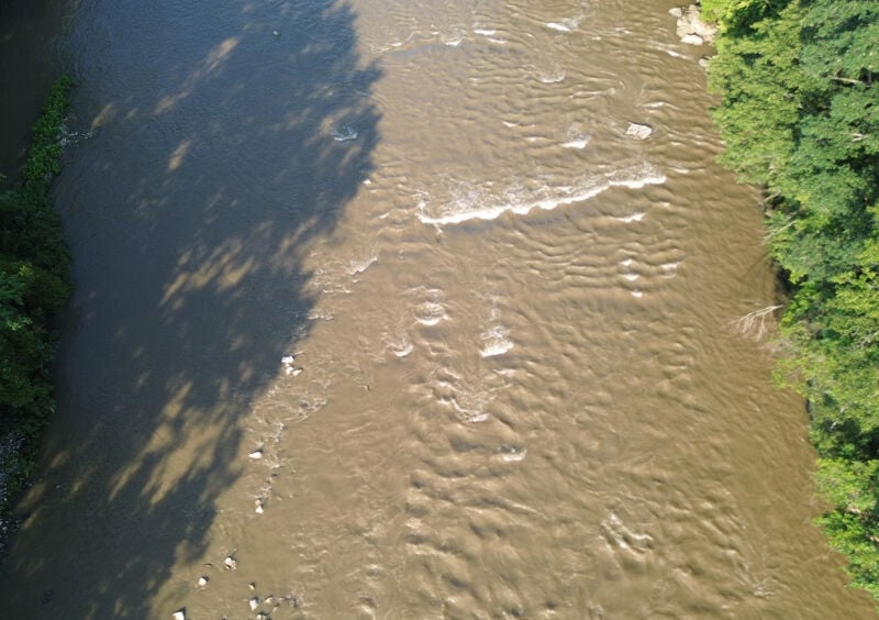
Thought there was going to be a super cool wave here? Sorry to disappoint. It’s called Haunt Hole because the river gets unexpectedly deep next to the Haunted Hydro. Rumor has it, there’s still a void in the riverbed from the old power generation days—a ghost of the hydroelectric past lurking beneath the surface. Spooky, but not surfy.
One final chance for a little entertainment—very little. Like a haunted house with the lights on, it’s more about the vibe than the thrill. Don’t expect much, but hey… it’s your last shot before the show’s over.
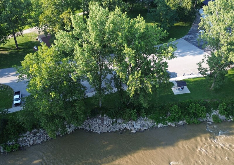
Take out at Don Miller Memorial Park: 1329 Tiffin St, Fremont, OH 43420
GPS Coordinates: 41.329183768097614, -83.12173051342005
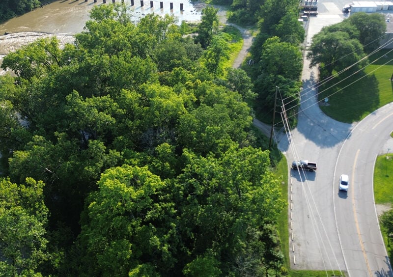
Side note: This was once Thornwood Golf Course.
Aug 2, 2025
Apr 2, 2020
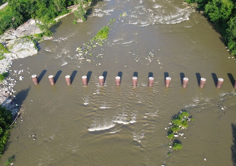
Ballville Dam was (indeed) removed in 2018. A drone video of the river is available. This link will skip the lower part of the river, starting where more ledgy whitewater is prevalent, and continuing to the site of the dam (where you will see circular pillars still in the river): https://youtu.be/I\_WwDw8NSYM?t=225
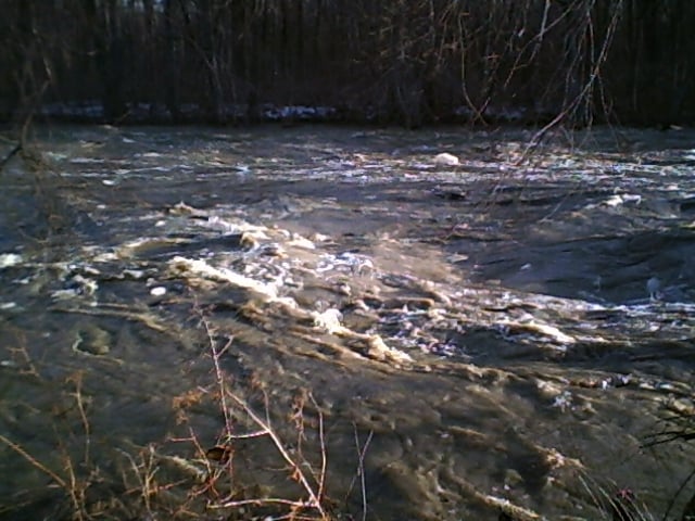
Feb 20, 2011
Checked out the run from the dam to the golf course, and the last wave train before the takeout looked like Alaska big water. Standing waves were six or seven feet tall, and were unrunnable in anything but a raft. Islands were washed out, and the river was at flood stage, but it was a hell of a sight.