Clackamas
3. Three Lynx Power Station to North Fork Reservoir
| Difficulty | III-IV |
| Length | 14 mi |
| Avg Gradient | n/a |
| Gauge | Clackamas River Above Three Lynx Creek, or |
| Flow Rate as of 34 minutes | 640 cfslow runnable |
| Reach Info Last Updated | May 17, 2026 |
The Clackamas River is one of the Pacific Northwest’s most beloved whitewater rivers—renowned for its clear water, lush forests, and a mix of Class III runs ideal for intermediate paddlers along with tributaries that offer challenging Class V whitewater. The river is also part of the National Wild and [...]Read More
The Clackamas River is a classic whitewater run of the Pacific Northwest with great class III whitewater and reliable flows.
In December 2010 Portland General Electric (PGE) was issued a new license for operation of the hydropower project on the river and American Whitewater was a formal participant in that process, advocating for river and fisheries restoration, improved public access to the river, enhanced and expanded gage information, and other measures to mitigate for the impacts of the project.
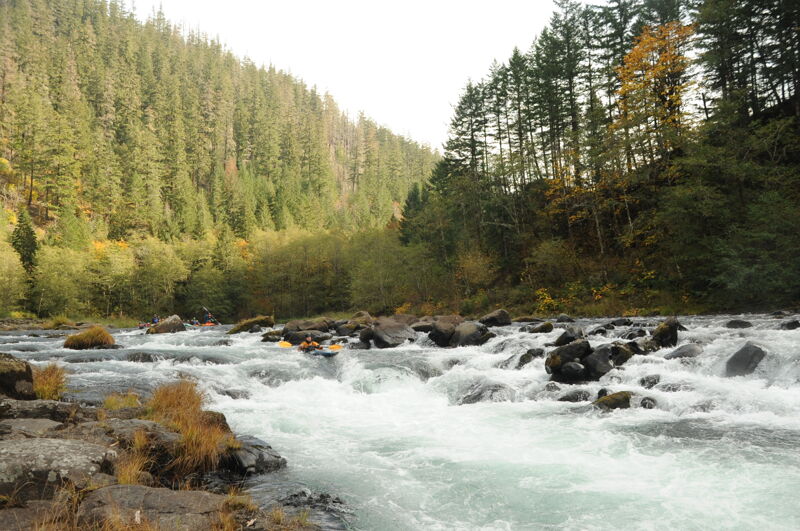
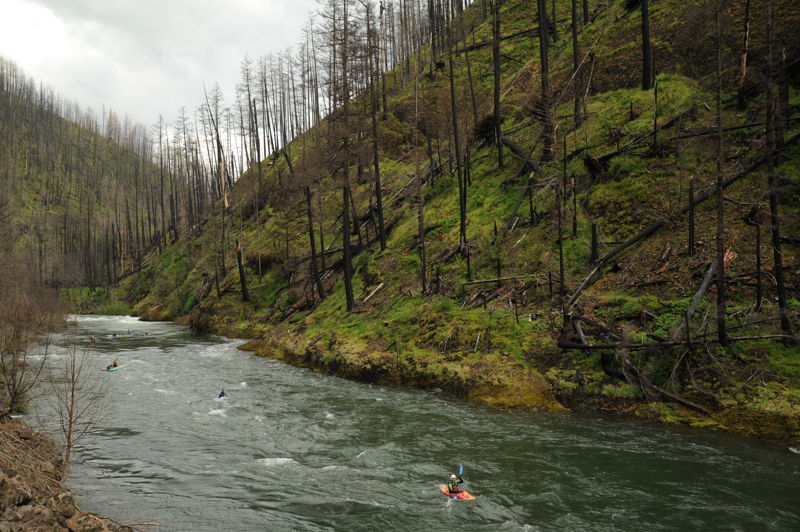
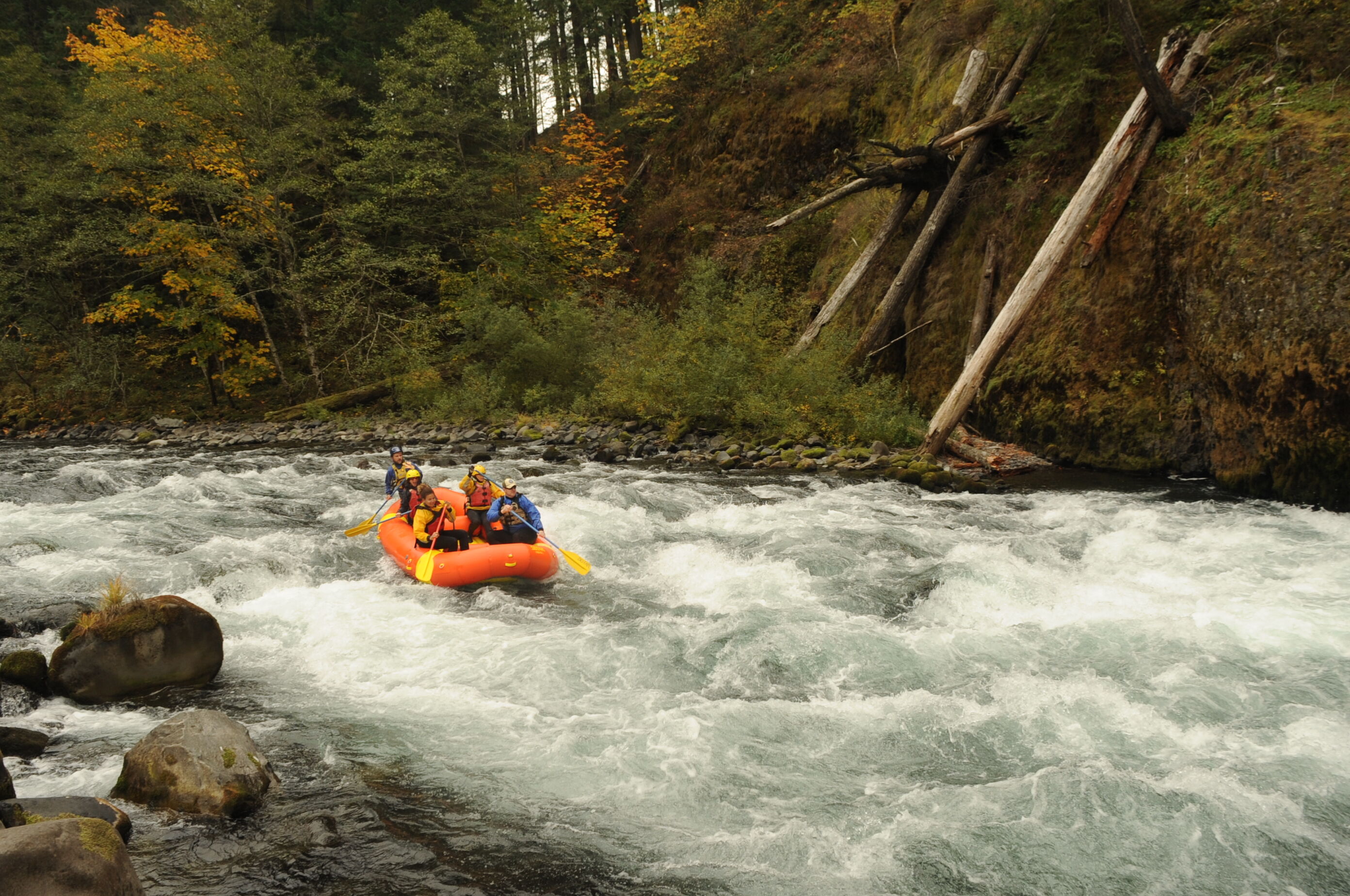
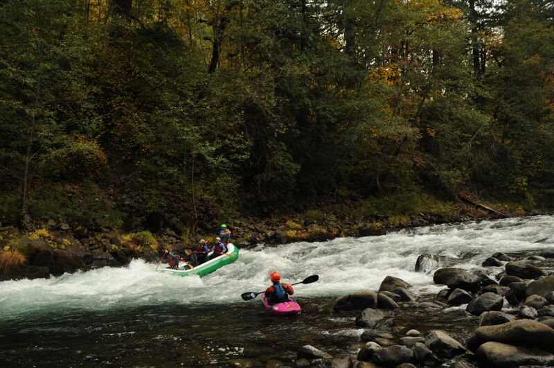
When paddlers refer to the Upper Clackamas they mean the river section upstream of North Fork Resevoir. The run from Sandstone Bridge (historically referenced as Three Lynx) down to Big Clif comprises the entire 13.5 mile run. Most paddlers do shorter sections, especially when the water drops under 1200-1500cfs. The two most popular sections are known to locals as the Confidence Run (class II, from below Toiletbowl or Moore Creek to Memaloose or Big Cliff) and the Carnage Run (class III, from Hole in the Wall to Moore Creek).
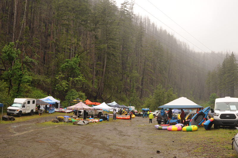
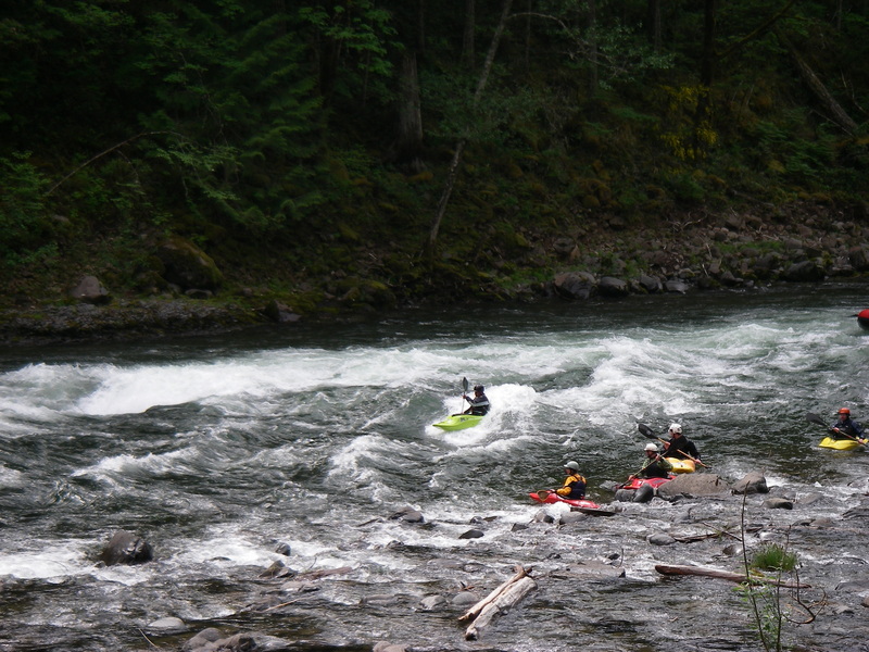
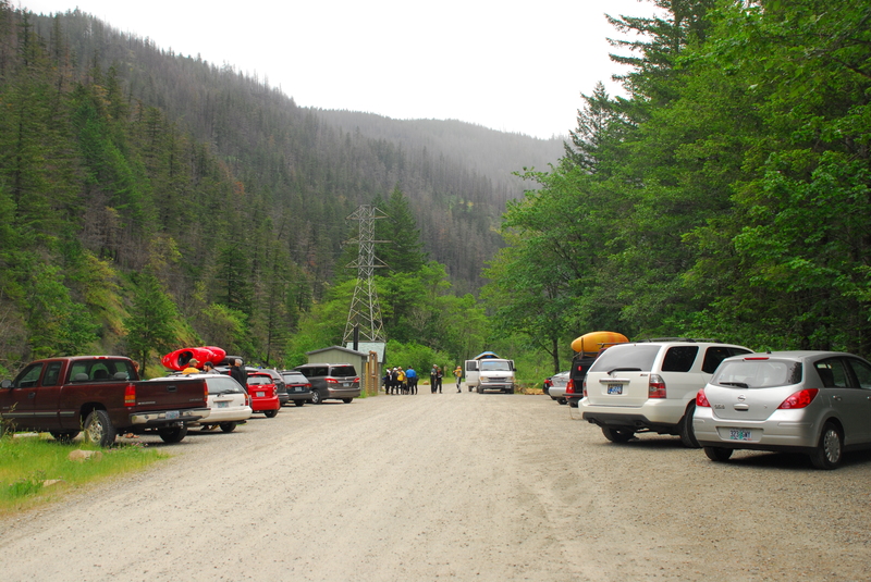
The annual Upper Clackamas Whitewater Festival takes place in May every year. The festival site is in a large river left parking area adjacent to Carter Bridge. The most exciting viewpoint for the majority of events is at Carter Rapid, just upstream from the bridge.
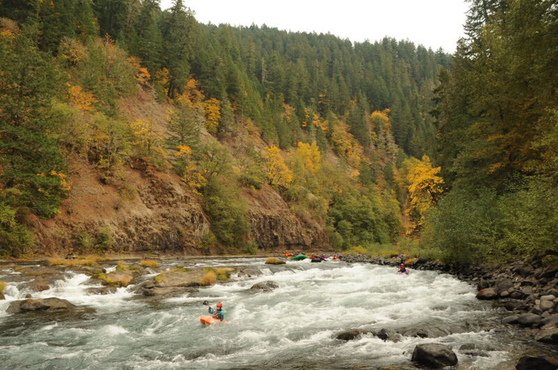
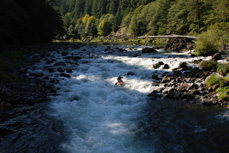
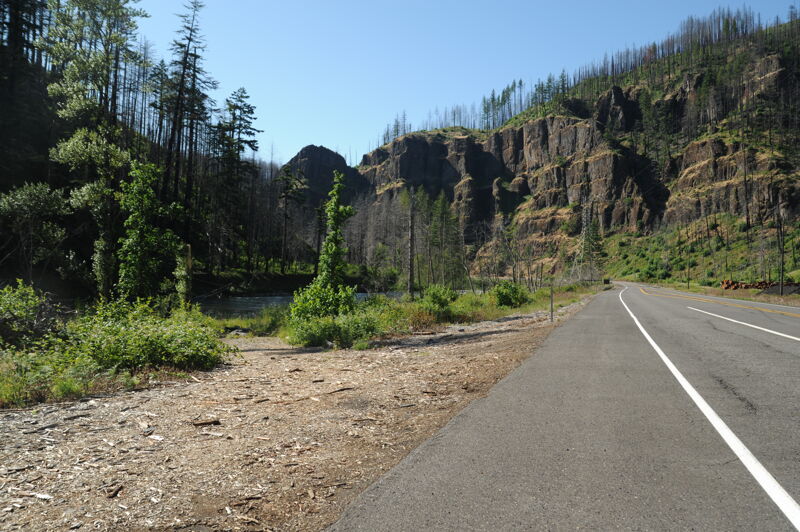
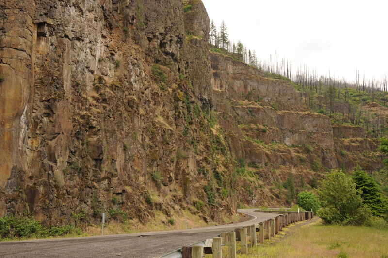
The character of the run is pool-drop class III rapids which can develop class IV hydraulics as the river rises during intense winter storms or strong snowmelt. Consistent flows are available year-round with rain in the winter, snowmelt in the spring and year-round springs that keep flows boatable all summer and fall. The river drops low in the summer, but many enjoy the technical boating and a wonderful escape into the National Forest just an hour from downtown Portland. Highway 224 follows most of the river which makes scouting easy, but the road disappears from view once you are on the water. Even after the changes wrought by wildfire in 2020, t
...
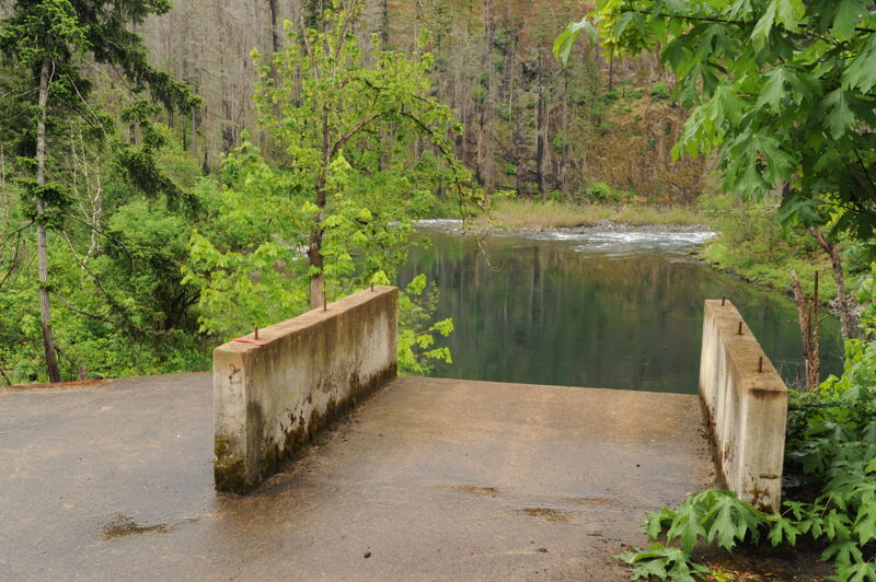
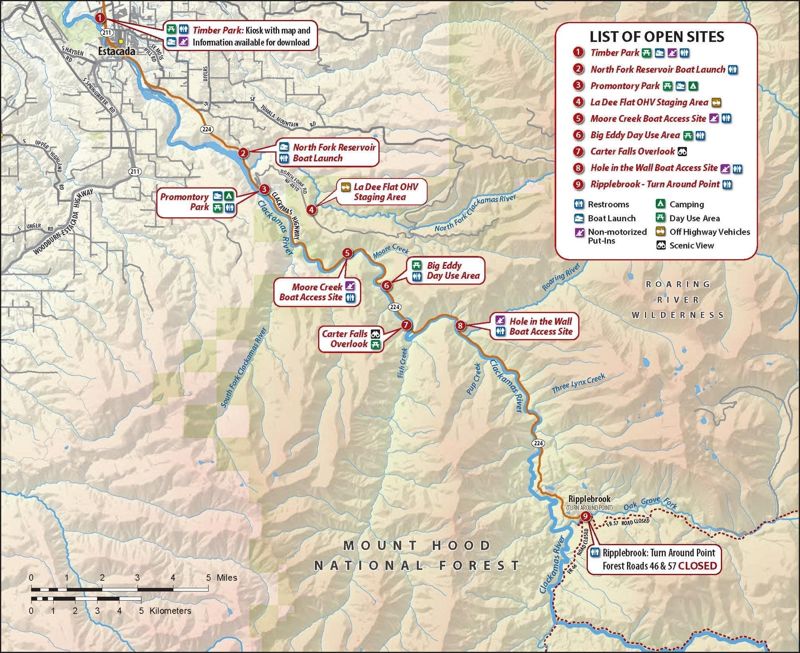
Sandstone Boat Access Site is located at Highway 224 mile 45.7 on the upstream river left side of the Sandstone Bridge and above the Three Lynx powerhouse. The site provides formalized river access and a moderate amount of parking for boaters using the upper Clackamas River and is suitable for all craft types, though it is less commonly used during low-flow periods. River access improvements were completed in 2016. The facility was developed and is maintained by Portland General Electric as a condition of the Clackamas Hydroelectric Project license. American Whitewater worked during the hydropower relicensing process to help secure and formalize this public river access site.
A fun rapid just upstream of the Three Lynx Powerhouse that can get a little boney as flows drop. You typically get more water as you pass the powerhouse at the downstream end of this rapid.

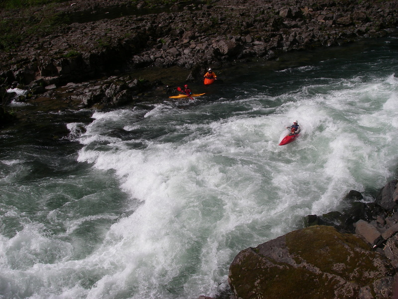
One of the more beautiful spots on the river where basalt walls on either side constrict the river as it flows through a short gorge.
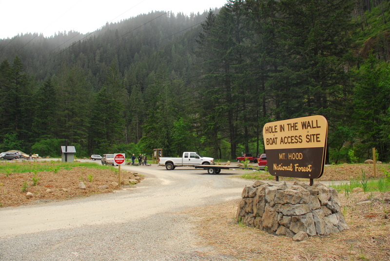
Hole in the Wall Access is located at Highway 224 mile 41.0 on river right a short distance downstream of the Roaring River confluence. The site is a well-developed river access point opened in 2016 and managed by Portland General Electric for river runners, with a restroom facility and a good raft slide and launch area. It provides easy access for rafts and smaller craft and is a common put-in for the “Carnage Run,” particularly at lower flows or when playboating conditions are preferred. If the main raft launch is congested, kayakers can use a short trail at the downstream end of the site near the entrance to reach an alternate launch. American Whitewater worked to help formalize this site during the Clackamas Hydroelectric Project relicensing process, and the facility is developed and maintained by Portland General Electric as a license condition.
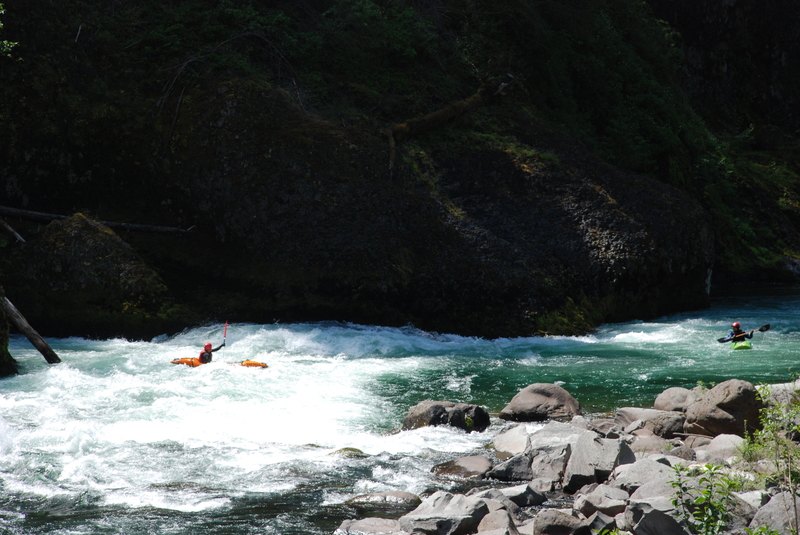
This rapid can develop a recirculating eddy on river left as flows increase that has caused trouble for many. Run right and stay away from the wall to avoid. Check it out on the shuttle and if you have doubts you can always put-in downstream at Fish Creek Access.
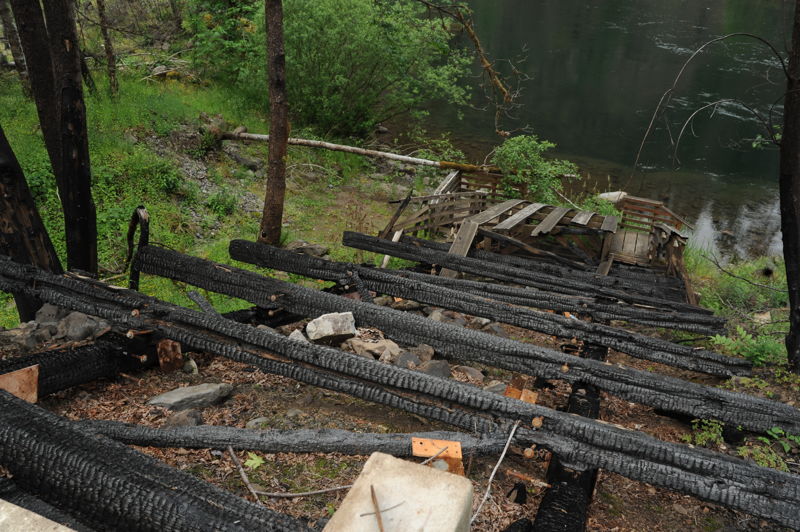
Fish Creek Access is located at Highway 224 mile 39.2 and provides marginal river access for boats that can be shouldered as of 2026. From Highway 224, turn onto Fish Creek Road and continue approximately 0.2 miles to the bridge, where roadside parking is available on river right before crossing. Access to the river is via a descent on river right on the downstream side of the bridge. The former boat ramp on river left (across the bridge) was destroyed in the 2020 Riverside Fire and has not been replaced, but is scheduled to be rebuilt. Over the years the site has had recurring issues with vehicle break-ins.
Located just downstream of the pool formed at the confluence with Fish Creek.
Rapid at the approach to the bridge typically run down the right.
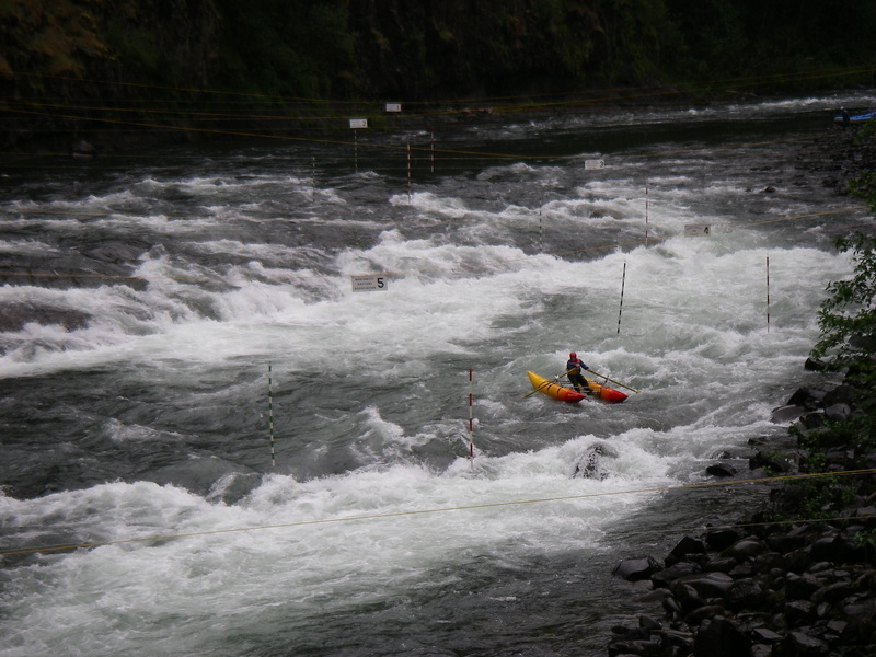
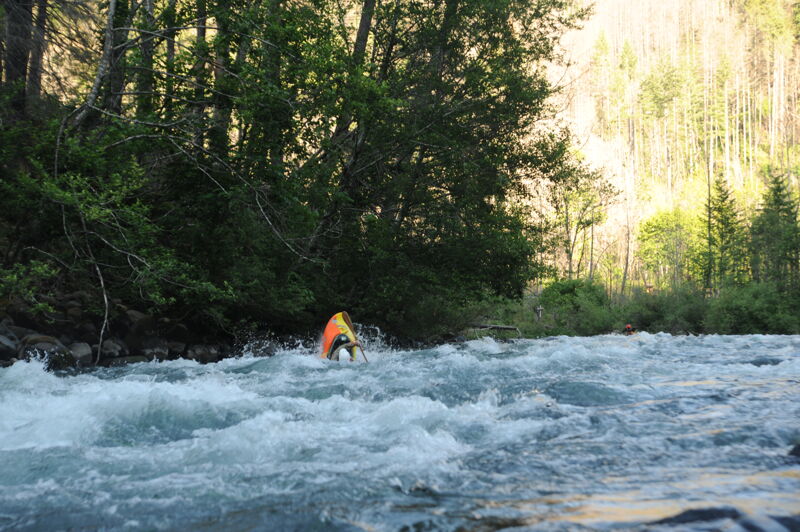
A fun rapid and the site of many of the competitions for the Upper Clackamas Whitewater Festival. The main flow is down the left which is generally the preferred line. Beware of the ledge to the right side of the rapid which comes in play as flows increase.
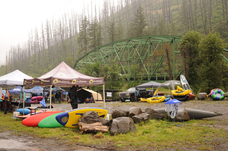
Carter Bridge is located at Highway 224 mile 38.8 and provides river access on the downstream river left side of the bridge, just below Carter Bridge Rapid. The site offers unimproved access for rafts and kayaks, though the bank is steep and rocky. This location is also the primary site for the Upper Clackamas Whitewater Festival.
Run down the main flow on river right through the big waves. Avoid swimming in the eddies against the right wall, at least at higher flows.
Big Eddy is located at Highway 224 mile 37.4 and provides river access on river right via a good trail to the river above Toilet Bowl. The site offers easy access for kayaks and can be used for raft take-outs with some effort. Rock and Roll Rapid is located immediately downstream of this access point.
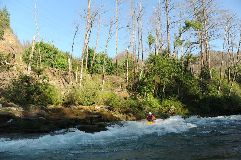
The last major rapid on the run with some big waves that can be a lot of fun.
There is a steep but decent trail to the river from the small parking area.
Below Toilet Bowl is located at Highway 224 mile 37.0 and provides river access via a roadside pullout with a short, primitive trail to the river on river right below the Toilet Bowl rapid. The site offers limited, unimproved access and serves as the highest possible put-in for the “Confidence Run,” providing an alternate start above Bob’s Hole
In the heyday of whitewater rodeo, this was a popular playspot and the site of Bob's Hole Rodeo. The feature has changed over the years but it is still good fun for playboating. Historically it was a park-and-play site but parking in this area at Highway 224 mile 36.7 has been closed due to unstable hillslopes and chance of rock fall.
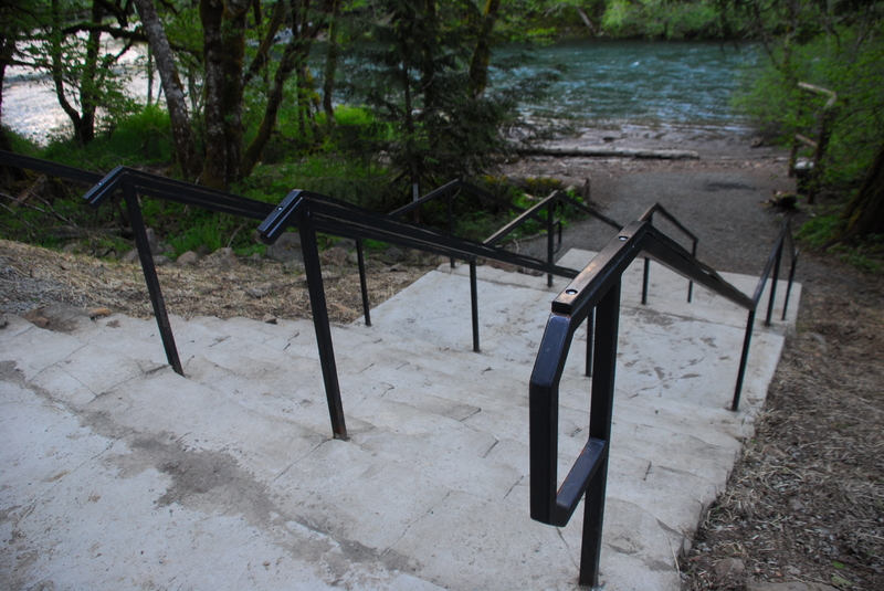
Moore Creek Access is located at Highway 224 mile 35.3 on river right and was opened in 2015 as a managed river access site for Clackamas River boaters. The site provides the best raft access on this reach and is the most common meeting point for trips on this section of the river. It serves as a standard take-out, with a wide switchback trail suitable for rafts and a steeper, more direct route from the river commonly used by kayakers, and it can also function as a put-in for beginner floats. It is the usual take-out for the “Carnage Run” and a possible put-in for the “Confidence Run.” The facility includes changing rooms and restroom amenities and is developed and maintained by Portland General Electric as a condition of the Clackamas Hydroelectric Project license, with American Whitewater having worked to help formalize the site through the relicensing process.
Memaloose Weigh Station is located at Highway 224 mile 33.5 and provides river access on river right with parking located on the far side of the highway from the river, requiring a crossing of the roadway and caution due to fast-moving traffic. The site can accommodate rafts and is the last raft-accessible take-out before the slackwater of North Fork Reservoir, and it is commonly used as the take-out for the “Confidence Run.” Historically, this was an active log scaling station during periods of intensive federal forest logging, and today it serves as a meeting point for boating groups and a transition to the flatwater reach downstream toward Promontory Park, which has become increasingly popular for mellow paddling. USGS RM 35.2.
Big Cliff take-out is located at Highway 224 mile 33.0 on river right at a large pullout on the outside of a bend in the highway. It is the last take-out on the Clackamas River before the slackwater of North Fork Reservoir. The site provides access for hand-carry craft but is not optimal for large rafts. This access is sometimes used as a take-out for the “Confidence Run.”
May 15, 2026
It was a fun weekend at the Upper Clackamas Whitewater Festival. Water was at the lower range of flows but still pretty fun. I got on the river with a group of packrafters from Hole Creek down to Hole in the Wall.
May 17, 2025
The 2025 Upper Clackamas Whitewater Festival had low flows and consistent rain throughout the day but participation was high and everyone was out having a good time ont the water.