John Day, N. Fork
2. Dale to Monument
| Difficulty | II(III) |
| Length | 42 mi |
| Avg Gradient | n/a |
| Permit | Self-issued paper permits at Monument and Camas Creek Kiosks |
| Gauge | North Fork John Day River at Monument, or |
| Flow Rate as of 48 minutes | 57 cfsbelow recommended |
| Reach Info Last Updated | March 2, 2023 |
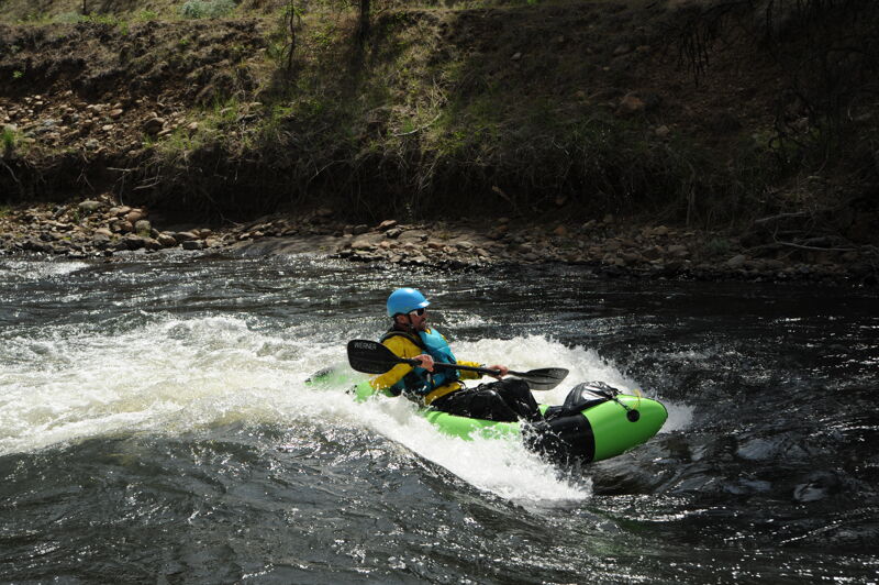
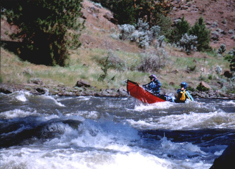
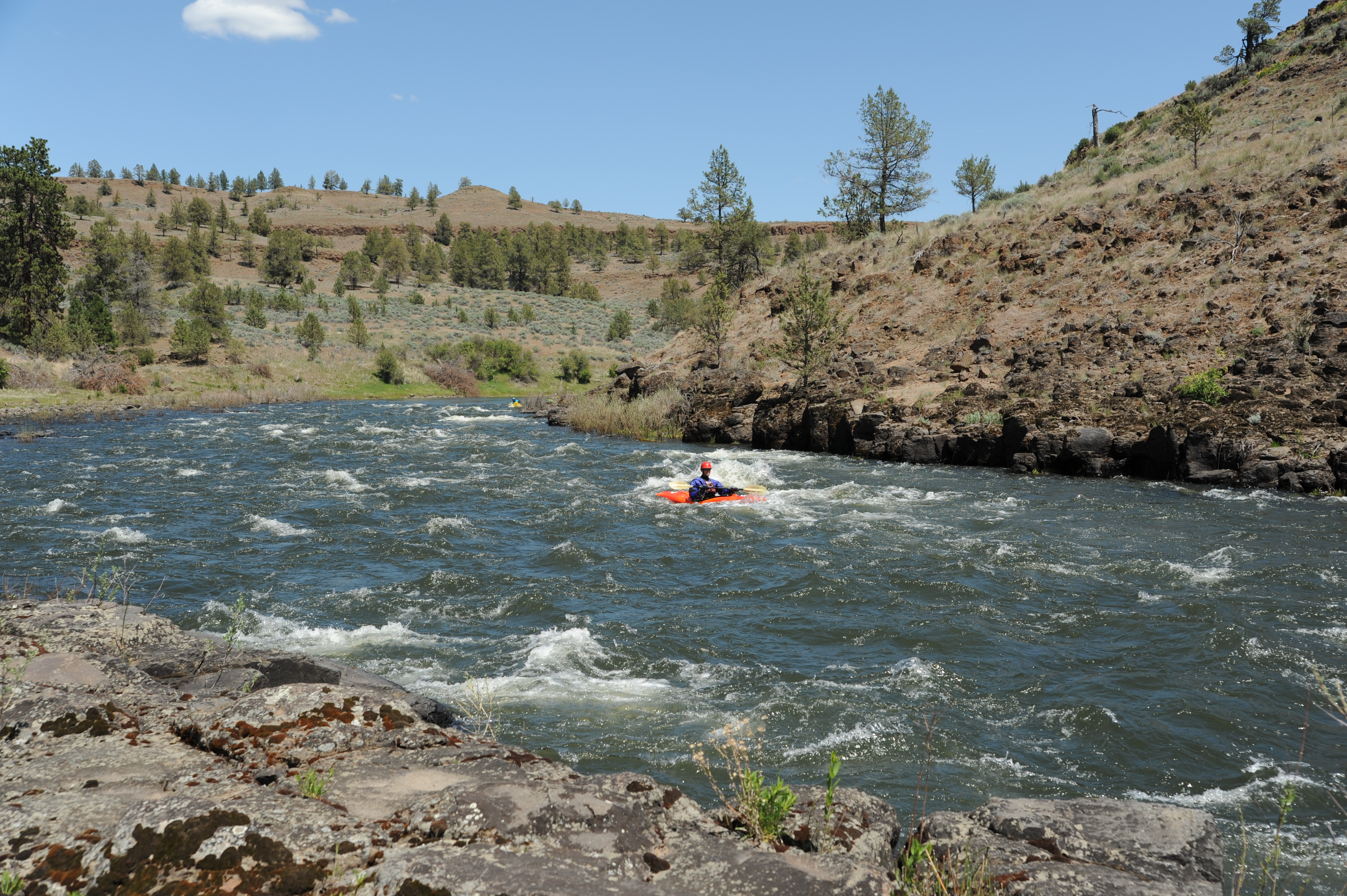
The North Fork John Day is a wonderful multi-day whitewater run suitable for intermediate paddlers that is typically run over 2-3 days. Rafts, kayaks, and inflatable kayaks are all popular but this is also a great run for experienced whitewater canoeists. Because this is a good weekend trip, consider a weekday trip if you want to encounter fewer people.
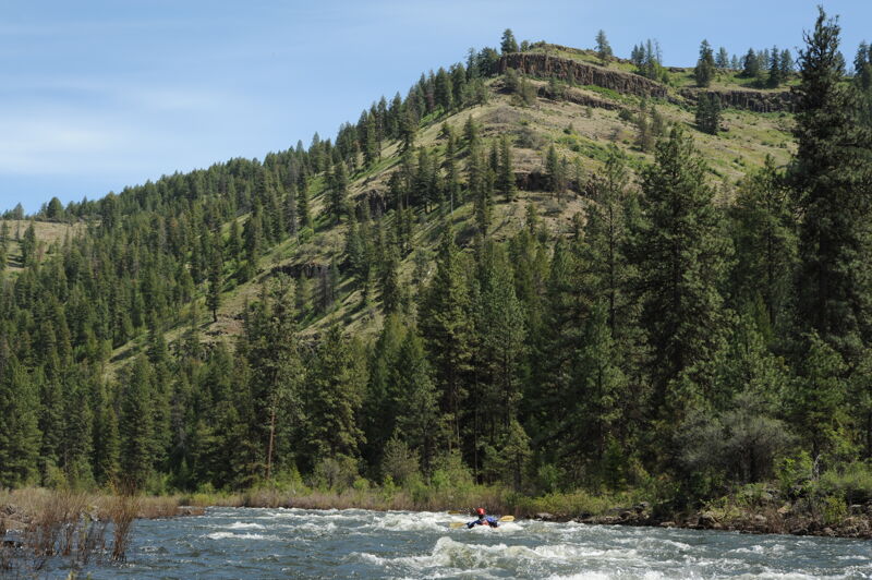
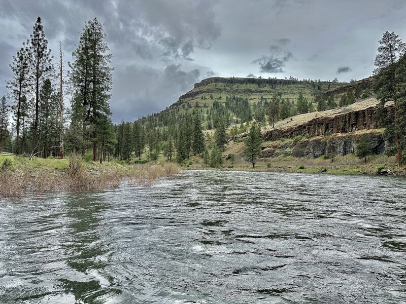
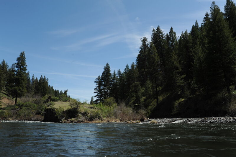
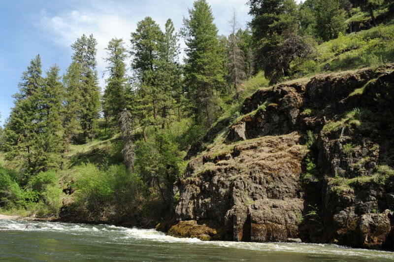
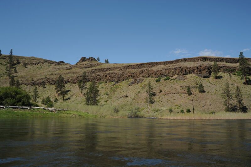
This section of the river emerges from the Umatilla National Forest and flows through a landscape of ponderosa pine groves and layered outcrops of basalt that form the canyon this river flows through. Towards the end of the run the pine forests start to transition to juniper and sagebrush. The wide open country invites hiking and exploration for spectacular views.
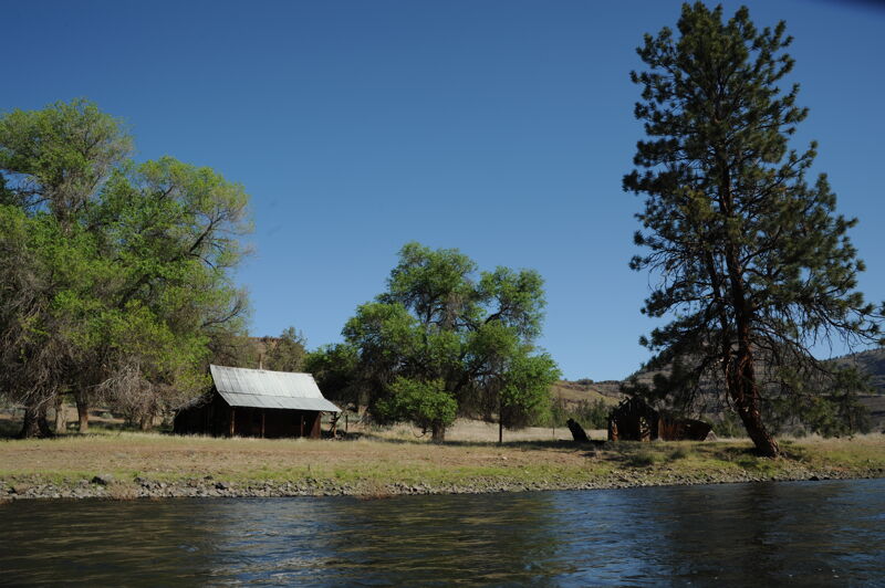
The public land along the river, managed by Bureau of Land Management, is interspersed with private land and some ranch homes as well as a handful of remote vacation properties. While this is a multi-day river trip, a dirt/gravel road parallels river right and a handful of roads enter the canyon in a few places. This does not intrude from the experience however and you will see more boats on the water than vehicles on the road as traffic is extremely light; in some places it is non existent where road segments are blocked by private gates. Campsites are plentiful on the benches along both sides of the river. The season for this run is late spring snowmelt and it's important to come prepared for the cold water and unpredictable spring weather.
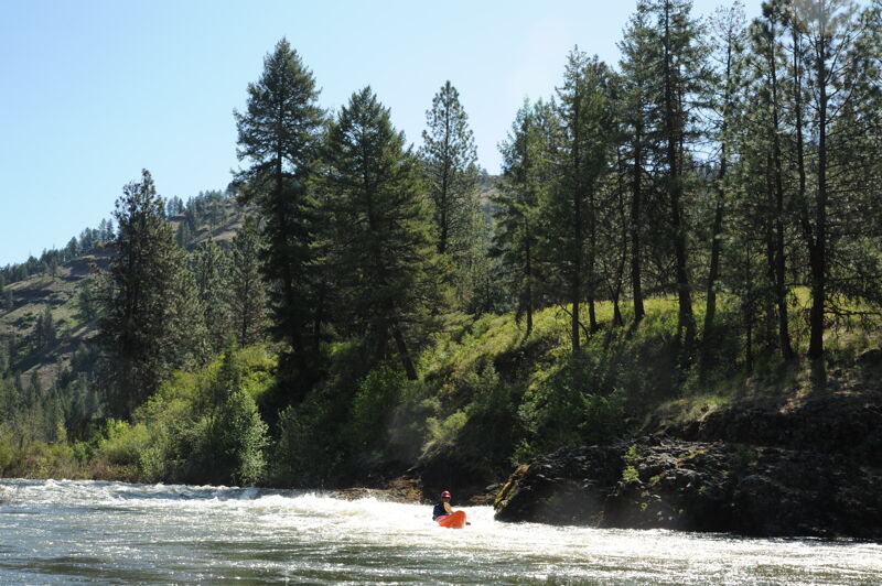
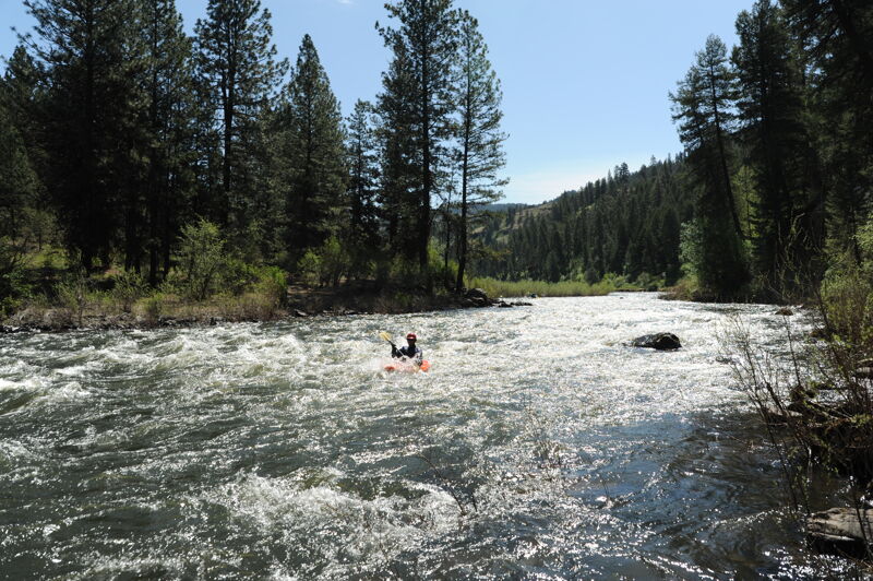
The most significant rapids come in the first 10 miles and are in the class II/III range. Several additional class II rapids continue all the way to the take-out with several fun surf waves.
Camping options become more limited once you pass Wall Creek near the end of the run so plan your last night's camp at a point upstream.
Logistics:
The standard put-in is just upstream of the Camas Creek confluence at a river access site on river left (across the river from Highway 395) where
...
Tollbridge Campground is a good place to meet and camp the night before your trip. Access is possible here on Desolation Creek just above its confluence with the North Fork John Day. Short social trails from the camping area to the creek are usable by kayaks and canoes but the it is not recommended for large trips or big boats.
Accesss just upstream of where Haden Creek joins the North Fork John Day. A gravel ramp provides an access to the river on river left (opposite side of the river from Highway 395 that parallels the river in this section).
River curves to the left and leads into a bedrock head wall at the bottom left.
This rapids ends with a surging boil off the head wall on the left.
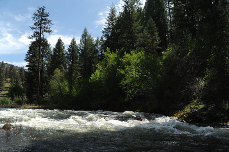
A long series of class II in two sections. The first section starts with an eddy on the right and is easy read-and-run down the middle for about 300 yards. After the first section you pass an A frame house and the river makes a 90 degree turn to the left. The rapid continues as the river bends to the left for another 300 yards.
The approach to this rapid is marked by an S bend in the river where the river bends left, then to the right, and back left as the rapid begins. It ends with a basalt outcrop on river left at the bottom that forms a tricky hydraulic.
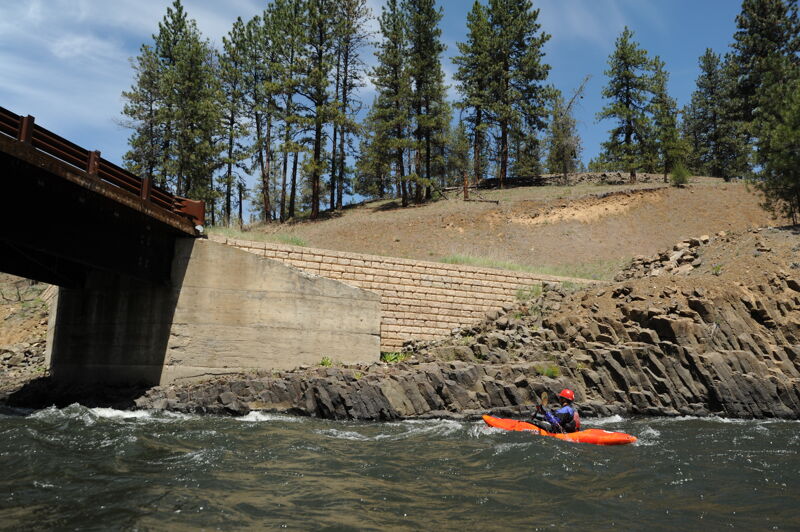
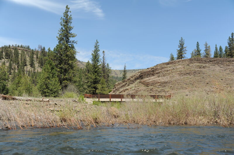
Rapid that ends at a bridge crossing with a basalt wall along river right.
Major tributary enters from the left contributing about 1/4 of the flow.
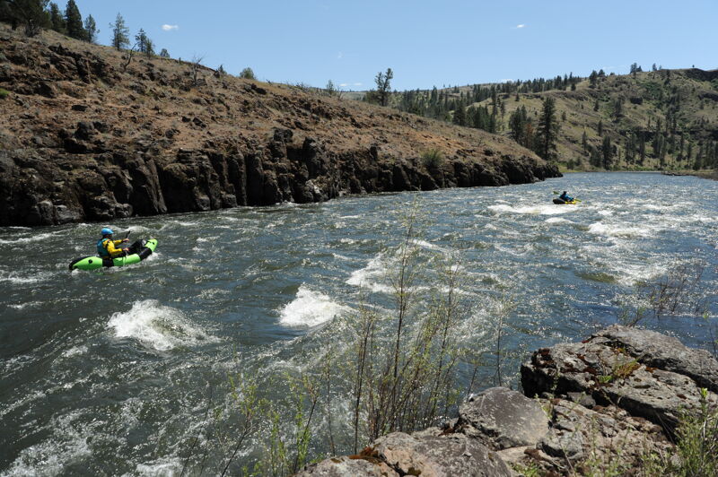
Fun wave trains down the middle where the river is constrained by basalt outcrops on both sides.
Tributary enters from river right. Camping downstream of this point becomes more limited.
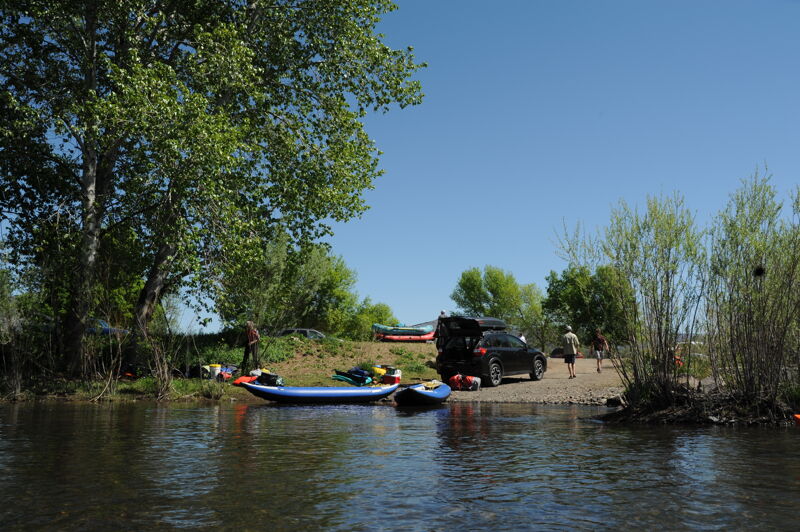
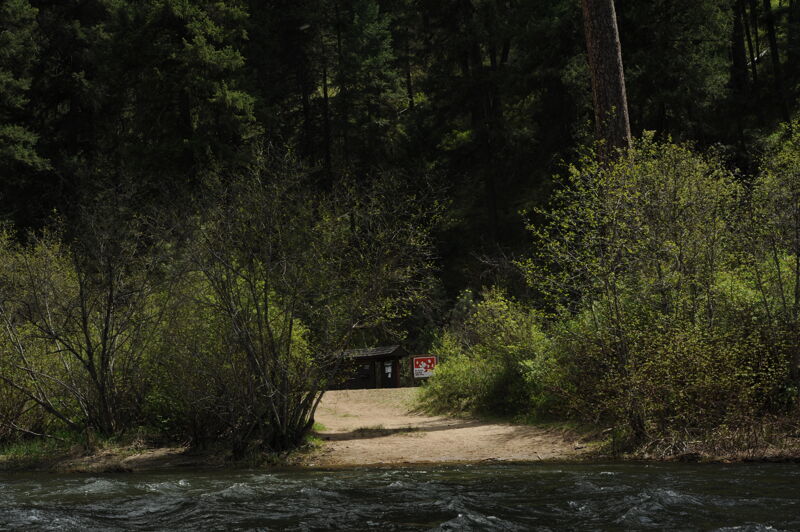
River access site with a paved loop and parking for approximatley 40 vehicles, toilet, picnic tables, and information board. The ramp is a single lane gravel ramp that can get congested on busy weekends.
May 5, 2024
Our first time down the stretch. One gear boat and one kayak. Full on high desert spring weather - sunny and warm the first day, snow flakes on the last day. Spent 3 days on the water - day 1 had all the class IIIs which were very read and run, day 2 and 3 were a good pace of class II, riffles and flats. Some great bigger camp sites. Lots of other smaller ones. Not much for camps for the last 10 miles. Take out is easy to miss, kind of in the bushes on the right, right before a riffle/drop...hug the right shore after the bridge. No logs or other obstructions were seen by us. Didn't see another sole the whole trip - can't wait to do this one again.
Mar 31, 2022
We did a 3 day from Dale to Monument late In late March. Flows were about 2600@Monument. Tollgate to Monument ( Takeout is a park on river right about .25 miles below hwy bridge). In the future I’d do Camas creek into the NF, or possibly Middle Fork into NF. Camas Creek looked like a FuN 8-9 miles of steep class 3+ creeky action. Camped at ‘50mile’ on the left, and ‘27mile’ on the left. Nice, flat camps with hikes. Hiked Wall creek, middle fork confluence, and Mallory creek. Would hike maybe Potamus creek, and Johnny cake Mountain with more time. I’d suggest camping above Wall creek on last night, as a ‘busier’ road come into Wall Creek. Lots of down and dead wood for burning. Dirt road on river right for most of the trip. ‘Oregon River Tours’ by John Garren is a phenomenal resource.
May 13, 2021
Our group that included Thomas O'Keefe and Omar Jepperson in kayaks and Adrian Boloveschi and Chris Barnard in packrafts came planning to run the section above this one but were not able to access it due to snow coverage. We were able to arrange a driver at the Dale Store who took us up to Oriental Campground and we ran from there down to Monument over four days which was a very relaxed pace (we could easily have covered the distance on a 3 day trip). Flows hovered just above 2000 cfs which would be a great flow for intermediate paddlers or advanced beginners with appropriate support. I would come back and do this as a family trip. There are a few old ranch houses and newer vacation homes along river right but they are infrequent and did not detract from the overall experience. We found plenty of camping on both sides of the river. Campsite competition was a minor issue on Saturday evening as we approached the take-out and sought a spot upstream of Wall Creek. The take-out was busy on Sunday at noon with several trips taking off the river.
May 27, 2020
We arrived at the Camas creek put in on 5/22/2020 with 10k on the Monument gauge, a day after the big flood where it had hit 20k in only a matter of hours. Our party consisted of all experienced river runners and their kids in a raft and drift boat. The river was pushy and bank full at 10k and while there were eddies, it appeared difficult to stop safely at the upper camps - especially with a fully loaded drift boat. We decided to wait it out one day and found roadside camping that had not previously flooded just up stream from Surprise rapid. When we put on the next day, it had dropped to 7500 on the Monument gauge and was a much more comfortable level however still was pushy and challenging to land the drift boat at camps. Surprise was runnable on the far right at 10k but not at 7500. The rest of the rapids were great fun with big waves. The takeout boat ramp is tight for a lot of people especially at high water and folks were lined up holding on to bushes waiting for the ramp to clear.
Jul 2, 2019
Floated the N. Fork John Day from Dale to Monument on June 14-16, 2019 (see comment below). River level was 1350 cfs when we put on and 1100 cfs when we took out. At this level there are many nice Class II rapids that make for a fun family float trip. Not a problem for canoes and kayaks at this level, but the rafts had to be a little careful through the shallow sections and scraped bottom a few times on gravel bars. I'd say this was near or at the minimum level for loaded rafts.
Jul 2, 2019
We ran this section June 14-16, 2019. Great section of river - more forested so a bit cooler with summer heat. GREAT for kids - we ran this with a raft, a SUP and WW Canoe. Our four year old enjoyed running rapids sitting on the SUP (with adult paddling), in the canoe with an adult and hung out all over the raft. Campsites were easy to find and nice to use, length of days were also appropriate for that age.
May 23, 2011
River flooded at 28K cfs at the Monument Gauge on May 14-15, 2010. Had not flooded this high since 1997 (30K). Only other flood of this magnitude was in 1925. Due to flooding BLM river ranger/Grant County Sheriff did not recommend running river weekend of May 21-22, we did it anyway. Flows were approx 8.75 @ put-in and 8.5 at take-out. (Middle Fork was contributing 2K of this amount). 1 14' raft and 1 16' cataraft and 1 tandem canoe, mixed levels of experience among the boaters. No new debris encountered (somewhat surprisingly).
Campsites and their access were reasonable. No problems. Shuttle driver reported that a couple of fellas floated river at peak flow. I assume there were no problems for them. River appears runnable (and importantly, camp-able) at flows up to 15K or less. Open-canoeists can expect to regularly take-on water unless they sneak rapids.
Jun 1, 2004
The gage listed above is not the right one for the North Fork of the John Day. Look instead at
USGS 14046000 NORTH FORK JOHN DAY RIVER AT MONUMENT, OR
http://waterdata.usgs.gov/or/nwis/uv?14046000
The river gets only slightly more difficult (3- in my estimation) for levels higher than the max suggested level on this page. The rapids mostly become washed out with larger waves, and the river becomes more continuous, making it harder to rescue a swimmer. We put in at 9,000 CFS (on Monument gage) and floated for 3 days taking out at about 5,500 CFS. Others in Paddle Trails Club have told me they have done similar levels in open canoes. At higher levels you have a chance of sneaking the rapid 'Surprise' on the right, but only if you recognize it in time and there is no wood. Both of those things happened to me in my kayak at 8,200 CFS but it is not much harder going right through the middle anyhow.
The take-out at Monument is about a quarter mile downstream of the the bridge, on river-right. Peer through the willows looking for a small boat ramp where there is now a nice parking lot with picnic tables and a toilet. Some guidebooks still tell you to take out at the bridge.