Metolius
Riverside Forest Campground to Billy Chinook Reservoir
| Difficulty | III-IV |
| Length | 28.1 mi |
| Avg Gradient | n/a |
| Gauge | Metolius River Near Grandview, or |
| Flow Rate as of 1 hour | 1250 cfsrunnable |
| Reach Info Last Updated | February 26, 2023 |
See Soggy Sneakers for run details.
Many options exist for shorter runs.
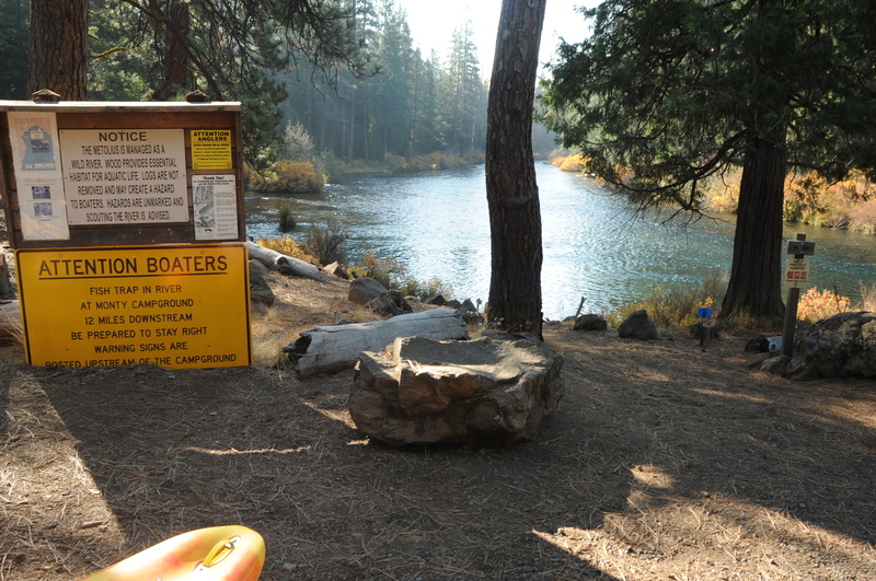
Good access on the upstream river right side of the bridge.
Access on river right in the campground before the slackwater of the reservoir.
Jun 20, 2026
Metolius River - Trip Report 6/20/26 - 1260 cfs - Gorge CG to Monty CG:
Providing an update to the last report from 10/12/2025. The high water event in December of 2025 appears to have changed a lot of the log jams, mostly for the better.
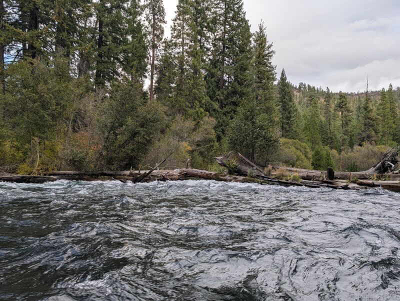
We only encountered 2 mandatory portages. As always, you should stay on your toes for wood on this run and use these coordinates at your own risk.
There is still a log boof/ jam at 44.57307, -121.61930 but it is not a mandatory portage. At 1260, the log boof did not look safe. Maybe doable in a pinch, but certainly not worth risking in a loaded, over-night boat. The log jam can be snuck on the left with relative ease.
We encountered a similar double strainer portage that was described in the October report but I have different coordinates. We encountered this at 44.64865, -121.61393. The first log looks boof-able, but the one behind it is in not. This one looks nasty, and a little difficult to see depending on the lighting. We portaged on the right.
The last portage is still in the general area previously noted as 'libertarian log jam' but appears to be further downstream in a new configuration. We still saw the German Shepard, so we knew we were close, but it was a couple hundred yards downstream and easily visible. The coordinates are 44.64984, -121.51662. The river splits around a small island with wood strainers on both sides. We beached ourselves on the shallow shelf of the island and portaged over fairly easily. At higher water, this may not be advisable.
Otherwise, there were only a couple of other places with easily avoidable wood and nothing that required ducking or other heroics.
Photos from the 2 portages
Oct 12, 2025
Full Metolius Trip Report from 10/12/2025-- sharing because I would've appreciated this beta beforehand and know there's other folks here newer to central Oregon paddling. Portage descriptions (we had 3 plus a number of barely squeezable moves around wood) with their respective locations in the description of the Lower below.
We put in at Riverside Campground (practically the head of the Metolius) for the sake of doing the whole thing, and unsurprisingly had a bunch of janky wood and very low water in the stretch above (and immediately below) Camp Sherman. If you like feeling like a spawning salmon I'd highly recommend this section. Probably could've walked it faster than we boated it though. My first time running this as I had been shown the put in below Camp Sherman-- I now better understand why.
Upper Metolius: we know and love it. I appreciate the variety and accessibility of this first stretch even more having seen the whole shebang.
Lower Metolius (below Lower Bridge):
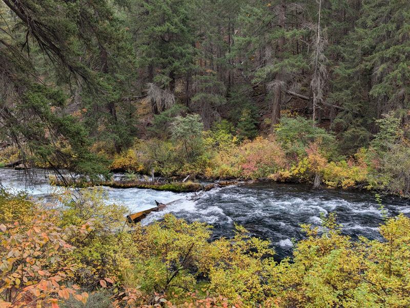
There were a few riverwide log boofs, the first and most prominent of which (right above Candle Creek campground) is good to go. This is the log jam the 2022 poster mentions. A notch has been cut in the middle of the log, so at 1300 CFS (standard non-melt flow) it's definitely runnable. I didn't get a location but looking at satellite view I think it's: 44.573068,-121.619304
Below this jam and above Candle Creek campground there's a long-ish rapid around a bend I'd called 3+. It's probably the most substantial rapid of the Lower. What do you guys call this one?
Significant log jam that looks enticing (first log boofable on right side) but sends you into a second, impassable log (see first photo) is at:
44.629054,-121.602657
Eddy out and portage on right
Island with log jam in right channel (see second photo), easy pullover and portage OR scrape down left channel:
44.666012,-121.581901
Libertarian logjam (just past the private inholding [you'll see solar panels and a bunch of equipment on your right] and below the rapid with some big high water marks in it). The older couple that lives here are nice provided you survive getting attacked by their 3 German shepherd police dogs and/or getting shot for trespassing. I learned this after an errant trail run last year from Monty.
44.644930,-121.513594
Eddy out right, portage right (see third photo). This is a crazy big jam.
One riverbend below there's the third mandatory portage-- easy eddy out on right and a bit of a hike along a decently developed trail to clear the brush and get to a decent put in.
44.643163,-121.509667
Eddy out right, portage right.
The only other notable feature on the run was a pillow piling up/off of a wall on the right, shortly before Monty. It looks appealing to run up onto but as you get closer you'll see that the wall is quite undercut and there's a nasty seam just downstream of the pillow. Would recommend staying away.
We got to see spawning salmon (90% sure they were Kokanee) cruising up the Whitewater River, would highly recommend a stop there! Fall colors of the understory, particularly the vine maple, were amazing. Grateful for this place and for the opportunity we have to inhabit it for a moment!
Oct 11, 2025
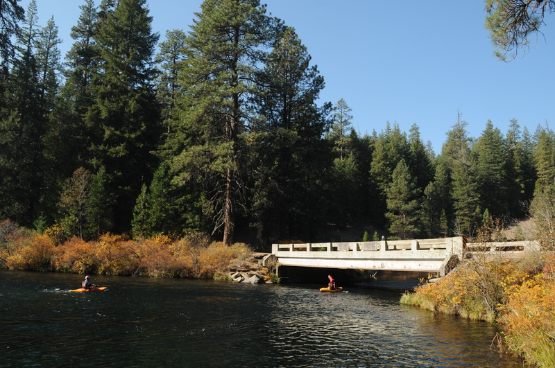
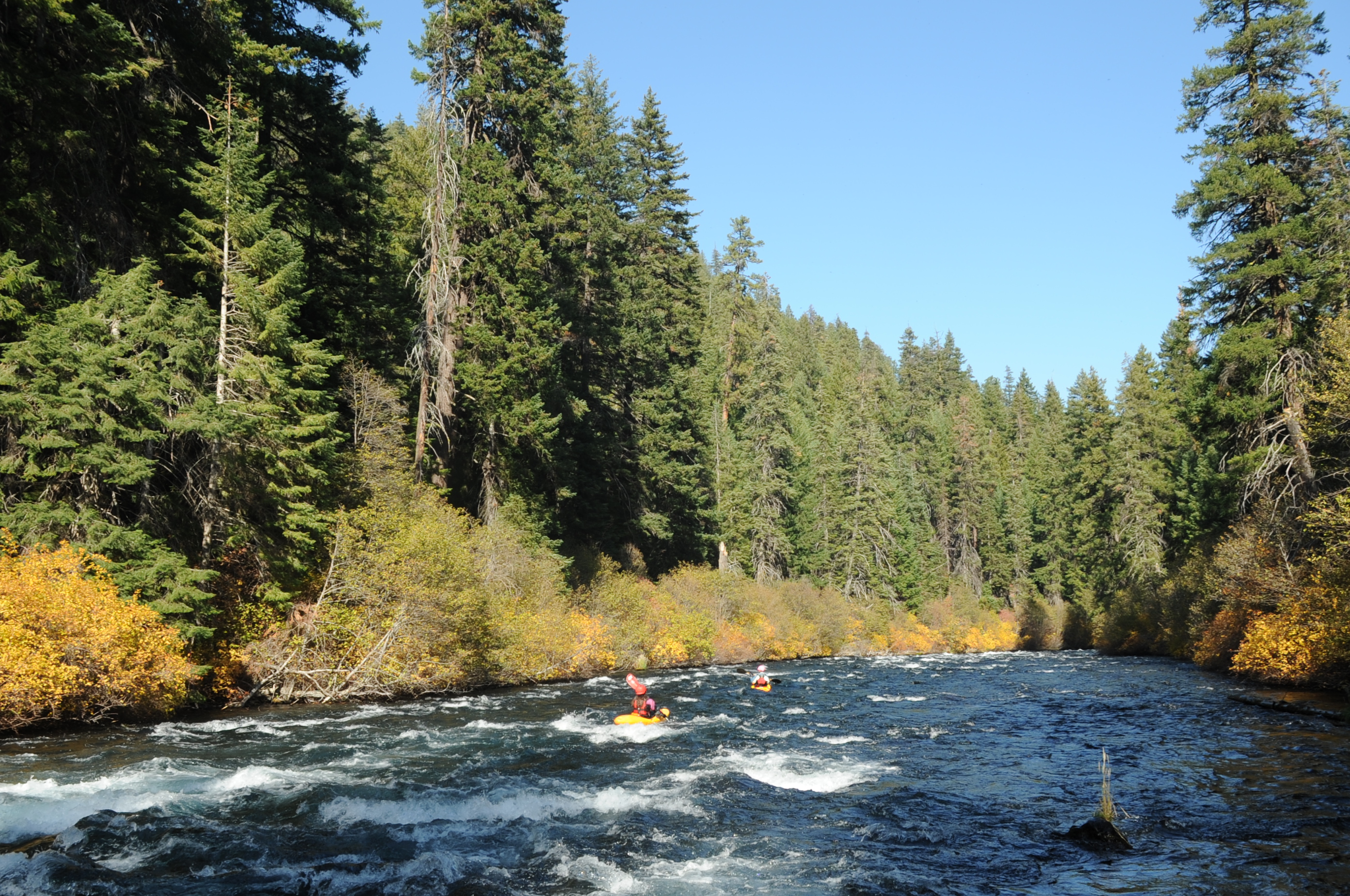
Two of us kayked from House on the Metolius to Monty Campground on 2025-10-11. We were able to average about 6 miles per hour. The fall colors were amazing and we saw lots of eagles and ospreys. It is an amesome run that I am surprised doesn't see more boaters.
The wood was all visible and we were able to easily catch eddies and portage around it. We portaged everything on river right. Locations:
Portage: 44.629175° N 121.602494° W
Large Log Jam: 44.644586° N 121.513364° W
New Log Below Large Log Jam: 44.643272° N 121.510072° W
Log in Rapid (can paddle around, but comes up quickly): 44.496556° N 121.636022° W
You can also look at the Strava recording and see the locations of the pictures on the map: https://www.strava.com/activities/16109515353/overview Feel free to leave a comment if you have any questions.