Owyhee
4. Rome to Birch Creek or Leslie Gulch(Lower Owyhee)
| Difficulty | II-III+ |
| Length | 68.2 mi |
| Avg Gradient | 18 fpm |
| Permit | Self issue permit can be downloaded from BLM website. |
| Gauge | Owyhee River Nr Rome or |
| Flow Rate as of 1 hour | 75 cfsbelow recommended |
| Reach Info Last Updated | June 4, 2019 |
The Owyhee River, protected as a Wild and Scenic River, is renowned among river runners as one of the region’s most spectacular multi-day spring trips. Three distinct sections of the mainstem can be paddled as separate adventures or combined into one extended journey. In addition, the river’s side canyons [...]Read More
SEASON: The river is typically paddled between March and June with peak flows in March or April. Weather can fluctuate and even dip below freezing. The last two weeks of May are typically the most popular time to paddle this river. Heavy rains can make passage on shuttle road problematic and bring flows up to high levels rather quickly.
DESCRIPTION: The Vale District of the BLM maintains an Owyhee website with information including a river guide in pdf format (note that this guide tends to rate several of the rapids a grade higher than the majority of other guides), maps, and local contacts for shuttle services (Vale District office 541-473-3144, Rome Launch Site 541-586-2612). This is a 4 to 6 day trip and the most popular of the runs on the Owyhee. The launch site in Rome is typically staffed by BLM. The ranger has been giving all groups an enviromental and welcome talk prior to parties launching on their trips. He will go over the best ways to accomplish camp tasks along with explaining areas of concern. These talks have been very infomative in the past 5 years and have significanty reduced the impacts in the canyon. Please support this program so we dont loose it in budget cuts.
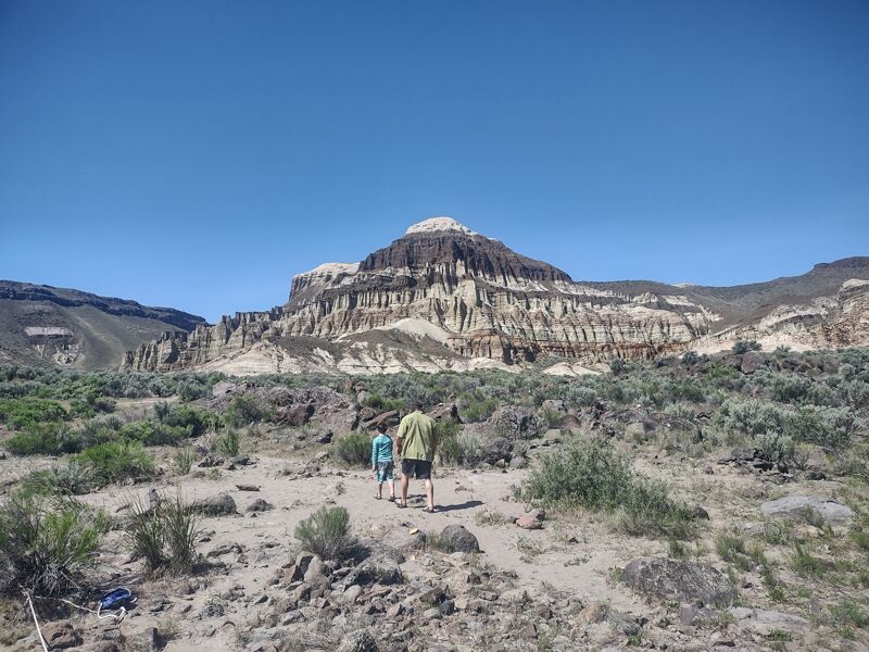
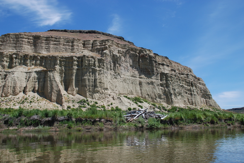
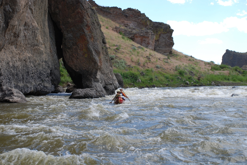
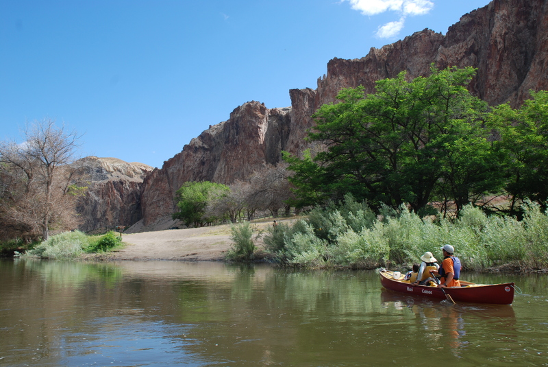
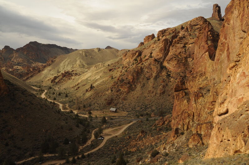
The Owyhee's headwaters start in Northern Nevada and flows North through South Eastern Oregon. At the Rome launch site the Owyhee is still a free flowing river fed by snowmelt and spring rains. As one travels down into this remote canyon the adventures from the river trip and hiking the canyon will bring lessons of Archeology, Geology, American history, and survival in the Eastern Oregon Desert. For the first five miles of the trip you will find yourself on a relatively flat meandering Owyhee river through ranch land. The Cliffs of Rome, Jordan Creek, and an old stage coach stop are the major sites until the river flows into Sweetwater Canyon.
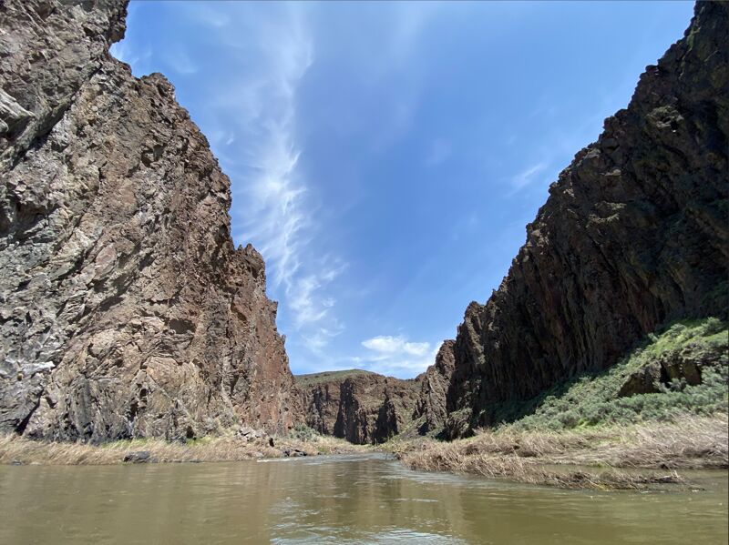
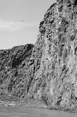
Entering the canyons,
...
The Rome put-in is on the upstream river right side of the bridge in Rome at a site administered by Bureau of Land Management. It can get busy when flows are optimal and the weather is nice in the spring. Many groups come in the day before their intended launch date, rig boats, and then spend the night. Camping at this site is possible although it is not a formal campground. Beware of the inviting grass area in the center of the site as the sprinklers come on very early in the morning. There is a ranger station at the site that has sometimes been staffed in years past.
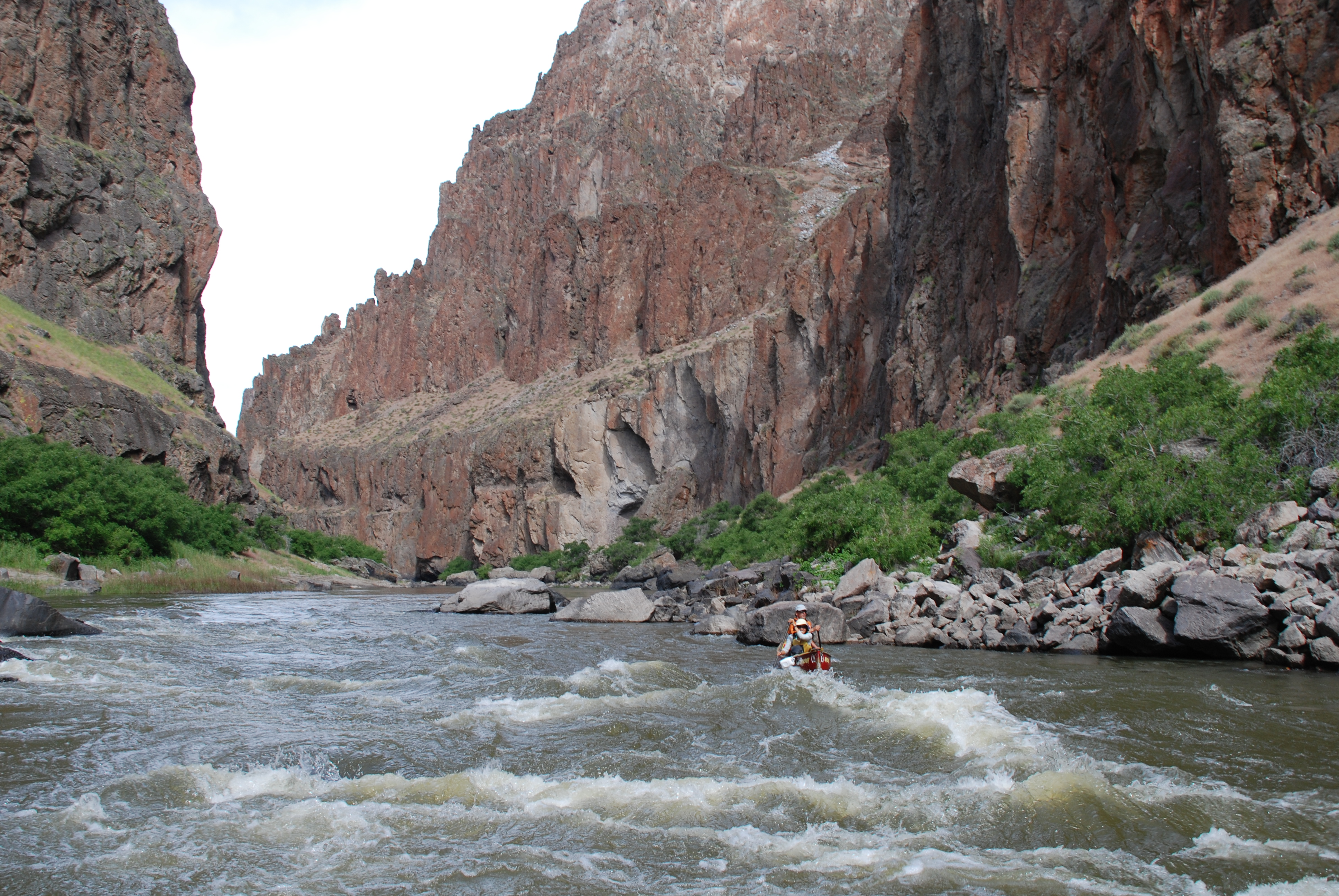
Scout left. Debris fan on river left forces river to the right where you need to avoid a rock slab. Difficulty increases as flow drops. USGS River Mile 93.1.
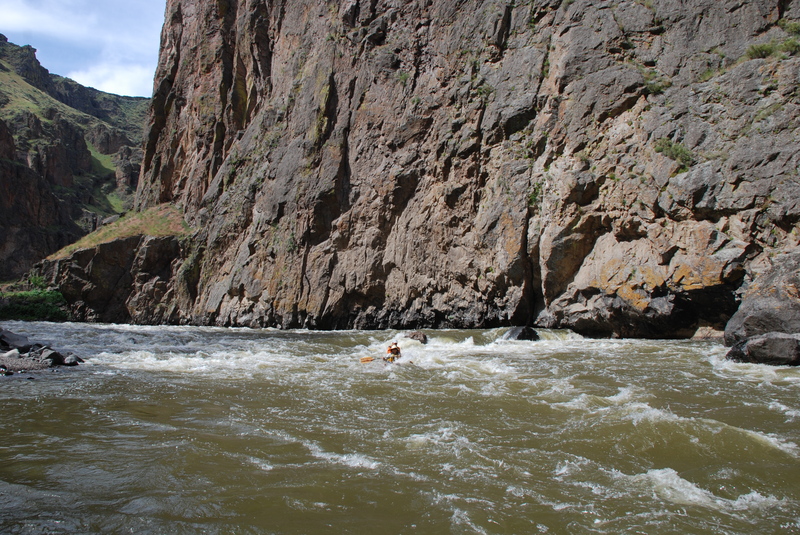
Most challenging drop on this section. Difficulty increases as flows drop. River drops into a tight constriction with rocks below that are to be avoided. Scout from river left. USGS River Mile 89.4.
An old diversion structure for the ranch. Scout from left. Difficulty increases as flows drop. USGS river mile 84.3.
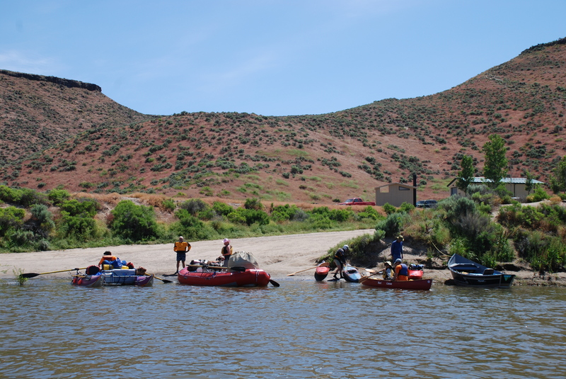
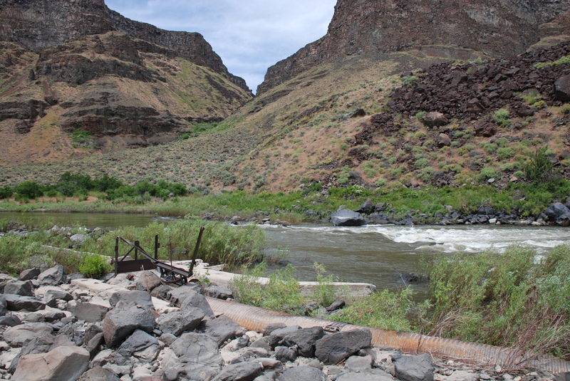
Last take-out before the reservoir. Alternatives are to take-out here (4WD recommended) or continue on down to the reservoir and get a tow out (about 10 miles down the reservoir). USGS River Mile 73.8.
A good road provides access in to Leslie Gulch. A good launch area provides access to the upstream end of the reservoir and some groups arrange a two out to this access point which serves as an alternative to driving in to Birch Creek.
Aug 21, 2025
We put on May 9 for a 6 day trip to Leslie Gulch. 1st obsicale was the rock dam 1/2 mile below the bridge at Rome. Even though flows started out at a 1k CFS I had to get out of my boat to finagle it and the fam over the Rock dam, the most challenging part of the whole trip. The rest of the trip went without a hitch including the Morcum Rock dam with the flow down to 600 CFS. Whistling bird was its normal self just a little bit tighter, but not bad considering flows where around 700-800 cfs. Montgomery was way tight with my left oar basically touching the left wall. With my right oar I had to plan my strokes to keep from sticking it in the rock bar on the right. Thankfully the river wasn't too pushy and it was fairly easy to line up and make the slot between the rocks bottom left. Rock Trap was visually challenging until you get down into the throat of it, and could see the way through the maze. Even though it was a low to very low water raft trip the river was fairly easy to navigate. I'm guessing we were the last trip on the river as we saw no other rafts once the two solo boats left us below Montgomery.
May 14, 2023
With flows dropping 300 cfs a day we experienced all the best of what this section has to offer. With just two of us in a 16' RMR we were able to complete the 48 miles from HWY 95 put in to Birch Creek in 3 days. The flow range being from 2600, dropping to 1900 cfs made all the major rapids technical and challenging but also low enough to have action practially on every corner. All the campsites were beautiful with plenty to choose from. With good weather there was plenty of company as well with all of the other boaters being helpful and friendly. I can't say enough about the scenery. With canyon walls towering overhead and geologic wonders all around, the contrasting colors and rock formations make this truly a one-of-a-kind experience. Bring a camera and prepare to be busy. To Note: the Birch Creek take out road is really rough. Single lane with very few turn outs. Caution in wet conditions.