Laurel Hill Creek
2. Whipkey Dam to Humbert Covered Bridge Nr. Ursina
Feb 11, 2018
Ran the lower section today from Kings covered bridge to the walking bridge at the states game lands. Level was a little over 3ft and just under 2000 Cfs.
No major strainers thought we took the main lines at the braids.
At this level there were big wave trains and a few solid class 3s mostly at left hand turns.
Jul 26, 2017
USGS manages the gauge, but they already know. If you go to the actual USGS page (https://waterdata.usgs.gov/pa/nwis/current/?type=flow), you'll see that they list 'eqp' malfunction for the gauge. It appears to still be reporting, however, but maybe it got stuck at 1,200 cfs when you were there. It looks like it's sticking as the level goes down -- it seems to be stuck at 3950 cfs right now (July 23 - 25, 2017). Anyway, when this happens, there is a very short drive to the Casselman.
There appears to be a pattern of 'Ursina' getting stuck when the creek has been high and is dropping. It's possible that the current location of the 'Ursina' gauge is one that picks up a lot of trash in the gauge, which, I'm guessing, is why USGS has created an auxillary gauge. My guess is that they'll run them together to make sure they track similarly and then USGS will move the gauge to the new location.
Jul 25, 2017
Thanks! USGS personnel quickly responded and are working to resolve gauge issue. I received an email from them Monday morning about this.
Mar 26, 2012
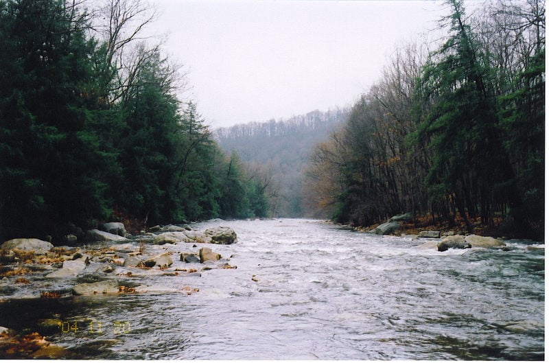
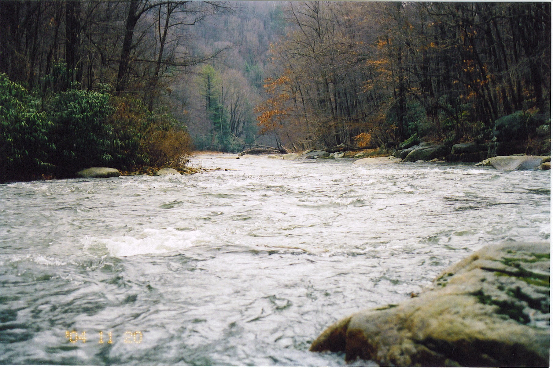
Ran from Triple Creek Rd near Trent to State Gamelands Near Ursina on 3/24/12. Level was 3.4 1910 cfs. This fills the top section in nice. There is changing wood on this run. All was passable but stay alert. There are some choices around islands also. Most of the run is swift water without features. This limits the amount of bank eddies. There are some rapids with medium waves and a hole here and there. Two spots are of concern: the first is a horizon line of about 5 ft. You may want to scout here. I took the flume right of center, carved right, hit shallow rock and swam. Another in the group took a beating here. There is an easy portage on river right. Get out early to avoid getting swept into this. The rapid just below is split by a mid stream boulder. There was wood on the left but looked passable. we took the right. When rounding the boulder, there was a intense seam of current. This can be avoided by getting back to the middle. There is some squirelly water below also. Things slowed down around Scottyland and progressively got slower to Whipkey Dam. We portaged on the left. The lower run was easy for a couple of miles and increased in difficulty. Waves got big and there was an ocassional monster hole. Lines are pretty obvious. Some of the heavier rapids are left turns. staying on the inside will avoid getting into the big stuff. After passing Cranberry Run, work left hard to avoid a good sized hole. There is a heavy set below this point also. Eventually, things start to settle when leaving the gorge. Choose braids wisely. Most choices seem to be to the right. Wood is changing here also. We hand to squeeze around a tree in one spot.
Mar 8, 2012
Ran from Whipkey to State Gamelands on 3/4/12. Gauge was 2.1 540 cfs. This is about as low as I would go. With the exception of a couple spots, good water until the braids. Then, enough if you make good decisions. Very pretty! Upper needs more water. Ran it pretty high once. Had to stay alert due to lack of eddies.
There are a couple good rapids. First is a 4ft broken out ledge that can be run right of center. The next is not far below and requires some maneuvering.
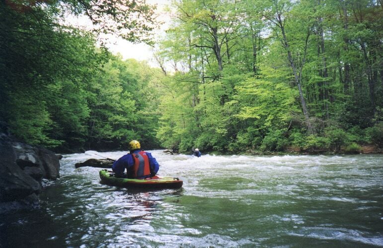
May 24, 2003
This rapid is the first Class II drop on the Laurel Hill Creek and consists of a river-right hole and a nice surfing wave on river left. The river widens and braids once below this drop. About 1/3-1/2 mile below this point, there is a very long Class II+ to III- rapid (approximately 4-5 miles into the run) that may be recognized by small ledges leading into a 90 degree turn left hand turn. The gradient is 70 feet per mile for over 1-1/2 miles. This section is very enjoyable, but hang on....