Little Conemaugh
South Fork to Johnstown(Path of the Flood - Part II)
| Difficulty | II-III(V) |
| Length | 9.1 mi |
| Avg Gradient | 27 fpm |
| Gauge | Little Conemaugh River at East Conemaugh, Pa |
| Flow Rate as of 1 hour | 8.29 ftbelow recommended |
| Reach Info Last Updated | July 2, 2022 |
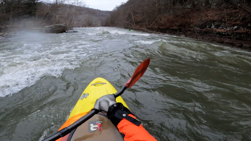
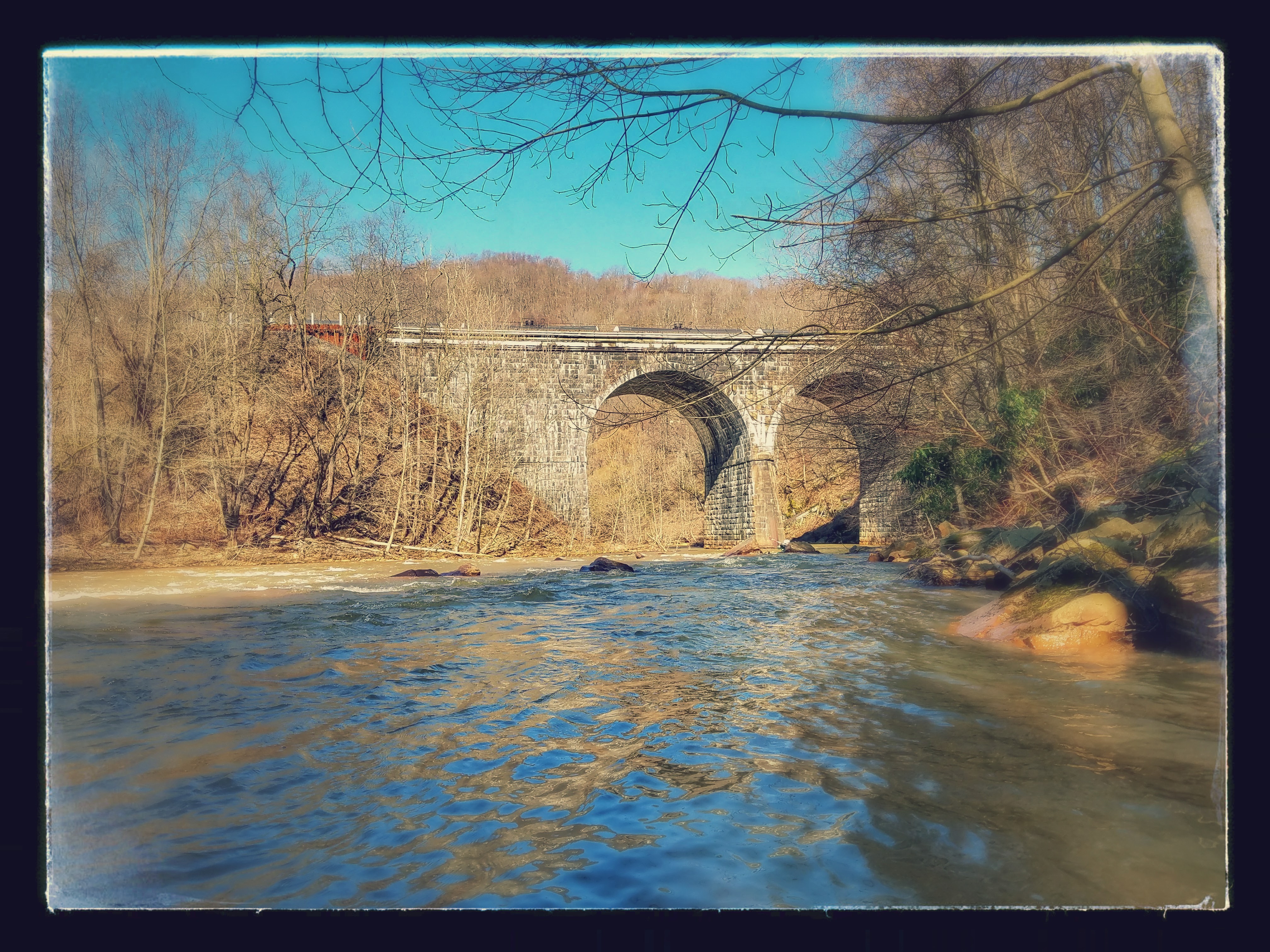
Description: This run starts in South Fork or on one of two other Little Conemaugh reaches (North or South) taken down into Mineral Point, onto Johnstown. This is the riverway which the great flood of 1889 took decimating the city. It is a pretty nice beginner/intermediate river, mainly a scenic class II river, with a few Class III rapids on it and with one major class V in Echo right past Mineral Point. For historic reasons, putting in along the South branch will take you on the path of the 1889 flood. The river itself is damaged due to Acid Mine Drainage but it is currently being cleaned up with some fish returning in sections up above. A brand new AMD clean up plant has started on the South Branch with plans to clean the North Branch as well. Claimed to be one of the best fishing rivers pre-mining. The Little Conemaugh's headwaters begin in Cresson, PA (North Branch). Along the river you will see a dam, trains and the infamous Conemaugh Viaduct that was rebuilt in 1889 after the flood damaged the first one. If you are lucky you will see a train go over it as you run the rapid beforehand and under the tunnel.
THE ONLY REASON WHY IT IS CLASS 2-3 (V):
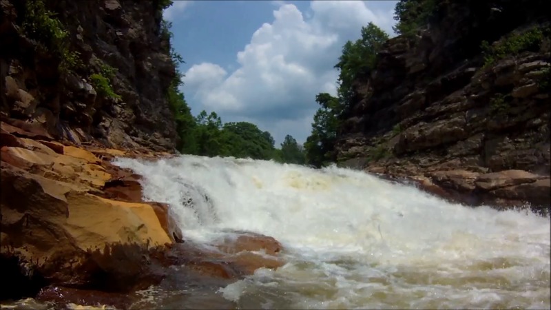
The Little Conemaugh originally ran around the mountain in which it flows through now near Echo in East Conemaugh, but after the flood the mining companies decided to cut through the rock creating Echo Rapid around 1920. Echo rapid is comprised of a straightforward path above the actual drop, then goes to a 5-8 foot waterfall, into a rockslide, into a hole with a rather large pool afterwards. The hole at the bottom can get rather chompy so make sure you scout this thing before you run it. You can tell the rapid is coming up by looking for a green bridge that connects the top of the canyon together, used as an old coal tram. You will also notice some boney piles on the right, and essentially a mountain cut down the middle. Portage to river left through the f
...
This is the standard put in location where the South and the North fork of the Little Conemaugh confluence in the town of South Fork. There is a trailhead here for the path of the flood and parking on either side of the bridge down past the post office. Put in here, you will see the north branch coming in shortly after on river right. This begins some class I all the way until the dam that you must portage around.
Almost right after the put in is a low head dam. You will should see a building on the right along the railroad tracks, portage river left, you will see a sign. You can also put in here if you drive back Cross St. in South Fork and park off the path. There are signs and bouyies that warn you of the approaching dam. The path that is here also leads back to the start of a loop section at the first class III.
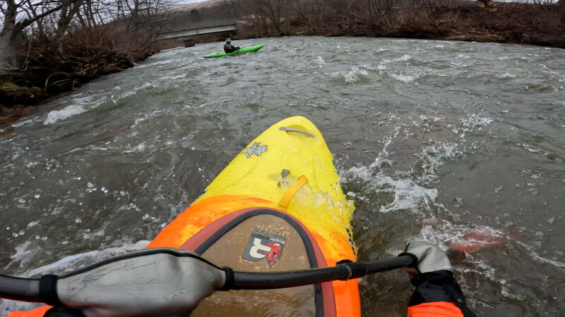
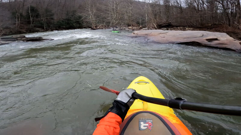
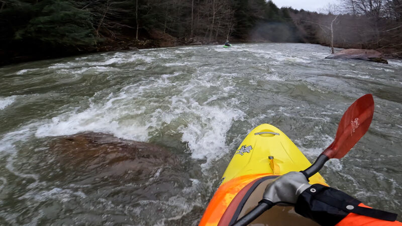
This begins a loop section that if you hike from the other side, you will end up back here. You will notice train tracks (active, every 20 min) on river right and a cliff face in front of you. The river bends to the left, this starts a small class 2 section before the chute, the first bigger rapid on the loop section.
Some smaller class 2 waves before you notice a big rock on river left. The river forms a chute sort of over a river left/center line, too far to the right you will land in a pretty nasty looking curler wave (the cockscomb). You can ride this out on a nice wave train or eddy on the right to ferry across, surf, do whatever you'd like. River left allows you also to eddy out, attain back up from the other side, or get out of your boat and hike back to the start to do it again. Watch the big hole at the end of the wave train on river right at 11ft+
The loop section starts above this, and this rapid is also accessible via a car or ATV from the dam. There is a path that takes you all the way back to this.
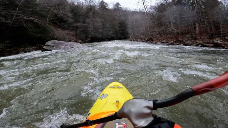
Nice surf hole at the beginning, also another nice surf hole around the bend river left.
Smaller class 2 at a lower level where Bear Run comes in, washes out into a wave train at higher levels.
You should see a big rock river left, the line is to the right of the rock over a ledge drop, can also run an easier line river left of the rock. Bring boof on center line. Easier sneak far river left, portage river right
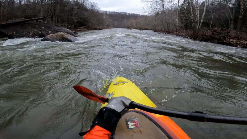
The river splits, you can take the right at higher water, very easy class I type stuff.
The left channel starts with a bigger rock on river left that usually collects some wood far left. There is also a rock right above it that you can sort of shoot between, but the standard line is right through some waves.
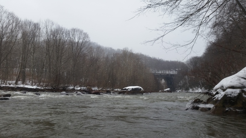
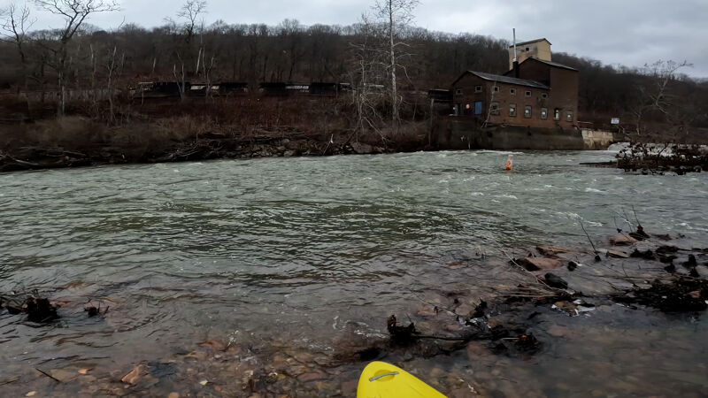
After doldrums around 2.8 miles in the river splits 3 ways, normal run to mineral point and beyond is center or right, but if you go right you can exit river on river right for a loop. There is a sloping path to the right you can walk up to near the top of the big bridge and put back in, just eddy out on the right. You will miss the next bigger II (conemaugh viaduct rapids) before Mineral Point take out, or attain back to it, as you would have to cross railroad.
Few more small II's down to the last easy take out before Echo. Big parking lot at bridge, or church down Front St.

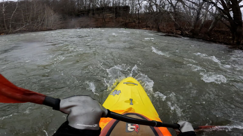
Bigger Class II before Echo, mostly all I-II flows from Mineral Point til now.
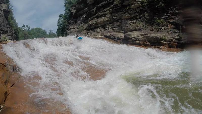
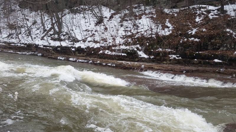
Echo rapid is a man-made dynamite blasted rapid formed around 1920 creating a canyon through a mountain. You should be able to see an old green tram bridge that connects the canyon together at the top and old boney piles on the right.
Use major caution here as it is manmade.
Approach the rapid starting river right and end river left, please scout there is a hole you need to miss or boof at the enterance. Boof the drop, rock slide, punch the hole. Gets pushy and forms a nasty recirc in big water.
On a low flow, you can walk right through it if you are skilled on your toes, though a portage more than likely is on river left, through the train tracks.
Take out under tunnel of clapboard run, park in lot at park, walk under the tunnel stream to get to the river.
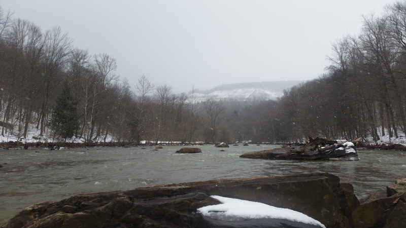
From Echo to Franklin the water turns back into sadness. The boney piles are pretty unappealing and the smell is bad, but you get used to it. Some neat history, class II rapids down to Franklin. Some potential to be class III in some at higher flow from Mineral Point down to here.
Jan 31, 2023
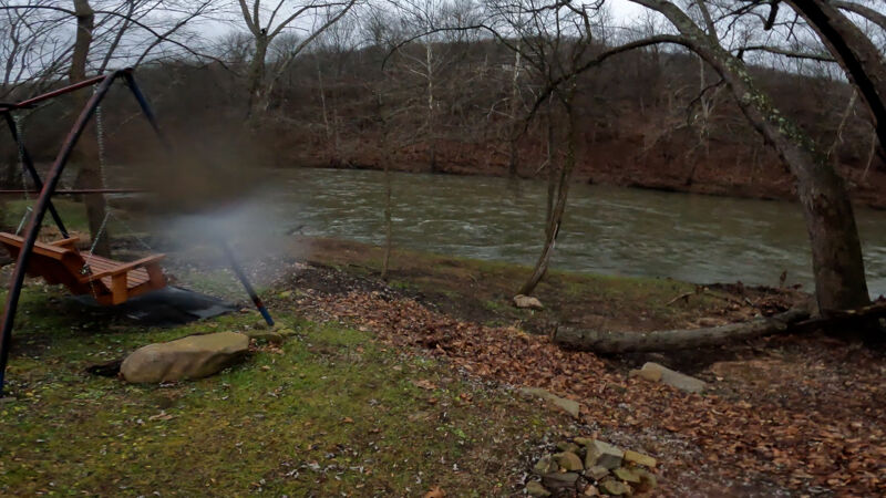
Carrying on from the previous trip report, Stefan and myself on a January journey down the Little Conemaugh. We take out usually in Mineral Point since Echo is such a challenge to deal with when you decide not to run it, which at medium level, has never been seen before.
Anyways, some nice photo documentation for some go pro footage, trip report is to update the pictures, enjoy!