Tohickon Creek
3. Ralph Stover State Park to Point Pleasant (PA Route 32)
Sep 21, 2020
The co-ordinates are wrong. The put in is actually on the other side of the bridge at 40.434594, -75.098087. Also, the bridge is closed so you can't drive across.
Jun 4, 2019
We ran this at 210 cfs, which is considered below recommended. Personally, I now consider 200 cfs, possibly even lower, as my minimum. It channelized very well and all of the rapids were easily runnable.
Nov 5, 2018
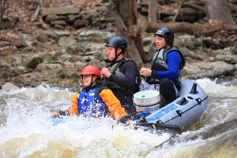
The Toe can be run at higher levels. We ran it at 2700 cfs two days ago, and while the character of the river changes, it is still a Class 3, although it is more challenging than at release level. There are lots of fun wave trains, the rapids are long and continuous, and the water is up in the trees. A swim would be long.
Oct 20, 2014
State Park Advisories 10/16/2014 3:15:00 PM
Due to bridge construction and low water level in the lake the white-water release for November has been cancelled. Construction on the Route 32 bridge spanning the Tohickon Creek would jeopardize the safety of the boaters. Lake Nockamixon is also more than 1.5 feet below normal level. The next release is scheduled for March 2015.
Apr 28, 2012
Tohickon
Apr 28, 2012
Small surfing hole
Apr 28, 2012
Larger surfing hole
Feb 29, 2012
Update..a few months back a small (ahem) rockslide blocked this crack..IF the rocks are still in place then it may be safer than it was, but I personally am staying away from this line just to be safe.
Folks who were at the Tohickon creek release 11/5-11/6 probably already know this but for those who weren't but might get there the next time it rains, there is a new pinning hazard that I want to publicize.
DON'T take the 'sneak' line on far river left on second ledge, the one where you drop through a slot into a pool and miss all the holes. I've run it many times but now the drop has changed (I'm told a log that was in the crack between two rocks is gone) and now it's very dangerous! I personally saw 4 pins in that crack over the weekend, and there were many more. The crack was catching all boats big and small but it was far worse with a playboat, one that I saw with a very small boat actually had the paddler and boat slip down totally into the crack, all that was above water was one waving hand!
This could have easily been a disaster..so BEWARE!
Feb 29, 2012
I heard through the grapevine that this nasty strainer has been removed, thanks to everyone who worked on it!
I'm leaving the information below for posterity, but this thing is gone...
There is a tree caught on Pyramid rock, sticking out into the flow. It's in a bad spot, right down at the water level and not visible from above till your right on top of it. I would strongly advise running the left side of this rapid until this has been verified clear, the normal line next to pyramid rock will lead you directly into this dangerous strainer.
This tree has been there for over a month, it's probably going to stay until someone removes it.
Feb 27, 2012
Good News!! As of February 26th, the strainer at Pyramid Rock has been removed.
Jan 29, 2012
We ran the Toh yesterday Jan 28, 2012. The tree is still there and looks very dangerous. Right at waterlevel to the left of Pyramid rock.
Nov 9, 2011
also wanted to add another link, used endomondo to track my route, started at the launch and ended at the takeout, both put in/take out have no charge on dam release and both have parking lots.
Nov 6, 2011
the tree at pyramid rock has been cleared, as of 11/5/11 there are really no hazards in the creek
clips from all the rapids on the tohickon after the nockamixon dam release in 720p HD ------>
Mar 4, 2010
Strainer on Tohickon: Near river-wide strainer formed by two downed trees on Tohickon Creek about 200 yards above Pyramid Rock. Passage on extreme left. Hazard for swimmer, beware at higher levels than today (3/4/10 at 600 cfs).
Mar 21, 2009
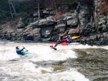
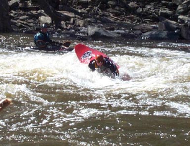
Smashing through a hole on a cold saturday morning in march, Green monster or one of the ledges, i'm not sure, but it was AWESOME!!!!!
Jun 13, 2008
Tohickon Creek Description (Copied from Brad above with the HTLM codes removed).
Photos & more info. at Northeastern Whitewater USA. (www.balajthy.com/tohickon.html).
The section from Lake Nockamixon to Ralph Stover State Park is a easy class II through farm country.
The whitewater section starts at Stover and runs down to the Delaware at Point Pleasant, PA. It is about 3 miles of medium to hard class III. A lot of surfing waves, holes and ledges makes it very popular and very crowded during release weekends.
The put-in is at the old bridge at Ralph Stover State Park. After a few hundred yards of warmup, the river starts off with a bang at Fish or Swim. A large sticky surfing hole on river right, with a surfing wave in the center right next to it. There is a small eddy on the right, and a large one on the left. Just below on the left is a small friendly side surfing hole.
Down past the rock climbers at High Rocks is Corner Hole. A surfing hole on the left, with an eddy below and above. The left side of the hole is a little sticky and pour-over-ish, but its easy to get out the right side (and then some power stroking to get back into the eddy).
After some small ledges is the Chute (a.k.a. Chainsaw or Flume). There are boofing rocks with a micro eddys behind them on the right or left, with a big eddy below the chute on the left. Nice surfing waves in the center. 100 yards below is a small ledge with an eddy to its right, with a squirtable eddy line.
Some more small ledges and waves leads to the first ledge, No Name Ledge. This is a small single drop which can be run down the center, or thru a slot on the right. The right side slot can give rocky popups to short boats. A side surfing hole is about 100 yards below.
The fun starts with the next rapid, First Ledge. This can be run center-right over some pillows down thru a surfable wave/hole. Alternatively you can eddy out left after the first little drop, and then ferry right (with a couple of stops to surf waves) and down to the wave/hole. Then pick a number and get in line to surf the hole. Great backenders for boats with low volume back decks.
A quick pool to catch your breath, and you come up to Second Ledge. This is a two part drop (this ledge and the one above is is also called Triple Drop). The first river wide ledge can be run to the center right, and then down to the right of the washed over rock at the bottom. Or you can run a chute on the center left of the first drop, eddy out in the pool, and either then ferry over far right or thread the needle to the left and then behind the washover rock (a raft snagging rock is ready for you if you don't cut behind the washover rock).
Another pool brings you to the start of the area used for slalom races - the Race Course Rapid. You can enter on the left, and stay middle left down past rocks and ledges to the end of a small island. Or, you can catch a slot to the right of a washed over rock in the center, and then down to a surfable hole. Head left after the hole to the end of the island, and then down thru some nice waves in a fairly narrow section. Eddy out at the bottom.
The last big drop is Hat's Rock Rapid (a.k.a. Ricki's Rapid). Scout it from the left shore to be sure to catch all the good spots on the way down. You can enter it on the right past some irritating small rocks, then down through waves and a couple holes on the right side. Keep the big rock to your left at the bottom.
For the more adventurous, you can enter it at a small chute at the center left. Spin your boat and drop into the hole facing the left side. Back out of the hole and ferry over right to drop into two holes in the center of the drop. If you come out of the left side of the first hole, you are in for an interesting ride through some slots down the left side of the river (especially if you are in a low volume boat).
Below this drop is a rather sticky hole along the right shore, and then the last gasp of the Tohickon, Pyramid Rock. Aim just a shade to the left of this rock which is just off the right shore, brace off some steep pillows, and shoot past the rock. Or, eddy out on the right shore just above the rock, and ferry over into the pillows above the rock. For the less adventurous, it can be completely snuck by staying left. The site of my first (and unfortunately not the last) swim on the Tohickon back in the dark ages of prehistory.
Coast on into Point Pleasant, enjoying the scenery, and take out at the small park (if you have a shuttle bunny - don't park there and don't block the road), or at Bucks County River Country (and pay some $ which goes to the local fire department), or continue on to the Delaware and head downstream to Bulls Island State Park take-out on the Jersey side. Its about a mile and a half down the Delaware just below the Lumberton wing dam. Don't block the roads when loading or unloading to keep the locals happy.
The local Boy Scouts sell some great hot food at the Ralph Stover put-in on fall release weekends.
Feb 28, 2005
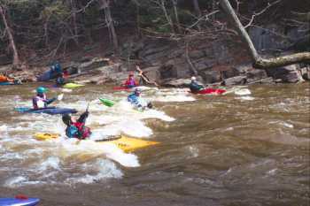
Typical Spring Release Level
Nov 9, 2004
From Iplayoutside.com
http://www.iplayoutside.com/Events/2004/11/6538e.html
Tohickon Creek Description
Photos & Info. by Northeastern Whitewater USA.
The section from Lake Nockamixon to Ralph Stover State Park is a easy class II through farm country.
The whitewater section starts at Stover and runs down to the Delaware at Point Pleasant, PA. It is about 3 miles of medium to hard class III. A lot of surfing waves, holes and ledges makes it very popular and very crowded during release weekends. The scenic [Put-In]
After a few hundred yards of warmup, the river starts off with a bang at [Fish or Swim] A large sticky surfing hole on river right, with a surfing wave in the center right next to it. There is a small eddy on the right, and a large one on the left. Just below on the left is a small friendly side surfing hole.
Down past the rock climbers at High Rocks is [Corner Hole] A large sticky surfing hole on river right, with corner Hole (a.k.a. Diagonal Ledge). A surfing hole on the left, with an eddy below and above. The left side of the hole is a little sticky and pour-over-ish, but its easy to get out the right side (and then some power stroking to get back into the eddy).
After some small ledges is [The Chute] (a.k.a. Chainsaw or Flume). There are boofing rocks with a micro eddys behind them on the right or left, with a big eddy below the chute on the left. Nice surfing waves in the center. 100 yards below is a small ledge with an eddy to its right, with a squirtable eddy line.
Some more small ledges and waves leads to the first ledge, [No Name Ledge]. This is a small single drop which can be run down the center, or thru a slot on the right. The right side slot can give rocky popups to short boats. A side surfing hole is about 100 yards below.
The fun starts with the next rapid, [First Ledge]. This can be run center-right over some pillows down thru a surfable wave/hole. Alternatively you can eddy out left after the first little drop, and then ferry right (with a couple of stops to surf waves) and down to the wave/hole. Then pick a number and get in line to surf the hole. Great backenders for boats with low volume back decks.
A quick pool to catch your breath, and you come up to [Second Ledge]. This is a two part drop (this ledge and the one above is is also called Triple Drop). The first river wide ledge can be run to the center right, and then down to the right of the washed over rock at the bottom. Or you can run a chute on the center left of the first drop, eddy out in the pool, and either then ferry over far right or thread the needle to the left and then behind the washover rock (a raft snagging rock is ready for you if you don't cut behind the washover rock). Another pool brings you to the start of the area used for slalom races - the [Race Course]. You can enter on the left, and stay middle left down past rocks and ledges to the end of a small island. Or, you can catch a slot to the right of a washed over rock in the center, and then down to a surfable hole. Head left after the hole to the end of the island, and then down thru some nice waves in a fairly narrow section. Eddy out at the bottom. The last big drop is Hat's Rock] (a.k.a. Ricki's Rapid). Scout it from the left shore to be sure to catch all the good spots on the way down. You can enter it on the right past some irritating small rocks, then down through waves and a couple holes on the right side. Keep the big rock to your left at the bottom.
For the more adventurous, you can enter it at a small chute at the center left. Spin your boat and drop into the hole facing the left side. Back out of the hole and ferry over right to drop into two holes in the center of the drop. If you come out of the left side of the first hole, you are in for an interesting ride through some slots down the left side of the river (especially if you are in a low volume boat). Below this drop is a rather sticky hole along the right shore, and then the last gasp of the Tohickon, [Pyramid Rock]. Aim just a shade to the left of this rock which is just off the right shore, brace off some steep pillows, and shoot past the rock. Or, eddy out on the right shore just above the rock, and ferry over into the pillows above the rock. For the less adventurous, it can be completely snuck by staying left. The site of my first (and unfortunately not the last) swim on the Tohickon back in the dark ages of prehistory.
Coast on into Point Pleasant, enjoying the scenery, and take out at the small park (if you have a shuttle bunny), or at Bucks County River Country (and pay some $ which goes to the local fire department), or continue on to the Delaware and head downstream to Bulls Island State Park take-out on the Jersey side. Its about a mile and a half down the Delaware just below the Lumberton wing dam. Don't block the roads when loading or unloading to keep the locals happy.
The local Boy Scouts sell some great hot food at the Ralph Stover put-in on fall release weekends.
Nov 9, 2004
Fun little run.
We put on at the so-called secret put in, just upstream of Ralph stover park. Pretty continuous water all the way to the dam at the normal put in. There is a break in the dam, run with a slight left to right angle to hit the break in the hole. Easy move.
From there the first good rapid is just a little downstream and around a left bend. This from what i understand is the so-called green monster. Nice hole top right, and a smaller hole on the bottom left. Easy 2+ move thru the rapid if you can read it. Nice eddy for play on both sides.
Next was a bunch more fast moving class 2 followed by a river left ledge hole. Easy to avoid on the right, or catch the left eddy to play the hole. More fast moving class two water leads you to the three ledges. There is a false ledge before you get to the big three. For intermediates these are all read & run. Easy scouting and portaging on both sides for beginners. Most of the ledges were run down the right side.
Then more fast class two. Not a whole lot of flatwater on the run. Nice!
I can't remember if the rapid split by the rock was above of below the ledges. The left side drops you into a shallow but punchable hole, the right side is a sneak. Easy portage on the right and left. Lots of surfing done in this one.
Next biggie was the race course. Its the longest rapid on the river. Easiest route is down the left, but there are option center & right and some holes to be avoided. Once again, read & run for an intermediate.
The final big rapid had a garage sized rock on the right. There was a nasty log over there, so most of us ran left.
We took out at the big confluence parking lot with the delaware.
Fun run, easy shuttle, good play. A nice one for a beginner looking to bounce up a notch.
Brad.
Jul 31, 2002
During release weekends this is a very busy area and crowd control is essential. Ralph Stover Park somehow manages to provide excellent traffic flow at the put-in but do follow the instructions of park police and the temporary traffic signs. Takeouts basically include one pay to park location at the mouth of the creek (river left) and some other tiny legal and illegal spots. Please patronize the big pay to park site. Funds go to support local activities (fire department, etc.) The beginning of the first day of the release weekend bunches up the paddlers at all play spots but by afternoon or morning of the next day things are more relaxed on the creek.
Jan 1, 1900
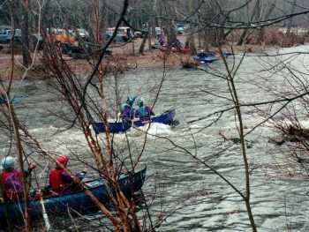
me and johny having a time. umlike the release we had the river to ourselves, woo hoo!!
Jan 1, 1900
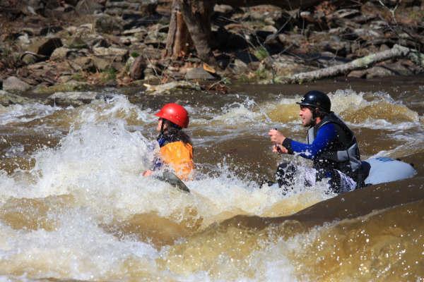
jackie crapping her pants, brian's first ever whitewater trip, and joe doin' it in his sleep....haha