Nolichucky River
1. Poplar NC to Chestoa TN(Nolichucky Gorge)
November 3, 2024
| Reporter | Kevin Colburn |
| Gauge Reading | 1.15 inches at NOLICHUCKY RIVER AT EMBREEVILLE, TN |
| Flow | Low Runnable |
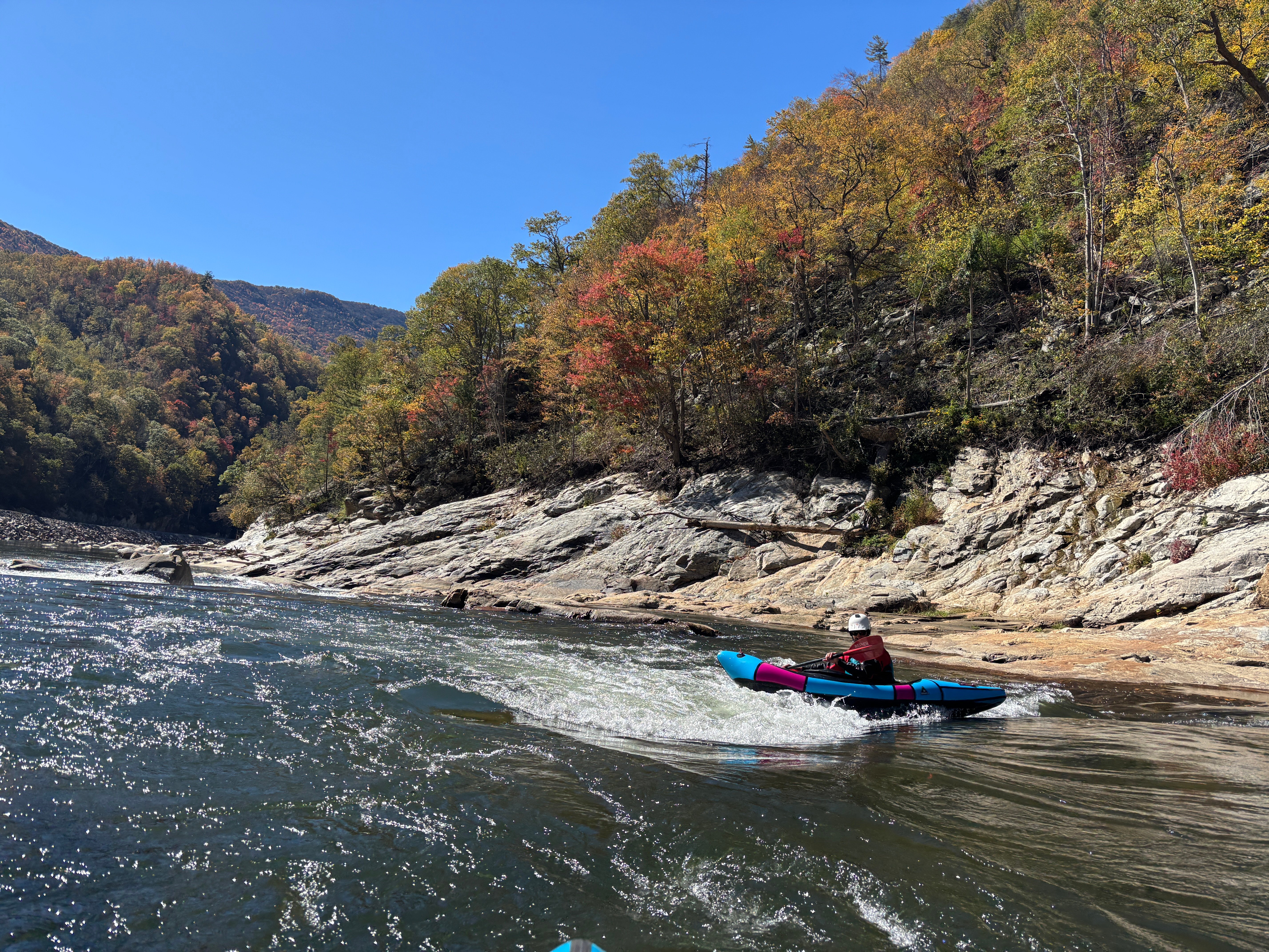
A group of us paddled the Noli Gorge on November 3 to assess the river following Hurricane Helene. We secured permission from the US Forest Service, as well as permission to park on private property. The river, as part of the Appalachian Ranger District is currently closed to paddling.
First and foremost, there are at least 3 places where traintrack rails are in the water in dangerous and very-hard-to-see places, and Quartermile has a stout ledge drop in it. Be aware.
The entire river felt much higher that we presumed it to be. While we thought it might be flowing 450cfs, it felt more like 1300cfs. The whole river has narrowed and channelized, making it feel higher and more powerful at lower flows. This could be a game changer at summer flows, which could be quite fun.
The rapids in the river are almost entirely different. The first rapid is quite similar, Jaws is still there but is a wider hole and backed up by a rock, and Twin Eddies seemed similar. but other than those three spots and some familiar bedrock outcrops here and there the river is almost entirely reshaped.
On The Rocks is now a fun rapid down the left with a hole in it. Quartermile starts off with a stout walkable 3-4 foot ledge hole with some moves afterwards. Roostertail moved upstream and the gradient is spread out through fun moves, Rollercoaster is a totally new and more challenging rapid, the entire riverbed moved to a new channel through a giant cobble bar at Maggies Rock, the ledge in Railroad Wall rapid is taller and steeper, and the run-out seemed to go a lot faster. The Nolichucky has seen a full reset, and it remains delightful, very fun, and with a bit more difficulty.
The scenery in the Gorge is still lovely of course, and the riverbed has a polished fresh feel, with light colored cobble bars and a high rocky scour line. There is very little trash and debris from the flood - almost none - with the exception of the railroad tracks that are often in or across the river. In many places the railbed is entirely gone and you can't tell there was ever a railroad there. It is shocking to see, and of course temporary beauty.
The railroad is being rebuilt with no regulatory oversight or permits. They were actively mining cobble bars, river banks, and even bedrock at a staggering scale when we paddled through, to use as ballast under the new rails. They had bult a haul road across the river at Devil's Creek and were hauling dirt and cobble across the river. Below Devils Creek most of the cobble bars had been shaved down to river level, and a dumptruck full of river rock was leaving Chestoa every 2-3 minutes. They had built new roads on both sides of the river at Poplar, including a new bridge that is a fish barrier over Poplar Creek. Paddlers and other folks are working to protect the river as the rail line is rebuilt.