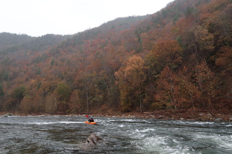
Nolichucky River
1. Poplar NC to Chestoa TN(Nolichucky Gorge)
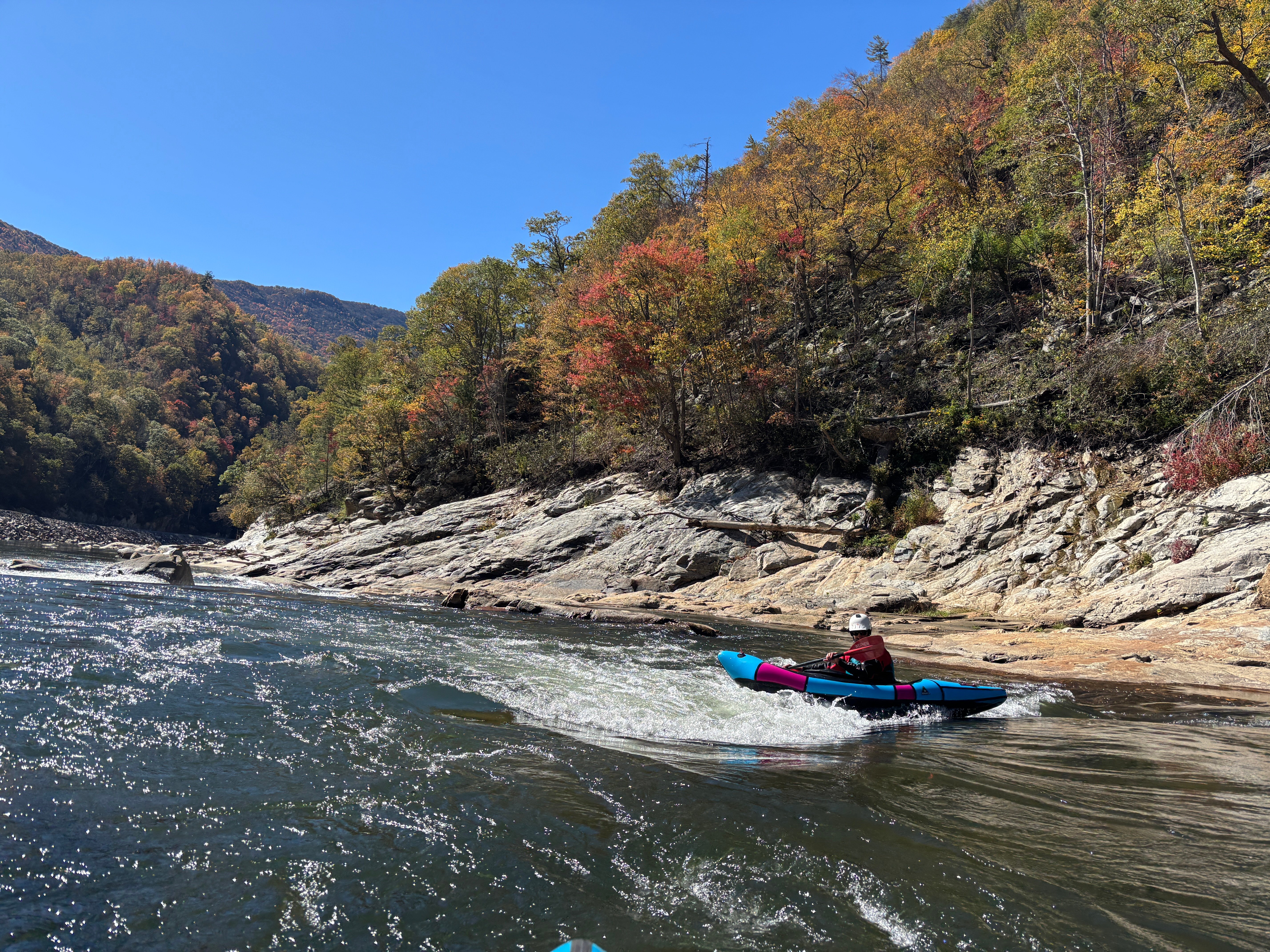
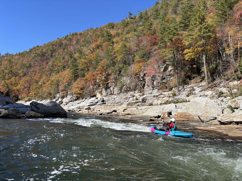
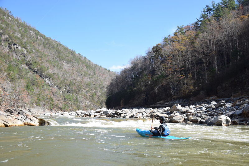
Oct 21, 2025
This was a very low water descent, but still enjoyable for us. The big news is that paddlers should stay heads up downstream of Roostertail in the vicinity of the old Rollercoaster. CSX has filled in the once-clear left channel completely with rock, and what remains is a steeply sloped 5 food drop into a significant hole, which is backed by an undercut right at the foot of the drop on its right side. There is a swift wave train leading to this narrow drop. Scout right. You can run down a left side tongue at some levels, and likely at higher water you'll be able to safely run right of the undercut. This is a dangerous spot. We saw some fish and wildlife, surfed a bunch of nice small holes, and enjoyed the fall colors.
Nov 3, 2024
A group of us paddled the Noli Gorge on November 3 to assess the river following Hurricane Helene. We secured permission from the US Forest Service, as well as permission to park on private property. The river, as part of the Appalachian Ranger District is currently closed to paddling.
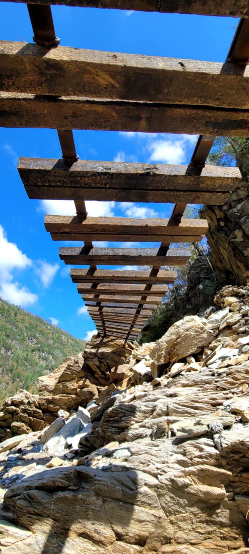
First and foremost, there are at least 3 places where traintrack rails are in the water in dangerous and very-hard-to-see places, and Quartermile has a stout ledge drop in it. Be aware.
The entire river felt much higher that we presumed it to be. While we thought it might be flowing 450cfs, it felt more like 1300cfs. The whole river has narrowed and channelized, making it feel higher and more powerful at lower flows. This could be a game changer at summer flows, which could be quite fun.
The rapids in the river are almost entirely different. The first rapid is quite similar, Jaws is still there but is a wider hole and backed up by a rock, and Twin Eddies seemed similar. but other than those three spots and some familiar bedrock outcrops here and there the river is almost entirely reshaped.
On The Rocks is now a fun rapid down the left with a hole in it. Quartermile starts off with a stout walkable 3-4 foot ledge hole with some moves afterwards. Roostertail moved upstream and the gradient is spread out through fun moves, Rollercoaster is a totally new and more challenging rapid, the entire riverbed moved to a new channel through a giant cobble bar at Maggies Rock, the ledge in Railroad Wall rapid is taller and steeper, and the run-out seemed to go a lot faster. The Nolichucky has seen a full reset, and it remains delightful, very fun, and with a bit more difficulty.
The scenery in the Gorge is still lovely of course, and the riverbed has a polished fresh feel, with light colored cobble bars and a high rocky scour line. There is very little trash and debris from the flood - almost none - with the exception of the railroad tracks that are often in or across the river. In many places the railbed is entirely gone and you can't tell there was ever a railroad there. It is shocking to see, and of course temporary beauty.
The railroad is being rebuilt with no regulatory oversight or permits. They were actively mining cobble bars, river banks, and even bedrock at a staggering scale when we paddled through, to use as ballast under the new rails. They had bult a haul road across the river at Devil's Creek and were hauling dirt and cobble across the river. Below Devils Creek most of the cobble bars had been shaved down to river level, and a dumptruck full of river rock was leaving Chestoa every 2-3 minutes. They had built new roads on both sides of the river at Poplar, including a new bridge that is a fish barrier over Poplar Creek. Paddlers and other folks are working to protect the river as the rail line is rebuilt.
Oct 2, 2024
Hurricane Helene Search and Rescue 10/2/2024
The First Descent of the New Nolichucky Gorge
Raft Team: Patrick Mannion (rafting lead), Bert Stirton, Jes Paulino, Justin Wills, Nathan Rakestraw, Jacob Hauser, Wik Ingle, Thomas Martin, Patrick Toups
Kayak Support: Scott Fisher (kayaking lead), Dennis Ashford, Elijah White, Trey Moore (Team Lead)
Medical certifications: Nathan Rakestraw A-EMT, Trey Moore and Scott Fisher WFR. All Raft Guides have WFA training.
Rescue certifications: All Raft Guides have SWR training annually, Trey Moore ACA SWR Instructor, Scott Fisher ACA SWR Instructor Trainer
Guide and Instruction Companies Represented; Osprey Whitewater, NOLI - Nolichucky Learning Institute, and the Eddyhopper Workshop
On Monday afternoon September 30th, 2024, Trey Moore reached out to the Hurricane Helene response command center at The Unicoi Middle School in Erwin, TN to offer and coordinate professional river rescue resources to the response efforts.
On Tuesday evening October 1st, 2024, the team was mobilized for a search and rescue effort into the “new” Nolichucky Gorge. The target was a white Mazda sedan, believed to have a family of 4, two adults and two children that were known to have washed into the gorge from the upstream communities and neither the vehicle or the people had been seen or found downstream.
The team assembled overnight and crafted an expedition style plan to run the river as a self contained group with an abundance of medical supplies, rescue gear, food, water, overnight options and extra pfd’s and helmets to retrieve and transport any survivors. We had 4 rafts, each manned by two highly experienced guides from the professional Nolichucky outfitter community. The rafts carried extra gear and had space for survivors, yet remained light enough should we have to portage around any unknown debris or new found river hazards. Our team of kayak safety boaters included some of the most experienced Nolichucky instructors and boaters in the area.
On Wednesday October 2nd, 2024 we met at Osprey Whitewater in Erwin, TN to discuss our plan for the day, possible scouting locations and search protocols. It was explained by members of Unicoi County EMA that any human remains in a disaster zone would be considered a federal crime scene until the National Guard could come and conduct an investigation to clear the scene, identify and remove the remains and notify next of kin. Our instructions were to take photos of any identifying features; medical alert tags, shoes, etc., mark GPS coordinates and leave in place for the investigation to take place.
At the put in we met another SAR team dispatched by Mitchell county to search for the same vehicle and family. We notified them that we would also be on the water and would also be conducting a search, but due to the traffic jam at the railroad construction site we launched before them.
We launched at 11am and floated into the gorge through the railroad construction site. The level was difficult to assess, it felt strong on your paddle and pushy. Estimates varied from 5,000 cfs to 10,000+ cfs from different members of the group. The kayaks would lead boat scouts through the first rapids while the rafts received paddle signals and followed. We floated through a new class II rapid directly across from the former home site of Patrick Toups. He suggested “House Rapid” as a name for this new rapid, in honor of the home he lost in the flood to the Nolichucky River.
There is significant railroad debris throughout the Nolichucky Gorge; rails and ties as well as large pieces of the Poplar trestle. The flow has changed at the trestle and will continue to change as rail construction moves along. We entered on river left through a set of standing waves and moved to the center of the river to avoid a large piece of trestle in the flow. At this point we encountered the “Entrance” rapid also known as “Last Chance.” This rapid had a similar right of center entrance. The majority of the flow continues down the right side now, but still retains its character of the Last Chance rapid.
In between rapids we all took turns blowing one long blast on whistles to alert possible survivors, scanning the banks for signs of life, shouting up the mountains to anyone that could be there. We all agreed to this use of whistles and reserved 3 short blasts for any on water emergency with our team that needed immediate attention.
The kayakers bumped ahead to the eddy on river left above “On the Rocks.” Again this rapid retained its character, but many things have changed on river right. At normal flows it will be quite the slalom course in the future. At the higher flows of this descent we simply stayed in the wave train headed left and cut back to the right for a traditional entrance to “Jaws.”
The kayakers cruised ahead again and found a much larger, deeper and more powerful “Jaws” wave that was difficult to skirt without being pulled out into the hole. We signaled the rafts to run left and sneak around the big rock on river left. Following the flow into what was once “Snappy’s” we found a series of standing waves and holes, which were once read and run splashes, on our way to our first land scout on river right above “The Pearly Gates” also known as “Canyon Doors.”
Members of the team irrigated their eyes with fresh potable water if they took splashes, some wore gloves. Everyone had dry tops and dry suits to protect themselves as much as possible from water contact. After the destruction of the river corridor, the water carried known and unknown pollutants; sewage, chemicals, organic remains, and possibly heavy metals. The team knew about this risk and took every precaution, including a decontamination rinse of gear and a vinegar bath as well as updated vaccines which were offered for free at the Unicoi High School which was acting as a hurricane relief shelter.
The old “Quarter Mile” rapid is gone and deserving of a new name, and her features will most assuredly each gain new names as time goes on. We believe new names will alert boaters to the new challenges that await them on the New Nolichucky. At the flows of this descent this rapid joins with the Pearly Gates and forms one long powerful rapid.
The river is now constricted by cobble bars and boulders on both sides of the rapid. A large section of railroad is overturned on on river right, partially covered in cobble bars, partially exposed and extending into the river right side of the rapid. At the flows of this descent, after the first drop at Canyon Entrance the current moved swiftly through large standing waves into the first main drop. Dubbed “Helene’s (Hole/Drop/Ledge) by Dennis Ashford. This drop is split by a large boulder believed to possibly be the old “BFR” rock rolled downstream and onto its side. The left side pours over a ledge and into a powerful horseshoe shaped hole, (Helene’s?). While the right ride features a steep and fast ramp reminiscent of “Soc em Dog,” into a burst of energetic waves.
Not far downstream, the next significant drop was also split by another large boulder, which the group believes to be the “Tennessee” rock ripped and rolled from its old position. Water poured over this ledge creating what was jokingly dubbed, “Hungrier Jack.” Just downstream from there is the old “Copper” rock. We believe this rock to have stood its ground in the middle of the torrential flows, possibly protected by the collapse of all the old second drop features of Quarter Mile. “Copper” rock is river center and deeper in the water due to the constriction on both sides. Below Copper, the river widens again into a series of large ledges and waves and continues down through the old “Murphy’s Ledge.” This seemed to be somewhat tamed by the extreme flooding, at least at these higher flows. Murphy’s ledge was largely unrecognizable and is no longer the same definitive end to Quarter Mile.
Our group carefully scouted what was once “Quarter Mile” rapid for approximately half an hour. Patrick Toups elected to portage the main drops, putting back on at the “Copper” rock. On our way back to our boats we continued to blow whistles and shout, searching for survivors and other signs of people.
The kayakers would lead the rapid in groups of two. Trey and Scott got out above Copper rock to set bank safety and hold rope for the rafts, while Dennis and Elijah would stay in boats to chase gear if needed. The team took what was considered a sneak line hugging the right bank. Once safety was set, the all clear signal was sent upstream to dispatch the rafts. Once the rafts came through, they leapfrogged the kayaks and led the remainder of the rapid into the calm section below.
We continued blowing whistles and searching the banks for survivors. We were awestruck by the power and devastation we saw. Rails twisted like spaghetti, all the riprap, dirt and gravel of the railbed had been stripped and scoured clean, the new high water mark was in the trees of the Pisgah National Forest. All the new rocks on the river were freshly broken and sharp. Our once old friend, the Nolichucky, the one we had known for years, a wise old river that knew where to send her waters and had a strong sediment bed smoothing out her energy was gone. The new Nolichucky was presenting as a baby river, a young and energetic beast that we knew would be throwing all kinds of tantrums while she decided what to do with her energy, rolling rocks around, bouncing off of bedrock and slipping through abundant sieves and siphons in every boulder pile.
As we approached the site of the old “Roostertail” rapid, we pulled out on river left to scout. Here we found the new rapid has moved upstream of the old rapid, and is now nearly half the length of the original rapid. The bottom section of Roostertail was blown clean and into the next rapid, while large boulders created new ledges in what used to be the lead-in to the old rapid. Three powerful ledges created large waves and one incredible curler wave left of center. Energy poured through the rapid which now ended at the piece of bedrock extending into the river that created the old “Pop-Up Hole” feature.
When discussing what we might find as far as new rapids the discussion came down to new names. Elijah had strong feelings that no matter what, we would not name a rapid triple drop, as there were far too many in the whitewater world. However when he approached the rapid and found Trey scouting from a rock along the left bank, Trey turned around and shrugged his shoulders and said, “triple drop?,” which they both laughed at. It sparked Elijah’s creativity, when he then suggested, “Tres Ledges” (pronounced like tres leches) the group laughed and has enjoyed that name for now.
As we got back into our boats, we planned for Trey to run and set kayak safety on the left, Dennis would run and set kayak safety on the right and Elijah ran to the bottom. Patrick Toups and Scott Fisher elected to portage and set safety on the left bank. Once the rafts came through the rapid Trey and Dennis followed them to the bottom.
We found at these high water levels that Pop-Up hole remains a supreme play feature, perhaps improved by the slow and calm eddy below it, allowing for unlimited tries to figure it out. Still providing plenty of pop, Elijah sent his boat flying more than once. Trey was able to melt down in this feature and mystery his full sized creek boat. This could also become a good raft surf in the future because of the longer recovery eddy.
The search continued downstream into what was once “Roly-Poly” rapid, this was a straight forward read and run romp through big standing waves. Many of these will be excellent kayak surfs on future play runs, but our mission was to search for any survivors, so we continued on.
Feeling like we were running well with boat scouting we entered the site of the old “Rollercoater” rapids; upper and lower. What we didn’t expect was that these two rapids had now combined to become what Trey dubbed, the “Rolling Riddle” rapid. Kayaks in the lead caught some slack water on river right to try and gain some bearings, Scott entered the rapid center going right, Trey dropped in moving left and both found challenging currents, boiling eddies and steep pour overs. Dennis followed Trey with Elijah following Scott. We signaled the rafts to follow Scott’s center to right line. As the first rafts approached slowly, they came through the rapid to find a triangle shaped pour over that led to a chain surf of three rafts which was one of the more exciting moments of the day. Boaters threw to the high side and each surfed out clean. This sequence is arguably one of the longest rapids on the stretch now, and has undeniably increased in difficulty and class. There is a large sized boulder hazard on the bottom river right that is currently undercut.
Whistles continued to blast, shouts rang out and echoed off the walls of the Nolichucky gorge. The old “Cliff Side” rapid was an easy read and run through waves that took us to the lunch counter. Patrick commented that it was nice to see something reminiscent of the old Nolichcuky. The team took a short break to eat and regroup. Jes commented on the heightened feelings of a search and rescue mixed with emotions of a brand new run. It was a tough balance to strike for our group. We were each deeply impacted by the Nolichucky. All of us had built homes, businesses and lives around this perfect little stretch of southeastern whitewater. And now, while looking for survivors of the flood, we were also looking to see if our river and livelihoods would survive as well. Jacob made the comment that he had felt, “like he was mourning the loss of the riverbed, as a young man mourns the loss of his first love”, due to the major changes the flood made. He then gestured to the river with a wry smile and simply said, “but then you meet the new Lady…” Which brought some much needed levity to our group and the full spectrum of emotions our team was experiencing.
We launched from the lunch counter and resumed the search. We ran through “Pinball” and the “Surprise” ledge, running the classic left side affectionately called “Doo-doo’s.” There is a dangerous, underwater piece of rail in the drop of Doo-doos that forms a highly consequential pin spot. We suggest running the far right “Surprise Ledge” for the time being. Passing into the section known as “Sycamore Shoals,” we noticed that here was the first place where the energy of the flood slowed down enough to deposit all the rip rap rock from the rail bed. “Rip-Rap Bend” now extends as a large deposit of cracked and sharp gray rock and litters the left back through Sycamore Shoals and into the “Rock Garden” downstream.
Here we got out and searched the shore for about an hour. We climbed high to the railbed and found tracks lifted and bent like an amusement park ride. We looked for any signs of life. We were surprised by the lack of vehicle and construction debris. Natural debris littered the high water line, with only hints of vehicles or houses. We whistled and shouted, we wandered through a wasteland of logjams heaved high onto the banks. Elijah found a driver’s license.
We got back into boats and headed into the “Rock Garden.” There are a few new landslides on river right, and here is the biggest deposit of silt, sediment, rocks and boulders spread wide across the river bed. Rock Garden is still there, although very different and much steeper. We will have to see how it develops and channelizes in the future.
Passing another large cobble bar on river left we decided to get out again for a quick search. Nathan found footprints. Our hopes heightened with the possibility of survivors, we began chasing these prints in both directions, only to find out that Scott had actually walked this far down the bank on our previous search. The footprints belonged to him. The reality of the situation was setting in. Railroad workers were hiking in and out of the gorge from the top and the bottom. Helicopters were out in full force bringing supplies and supporting our efforts. And we were on the river filling the blanks in between. It was a beautiful sunny day and we all agreed that if any of us had been surviving alone for days in the gorge we would have made ourselves known. And yet we still pressed on, blowing whistles and shouting up the hillsides and mountains.
The concrete wall at “Hole in the Wall” rapid remained, but the tracks were torn off and twisted. We half expected a large amount of debris in the “Lost Cove” pool, but we found very little, the vast majority of debris in the river being from the railroad. As we entered “Souse Hole” rapid we found “Maggie’s Rock” to be gone, a large cobble bar had been pushed up on river right and the main flow had moved into the center channel. This is a new read and run rapid and will likely get a new name in the future.
Downstream we encountered railroad workers at Devil’s Creek. They informed us that the rail trestle was a half a mile down river in the middle of the flow and to beware. At this point we directed our search to river right as the workers were in force on river left. “Stateline Shoals” remains, but the lines and features are most assuredly different. We floated through the old “Zig-Zag” rapid and found the rail trestle above “Twin Eddies.” This rapid also remains and should keep its name, but the lines and features will be different as the water drops.
We pulled off the river at Twin Eddies and the SAR team dispatched from Mitchell County caught up to us. They had been dispatched in a single raft with four paddlers and support from above via a military blackhawk helicopter. They were visibly shaken and requested a light from our group to smoke a cigarette. They told us they were very happy to see us. They ran in a single boat, without scouting and knew they had gotten lucky. They were able to see where the last of our group entered some rapids and followed as best they could.
We debriefed and discussed what we learned from our trips with each other. We talked about ways to improve our spacing, communication and searching for future on water missions. We made a list of hotspots that we thought could benefit from a recovery team with cadaver dogs. We passed off the driver’s license Elijah found. After being a part of our debrief and seeing how thoughtful our approach had been they reached out to their dispatch and told them the gorge was too dangerous for them to return without professional escort from our group of experienced Nolichucky guides. It was an intentional decision to debrief here so we could be quick at the take out and not impede ongoing relief and recovery efforts. A group photo was taken here.
From here we floated past the Nolichucky Campground and USA Raft Resort. These properties were heavily impacted, with buildings floating away, large pieces of land ripped into the river and huge sand deposits over the grounds as the water dropped. Jones Branch and Unaka Springs roads were washed away, making access very difficult. Luckily everyone in these two properties has been accounted for in the days after the flood.
The “Slide” and “Cowbell” rapids were buried underneath a large cobble bar which now pushes the flow to river right along the bank below USA Raft. Here there is a stompy and splashy rapid, dubbed “Jack’s Rapid” in honor of Rick Murray’s son Jack and the island formerly known as “Jack’s Island,” which no longer exists. An unexpected hazard emerged as we exited the rapid and found a powerline dangling across the river. Our team had to work hard to find flow over the lowest hanging part of the power line.
From here on out we ran through a series of standing waves until we found a place to take out in the rubble that was once the Chestoa Recreation Area.
While the hurricane has forever changed our rivers, it has not dampened our spirits. Within hours of the flood we witnessed paddlers coming together and adopting river communities across the southeast. Paddlers created supply lines and made access to these communities. We did wellness checks, hiked supplies in. We worked hand in hand with local survivors and government officials. We became trusted and respected response organizations literally overnight. We sourced funds, supplies and manpower and helped bring stability to the people we used to just drive past on our way to the put in. We learned their names and faces. We played with their children, and listened to the stories of their grandparents. We organized distribution centers, built shelves, opened driveways and split wood for winter with the locals. Paddlers played a huge role in the rescue and recovery efforts. For that we should be very proud.
As we return to paddling these rivers we should all understand the risks; known and unknown. The water and soils need continued testing to determine a trend line to see if they are cleaning themselves. Everyone running these rivers should be updated on their vaccinations like Tetanus and Hepatitis. Beware of debris in the water. As the levels have dropped we have found the railroad tracks cross the entire river in at least two places on the Nolichucky, which could require portages. And as construction projects get into full swing these rivers will continue to change. Truck loads of fill rock, dirt and gravel will push flows around. Rocks are already observed to be moving and settling into new places. Every boulder pile should be approached with extreme caution. Many hazards we will not know about until an unsuspecting boater interacts with them.
It is indeed a new era of river running and exploration in the southeast. We are known worldwide for having some of the best and most accomplished boaters out there. We are also known for having many cavalier groups of “beaters” who are more interested in firing up challenging rapids and filming it, than developing their basic river running and rescue skills. We are all going to have to improve our risk assessments and risk management techniques. We will all need to improve our scouting and spacing as the river beds continue to move and settle with each high flow event. This is an opportunity for us all to practice having tough conversations with ourselves and our friends about our skills which are not only physical, but the mental game of sound judgment and decision making. We should also prepare our spirits for the emotional impact of the loss of many of our favorite places, balanced by the excitement and draw of this new era of exploration and adventure.
Jun 24, 2019
The rapids in the description above are out of order. On the Rocks is the second major rapid after Railroad (called Entrance here.) Roostertail and Roallercoaster are below Quarter Mile.
Nov 12, 2018
Trip with American Whitewater staff and friends following November board meeting.
Jul 3, 2014
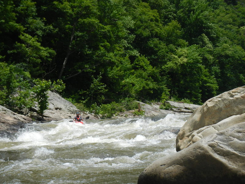
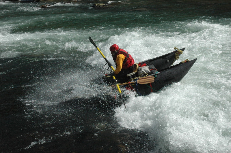
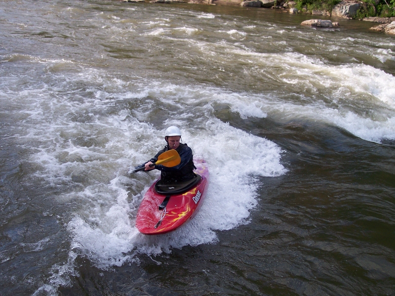
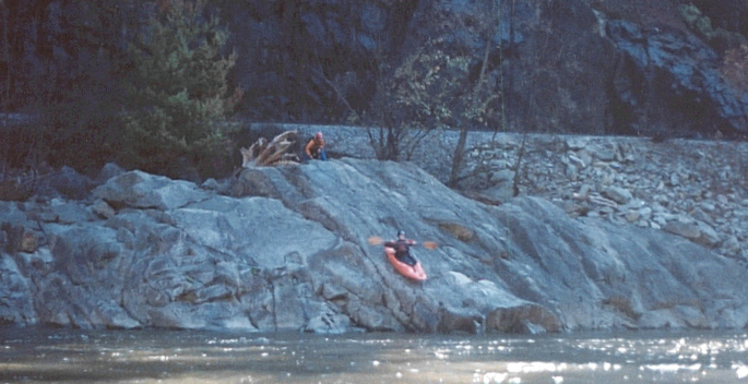
Tony S at the top of Roostertail
Jun 28, 2014
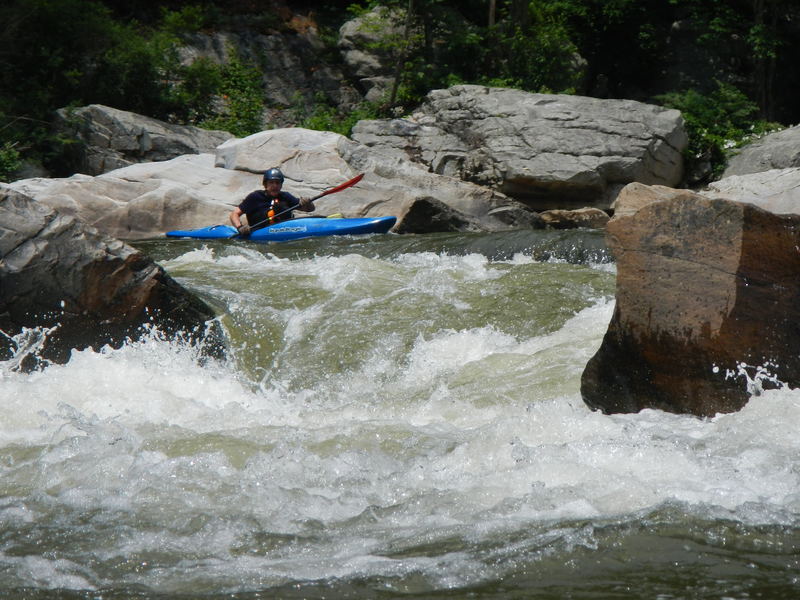
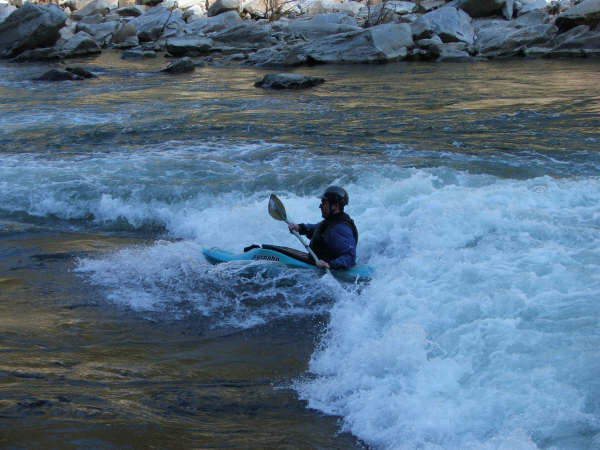
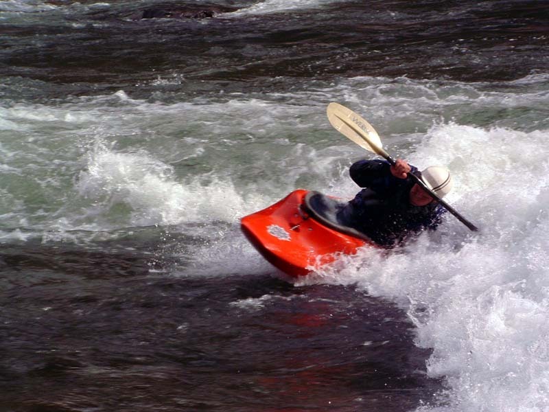
John Kreiner lines up for On the Rocks
Jun 20, 2012
I went for my first kayak run today and lost a left chaco, blue, mens 13 in quarter mile. If you find it please leave it at the hostel or find a High Mtn Expeditions van and throw it in there. I have learned my lesson to always stap things in my boat.
Nov 28, 2011
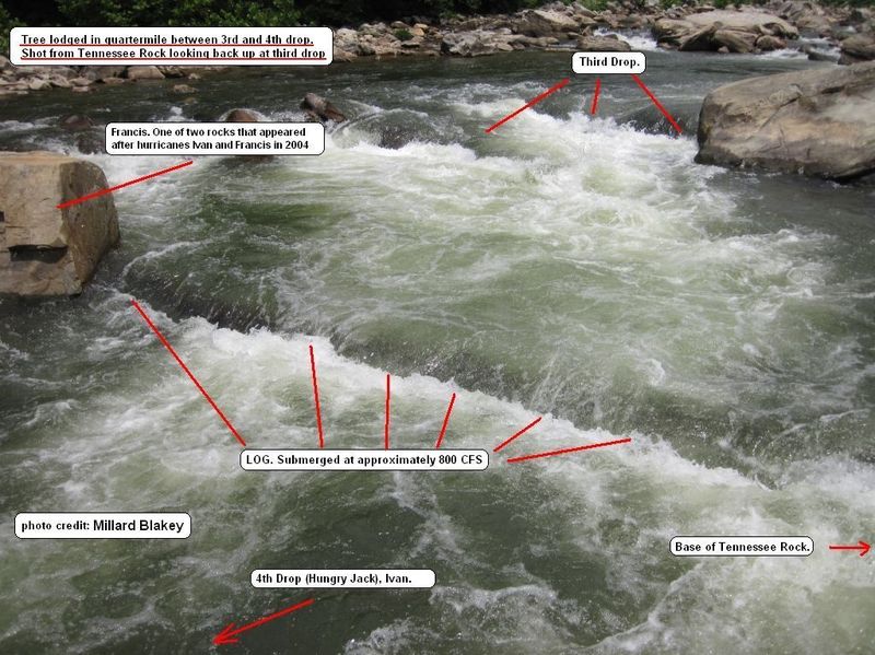
The log that was in between 3rd and 4th drops has been removed.
Jul 4, 2011
UPDATE: Tree removed around the 1st of August. -- Tree stretched across main channel in Quartermile rapid between 3rd and 4th drop. Picture Taken on July 4th, 2011 at approximately 800 CFS. BAD HAZARD.
Mar 29, 2011
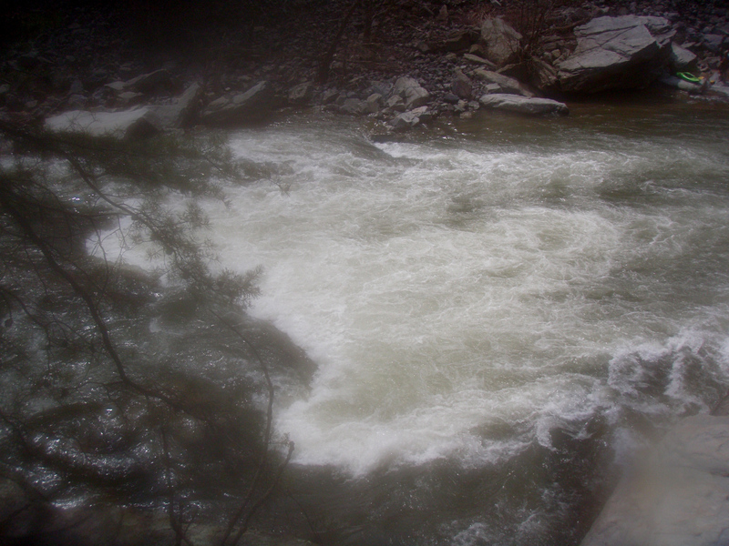
The campground that is currently listed as the take out charges money to use their area. We took out and while waiting for our shuttle, the owner came and asked for $3 per person. We payed, but I think it is worth noting that there is a forest service take out not far down that is free.
Nov 10, 2010
Gordon Byrd and Omer Hall surfing at Jaws, Spring 2000.
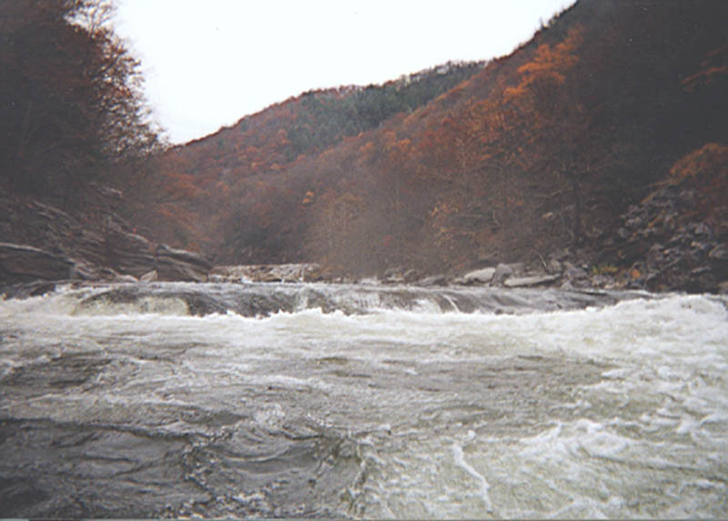
Apr 3, 2010
This is a view of Murphy's Ledge after Quater Mile on the Nolichucky. The level is about 2070 cfs and there is a back board up here!
Mar 4, 2010
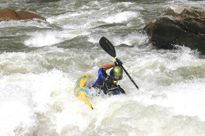
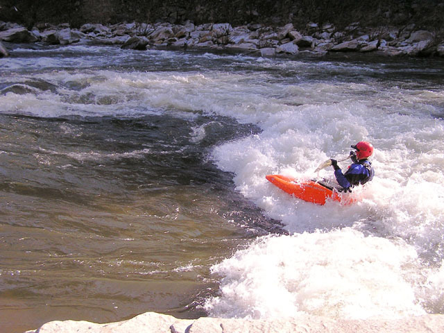
Wade White surfing Jaws
Apr 28, 2007
BWA students brave the advanced Gorge section of the Nolichucky River. Great jobs guys.
Mar 18, 2006
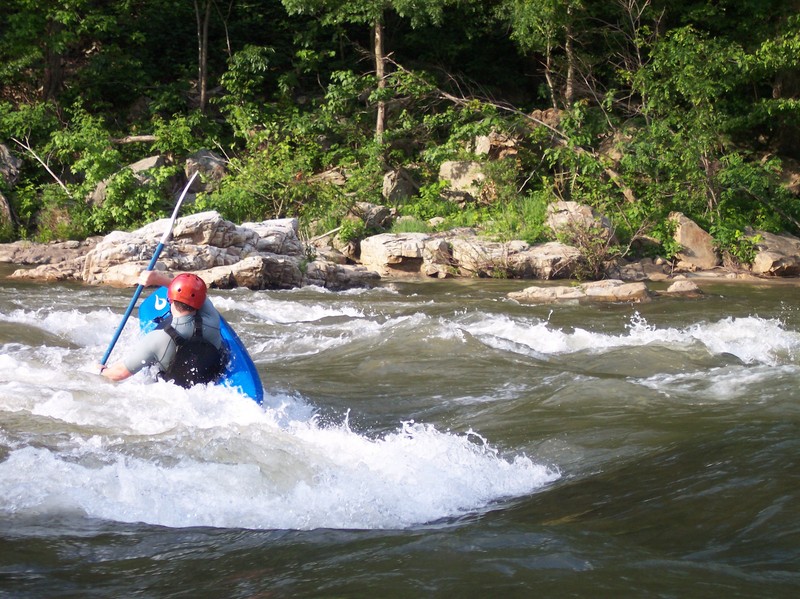
First Jaws surf. Fun Fun Fun.
Jun 23, 2005
good level for this wave and a beginner playboater
washing out
Jun 8, 2005
Nothing like a Daddy paddling on Father's Day on the 'Chucky'
Jun 8, 2005
Dave can work a wave, and a woman.
May 15, 2005
5/15/05
yesterday I ran the Nolichucky for the first time since the last round of floods. (1300cfs)
one area of note is the first ledge in Quartermile, the one above Hungry Jack. This has changed radically from the way it used to be. There is now a LARGE boulder in the middle of the channel (about where the old railroad barrel used to be), but it is not the main hazard. There is now a very sticky hole associated with this ledge. The old move of catching the eddy below the Big Rock on the left of the ledge now has consequences. whereas before, if you blew the ferry you could just go on down and run Hungry Jack, now you are likely to wash into this hole. I saw it briefly stop a raft yesterday, and pull boats back into it that got too close. Further, there is now a VERY BAD pinning rock on the left end of Hungry Jack with current running onto it. several people I saw had close encounters with this rock.
Scouting is easy, and hightly recommended. Portaging that first drop is also very easy, and IMO should be considered unless you are very confident you can make the required moves. you can also sneak Hungry Jack thru a small slot on the left if you carry the first drop...
have fun, be safe!
david
Jan 2, 2005
sweet.....
Sep 27, 2004
A few changes after the recent floods: A group of us ran the Nolichucky Gorge Saturday (myself, Jason Weems, Caleb Paquette, Ashley Strickland, Bill Schooley, Hank Mullins and Spanker). The level at Embreeville was 2150 at 6am Saturday. There are some changes in the Gorge to be aware of due to the recent floods. I have a feeling the gauge is out of calibration. It felt pushy to me for 2150. I thought things looked to be 2.8 to 3.0 feet which would correlate to 2500 to 2800. The only thing that bugs me a bit about this is that the difference between the gauge in Greenville and Embreeville seems correct. I doubt both of them are out of calibration the same way. It may be that the rate of decline is so slow that the level at the gauge is closer to the level in the gorge than what normally occurrs with a faster decline. Others in our group felt the same as I about the level. So take the gauge change for what it is worth. There is a large rock splitting the channel above Hungry Jack in Quarter Mile. You have to go right or left. The rock is easily visible from the eddy at ducky beach. There are some other rocks in the eddy formed by the new rock. They were just below the surface. Be careful if you decide to eddy hop. In my humble opinion, the new rock makes this part of Quarter Mile more difficult to run. The rock is going to give rafts a hard time next spring. I have never guided rafts but it looks to me that there is enough room for them to go right of the rock. There is another rock on the river left side of Hungry Jack. The most impressive change is at the perfect wave. Some of the large flat rocks have been moved about 20 feet downstream making a bowl eddy at the wave. It appeared to me the wave is a little more perpendicular to the current. It also appears that the eddy line is not as good as it used to be.
Nov 23, 2003
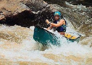
Milton Wicker surfing Jaws on a cold November day.
May 5, 2003
A Creature Craft takes a wild ride in
Jaws. After a surf lasting several
minutes the craft was kicked loose
from the hole. Loose beers
continued to float up in the eddy for
the next several minutes.
Feb 25, 2003
From Laura:
Here goes:
The first rapid is Last Chance, it will follow shortly after you cross under the RR bridge. Just about any line can be run through here with enough H20. You will see rocks in the river on your left side, most people start about 15' or so to the right of these rocks, pinning possibility if you go left of these rocks unless it is high water. Once you are headed down stay leftish & look for the eddy that is behind these rocks or you can blow past the eddy and stay left. If ya catch the eddy the wave hole below you is fun. (Look @ the picture on AW site)
You will have a pool then On the Rocks is next. In the center of the river there is a setup eddy behind a large rock start from here with an angle to river left, really depends on the level on how the hole will be. If you don't angle your boat going into the drop you can get pushed up on the rock in the bottom of this drop, hence the name. If you get pushed to the right of 'the rock' straighten your boat and look for a clean line, people pin here and some rocks are undercut. Ideally go left of all the large rocks that will divide the river below the drop. Instead of the drop you can also: boof on river left with enough H20, you would need to get out look @ the rapid to get that line you can pin if you go too far left. Also there are creekin' lines to be had on river right, it is better to follow someone who knows them or get out & look. (Look @ the picture on AW site)
Next is Jaws, which is a awesome playspot. Starts to get munchy around 2000 cfs, especially on river right. 1500-1800 is my favorite play level. If the weather is nice you will have locals here. People play here then hike the tracks back out. (Look @ the picture on AW site)
You will have some class II-III type stuff then you will come up on Quarter Mile, probably the toughest on the river, definitely the longest. You can boat scout your way through entrance to Quarter Mile. At the start of Quarter Mile rapid you will find a large eddy on river left, plenty of room. From here you can see down the first drop, there will be a curler wave, past that you will see small eddies that can be caught. Hit the curler wave angled towards river right. On your left there are some nasty pinning spots and sieves. You can easily get out of your boat in that eddy and check out the hazards in the first drop. Catch one of the small eddies I mentioned earlier. From here you will see a large rock on river right, peel out and head for the left side of that rock, you want to stay pretty close to that rock 5-8' there will be a large hole on your left. Catch the eddy behind that large rock you just passed. From here you will see a large rock kinda in the center, on the immediate right side of that rock is Hungry Jack hole. You will want to be right of that large rock avoiding the hole and then ferrying back left behind the large rock. DO NOT go left of that large rock, there is a spot called No way Jose that is bad. There is a move called Tilt a Whirl on the left of the rock, but you need to follow someone for that. From here it is boogey H20, look for the horizon line - that will be Murphy's Ledge, almost a river wide hole. You can take a far right or far left line, you can boat scout either side. Far left is the normal route, people have said there is RR debris on the right. There is a fine line in the middle of the ledge, again you should follow someone for this line.
This will get you through the toughest part of the river. Next significant rapid is Roostertail. Start river right and angle to river left for the first drop, avoiding hole on the right. After that you will cut behind a large rock on river left.
Rock Garden is deceiving and not easy to scout, the line is impossible to describe. The river will bend to the right and filter down through a rock garden, keep your boat straight here, you will broach if you get sideways, I have. You want to stay straight and bounce off the rocks.
Railroad wall rapid is indicated by a large concrete railroad wall. This is a large hole. When you see the horizon line get to the left eddy above it. There will be a rock in the center of the river sticking up out of the H20. Cut against the left side of this rock, you will be skirting the hole so keep it close to the rock.
I have only described the real significant rapids, there is plenty of stuff in between the rapids I have mentioned. Do Do Hole, Maggies, Twin Eddies (great play hole in the bottom), etc. and other class II-III type stuff. Keep in mind you can scout almost anything on river left and carry everything on the RR tracks. As I mentioned before, the Nolichucky is the coldest H20 I have been in this winter, there are RR tracks but the river is remote, no hiking out to a road. Also after last weeks flood keep your eyes open for new wood, I am sure it will be there, we came across some last Sunday in Bama. 2000 cfs will be juicy for a first time run with no guide. Just because I have given long descriptions does not mean that this is some kind of monster river (atleast not around 2000cfs) I am overly detailed, I guess.
I love this area Erwin is great, I have a lot of good friends in this town and the locals are always nice. Erwin Burrito is worth checking out as well, awesome spicy chicken quesadilla and spicy chicken sandwich.
Hope this helps, have a great time.
Nov 15, 2002
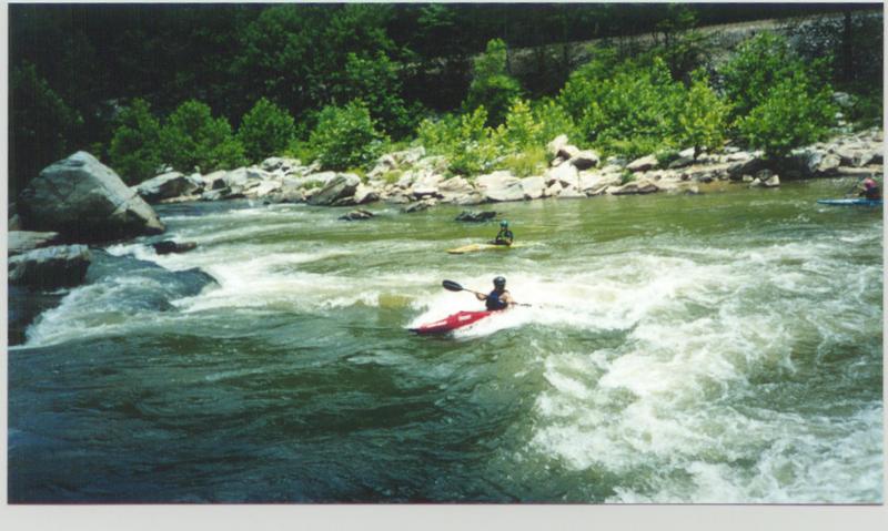
First drop at On The Rocks
Last drop of Quarter Mile. Usually ran far right (or far left when the water is up). Other lines are ran depending on water level but potential dangers include pinning &/or keeper hydraulic.
Looking upstream. Standard line is to the right of the large rock. At flows over 2200 cfs or so, a creeking move opens up on the left part of the rock.
Jan 1, 1900
Great river at this level. Easily my best trip down. And the scenery is always spectacular!
The floods couldnt change this rapid.
Jan 1, 1900
Boof
Jan 1, 1900
Photo courtesy of the Monocacy Canoe Club.
Jan 1, 1900
Gordon Byrd and Omer Hall surfing at Jaws on the Nolichucky Gorge at 1600cfs.