| Difficulty | I-III |
| Length | 15.2 mi |
| Avg Gradient | n/a |
| Gauge | Price River Near Scofield, Utah |
| Flow Rate as of 45 minutes | 94 cfsbelow recommended |
| Reach Info Last Updated | July 25, 2025 |
River Description
The Price River begins in the upper reaches of the Wasatch Plateau, a mountainous region that serves as the geological extension of the better-known Wasatch Range located east of the Salt Lake Valley. Sitting at almost 8,000’ in elevation, the 100-year-old Scofield Reservoir is fed by seasonal streams like Mud and Fish Creek. Below the Scofield Dam, the Price officially begins its 140-mile course from the mountains into the high desert of the Colorado Plateau toward its confluence with the Green River.
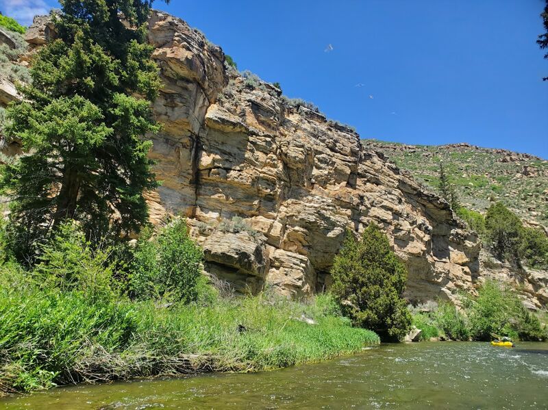
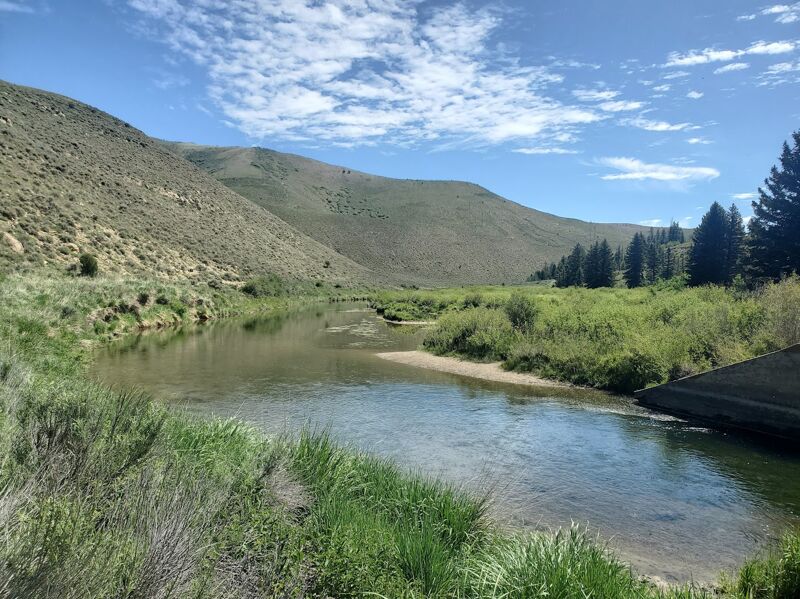
Upon launching at the footbridge below the base of Scofield Dam, the Price River meanders gently and slowly for the first few miles. Unlike many of Utah’s sediment-laden waterways, the Upper Price is clear and pristine. Anglers will rejoice at the sight of abundant trout species and colossal tiger muskies. The river also has an alpine canyon feel, as Engelmann spruce and Douglas fir become more common as the canyon closes in about two miles downstream from Scofield Dam.
A pair of powerlines essentially mark the canyon entrance, and paddlers should prepare themselves for potential encounters with river-wide wood and a faster float from here to US Highway 6. Here, the gradient steepens and the first few riffles emerge as the Price continues on an east/northeasterly course through the mountainscape. While the scenery is exceptional during this initial descent, a railroad track follows the path of the river and occasionally crosses it along historic trestles built at the beginning of the twentieth century.
About 4.5 miles below Scofield Dam at a right bend, the river approaches another train trestle that crosses from right to left. Just above this trestle is a gravel road that comes in on the right that serves as the only road access point between Scofield Dam and US-6 (Lower Fish Creek Road). Scout below this bridge for wood and to see the line for entering a fun drop before going under the trestle. A small eddy exists after the bridge on river right
...River Features
Put In
Access PointDistance: 0 mi
Launch below the footbridge at the base of Scofield Dam. A gravel road leads to a small parking area with a pit toilet at this location.
Take Out
Access PointDistance: 10.94 mi
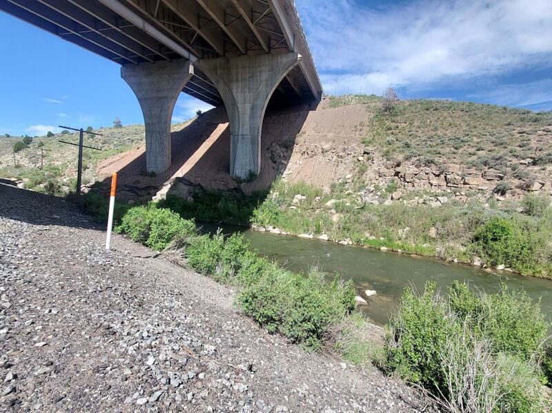
This take-out is directly under the US-6 overpass about 11.5 miles below Scofield Dam.