Black
Whitesville to Perkinsville
| Difficulty | II-III(IV) |
| Length | 5.5 mi |
| Avg Gradient | n/a |
| Gauge | Black River at North Springfield, Vt |
| Flow Rate as of 48 minutes | 54 cfsbelow recommended |
| Reach Info Last Updated | April 7, 2019 |
Review courtesy of TommyCBoat.
I made my personal first decent of the Black in Cavendish Vt. Carlton Road to Upper Falls Road with NHAMC today. No gage, no experience so I'll call it a medium level based on comments I heard.
NHAMC ran it as a class III and I won't argue. The first drop was billed as a III. I looked at it too long and listened to others declare it a IV- and finally chose to walk it (wimpy wimpy). Sean attempted to run it solo in a Mad River Freedom (16' tandem)with dramatic results. The short swim didn't seem to faze him though. John, Bruce and Dan, kayakers all ran various lines without any drama. Below that it started with fast class I building to fast class II and finally III.
As anyone paddling today is well aware it got colder and windier as the day went on. I was glad to be in the Cascade C1 and pitied the openboaters when the wind blew up the valley.
The gorge section was pretty sweet. Some of us had been hanging back surfing everything we could. We caught up to the main group while they scouted. The consensus seemed to be 'plenty of water watch out for the holes'. I was still wishing I'd not psyched myself out at the first drop so I took that as my cue and went for it. It quite reminded me of the gorge at New Boston at 5'. Tight and fluid with big waves and small eddies. No Decoration Drop though.
Below the Gorge it was II-III boogie water for a few more miles to the covered bridge takeout.
I was pooped by the time we finished which is to say it was a pretty great day.
Some of us drove up to and walked Cavendish Gorge Which has been compared to the Flume in Franconia Notch minus the boardwalk and cover charge. It's well worth seeing but I won't be paddling there any time soon... YIKES.

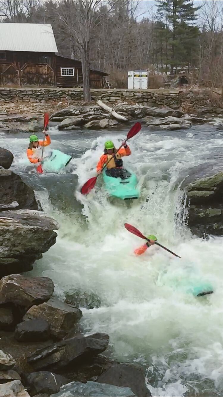
There are four different lines (drops of 3-5 feet) depending on water level, at 700cfs most were runnable - but there were some rocks to avoid underneath the drops.
The drop on far river right is the meatiest but most fun, just don't plug or you'll hit a rock.
The drop on far river left is pretty straightforward and the easiest to get through.
Can be scouted from the put-in.
The 'gorge' section runs for about a mile and is more narrow with a higher concentration of small drops and holes than the first three miles.
There are some places to get out and potentially scout, but most are read-and-run and the rapids flow into each other so it's hard to tell where one stops and another starts.
At 700 cfs it was mostly class II with a few class III moves and holes thrown in here and there.
Jun 19, 2023
Tree down across entire river at first major rapid in gorge. Cannot be seen until it's too late.
Location: https://goo.gl/maps/zYh6n2HD12XsREUP6
Coordinates 43°23'33.9'N 72°32'33.9'W
Otherwise great run. 700 is the lowest I'd run it, pretty scrapey even at that level.
There is one last surprise rapid right at the takeout (100 ft before covered bridge) that needs to be scouted at lower levels as there is a ledge drop and only one slot that has sufficient water in it to not get stuck.
May 4, 2018
Run Is about 5 miles and took about an hour at 800 cfs. 7.5 miles on main page needs editing. We beat our shuttle ride by an hour thinking it was longer run. Beautiful river.