Mad
2.) 1st Hydro Dam to Winooski River(Lower Mad)
| Difficulty | II-III+(IV) |
| Length | 2.1 mi |
| Avg Gradient | 30 fpm |
| Gauge | Mad River Near Moretown, Vt |
| Flow Rate as of 17 minutes | 55 cfsbelow recommended |
| Reach Info Last Updated | August 8, 2023 |
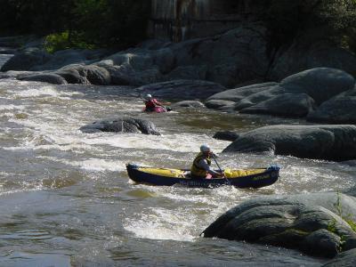
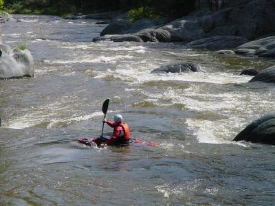
The most common class III run is the lower Mad. This is the last 2 miles, from the hydro dam to the confluence of the Winooski River. There is one possible portage at Horseshoe Falls. This is a class IV+ drop with a technical entrance and sticky recirculating hole at the bottom.
The run parallels Vermont Route 100B providing ample oppertunities to scout and access the river. Take out is 1/3 mile below the confluence of with the Winooski River on river left just downstream from Vermont Route 2. Please note the new take-out, parking area, and pull-through for trailers: It is just DOWNSTREAM of the Route 2 bridge on river left of the Winooski (just across the road from what it says above). You will still want to watch for poison ivy, though. Thank you Vermont River Conservancy for such great river access!
To find the put in travel south on Vermont Route 100B from Vermont Route 2 approximatel 1.5 miles. Just before the road crosses over the Mad River take a left on a dirt road. About a 1/4 mile park on the right then hike a short distance down to the river put in just below the dam.
Technical info
Put in elevation......485'
Take out elevation....426'
The put in rapid is an easy straight shot through and around large ledge boulders.
Rapids start under the high Vermont 100B bridge. Some good surf at the top of the rapid.
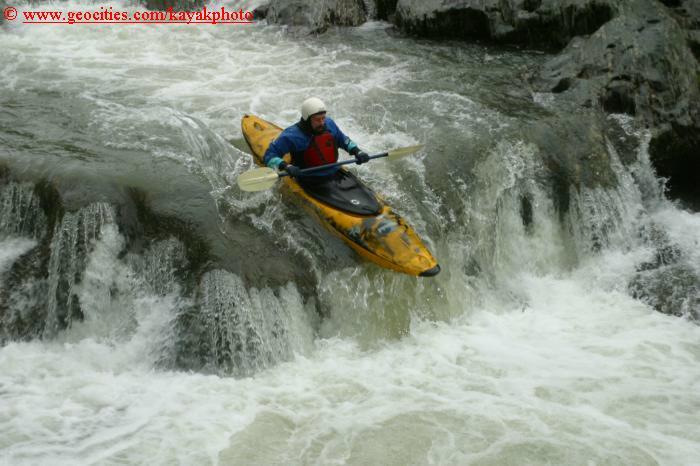
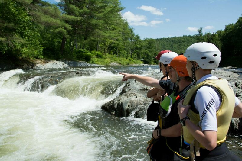
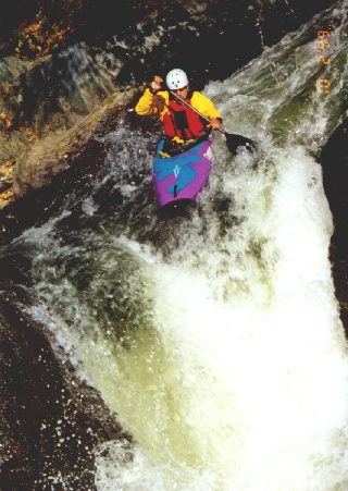
Shaped like a horseshoe, the right side is steeper and can result in some long downtime once you launch over the 6' ledge. There is a maw in the middle where the right side and left sides meet. This could easily flip a boat. River left has a two-step drop with a rather sticky hole at the bottom. The first step tends to slow the boater's momentum just enough to cause trouble for the second step. Rescue boaters and equipment efficiently since the Washing Machine is only a short distance downstream. However, most equipment/boats remains in the pool where Horseshoe pours into giving even those not prepped for a rescue time to collect belongings. The Horseshoe is very easily portaged on river left.
At levels below 400 cfs, it seems that the two stage river left drop is too shallow to run, and the ledges are mostly out of the water. River right is flows at <400 cfs, and is a solid 6 foot boof over a hole with a tricky entrance. At high waters, this drop is a solid class IV. At lower waters, this drop becomes much more manageable as the hole above the entrance calms down and makes the move up top easier. Additionally, there is an eddy that is fairly easy to to catch right above the drop, which allows for the boater to set up better before the falls. At low flows, this is a class III move.
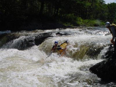
A short distance below the Horseshoe the river is squeezed between a vertical wall on river right and ledge on river left. Straight shot through, just a bit violent.
Fun playful rapid in a steep gorge. Identified by an old bridge crossing and a home on river left.
A short distance below 'Old Bridge' the river splits around a ledge island. The river right route provides more sport. Run the left side first then carry back up the ledge island to try the right side. Shortly below the Final drop the Mad converges with the Winooski.
Aug 9, 2023
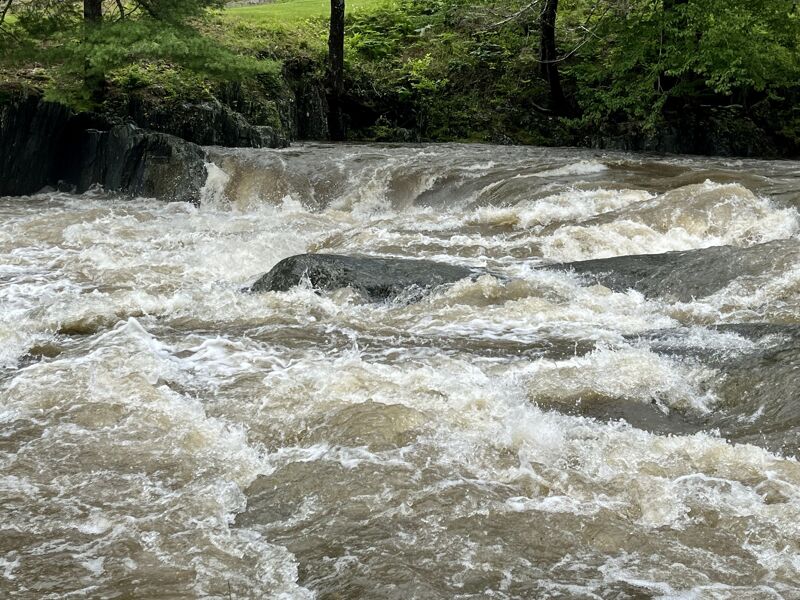
Heavy rain overnight brought the Mad River up to nearly 4,000 cfs. It quickly dropped to around 1,700 cfs when we put on for a run. It continued to drop after we took out, but heavy afternoon rains brought it back up again.
Apr 4, 2021
For the record, the preceding comment (and this one) were posted on April 3, 2021. The site seems to be recording the posting date incorrectly or the page isn't accounting for the local time zone when it derives the displayed date from the underlying timestamp.
Apr 4, 2021
WARNING!! As of this afternoon (and maybe yesterday) there is a large tree (hemlock or spruce) lodged in the right side of Horseshoe Falls, with branches actually sticking out of the falls, plus more (and larger) branches sticking out of the water 20-30 feet downstream of the drop. When I saw it late today the flow was about 500 cfs, so it seems to be quite securely held in place.
The trunk is not visible, but the branches indicate that it is fairly large, and may have many additional branches coming off of it under the surface. Clearly it is a very serious entrapment hazard for anyone who runs the falls blind. Even running the left side sneak drop is questionable, inasmuch as a swim or bad line could put someone right into the strainer in deep and turbulent water. My advice is just walk the drop, and wait for the next major runoff event to flush it out.
Everything downstream is clear—for now. If this tree does flush out of Horseshoe it may create a comparable hazard downstream, unless the flow is sufficient to push it all the way to the Winooski River or up on the left bank and out of play.
Jun 1, 2003
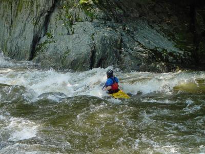
More of my photos can be found on my NEW kayakingphotos.com page and my American Whitewater page.
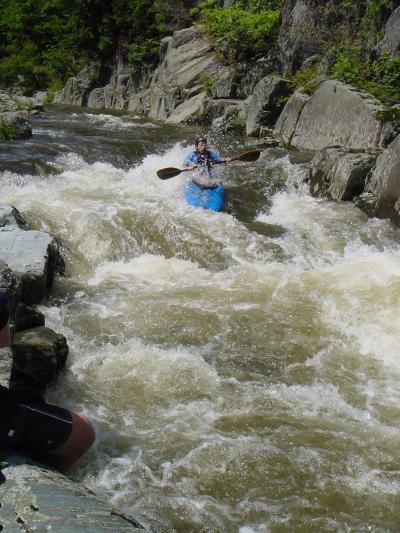
More of my photos can be found on my NEW kayakingphotos.com page and my American Whitewater page.
More of my photos can be found on my NEW kayakingphotos.com page and my American Whitewater page.
More of my photos can be found on my NEW kayakingphotos.com page and my American Whitewater page.