Mad
2.) 1st Hydro Dam to Winooski River(Lower Mad)
Aug 9, 2023
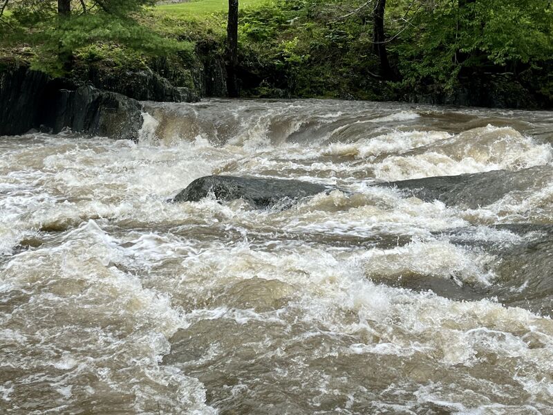
Heavy rain overnight brought the Mad River up to nearly 4,000 cfs. It quickly dropped to around 1,700 cfs when we put on for a run. It continued to drop after we took out, but heavy afternoon rains brought it back up again.
Apr 4, 2021
For the record, the preceding comment (and this one) were posted on April 3, 2021. The site seems to be recording the posting date incorrectly or the page isn't accounting for the local time zone when it derives the displayed date from the underlying timestamp.
Apr 4, 2021
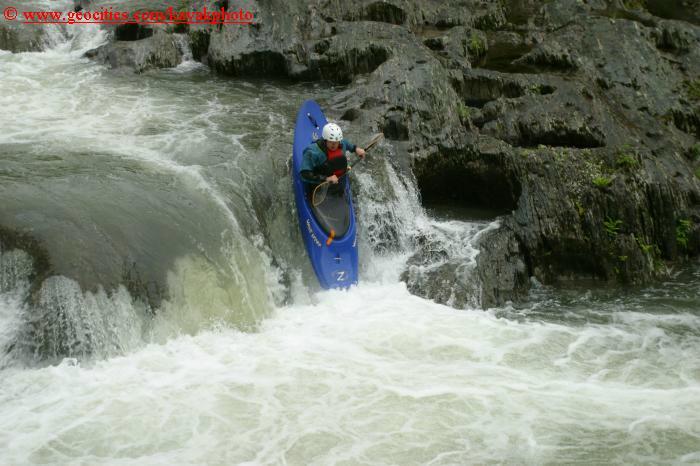
WARNING!! As of this afternoon (and maybe yesterday) there is a large tree (hemlock or spruce) lodged in the right side of Horseshoe Falls, with branches actually sticking out of the falls, plus more (and larger) branches sticking out of the water 20-30 feet downstream of the drop. When I saw it late today the flow was about 500 cfs, so it seems to be quite securely held in place.
The trunk is not visible, but the branches indicate that it is fairly large, and may have many additional branches coming off of it under the surface. Clearly it is a very serious entrapment hazard for anyone who runs the falls blind. Even running the left side sneak drop is questionable, inasmuch as a swim or bad line could put someone right into the strainer in deep and turbulent water. My advice is just walk the drop, and wait for the next major runoff event to flush it out.
Everything downstream is clear—for now. If this tree does flush out of Horseshoe it may create a comparable hazard downstream, unless the flow is sufficient to push it all the way to the Winooski River or up on the left bank and out of play.
Jul 7, 2017
Gauge is re-calibrated. Thanks USGS and local paddler Chris!
Jun 30, 2017
Please note the new take out, parking area, and pull-through for trailers: It is just DOWNSTREAM of the Route 2 bridge on river left of the Winooski (just across the road from what it says above). You will still want to watch for poison ivy, though.
Thank you Vermont River Conservancy for such a great river access!
May 9, 2014
-Take out: There is now a nice river access and parking area just downstream of the Rt. 2 bridge on river left. You'll still want to watch out for poison ivy.
Oct 5, 2011
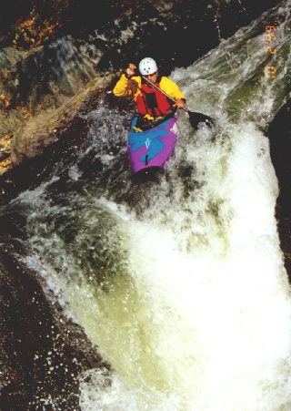
I've paddled this section three times at three different water levels since the hurricane. It is in very good shape (minus some trash on the banks). The put-in has been gouged out rather significantly but the first few rapids have not really changed. After Lower Put-In there is now a nice play wave at about 500-800cfs. Look out for a boulder on river left in Rt. 100 rapid at low flows. One of the two big changes (that I've noticed) is that the far right boof line of Horseshoe Falls (800cfs & under, although best below 500) banks even more to the left making an accidental meltdown potentially retentive in the hole below. The other change is in Final Drop: it seems much cleaner! A final note: there does seem to be some oil soaked into the sand and a bunch of broken glass laced into many of the beaches. Wear some shoes and use noseplugs for your health.
Bottom Line: Go to it all and enjoy! (just try not to think about the water quality)
Jun 1, 2003
More of my photos can be found on my NEW kayakingphotos.com page and my American Whitewater page.
More of my photos can be found on my NEW kayakingphotos.com page and my American Whitewater page.
More of my photos can be found on my NEW kayakingphotos.com page and my American Whitewater page.
More of my photos can be found on my NEW kayakingphotos.com page and my American Whitewater page.
Jan 1, 1900
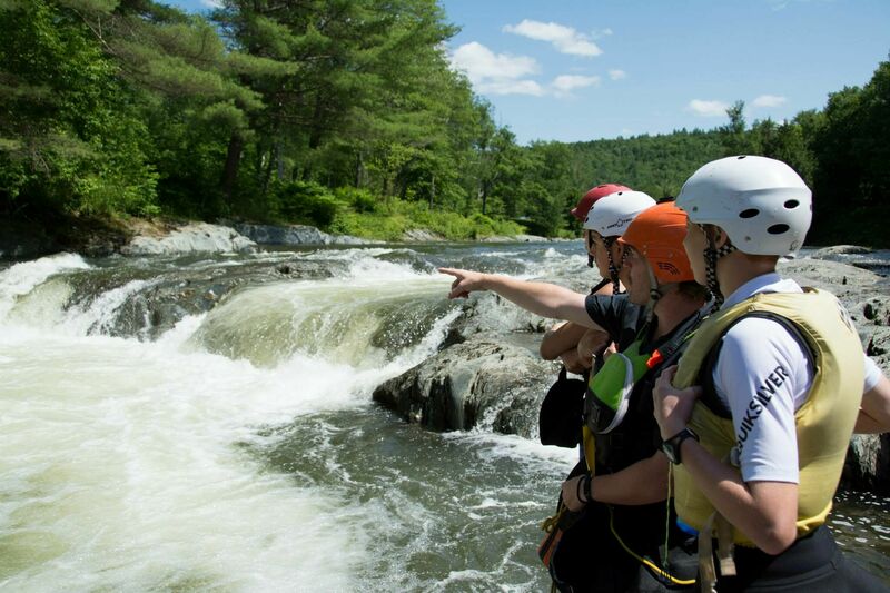
Scouting Horseshoe Falls with Keewaydin Campers.