Methow
3. Averill (at McFarland Creek) access to Pateros(Black Canyon)

Jun 29, 2026
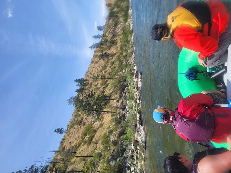
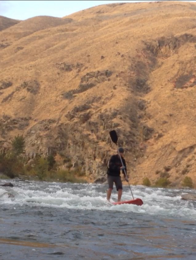
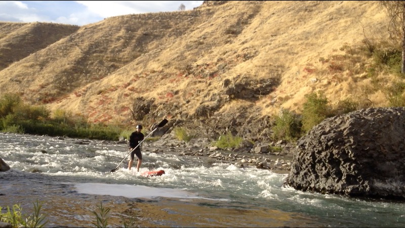
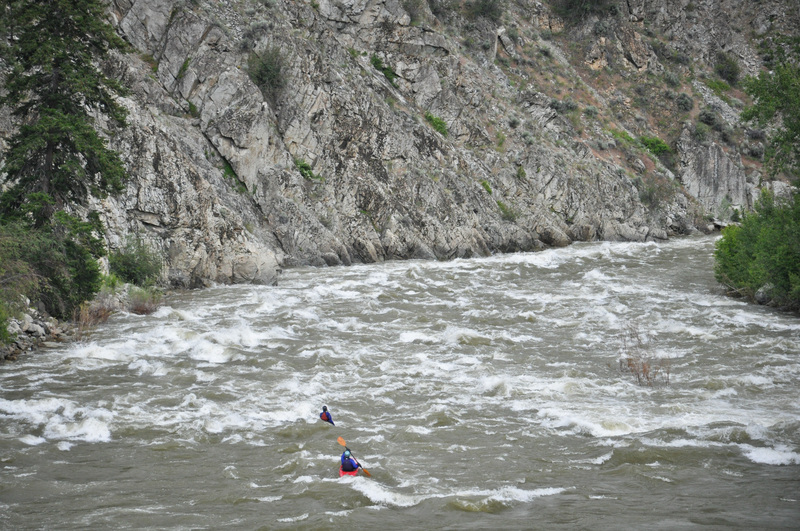
Ran the black canyon section yesterday and today for the first time in a 14' raft with a stern-mount frame and five paddles. We drove up from Seattle for the weekend to raft it and it did not disappoint. Would love to come back and do it again at higher flows! Water was around 1550 cfs, and the rocks were out, but if you are experienced reading the water, spotting sleepers, and dodging rocks, it won't be a problem for you. Too much lower and some of the sections might have small shallow parts where getting stuck is unavoidable. Waves were not too much of a challenge, nothing was sticky, but in the black canyon section, we did have some good, splashy action!!
Apr 16, 2026
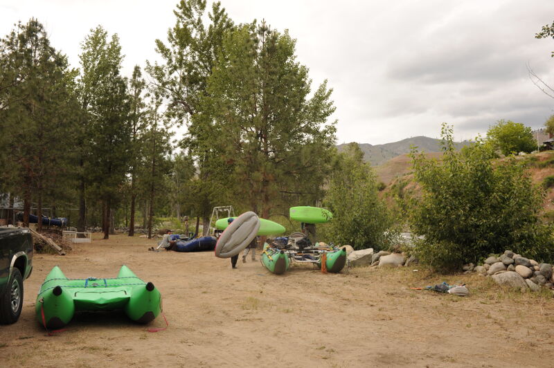
Two packrafters on a sunny spring day, flow measured at (methow river at pateros gauge) was 4310 CFS, the higher end of medium runnable. We decided to skip black canyon section, given small party size, and parked at Burma rd. bridge (SE side) for our take out. Biked to the put in at Averill DFW put in site. River was running fast, as we ran this 8.4 mile section in 75 minutes. Rapids were in the II to II+ range, with lots of splashy sections that are likely more calm at lower flows. There was no wood obstructions, and wildlife was mainly Canada geese, ducks and merganzers.
May 24, 2024
Fun trip with the local crew: Tom, Jonathan, Liza, Chris, Nelson, and Ned.
Jun 28, 2022
I was in Chelan for the 2022 US Open of Paragliding and we had a day that was too windy to race gliders, so I pulled the packraft out of the car and did a personal first descent of the Methow from McFarland Creek river access to just above Pateros.
The river was flowing well with snowmelt but wasn't terribly cold and I was able to get by on this 90ºF sunny day with a pair of shorts and long sleeve splash jacket in a decked packraft. I saw no other boaters out on the river except for a raft group that was already nearing the take-out when I was shuttled upriver. Although there were a few pieces of wood on the banks and near couple bridge pilings, no wood was in play and there were no atypical hazards on the run.
I stopped for a break at the formal river access that is located about 1/2 mile downstream of the Burma Road bridge. This river access has two trails from the parking area to the river and a restroom but requires a parking pass. It's a much more functional put-in or take-out than the Burma Road Bridge but you can't back a raft trailer to the water's edge like to you can at the bridge (but there is a lot more parking at this site).
The rapids were fun in a packraft and there was just enough punch that I chose to avoid a couple holes so I didn't get a packraft beat down out there on my own.
I took out at the Douglas County PUD river access that is about 3/4 mile upriver from Highway 97. There are several red buoys in the Methow that help identify the take-out site which is screened a bit by vegetation. After letting my gear quickly dry in the sun at the take-out, I was headed back to Chelan. Total time on the water for the 17 river miles from McFarland to Pateros was about 2-1/2 hours--pretty quick at this flow!
May 22, 2022
Sunday 5/22/2022 my father, brother and I took a float down the Methow starting at the Burma Road access under the bridge on 153. We were all running in packrafts and found the eddylines behind the bridge pilings to be fun to ferry back and forth across the river with.
Starting off, this section down to Burma Bridge is very fun and has plenty of fun class II/II+ rapids. We kept our eye out the whole time for Engles Slide but we got down to the Burma Bridge and didn't really think anything down to there deserved a class III rating. We didn't even know where Engles Slide was on the run because it must not have stood out as being any more difficult than the rest of this section. Lots of fun wave trains and holes to play in all over this section.
The river tapers off a bit after the Burma Bridge with a few fun rapids here and there until Black Canyon. We played around a bit here and there But kept moving cause we were stoked for the big stuff ahead. At the flows we had, Black Canyon had a busy and fast channel on the river right side that my dad and brother took and found to be quite fun at this level and was a bit tamer than the river left channel. The left channel was a couple small picket lines of holes before the channel came together and formed a big wave train into this huge hole on the river middle/left. After this there is a big wave train of like 15 big rollercoaster waves. After this Staircase comes pretty quick around the next corner and is a steep boulder garden with a couple pretty huge holes river middle and left toward the bottom, most people would say Black Canyon is the highlight of the run but I personally found Staircase to be a lot more fun. My dad swam above this and he got out at the top of the rapid but we couldn't get his boat until the bottom, we hiked his boat back up to where he rested at the top and we ran the rapid again. The lap on this is doable but kind of a crappy bushwhack through huge boulders. Shortly after this was Corner Rapid, which felt a lot more Mellow and spread out than the rapids above. Corner rapids is pretty much just a big long continuous boulder garden with lots of wave trains and holes. The rapid above the little bridge with the huge rock in the middle was a lot of fun, the line to the right of the rock being a little more rowdy. Roadside Attraction was a few rapids down and felt very similar to Corner Rapid, as it was a bit more tame than some of the other bigger class III rapids and was just a long boulder garden full of waves and holes. As you pass under the big hwy 153 bridge this next rapid is a bit more intense than the last few class III's. Bridge rapid has a steep band of waves and holes on the river left side and then whips around a corner and river right slams over a bunch of big boulders to create a funky band of waves/holes, mostly holes at this flow.
From here on down the river tapers off a bit and as we passed under the next highway bridge we found Metiorite, which was a very oddly placed boulder as it didn't seem to share any of the same geology of the rest of the valley (besides one more rock just downstream out of the water). The river from here had several fun wave trains and surf waves. There was one more rapid that came the second time the river butts up against the highway after Metiorite. This rapid had a lot of holes to dodge and towards the end had a very wide fan of boulders that created a pretty nice ledge hole.
The river loses a lot of punch and drops down another small set of rapids before splitting into a couple different channels. My dad and brother went right, I went left and then right at the next island. If you We're to go left and then left again, it appeared as though there was a river access point here on river left that cuts out the flatwater at the end. I'm not sure if this was a public access point but it had a vault toilet so I am assuming so. This access would add quite a few more minutes to the shuttle so it may not be ideal. The flatwater paddle out sucked in the packrafts but it was what it was. The entire float took a little over 4 hours with a few stops for snacks/surfing.
May 16, 2019
There is a huge log completely blocking the left channel of the Methow River. It is visible from highway 153 at the intersection with Lazy L Lane.
Oct 13, 2017
Hole at the bottom of shoals below meteorite
Oct 13, 2017
Shoals below meteorite
Oct 7, 2017
Ran from fishing access down. A nicely runnable channel forms down the river right side at this level.
May 14, 2014
Trip with rafts and kayaks through the Black Canyon including one big boat full of kids. The run was from McFarland down to Pateros.
May 25, 2013
A trip down the Black Canyon section of the Methow.
Jul 22, 2011
Amy Brown and Becky Brown at Black Canyon on the Methow
Oct 15, 2007
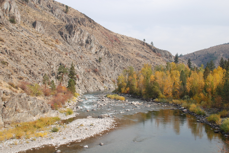
The Methow River at low water in the fall.
Sep 8, 2007
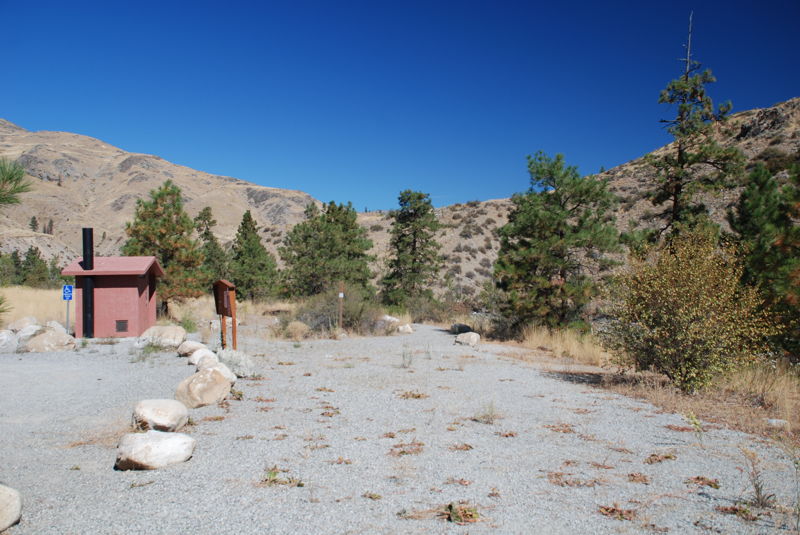
Public access points on the Methow River.
Jul 12, 2004
This run is always done by Paddle Trails Canoe Club as 2 runs. The first run is II+ putting in at McFarland Creek Access about 5 or 6 miles North of the town of Methow on highway 153. Take out at the concrete bridge, about 3 miles south of the town of Methow, where Burma Road crosses the river to the East side of the highway. You can park either on the west siide of Highway 153, or drive across the bridge and park on Burma Road. This run is great for canoes and kayaks, and a pleasant float for rafts at 1,100 CFS.
The second run is the Class III part and puts in at the Burma Road Concrete bridge and goes down to the top of the backwater near Pateros. You will see the parking on the left of the highway. This is known as the 'Black Canyon' run. Rafts will enjoy more excitement on this section at or above 2,000 CFS, but we have enjoyed tamer rafting as low as 1600. Canoes and kayaks can paddle and will enjoy this section much lower. At 750 cfs the Black Canyon forms a narrow chute, which is still canoeable.