Pilchuck Creek
2 - Pilchuck Creek Campsite to Highway 9 Bridge(Middle Pilchuck)
| Difficulty | III-IV(V) |
| Length | 5.8 mi |
| Avg Gradient | 57 fpm |
| Gauge | Pilchuck Cr. @ Bridge 626 |
| Flow Rate as of 1 hour | 10 cfsbelow recommended |
| Reach Info Last Updated | December 8, 2024 |
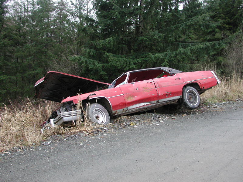
Pilchuck Creek has a beautiful low-elevation gorge and a fun 16' waterfall. The flashy nature of this creek that runs on winter rains makes it a hard one to catch. It can be at a perfect level on a Thursday, but way too low by the weekend. It used to be more challenging to figure out when the creek was running until Washington DOE added a real-time gage. Those who time it right are rewarded with a journey through a very rare low-elevation river system with no development in the river corridor. Logging occurs in the upland forests and it has been a popular dumping ground for old cars (resulting in closure of the road to the put-in), but the lush green gorges remind one of some of the runs on the Olympic Peninsula. It's a wonderful place in the middle of an otherwise grey Pacific Northwest winter. Although this run is mostly continuous class III+ at moderate flows, there are a couple of drops that push class IV, and the whole run can become class IV at higher water levels. Although a road runs along river right, access to the canyon is relatively limited.
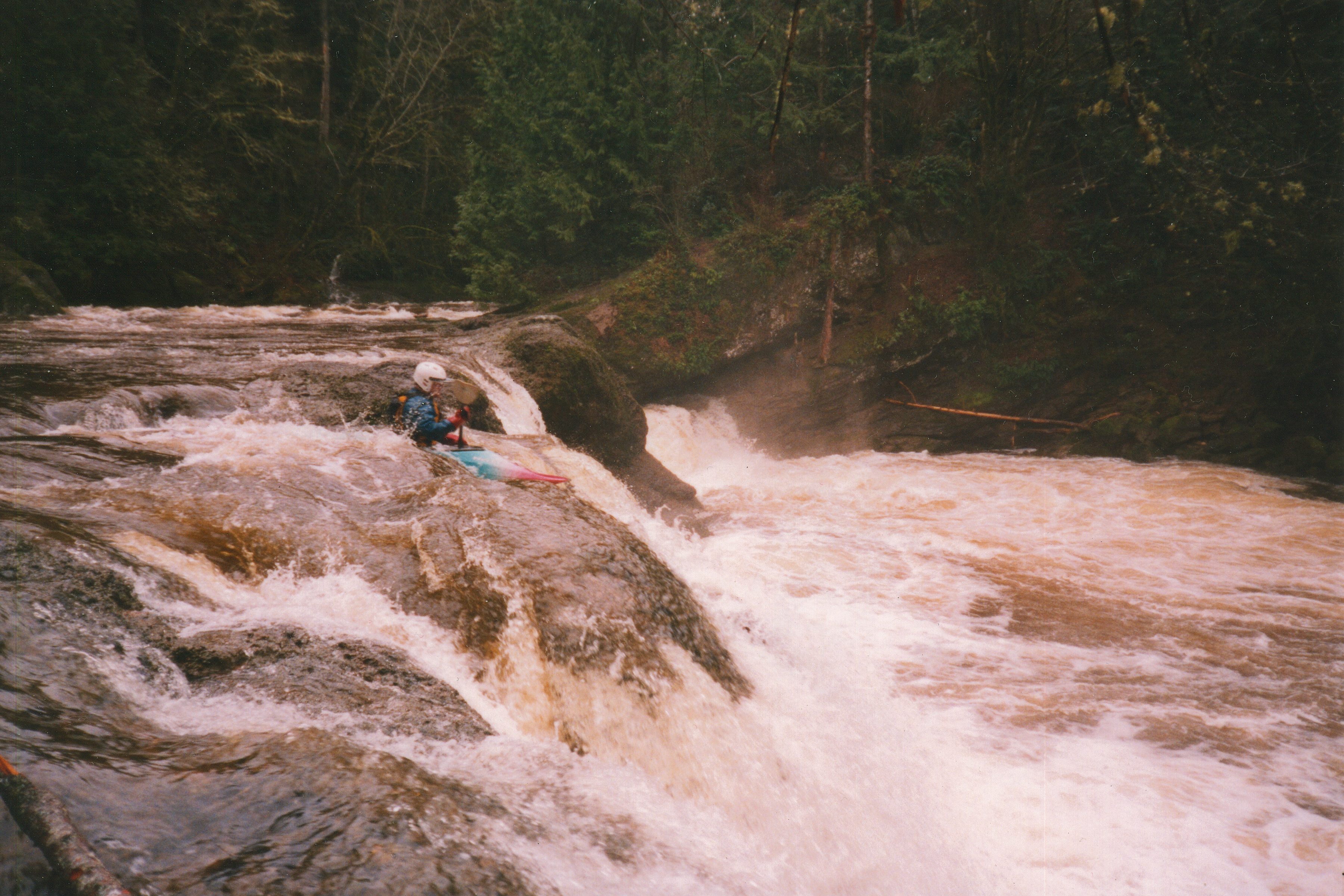
The run starts out with class III which builds to III+ as you enter the first bedrock canyon. It's a short paddle to Pilchuck Falls. You'll recognize it from powerlines overhead. The river takes a hard bend to the left and crashes through the most significant rapid on this section as the powerlines come into view. A large pool forms at the end of the last rapid above the falls so get over to river right to scout or potentially portage the falls.
Scouting Pilchuck Falls will quickly reveal that you want to avoid the nasty hydraulics on river left (where most of the flow heads). There are routes on river right or towards the center. If you have never run the falls it's best to go with someone who has and knows the lines. They aren't too difficult to figure out, but a rock to the left of the center line is submerged at higher flows. The drop is often rated class V, but the launch from the pool at the top
...The put-in is on river right at an informal campsite with low bank access just upstream of the bridge across Pilchuck Creek. This access is located on land administerd by Washington Department of Natural Resources and will require a hike in of 0.9 mile if the road is gated (as a result of issues with garbage dumping). As an alterantive for a longer run, you can put in on the next run upstream and run the Middle Pilchuck as a continuation of the Upper Pilchuck.
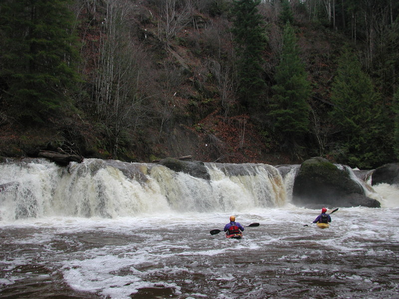
Pilchuck Falls is an approximately 14' waterfall and is recognized by the powerlines overhead. The river takes a hard bend to the right and drops over a horizon line. A large pool at the end of the last rapid just above the falls alllows you to get out on the right to scout or portage. Avoid the hydraulices on the left where most of the river flows and look for a line river right or towards the center. A rock to be avoided left of center is submerged at higher flows. The rapid is not hard as long as you have picked a good line with a straightforward lead in from the pool above and a good recovery section in the pool below. At high flows, the powerful hydraulics that develop convince many to portage. This section of the river where the waterfall is located is on private land.
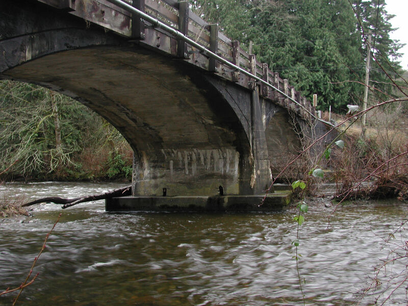
The take-out is within the public right of way of the Old Highway 9 Road Bridge. The new bridge is immediately downstream.
Dec 14, 2024
There were various wood pieces in play, including 5 trees most or all the way across the channel, and all visible on approach. We needed to portage the same 2 as last year, got around far left on another 2, and slid over one that would be a portage at lower flows. With a group of 9, including 6 PFDs, it was a 4 hour run with no troubles. Happy to see the Ecology gauge is much improved!
Jan 28, 2024
Gauge rock at the takeout was almost covered and gauge above the bridge was 4.2. One tree in the upper section that we had to portage around. Very obvious to see from above, looked pretty fresh with no way through it. One log on the lower section we snuck under on the left, but required a deep brace. Everything else was clean.
Nov 11, 2006
Ran Pilchuck Creek post 2006 flood. Run was clean, except for one logjam requiring a limbo or far left move to avoid a clean log.
Jan 12, 2002
A fun winter day on Pilchuck Creek with David Wilson, Jen O'Neal, David Vican, Eric Bessettee, Mike Rausch, and Thomas O'Keefe. Russ came to meet us at the take-out and ran shuttle for us. Mike shattered his paddle and Jen injured here nose but everyone came through safely. We found Jennie Goldberg's boat which had been lost and severely damaged on a prior higher water run.