Snoqualmie, Middle Fork
2 - Burnboot Creek to Taylor River
May 9, 2024
| Reporter | Thomas O'Keefe |
| Gauge Reading | 1350 cfs at MIDDLE FORK SNOQUALMIE RIVER NEAR TANNER, WA |
| Flow | Low Runnable |
This is a great pack rafting adventure that can be completed in a day. While you can drive the Middle Fork Road (Forest Road 56) on river right up to Dingford Creek where it is gated, the road is in rough shape from the point where the pavement ends at the Taylor River and only suitable for high clearance vehicles. From the Middle Fork Trail it is a 5 mile hike up to Dingford Creek, the dividing point between class IV upstream and class III rapids downstream.
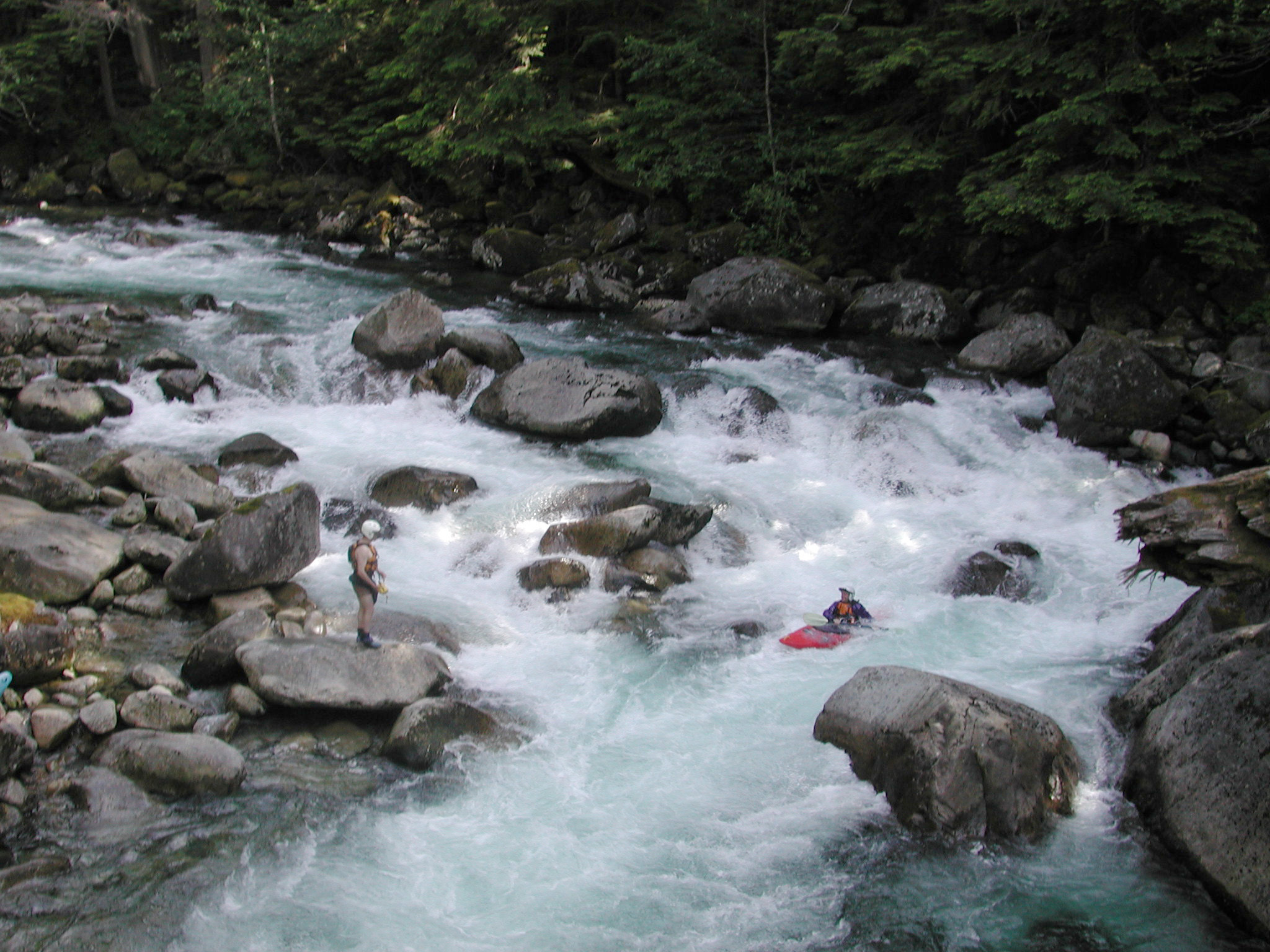
We began our hike from the Middle Fork Trailhead leaving shortly before 11:30 and arrived at Dingford Creek around 2:00. It took us about 30 minutes to get ready and launch from the eddy on the upstream river right side of the trail bridge.
For the first half mile from the Dingford Creek Trail Bridge the river flows through continuous class III boulder gardens. There are no distinct drops, just lots of boulders and plenty of eddies but none that are very large. Some wood was in play that required caution. As you approach the Cripple Creek confluence the river divides around an island with a main channel that continues straight and a high flow channel off to the left. We encountered a river-wide log in the main channel that required a portage. At the flows we experienced it was not an issue to eddy out just upstream of the log but use caution at higher flows.
After the Cripple Creek confluence the gradient tapered off slightly and we enjoyed fun class II whitewater with amazing views of the granite faces of Mt. Garfield off to river right. This is an incredibly scenic section of river. We had plenty of water to enjoy the run but did have a few bumps on rocks in some of the rapids that flowed over gravel bars.
The run was clean until we were just over a mile upstream of the Taylor River confluence. A large log jam that has been persistent over many years splits the channel and it continues to change. A few years ago river left was the primary channel with the log jam blocking the flow to river right. On this trip it is apparent that river right is becoming the primary channel with the log jam starting to open up but one river-wide log meant we still had to portage. We continued down the river right channel and encountered one more river-wide log, a cottonwood that recently came down, requiring a portage. Both of these portages were relatively easy with plenty of sight distance and good eddies.
We arrived at the Taylor River confluence and took out at the Gateway Bridge on the downstream river right side around 4:30. Total trip time was approximately 5 hours with 2.5 hours hiking up the trail, 0.5 hour getting boats inflated and getting ready to launch, and approximately 2 hours on the water. This is a great packrafting trip but use caution with wood hazards that are present. I would do the run at higher flows but this was a good level to explore given the lack of current beta.
One of the objectives of the day was to see if any Harlequin Ducks were present on this section as part of a community science effor that includes American Whitewater, Conservation Northwest, and the Forest Service. We did not see any Harelquin Ducks but did see four Mallard Ducks.