Snoqualmie, Middle Fork
2 - Burnboot Creek to Taylor River
May 31, 2026
I had an opportunity to introduce writer and photographer Tim Palmer to packrafting on the Middle Fork Snoqualmie as part of a research trip for a new book he is working on. We met at the Middle Fork Trailhead after breakfast on a Sunday morning. We hiked the trail on river left to a point just downstream of Cripple Creek and paddled back to the trailhead. The hike took a couple of hours, and we were on the river by noon after a quick lunch and inflating our boats. We spent a couple of hours on the water.
We found a couple of pieces of wood in play, including an undercut bank with roots protruding into the main flow and a tree spanning the channel that still had a line through the branches. The good news is that the major logjam that previously spanned the river last year is now gone, likely as a result of the December 2025 flood event.
The flow was approximately 570 cfs at the Tanner gage and slowly declining. While this seemed much too low for the Middle-Middle segment of the river, it was adequate for this section, which held its water better than I expected. At this flow, the run from Cripple Creek down to the Taylor River confluence is a great Class II paddle, and we had a beautiful day to enjoy it. This is one of the best packrafting trips in close proximity to Seattle and is the perfect destination to test out all your systems for more ambitious packrafting adventures.
May 12, 2025
Ran Wildcat Canyon down to Dingford bridge, fast class 4+, be on your toes for wood. Lost Key is a beauty, next drop had tree problems and a very manky start. Right is the easier portage at the top, then launch from middle rockpile and head left or charge the center mank.
May 3, 2025
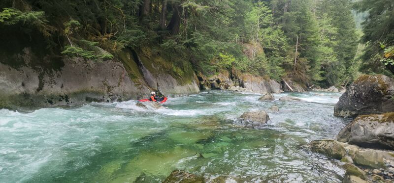
I found the section above Dingford Creek was more stout at 1,500 cfs than expected. The rapids were complex, fast, and continuous with numerous boulder seives, manky lines, some wood, and limited recovery areas. I made several portages without much difficulty and thought the run was more challenging/consequential than most of our IV+ runs in the region (Cooper, China Gorge, Lower Icicle, Horshoe Bend, CC Lewis). It was flat-out gorgeous and a great adventure, but fair warning the rating of II-III(IV) does not apply above Dingford Creek, IMHO. Wish I had my camera with me because Lost Keys is one of the most photogenic rapids I have ever seen.
Mar 30, 2025
Had a great time packrafting the MF of the Snoqualmie between Dingford and Taylor on 3/30/25 at 1725cfs.
Started our day at the MF of the Snoqualmie TH near the wooden arch pedestrian bridge, just below the confluence with the Taylor. Hiked ~5.5 miles upriver on the MF Snoqualmie river trail to the bridge crossing the Snoqualmie near the Dingford Creek TH. The trail was in great shape. Put in right below the Dingford bridge.
The whitewater starting at the bridge is swift and continuous boulder gardens. The first quarter mile drops 50 feet alone. That's a gradient of 200 feet per mile (fpm)! Our group felt this quarter mile stretch felt more like class IV. At 1725cfs, there was enough water, but we would have liked a tad more to open up the lines a bit. If you are looking at this stretch from the bridge and it looks more intense than you want to tackle, you can put in below it via a campsite on river left about a quarter mile below the Dingford bridge.
After the first quarter mile, the next half mile drops another 60 feet (120fpm). This stretch was still continuous boulder gardens, but was a tad less intense. Maybe more like IV-.
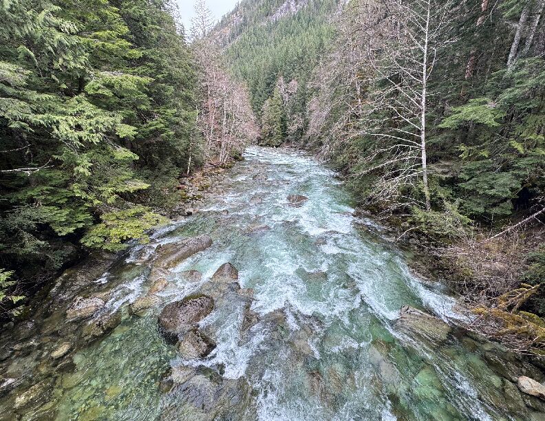
After the first mile, the river settles into beautiful scenic class II+ with fantastic views of the surrounding mountains. There are some trail access points you could use along this stretch if you want to avoid the class III-IV above. Just keep an eye out for wood. We had one portage around a river wide strainer with some swift current pushing through it at the bottom of a little class II+ riffle. 47.5195307, -121.4688651
May 19, 2024
This is a great pack rafting adventure and the perfect local run to test out your packing system with a five mile hike in followed by a fun, and very scenic, paddle back. Alex and I hiked up to Dingford Creek and put in there. I found a spot on river right on the upstream side of the trail bridge and Alex found a spot on the downstream river left side of the bridge.
We had enough water but I would have preferred a bit more. The run starts off with nearly continuous class III+ boulder gardens for about half a mile that requires good route finding and boat scouting skills. I think 2000 cfs (on the Middle Fork gage; the lower here is much lower) would be about ideal but the lower flows may be preferred by some who want to proceed more cautiously without the push of higher flows. A flow of 1100 cfs as we experienced, while at the low end of the range, provided enough water to get down safely with more time to set up than would be the case at higher flows.
As we approached Cripple Creek we encountered the same river-wide logs that were there last week and will likely be there until a future high water event associated with a fall storm. It was relatively easy to eddy out just above it at the flows we experienced. You would be coming into it faster at higher flows.
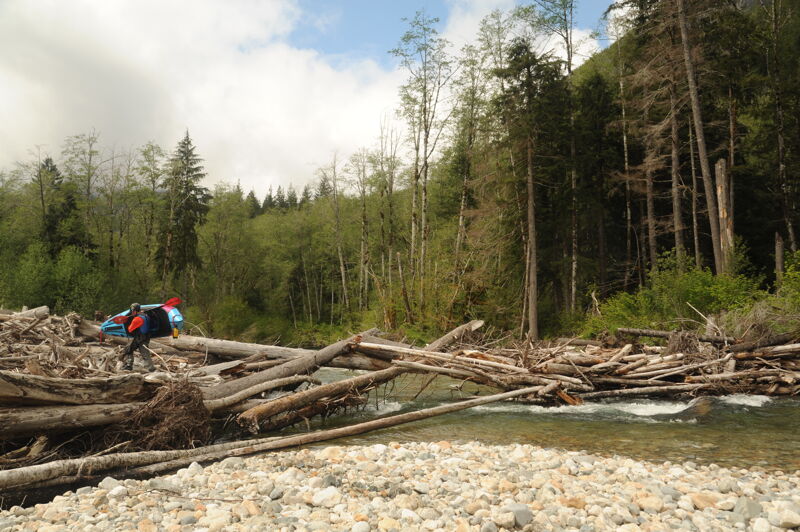
After Cripple Creek we were treated to amazing views of Mt. Garfield and passed by a few sites that would make great campsites for an overnight trip. As we approached the island where the flow splits just over a mile upstream of the Taylor River we encountered another portage at the big log jam. Currently only one log blocks the river right channel that now has most of the flow. Just around the corner downstream of this log jam we encountered a solitary tree across the channel that resulted in our third portage of the day. We had more great views as we looked back upstream and soon the Taylor River confluence and Arch Bridge came into view marking the end of the trip.
An objective of our trip was to survey for Harlequin Ducks. We did not see any but did see a solitary merganser. We took out at the Middle Fork Trailhead Arch Bridge.
It took a little over 2 hours to hike in and get geared up. Total float time was approximately 2 hours.
May 9, 2024
This is a great pack rafting adventure that can be completed in a day. While you can drive the Middle Fork Road (Forest Road 56) on river right up to Dingford Creek where it is gated, the road is in rough shape from the point where the pavement ends at the Taylor River and only suitable for high clearance vehicles. From the Middle Fork Trail it is a 5 mile hike up to Dingford Creek, the dividing point between class IV upstream and class III rapids downstream.
We began our hike from the Middle Fork Trailhead leaving shortly before 11:30 and arrived at Dingford Creek around 2:00. It took us about 30 minutes to get ready and launch from the eddy on the upstream river right side of the trail bridge.
For the first half mile from the Dingford Creek Trail Bridge the river flows through continuous class III boulder gardens. There are no distinct drops, just lots of boulders and plenty of eddies but none that are very large. Some wood was in play that required caution. As you approach the Cripple Creek confluence the river divides around an island with a main channel that continues straight and a high flow channel off to the left. We encountered a river-wide log in the main channel that required a portage. At the flows we experienced it was not an issue to eddy out just upstream of the log but use caution at higher flows.
After the Cripple Creek confluence the gradient tapered off slightly and we enjoyed fun class II whitewater with amazing views of the granite faces of Mt. Garfield off to river right. This is an incredibly scenic section of river. We had plenty of water to enjoy the run but did have a few bumps on rocks in some of the rapids that flowed over gravel bars.
The run was clean until we were just over a mile upstream of the Taylor River confluence. A large log jam that has been persistent over many years splits the channel and it continues to change. A few years ago river left was the primary channel with the log jam blocking the flow to river right. On this trip it is apparent that river right is becoming the primary channel with the log jam starting to open up but one river-wide log meant we still had to portage. We continued down the river right channel and encountered one more river-wide log, a cottonwood that recently came down, requiring a portage. Both of these portages were relatively easy with plenty of sight distance and good eddies.
We arrived at the Taylor River confluence and took out at the Gateway Bridge on the downstream river right side around 4:30. Total trip time was approximately 5 hours with 2.5 hours hiking up the trail, 0.5 hour getting boats inflated and getting ready to launch, and approximately 2 hours on the water. This is a great packrafting trip but use caution with wood hazards that are present. I would do the run at higher flows but this was a good level to explore given the lack of current beta.
One of the objectives of the day was to see if any Harlequin Ducks were present on this section as part of a community science effor that includes American Whitewater, Conservation Northwest, and the Forest Service. We did not see any Harelquin Ducks but did see four Mallard Ducks.
Apr 27, 2024
Access point at Bridgeview just downstream of the Gateway Bridge and Middle Fork Trailhead.
Mar 8, 2024
Scouting mission at low water in preparation for a potential spring trip. The road was rough and it took about 45 minutes to drive the 6 miles from the Middle Fork Trailhead up to Dingford Creek trailhead. It was passable with front wheel driving and moderate clearance if driving slowly and carefully. I hiked down on river left to Cripple Creek. It looked like the best way to get through the braided section of islands would be to hike the approximately 1/3 of a mile down the high-flow channel on river left. There were channel-spanning logs in the channel with the most flow.
Sep 13, 2009
The Middle Fork road is closed at the gate two miles or so above the concrete bridge/Granite Creek access. There were apparently big washouts that occured on the road as well as the Taylor river bridge being knocked out. The road crew said that the road could be closed as late as December while repairs are done, making the bridge about the highest put-in possible on the MF.
Jan 27, 2009
The Middle Fork Road experienced a major washout at the Taylor River Bridge (just past the campground and trailhead) during recent floods in January 2009 so you can no longer drive to this section of river.
Jun 1, 2008
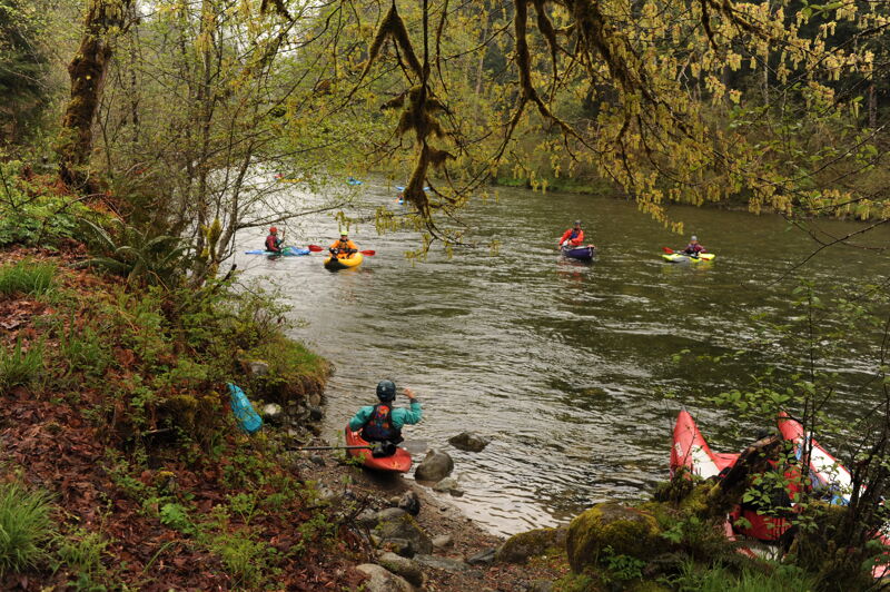
American Whitewater led a trip on the Upper Middle Fork Snoqualmie as part of the day of activities hosted by Forterra in the Middle Fork Valley. This trip continued on down the standard Upper Middle run.
Jun 1, 2007
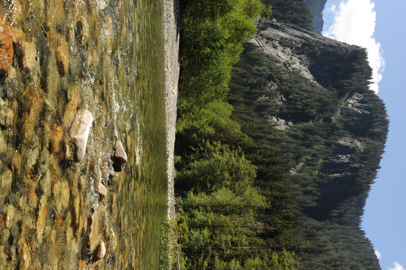
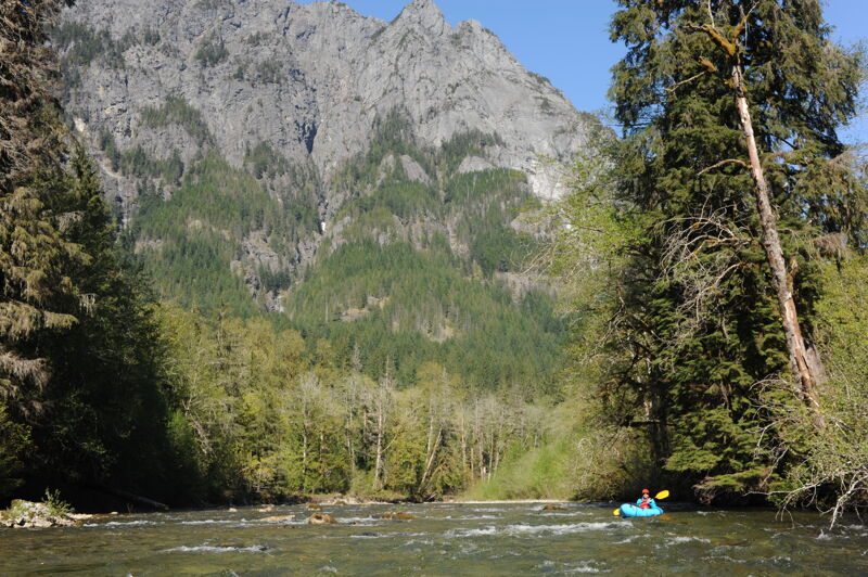
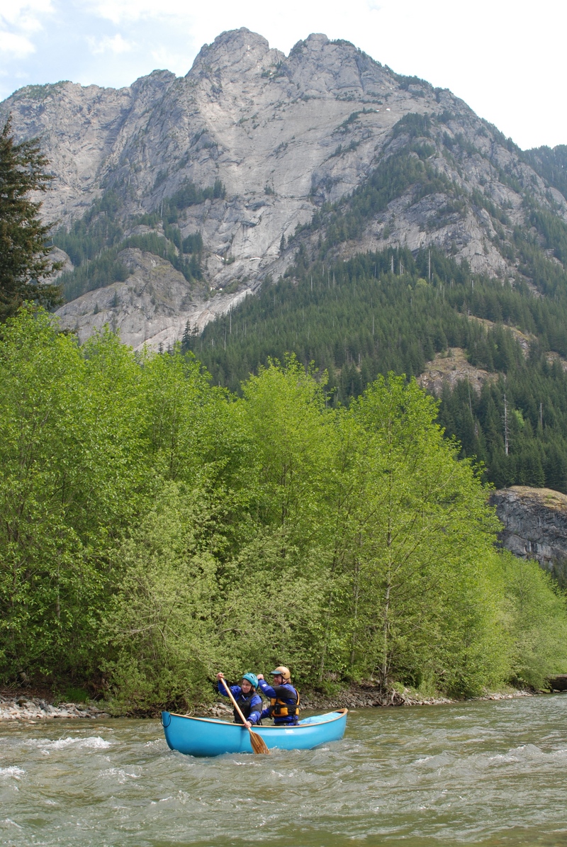
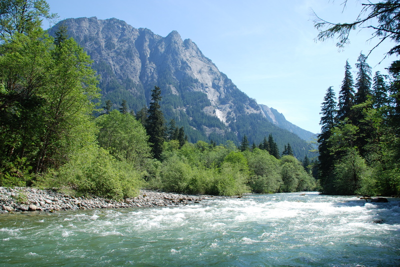
Rapid on the Middle Fork Snoqualmie at the confluence with the Taylor River. Mt. Garfield provides a dramatic backdrop.
Jun 6, 2006
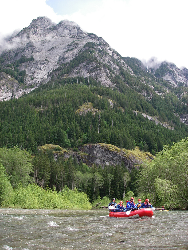
Rafting the Middle Fork a couple miles above the Taylor River confluence. This section of river flows past Mt. Garfield. On this trip, outfitted by Seattle Raft and Kayak, American Whitewater was out on the river as part of an effort to conduct an assessment of invasive weeds. The trip continued on down the Upper Middle.
Jun 3, 2006
This photo shows the Moore oxbow property, a 120-acre property along the Middle Fork of the Snoqualmie River at a bend in the river beneath 5,500-foot Mount Garfield. At 120 acres it was the last piece of unprotected riverfront land in the upper Middle Fork valley until it was acquired by the Cascade Land Conservancy and transferred to the US Forest Service in 2005.
Jul 4, 2001
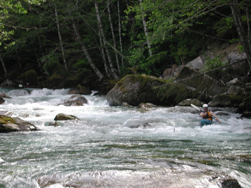
Dave Pearton, David Wilson, and Thomas O'Keefe ran the section from Wildcat Creek to Dingford Creek at approximately 800 cfs on the Middle Fork Snoqualmie gauge. Flow on this section was probably a little more than half that. This was about the lower limit of flow for this section.
This was a fun section with class IV whitewater but short and a long drive up a poorly maintained road.
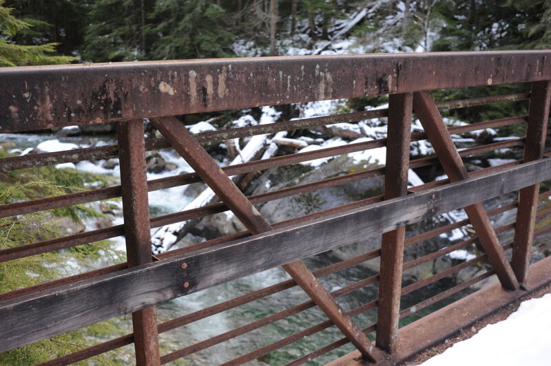
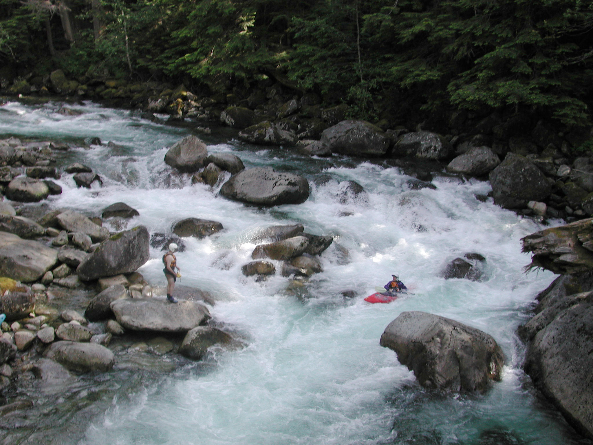
To see scout the last rapid and get an idea of the character of the run, drive up to mile 18.0 on the Middle Fork Road at the Dingford Creek trailhead. It's a short walk down a trail to a bridge that crosses the river.
Photos are screenshots from video and one photo of the last rapid from the bridge.