Sultan
1. Spada Reservoir to Powerhouse(Upper Sultan)
| Difficulty | IV+ |
| Length | 10.8 mi |
| Avg Gradient | 81 fpm |
| Gauge | Sultan River Below Diversion Dam Near Sultan, Wa |
| Flow Rate as of 34 minutes | 109 cfsbelow recommended |
| Reach Info Last Updated | August 10, 2024 |
Snohomish PUD operates the Jackson Hydroelctric Project on the Sultan River. American Whitewater has a direct interest in river and riparian conservation and resource protection, appropriate public access to the river that protects resource values, and instream flows for the benefit of fishery resources, river and riparian condition, and [...]Read More
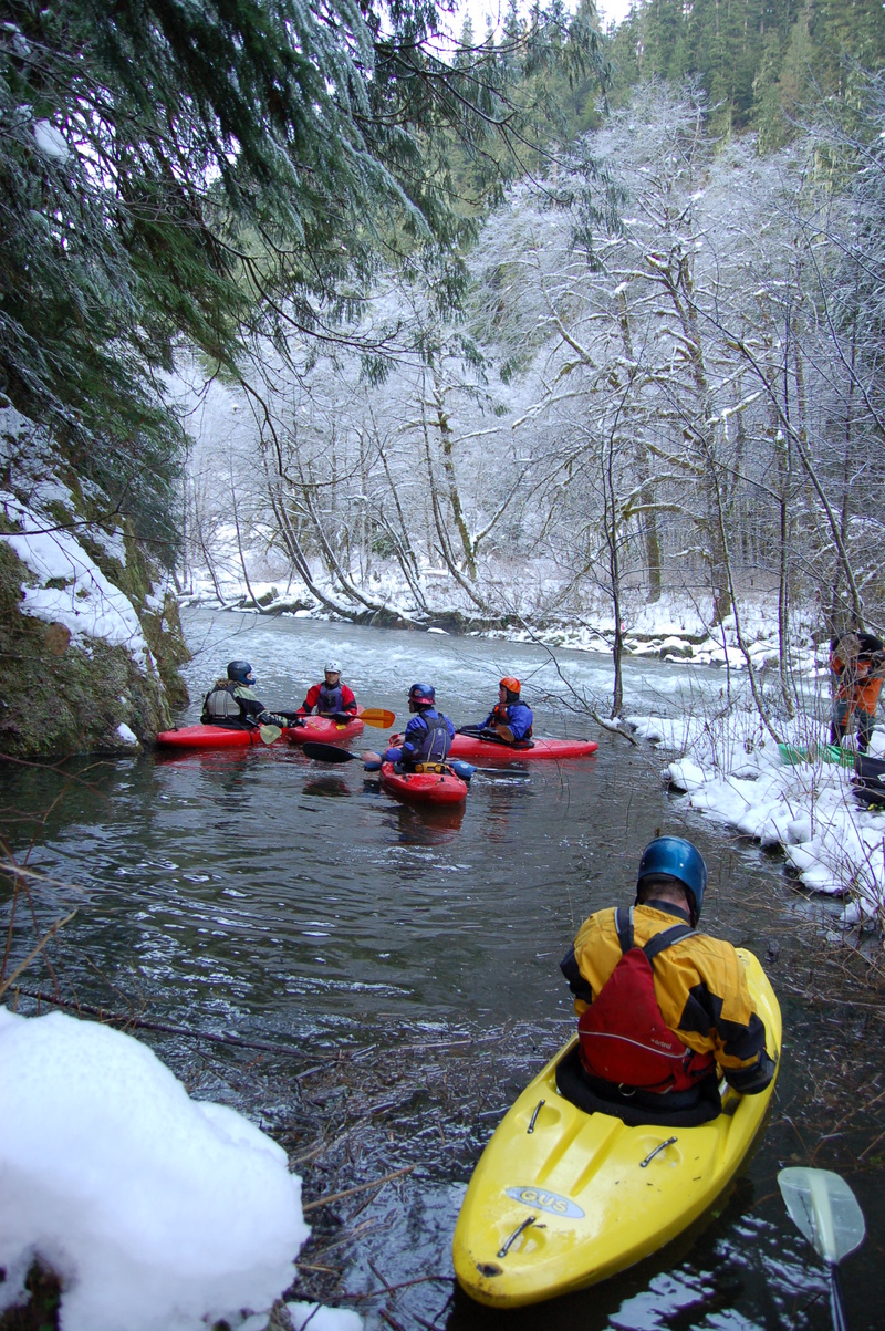
The Sultan River was one of the Pacific Northwest's premiere whitewater rivers before the construction (1965) and later enlargement (1982) of Culmback Dam. Today, paddling opportunities on the Upper Sultan only occur when the level of Spada Reservoir reaches the overflow tubes at 1450' ( view table) and water once again returns to the channel (this typically occurs only once every few years) or during extremely heavy rain events (i.e. flooding on area rivers). With the hydropower license issued in 2014, the utiliy has a goal of providing up to four whitewater boating opportunities each year with at least two of these scheduled in advance (typically in late April and early September). Check the Snohomish PUD whitewater page for more information on upcoming opportunities and to sign up in advance.
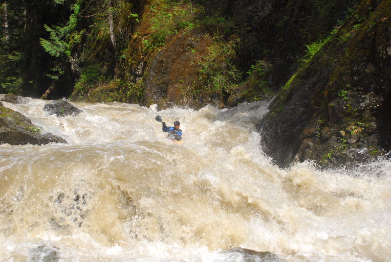
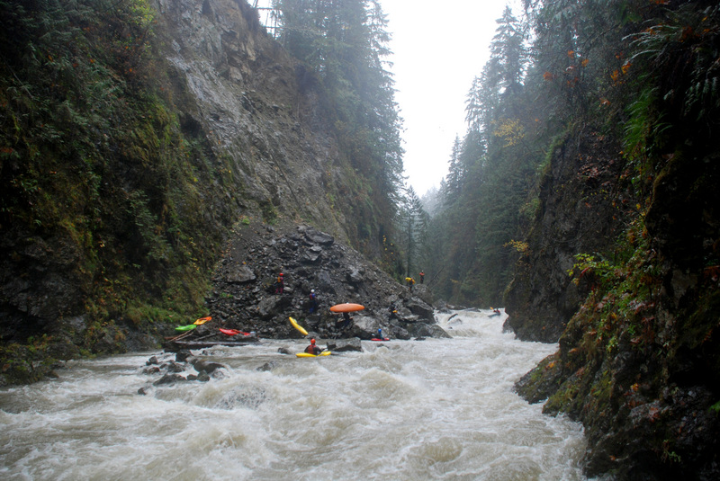
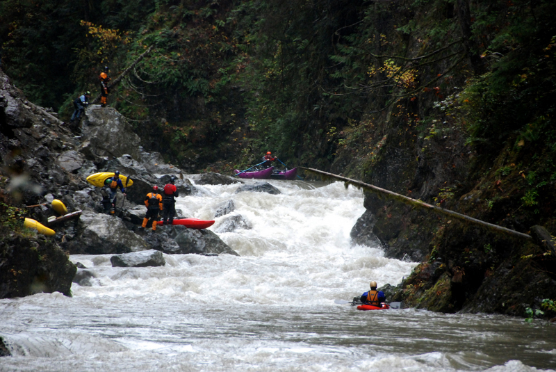
The run has a wonderful combination of complexity and difficulty without a sense of being truly dangerous. It's really the perfect advanced run; consistent, technical, and powerful. The gorge itself is absolutely beautiful: green, lush, isolated. It's a fantastic run in every sense.
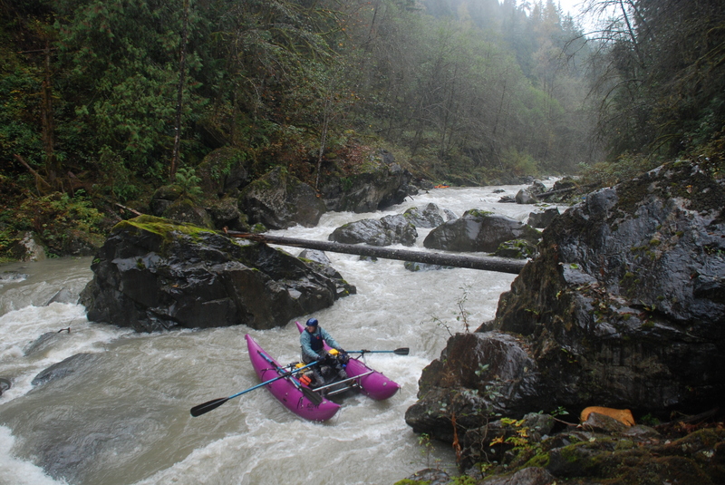
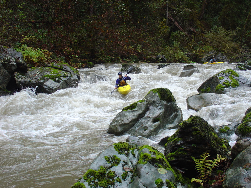
The Upper Sultan is a classic pool-drop river. There are almost no flat sections--medium-sized pools immediately lead into the next rapid. Aside from a potential wood portage, every drop is runnable and the difficulty factor is solid class IVs. Most of the run can be boat scouted and nearly every rapid is big, fun, and has a clear route.
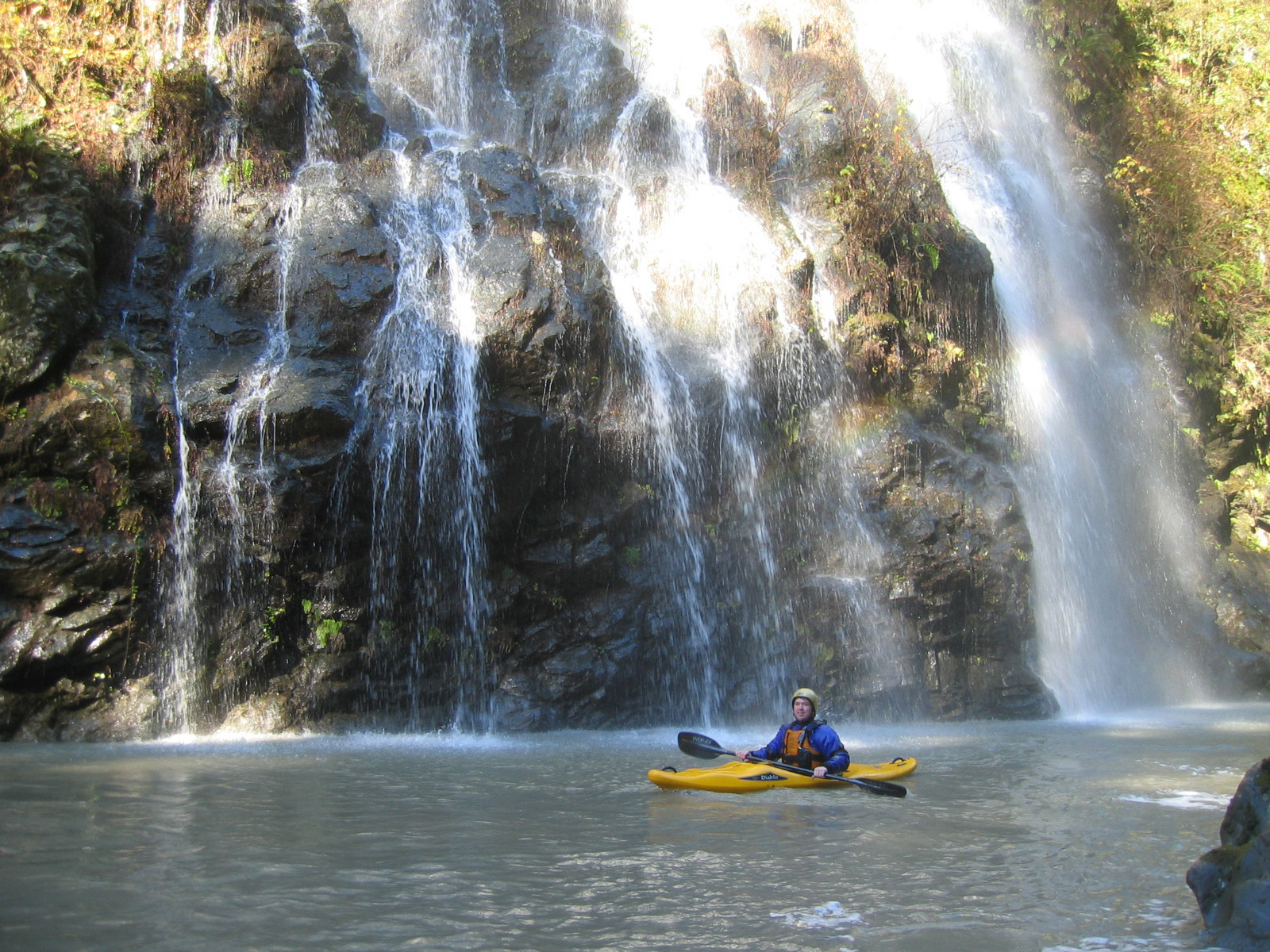
You enter the first gorge section after passing beneath the old bridge and begin the first few miles of fun class IV boulder gardens. The action tapers off after a few miles when you squeeze through a narrow constriction in the canyon walls. This is an incredibly scenic section with some fun class III/IV rapids and some amazing waterfalls that cascade off the canyon walls.
About halfway through the run (6.5 miles from the dam,
...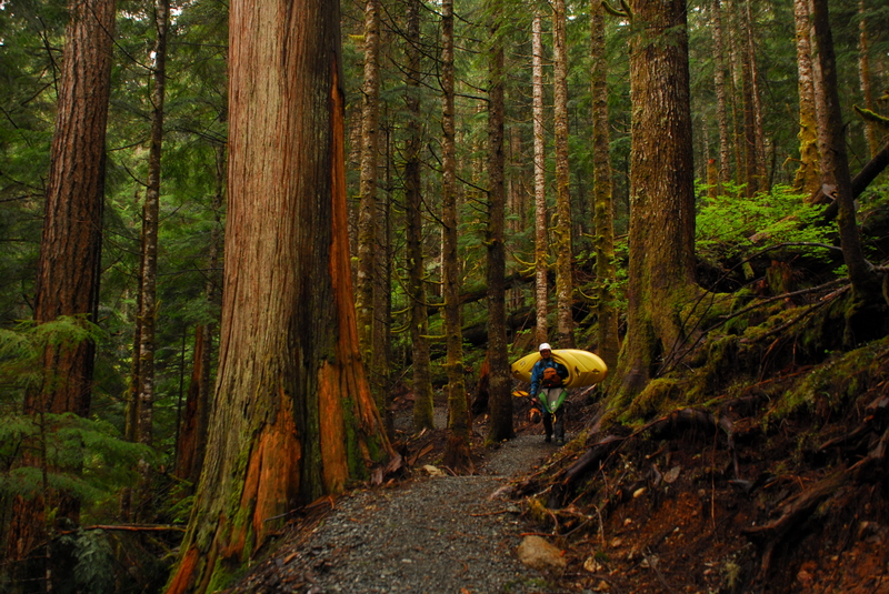
Trail down into the river canyon that was constructed as a license condition. FR 6122 is gated but during release weekends paddlers are sometimes able to drive boats down to the trailhead and drop them off.
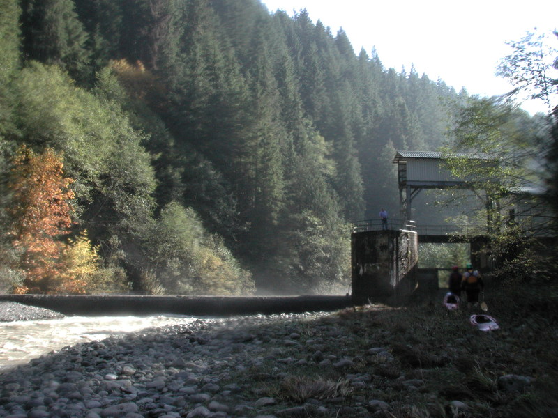
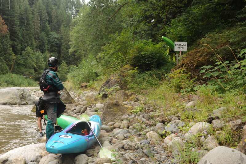
A potential intermediate access point that requires hiking in along the road to the diversion dam (restricted access). City of Everett requests that paddlers portage the dam on river right.
Rapid that formed below Marsh Creek following a major landslide. After nearly two decades the debris forming this class V rapid washed away and there is now barely a trace.
The gate to the powerhouse on river left is often open when releases are happening allowing you to park your car at parking area a short distance up the hill from the powerhouse. Check with the PUD however as the gate may be closed before you get to the powerhouse. You can also take out on river right on the Lake Chaplain Road although this makes for a longer shuttle. Continuing downstream past the powerhouse and taking out at Trout Farm Road or Sportsmen Park in Sultan is also an option.
Aug 13, 2022
Snohomish PUD provided a lower flow event in June. Although more water is prefereable, it was still nice to be out in a beautiful gorge boating in mid-summer. We had plenty of water to get down the river safely. I was boating with Boris Startsev and did not pull the camera out much. We linked up with others at the diversion dam portage. We had some wood in play and a river-wide log to portage in the Horseshoe Bend section.
May 22, 2021
A few notes from the 5/22 release: 1. The landslide rapid has changed, and is no longer the hardest rapid on the run. We boat scouted down the left, working center. Since any rapid named 'Landslide' has to be the biggest on the run, a rename might be in order. I've heard proposals for 'Erosion.' 2. The run was generally clean of wood, and we had no log portages. 3. I'm not sure why this run gets the rating, III-IV+. I would say the rapids in the second gorge are solidly IV+, and not particularly walkable. Given the possibility of wood, occasional sieves, length, and inescapable sections, I would personally give this run a V- rating. It's also worth noting that I talked to Stephen Cameron and his quote was apparently describing a run at 4k.
Sep 10, 2018
For the fall 2018 release, there was one river-wide log and portage during some slack water. There were other spots where we had to duck or squeeze through a tight spot due to wood. Most of the larger drops were mostly clear, though vigilance and quick maneuvering is required. The dam was run on the right, and is perhaps class III+. Video from the run: https://www.youtube.com/watch?v=5O3q4E8QYDM.