Sultan
1. Spada Reservoir to Powerhouse(Upper Sultan)
Aug 13, 2022
Snohomish PUD provided a lower flow event in June. Although more water is prefereable, it was still nice to be out in a beautiful gorge boating in mid-summer. We had plenty of water to get down the river safely. I was boating with Boris Startsev and did not pull the camera out much. We linked up with others at the diversion dam portage. We had some wood in play and a river-wide log to portage in the Horseshoe Bend section.
May 22, 2021
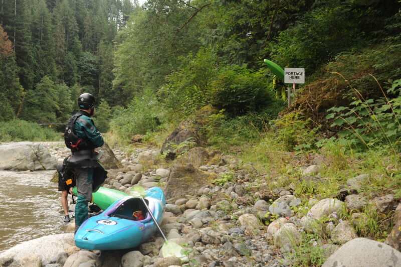
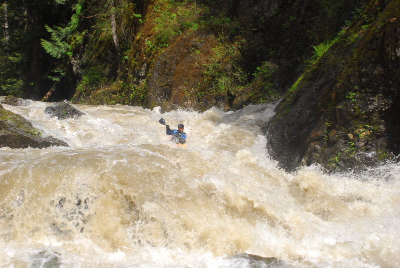
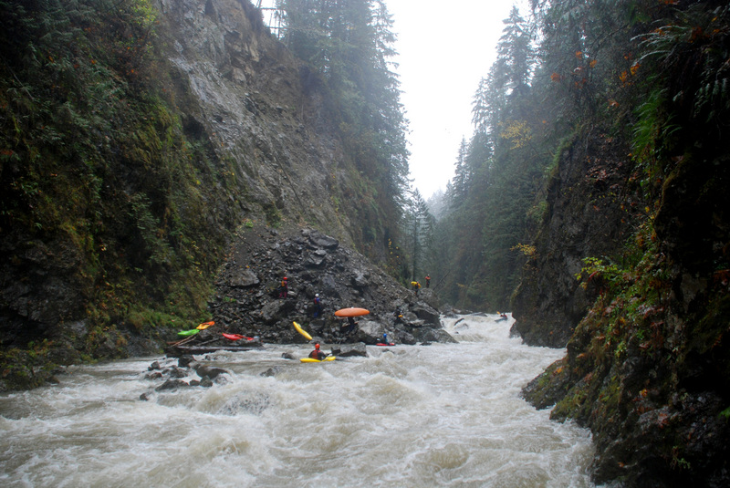
A few notes from the 5/22 release: 1. The landslide rapid has changed, and is no longer the hardest rapid on the run. We boat scouted down the left, working center. Since any rapid named 'Landslide' has to be the biggest on the run, a rename might be in order. I've heard proposals for 'Erosion.' 2. The run was generally clean of wood, and we had no log portages. 3. I'm not sure why this run gets the rating, III-IV+. I would say the rapids in the second gorge are solidly IV+, and not particularly walkable. Given the possibility of wood, occasional sieves, length, and inescapable sections, I would personally give this run a V- rating. It's also worth noting that I talked to Stephen Cameron and his quote was apparently describing a run at 4k.
Sep 10, 2018
For the fall 2018 release, there was one river-wide log and portage during some slack water. There were other spots where we had to duck or squeeze through a tight spot due to wood. Most of the larger drops were mostly clear, though vigilance and quick maneuvering is required. The dam was run on the right, and is perhaps class III+. Video from the run: https://www.youtube.com/watch?v=5O3q4E8QYDM.
May 5, 2017
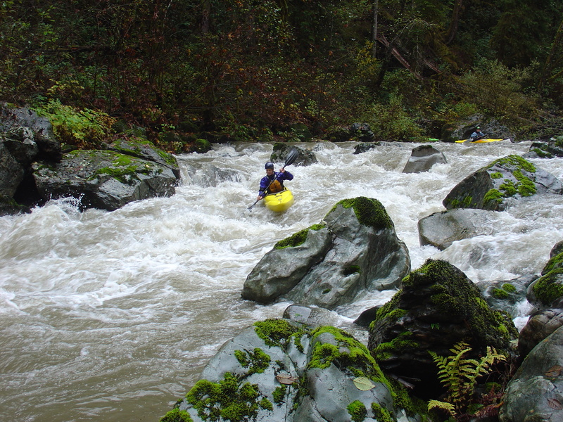
May 5, 2017 release at 900 cfs was a great flow. Only one log portage but plenty of wood in play with some must-make moves around wood hazards.
Jun 19, 2010
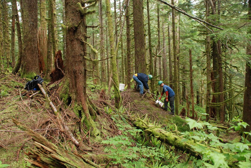
Construction of the trail into the Sultan River Canyon, a mitigation measure American Whitewater negotiated as part of the Jackson Hydropower license.
Oct 21, 2007
Great canyon scenery on the Upper Sultan.
Brian Zderic lines up for the first cataraft descent of Landslide rapid on the Sultan.
Oct 20, 2007
The Landlslide on the Sultan, recorded by Andrew Oberhardt on video as it happened, is now a great rapid.
The Sultan River canyon upstream of the City of Everett's Diversion Dam.
Oct 19, 2007
Andy threading his way through a rapid on the Upper Sultan upstream of the Diversion Dam.
Dec 12, 2005
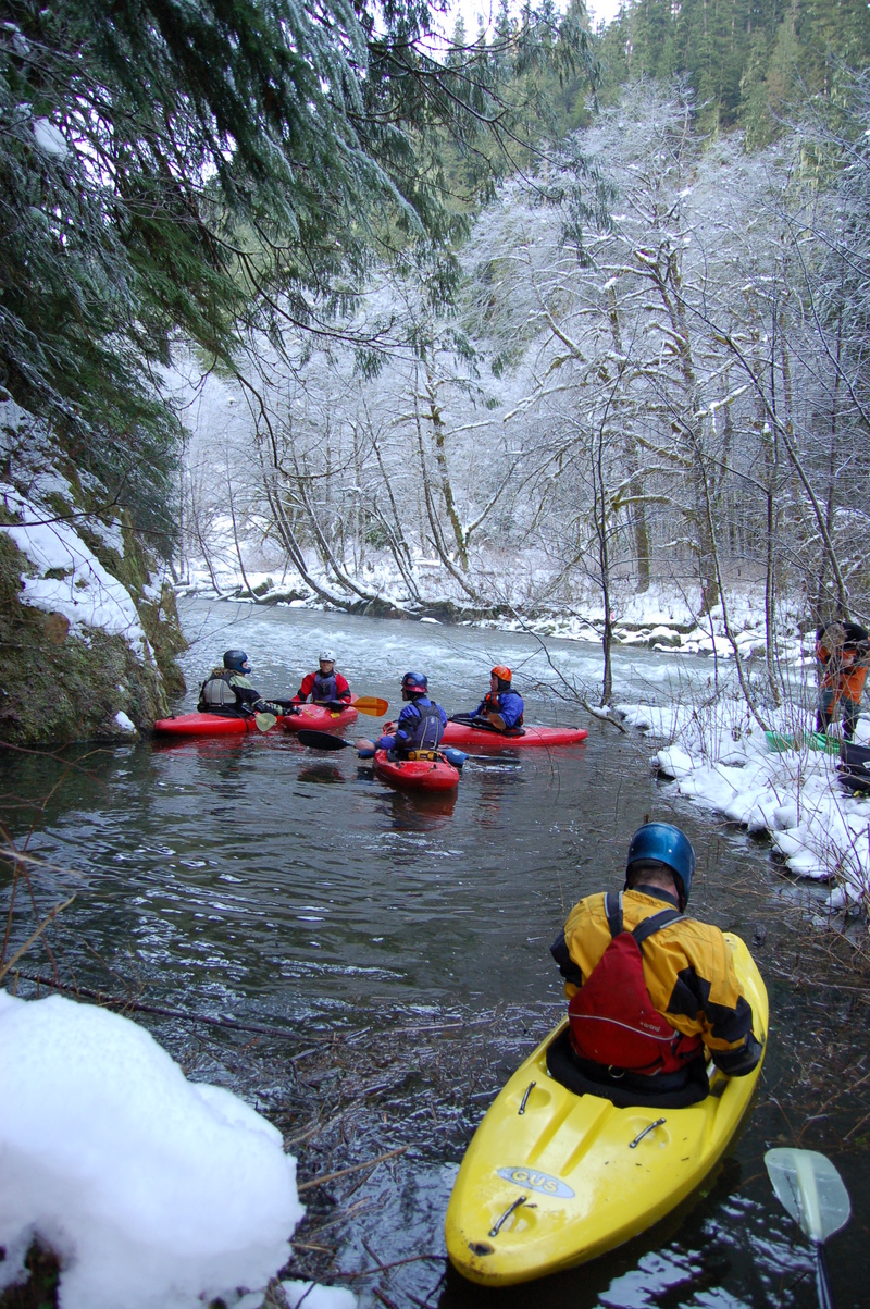
28 degrees and a very frosty scene at the put in. The hike in took almost 2 hours in one foot of snow, and we put on around 9:45am.
The Sultan has countless ledge and boulder drops. This was once of the first nice ledge drops.
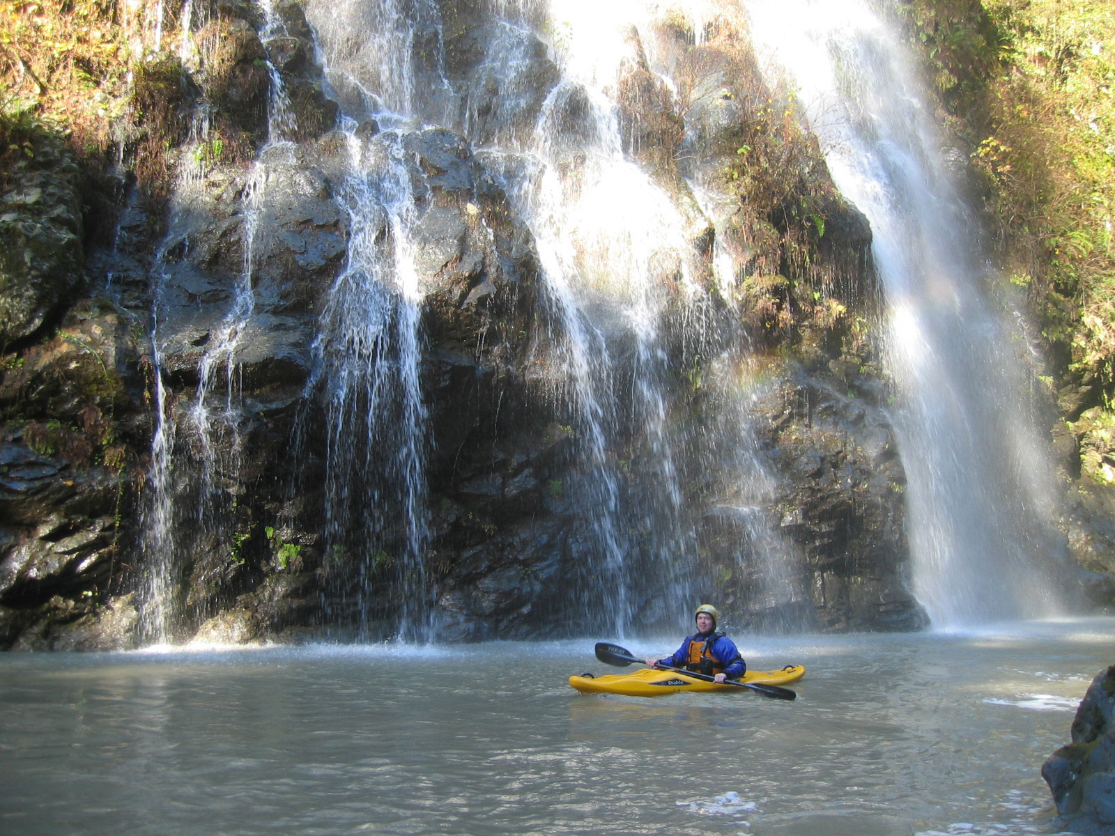
The Upper Sultan has many waterfalls pouring into it. This is one of the most spectacular.
The portage around the web-famous landslide was no problem. The rapid is very unrunnable due to trees jammed into the rocks that form the slide.
Dec 13, 2004
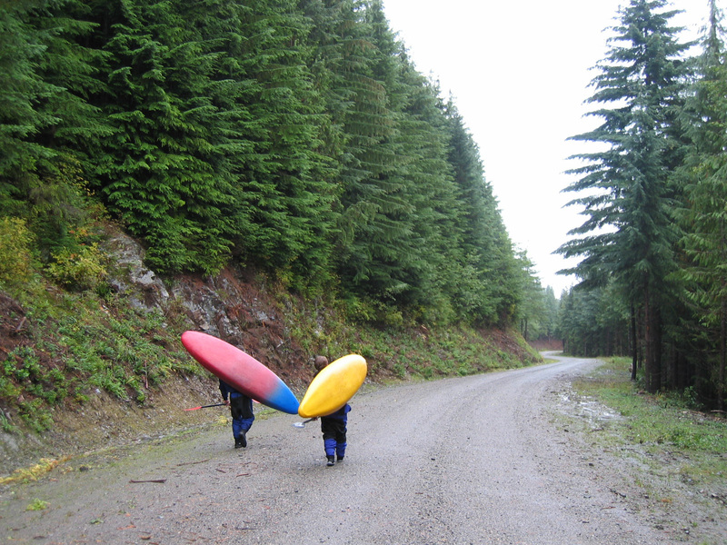
For those thinking of paddling the upper section...our way in was fairly easy. It cuts maybe 4-5 miles of the run but prevents you from having to put on the river extremely early. We drove about 2 miles upstream from the normal river right side lower put in (lower dam) and came to the 2nd right turn (1st that is gated and is an obvious gravel road). Said another way, it is the last right before you reach the Chaplain dam. We parked there (don't block the gate)and then hiked about 3/4 or so miles to the diversion dam. Easy flat hiking until the last mile or so. Lots of wood(small firs and alder trees) in the river. It needs a big flush. Something it won't see unless the upper dam and diversion dam are removed or in the FERC process, they release once a year to flush it out.
Dec 11, 2004
On 12/11 Saturday 15 people accessed the river by hiking accross the landslide which has now been chain sawed out somewhat. The PUD was very kind to open the Olney Pass gate and allowed everyone to drive to the clearing up on the FS road. We flagged the old miners trail down to the river which turns right just after the landslide. This trail allows you to put in approx. 1 mile above the old log bridge. Total hiking time was approx. 1 hour. I was in the first group of three paddlers. We started at 10 A.M. and arrived at Trout Farm Road without incident at 3:30 P.M. The level was at 900 cfs in the early A.M. but was down to 400-500 cfs at 12:30 when we were at the Diversion Dam. There is some new wood that fell in the major ice storm last winter but it is manageable. The second group of six paddlers was just downstream of Marsh Creek Falls when they observed and recorded on video a massive landslide that completely blocked the river for a brief time. The second group of six paddlers could not portage over the new and very unstable landslide and was forced to hike up very steep cliffs. It is not known at this time if portaging over this new landslide is possible. I will try and hike in their soon and post an update on the river situation. This landslide is just upstream of the Horseshoe Bend put in trail and it might be possible to paddle upstream to observe the landslide/dam.
Oct 21, 2003
We ran this section on 21OCT2003 after heavy rain (the Sky was up to 90k the evening before but the rain stopped and flows began dropping quickly). Hiking in took longer than expected due to a new major landslide across Jenny Ring Road. We estimated flow to be approximately 150 cfs at the start (no release from the dam). It was boney but enough to make good progress and flow continually increased as dozens of side creeks and waterfalls added flow (most of the big ones come in below the diversion dam). By the time we got to the Diversion Dam we estimated approximately 600 cfs and the drops started to fill in nicely. It was about 1000 cfs by the time we got down to the Powerhouse which was getting a little pushy in the drops, but there were still plenty of eddies and scouting was straightforward. The rapids were mostly clean (we had one log portage) but it did take some time to scout out lines on a few. Give yourself plenty of time. We ran out of light at Last Nasty and ended up hiking out on riverleft after paddling a short distance in the dark. This is is not recommended as the blackberries are extremely dense. Again, get an early start and if you're short of light consider the hike out at the Powerhouse. Great run! Would be a wonderful resource with more dependable water.
Oct 1, 2003
One of the rapids upstream of the
diversion dam.
A fun S turn rapid towards the end of
the first gorge section upstream of
the diversion dam. Shortly after this
drop the river enters one of the most
scenic sections of the run.
Scenic waterfall a short distance
upstream of the diversion dam.
One of the drops dowstream of the
diversion dam.
One of the rapids downstream of the
diversion dam.
One of the rapids below the diversion
dam.
The last big rapid before the start of
the Horseshoe Bend section.
Feb 2, 2003
Finally ventured down this stretch on 1/26/03 on natural flow without a release. The gage was near 400 which made the first few miles a bit low but there was plenty of water for the lower 6-7 miles due to side streams. The Sky at Gold Bar crested at 45k the same afternoon. Only one portage around a tree but otherwise very little wood. Beautiful gorge with many waterfalls.
Jan 1, 1900
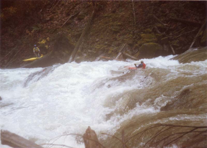
Exploring the Upper Sultan during high flow.