Yakima
Confluence with Teanaway River to Thorp
Jul 31, 2024
Great float, but there is some nearly river wide wood just below the E Cle Elum River Access (the one above the Teanaway River Junction). The two gaps we threaded barely fit our big raft. I see there is an alert added to this page now, but adding the TR to suggest using the lower access point if you are not sure about wood in this section. Everything below that was clean.
Aug 3, 2023
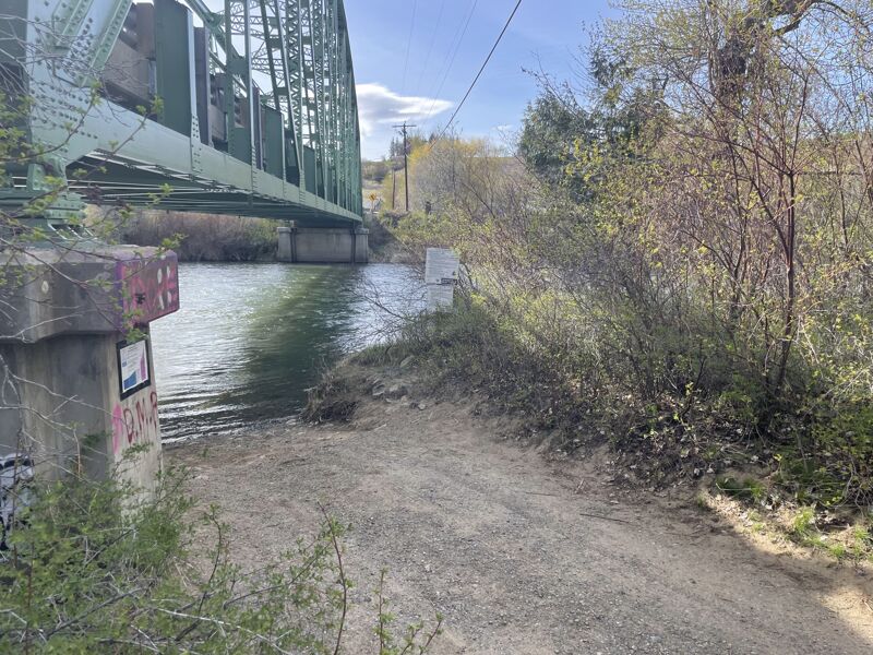
Ran this at 3625 CFS. Easy trip except the takeout at the Thorp Highway Bridge. This is a tricky and narrow takeout on river R underneath the green bridge. The current is strong and the eddy is easy to miss if you don't time it right. Hug the R bank as you approach and paddle hard until you're sure you are in the eddy.
If you miss it, be sure to stay on river R. About 50 yards downstream on the R, there is a bank with a path back to the parking lot.
Apr 27, 2023
Site tour of access sites.
Jun 11, 2022
Ran the Yakima on 6/11/22 at 9000 CFS. I'm a relatively newer paddler and ran this in a Tandem ducky with my girlfriend. The scenery was way better than I imagined, and there was plenty of fun class II wave trains. I will say, the log jam in the first .25-.5 miles is still prevalent, and was stressful to get through to say the least. Ended up doing some weird portages that took a while but once we got through it the rest of the river was clear of obstruction.
Aug 23, 2020
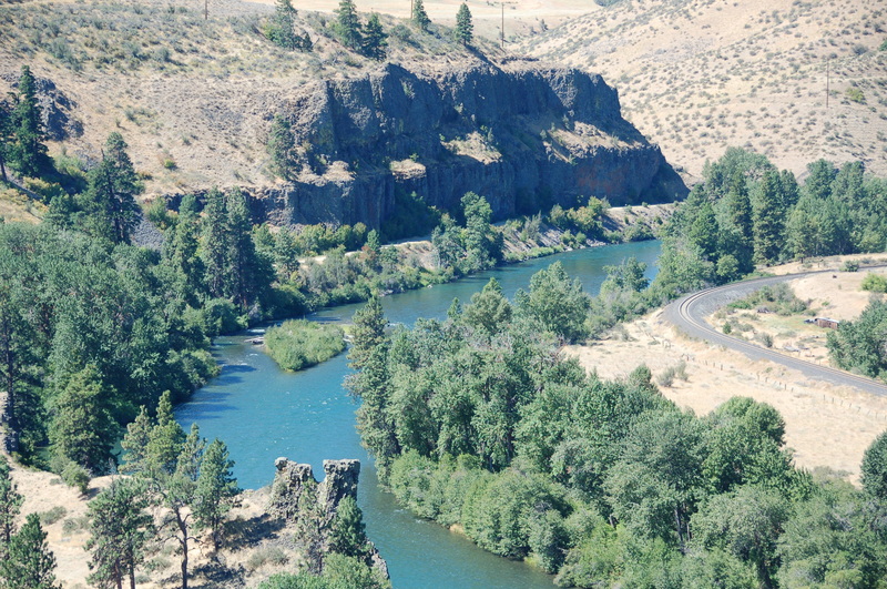
8/21/2020 - I am very new to paddling, and I love this site. We paddled this section of the Yakima and for our skill level it was perfect. Some wood in the first mile, but it’s easily avoided. Beautiful basalt formations.
Aug 25, 2018
Paddled from the Teanaway confluence to the Thorp Highway bridge on 8/25/18 in inflatable kayaks. Some folks putting in before us recommended staying to the right to avoid a logjam in the main channel ~1/4 mile after the put in. Looking at a map, we decided to take the small channel exiting nearly perpendicular to the main flow 200 yards from the put in. We're not sure if this is what they were recommending, but it was clear. We didn't come across any other hazards.
Aug 15, 2017
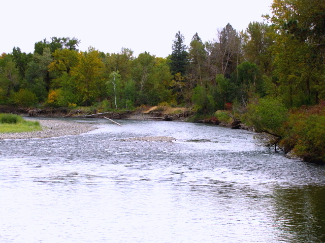
Driving along the river.
Aug 7, 2014
8-7-14 Put in at Teanaway confluence and floated down to the dam in 14ft float boat. Took about 3hrs. and was running about 4200 sq. ft. Great run for beginner to intermediate skill levels. Nothing hard to deal with except there was a log jamb to navigate around about a quarter mile down from the put in at the public access parking lot where Hwy 10 and 97 intersect. A Discover pass is required for parking or you can park out by the road and walk in about a quarter mile. You can unload equipment right next to the river. The take outs are well marked with signs on the river.
Oct 11, 2011
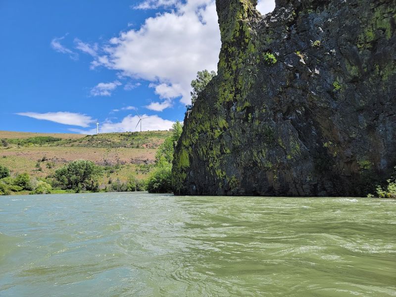
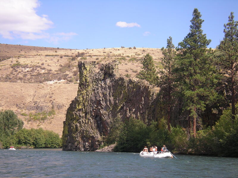
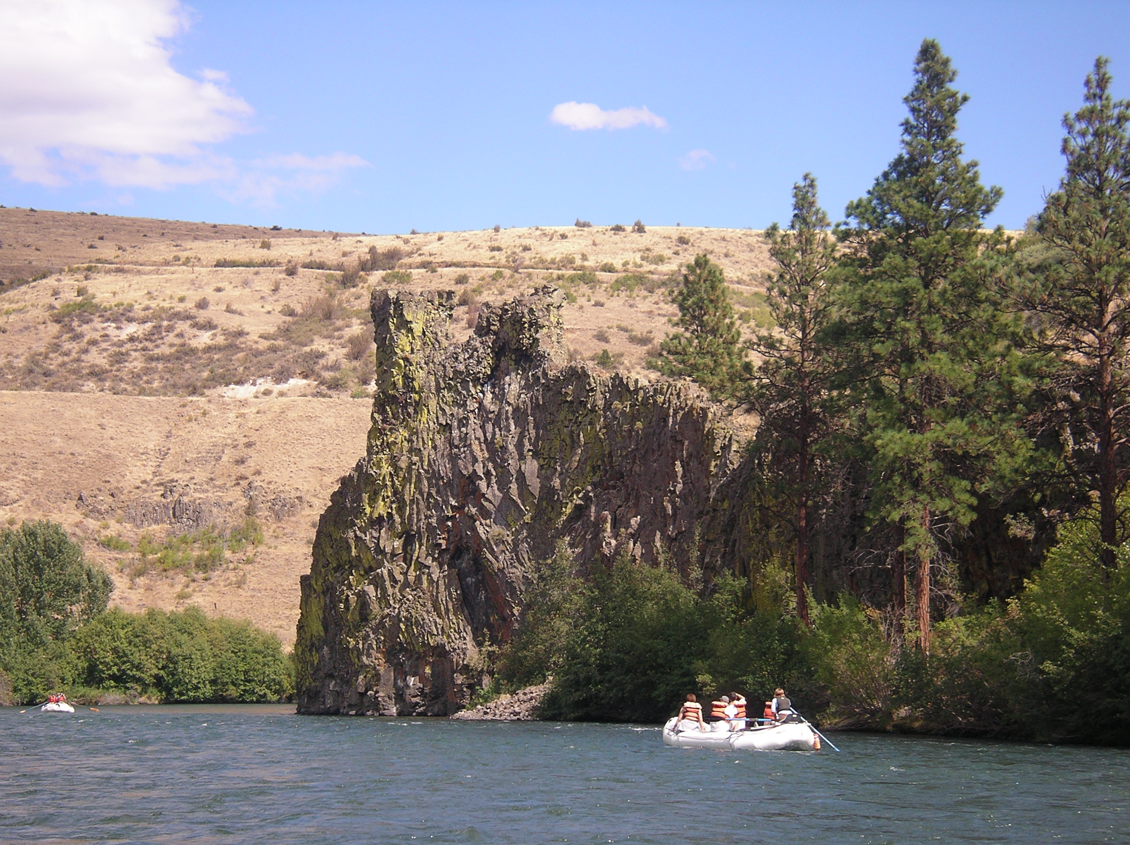
Paddled from Teanaway to dam afternoon 10-12-11. Cfs 1500. Water thin but excellent paddling, chutes full, good rock slaloming. Intermediate skills with Wenonah Rendezvous. 33 minor rapids were charted off Google Earth, through a country wilderness landscape. Excellent fall canoeing requiring waterproof cool weather clothing. Water at the Teanaway takes 16 hours traveling to the gauge at Umtanum. If the gauge at Umtanum is falling, Teanaway levels may be higher. Example, enjoyed the trip at gauge 1500, 16 hours before (upriver minus) gauge read 1540-50. Photos are at 1460 gauge minus 16 hours. Check with NOAA for rain or snow for melt at or above Cle Elum and rising or falling at Cle Elum gauge 43089. Of consequence for tandem canoes or beginners: First rapid is road visible at N47.16196 W120.81260. A 2+ at 1300-1500 CFS, scout from below. Possible name: RUIN YOUR DAY ? Second heads up drop is below a bridge, N47.10128 W120.70192. Run right side. Third rapid, see photos on right top bar extension, at N47.075042 W120.663440, shallow and sharp, scout from left sandbar. Rapid 3, visible from RT 10, is not a stream gauge, flow reduced by half in diversion, flow thru the sand hill's erosion. The hillside chute at Bristol Flats, N47.14945 W120.80875, is floated over a shallow sandbar left bank. Boat ramp is at the sandbar. Air quality degrades with agricultural dusts below the canyon and at dam take out, N47.06504 W120.65422. Local guide reports the right dam portage is strung with barbed wire. GPS coordinates are upriver from point. O'Keefe's photo is a pleasant burbling ripple at 1500 Cfs. Ellensburg KOA will shuttle.
Sep 30, 2011
Aug 28, 2005
Trip down the Yakima River with Cascade Land Conservancy.
Jul 19, 2004
This run can be extended upstream by putting in at the Cle Elum dam, which adds 18 miles (about 4 hours) or at Bullfrog Bridge on the Roslyn/Salmon La Sac road, which adds 10 miles (about 3 hours). The full 33 miles makes for a good long day in July or August, but the swift current requires little paddling.