Yakima
Confluence with Teanaway River to Thorp
| Difficulty | II |
| Length | 16 mi |
| Avg Gradient | 14 fpm |
| Gauge | Yakima River at Umtanum, Wa |
| Flow Rate as of 1 hour | 3730 cfsrunnable |
| Reach Info Last Updated | May 1, 2025 |
The Mountains to Sound Greenway stretches more than 100 miles along Interstate 90 from the shores of Puget Sound in Seattle, across Snoqualmie Pass, and into Central Washington. Encompassing over 700,000 acres of public land managed by local, state, and federal agencies, the Greenway protects an extraordinary landscape that [...]Read More
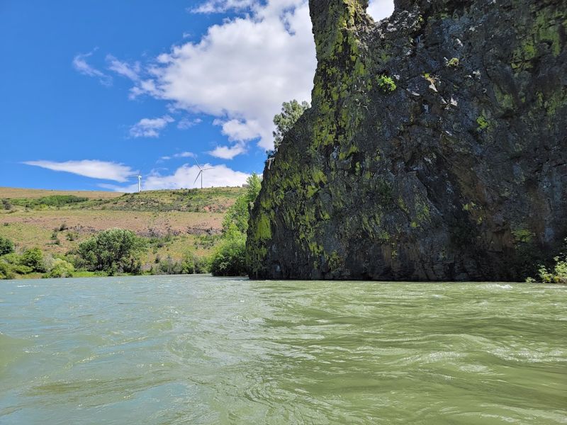
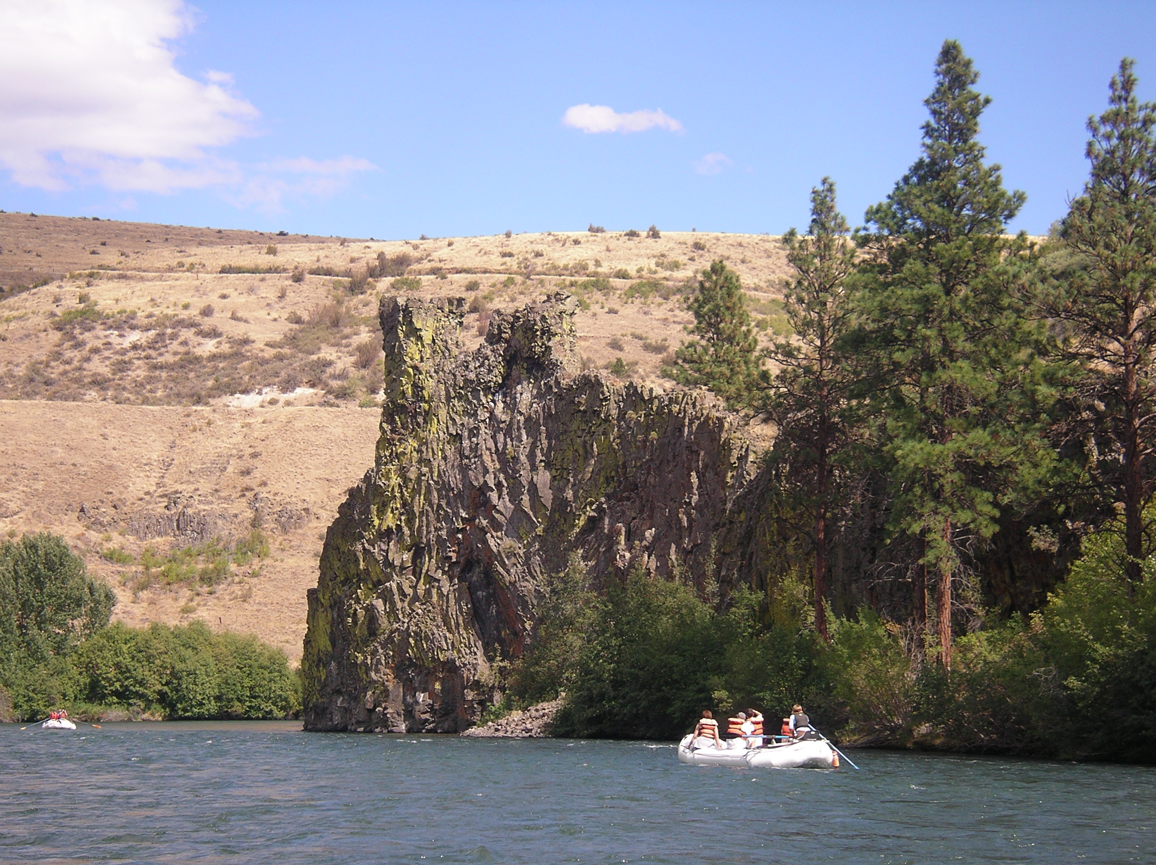
With a consistent release from upstream reservoirs supplying irrigation demand this is a good float through the summer. Be aware of wood hazards and avoid the irrigation weir that forms a dangerous hydraulic (either take-out upstream or make a plan to portage).
A standard run is from the Teanaway confluence down to the Thorp Highway Bridge. For a longer run you can put-in further upstream on the Cle Elum River at Bullfrog Road just before it joins the Yakima River.
ACCESS: The put-in at the Teanaway confluence is a WDFW site (Discover Pass required). At Highway 970 mile 2.5 (just west of the junction of Highway 970 and Highway 10) turn south on a dirt road following the signs for river access across the railroad tracks and continuing about a 1/4 mile down to the river. An alternate access about a mile downstream is avialable where Highway 10 crosses the Teanaway River at mile 89.3. This is an informal access with a short carry down to the water and roadside parking.
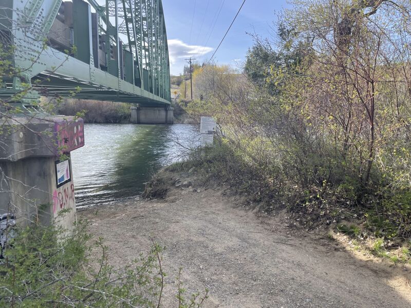
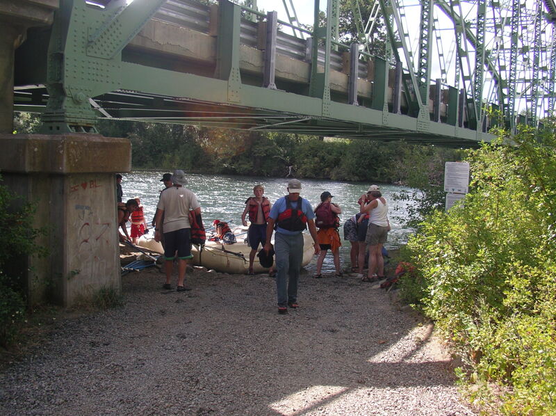
To reach the take-out from the put-in, head back out to Highway 970, turn right, and in 0.1 mile turn on to Highway 10. Follow it 9 miles to Highway 10 mile marker 97.3 where you turn right on Thorp Highway. Continue 0.9 mile down Thorp Highway to the bridge across the river. Access is available on the downstream river right side of the bridge.
An alternative take-out is available a little further downstream at Highway 10 mile marker 101.1. This is just upstream of the lowhead dam that must be avoided (it has been the site of a couple fatalities) at Highway 10 mile marker 101.5.
The put-in just upstream of the Teanaway confluence at a day-use site adminstered by Washington Department of Fish and Wildlife (Discover Pass required). At Highway 970 mile 2.5 (just west of the junction of Highway 970 and Highway 10) turn south on a dirt road following the signs for river access across the railroad tracks and continuing about a 1/4 mile down to the river.
Access point at the Highway 10 Bridge at mile 89.3 where it crosses the Teanaway River just upstream of its confluence with the Yakama River. A toilet is available and you can walk the rafts down to the river on the downstream river right side of the bridge. Parking is available along the road shoulder.
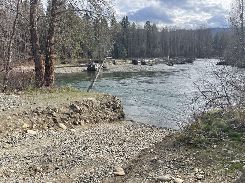
Access on river right downstream of the bridge.
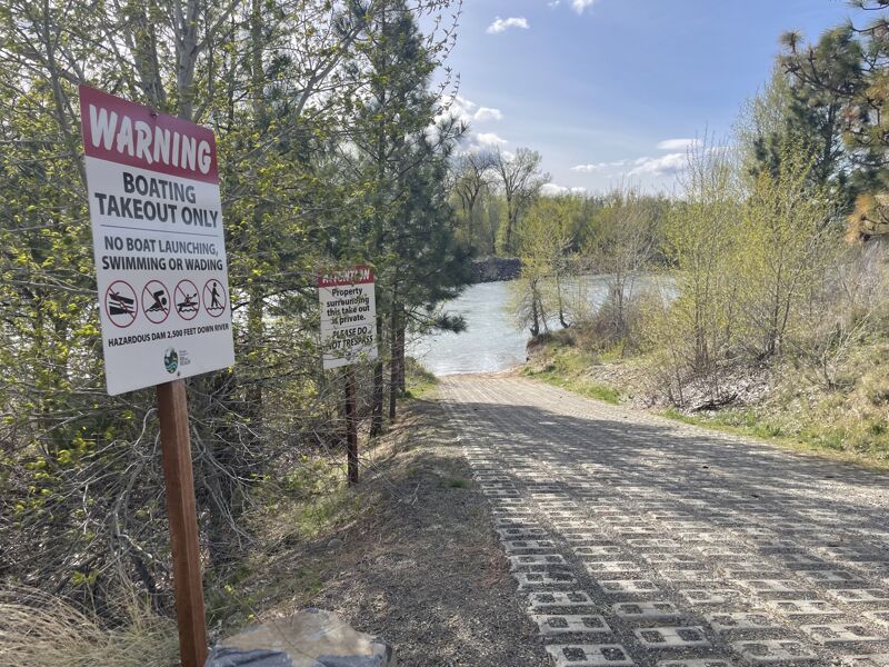
Access serving as a take out on river left immediately upstream of the lowhead dam at Highway 10 mile marker 101.1. This is just upstream of the lowhead dam that must be avoided.
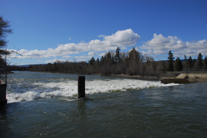
Be sure to take out before you reach the dam. It is located at Highway 10 mile marker 101.5.
Jul 31, 2024
Great float, but there is some nearly river wide wood just below the E Cle Elum River Access (the one above the Teanaway River Junction). The two gaps we threaded barely fit our big raft. I see there is an alert added to this page now, but adding the TR to suggest using the lower access point if you are not sure about wood in this section. Everything below that was clean.
Aug 3, 2023
Ran this at 3625 CFS. Easy trip except the takeout at the Thorp Highway Bridge. This is a tricky and narrow takeout on river R underneath the green bridge. The current is strong and the eddy is easy to miss if you don't time it right. Hug the R bank as you approach and paddle hard until you're sure you are in the eddy.
If you miss it, be sure to stay on river R. About 50 yards downstream on the R, there is a bank with a path back to the parking lot.
Apr 27, 2023
Site tour of access sites.