Yakima
Confluence with Teanaway River to Thorp
October 11, 2011
| Reporter | Gene Daniels |
| Flow | Low Runnable |
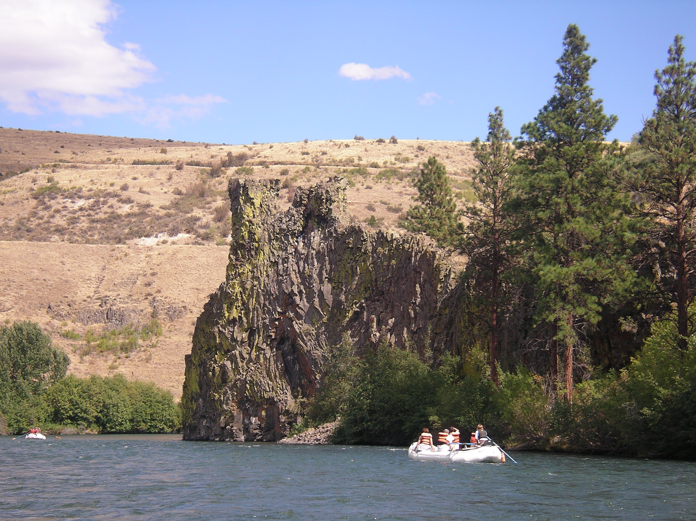
Paddled from Teanaway to dam afternoon 10-12-11. Cfs 1500. Water thin but excellent paddling, chutes full, good rock slaloming. Intermediate skills with Wenonah Rendezvous. 33 minor rapids were charted off Google Earth, through a country wilderness landscape. Excellent fall canoeing requiring waterproof cool weather clothing. Water at the Teanaway takes 16 hours traveling to the gauge at Umtanum. If the gauge at Umtanum is falling, Teanaway levels may be higher. Example, enjoyed the trip at gauge 1500, 16 hours before (upriver minus) gauge read 1540-50. Photos are at 1460 gauge minus 16 hours. Check with NOAA for rain or snow for melt at or above Cle Elum and rising or falling at Cle Elum gauge 43089. Of consequence for tandem canoes or beginners: First rapid is road visible at N47.16196 W120.81260. A 2+ at 1300-1500 CFS, scout from below. Possible name: RUIN YOUR DAY ? Second heads up drop is below a bridge, N47.10128 W120.70192. Run right side. Third rapid, see photos on right top bar extension, at N47.075042 W120.663440, shallow and sharp, scout from left sandbar. Rapid 3, visible from RT 10, is not a stream gauge, flow reduced by half in diversion, flow thru the sand hill's erosion. The hillside chute at Bristol Flats, N47.14945 W120.80875, is floated over a shallow sandbar left bank. Boat ramp is at the sandbar. Air quality degrades with agricultural dusts below the canyon and at dam take out, N47.06504 W120.65422. Local guide reports the right dam portage is strung with barbed wire. GPS coordinates are upriver from point. O'Keefe's photo is a pleasant burbling ripple at 1500 Cfs. Ellensburg KOA will shuttle.