Embarrass, S.Br.
Tigerton Dells: Hwy.45 to CTH.M (2.4 miles)
| Difficulty | II-III |
| Length | 2.4 mi |
| Avg Gradient | 25 fpm |
| Gauge | Tigerton Dells Virtual |
| Flow Rate as of 36 minutes | 25 cfsbelow recommended |
| Reach Info Last Updated | April 28, 2021 |
A mostly flatwater access paddle contains a few good warm-up drops which allow some fine, easy play. What could otherwise be a peaceful access is likely to be disturbed by the roar of off-road vehicles in the adjacent Tigerton OHV Park and Campground.
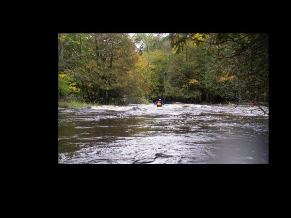
The crux of this run is a wonderful finale at the dells. A half-mile of continuous action, through a rock walled rocky dells, demands strong intermediate skills. (Be very vigilant, looking well downstream for rocks and possible wood! There will not be many eddies and action will be swift at moderate or higher flows.) Flips or swims are likely to be brutal. For strong paddlers, numerous play spots (generally with 'two-boat' eddies) exist in this stretch.
This reach is fairly short, so you may wish to combine it with one or more other sections which are close by (for a Shawano County double- or triple-header):
The 'access paddle' portion of the run does have a couple minor rapids. This is the first of these. Generally it rates class I-II.
The second rapids on the 'access paddle' is also fairly simple, class I-II.

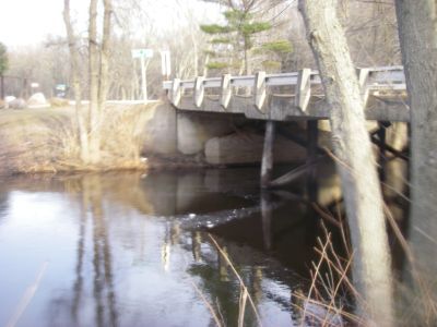
A bridge spans the river. A HUGE tree has fallen upstream of the bridge. There is NO passage on the river, and a portage is required.
Islands split the river. The widest/main channel is to the right. At higher flows, a narrow center channel may be run (fairly simple), and the left channel offers a rock-boof move.
There is a short rapids after leaving the 'Diamond D' Ranch property, but before you get to the main event, the dells.
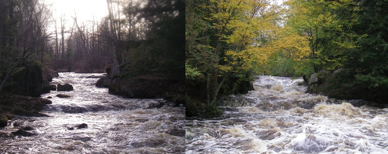
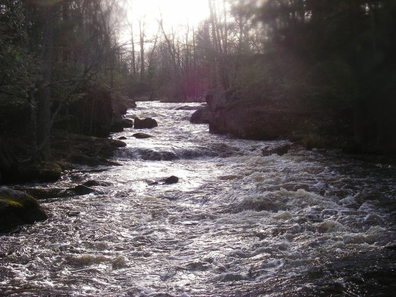
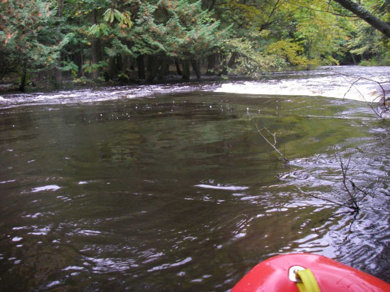
You will see an obvious narrowing and rocky shores, which should be your sign to get out and scout (river-right is generally best). The entrance to the dells has some interesting rocks, waves, and a hole which can be VERY keepy! It can be skirted to the left, but you want to be a strong paddler, and confident of your line to avoid betting worked (at least at some flows). (It may actually be more keepy at low-moderate flows, and less keepy at higher flows!)
For what it's worth, some call this the 'Upper Dells', and the entire rest of the run (after passing the bend) the 'Lower Dells'. I prefer calling this first bit the 'Dells Entrance', and then splitting the straight-away (after the bend) into the 'Upper' and 'Lower' Dells, since there is a brief pool which lies midway down that stretch.
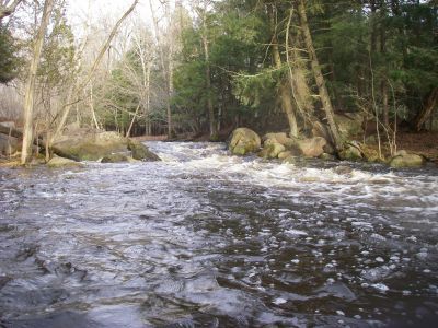
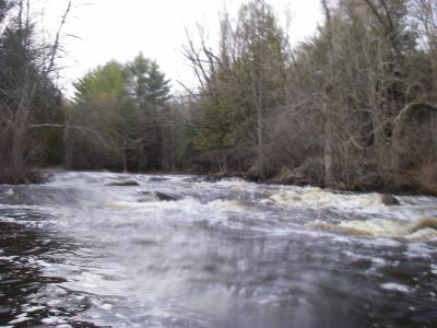
After running the Dells Entrance drop, the river swings 90-degrees to the right and immediately heads into a long, technical, boulder-garden dells. Depending on flows and your skills and interests, there may be some play possible through here, but action is pretty continuous until a brief pool midway along. This separates the Upper (or Middle) Dells from the Lower Dells, where more of the same technical boulder-bed leads to the final pool as you come to the bridge for your take-out.
Sep 12, 2019
Paddled at 136cfs and it was easily managed, a few more exposed rocks but easily maneuverable throughout all of the rapids. We were not getting hung up on rocks either. I would say the minimum level to paddle would be around 110cfs but I would risk it at 100 if I was itching. Currently the County M bridge is out but you can park at the end of the run on river right. There is a trailer river right at the take out that is currently habit-ted by a few younger guys. Give them a heads up when you park at the end what you are up to as a courtesy so they aren't confused as to why a car is now oddly there.
May 3, 2018
In April 2018, a local resident who lived in a trailer adjacent to the take-out died in a tragic fire and suicide. Given the sensitive nature of the situation and family issues regarding the parcel, we suggest avoiding the take-out at the County M Bridge. It’s probably best to skip this run for the immediate future.
Sep 24, 2010
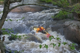
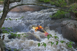
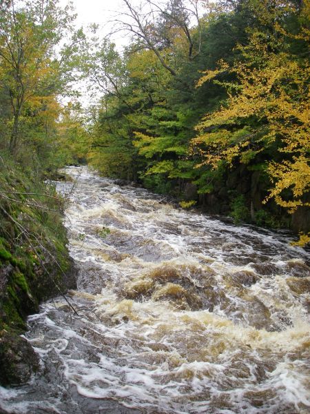
We ran this at 570cfs, this was a pretty full river. The most the lady living at the take-out had seen in a decade. The beginning small rapids that border the park had some minor surfing at this level. The 3rd set after the bridge, which was just high enough to squeeze under in a full duck, had all 3 channels open. The river right one, with the most water, was a clean drop of wave trains. The center was less exiting and the river left was fun with a skip off a pillow in front of a rock. The rapid just after the park developed a nice hole, which had a pretty clean line through on the left side. Was on the steep side for my play skill level, see pics. The upper dells should be scouted as it has 2 fair sized wave/holes. Both flushed well, but a look is always safe. The lower straight section of dells was a nice straight forward section, boat scoutable. I posted a few pics and vids to give an idea of the level.