Embarrass, S.Br.
Tigerton Dells: Hwy.45 to CTH.M (2.4 miles)
Sep 12, 2019
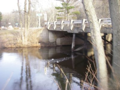
Paddled at 136cfs and it was easily managed, a few more exposed rocks but easily maneuverable throughout all of the rapids. We were not getting hung up on rocks either. I would say the minimum level to paddle would be around 110cfs but I would risk it at 100 if I was itching. Currently the County M bridge is out but you can park at the end of the run on river right. There is a trailer river right at the take out that is currently habit-ted by a few younger guys. Give them a heads up when you park at the end what you are up to as a courtesy so they aren't confused as to why a car is now oddly there.
May 3, 2018
In April 2018, a local resident who lived in a trailer adjacent to the take-out died in a tragic fire and suicide. Given the sensitive nature of the situation and family issues regarding the parcel, we suggest avoiding the take-out at the County M Bridge. It’s probably best to skip this run for the immediate future.
Sep 24, 2010
The embarrass rain gauge showed 4.5' of rain. This was close to the peak flow, there were no signs on the banks that the water was receding.
Sep 24, 2010
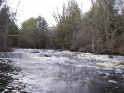
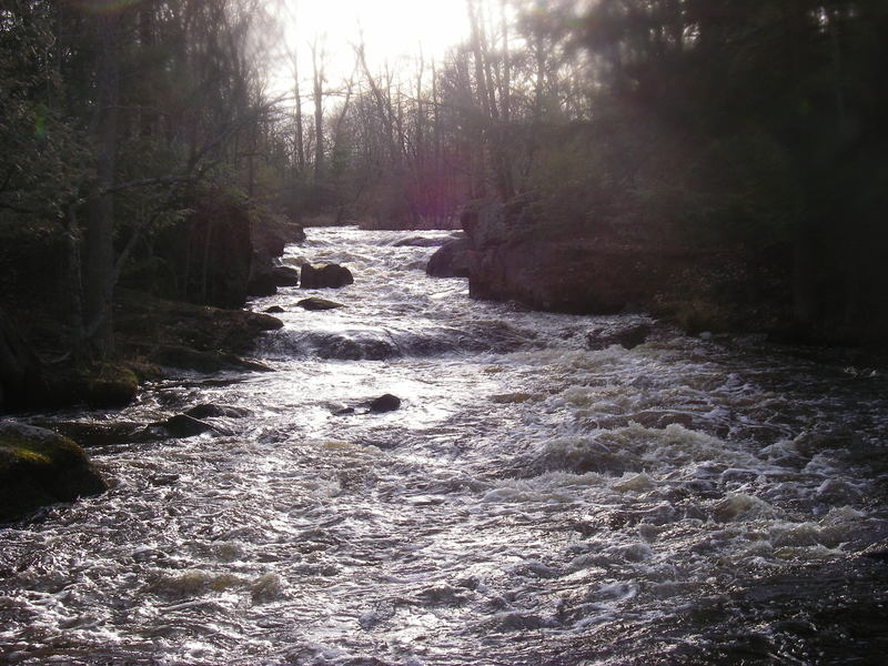
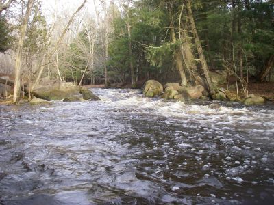
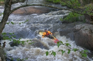
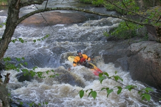
We ran this at 570cfs, this was a pretty full river. The most the lady living at the take-out had seen in a decade. The beginning small rapids that border the park had some minor surfing at this level. The 3rd set after the bridge, which was just high enough to squeeze under in a full duck, had all 3 channels open. The river right one, with the most water, was a clean drop of wave trains. The center was less exiting and the river left was fun with a skip off a pillow in front of a rock. The rapid just after the park developed a nice hole, which had a pretty clean line through on the left side. Was on the steep side for my play skill level, see pics. The upper dells should be scouted as it has 2 fair sized wave/holes. Both flushed well, but a look is always safe. The lower straight section of dells was a nice straight forward section, boat scoutable. I posted a few pics and vids to give an idea of the level.
Mar 21, 2010
We ran the dells at 270 cfs and falling. Was a great section of dells, just remember to avoid the big hole at the start of the straight section of tigerton dells.
You probably want to ask permission to park at the take out as it is no longer a bar, but apartments.
Mar 16, 2010
This was a short rapid/slide before the dells section starts.
Mar 16, 2010
This was at a virtual of 240 cfs and was runnable, but with rock dodging being a big part of the run. Tigerton Dells 'bar' is no more, one of the people living there allowed us to park and walk up to the dells.
Mar 16, 2010
The straight shot of dells is preceeded by another fun dells section that comes after a small island splits the river (with a log foot bridge in the right channel) . Virtual gauge was *240 cfs. See takeout visual gauge too.
Mar 16, 2010
This is the right channel (main) of the a rapid signaled by a wooden car bridge at Diamond D Ranch. Soon after is a gently sliding rapid. virtual gauge at 240cfs, also see visual at takeout.
May 21, 2005
Bill Diedrich leading the way through the Tigerton Dells section of the Embarrass River on the Ten Rivers Expedition.
Apr 4, 2004
3 April 04
We ran the Tigerton Dells, Leopolis, and Hayman Falls stretches in one afternoon. The gauge readings were 274 cfs on the Middle Branch and 1220 cfs on the Embarrass. At these levels there was plenty of water and none of the rapids were too difficult. The Dells was not too pushy. The Leopolis stretch was a fun and interesting short class II stretch. It would be fun to play at Hayman Falls all day IF it was warm!
Rich Krieg