Popple
C) Morgan Lake Rd to Hwy 101 (5.4 miles)
May 11, 2018
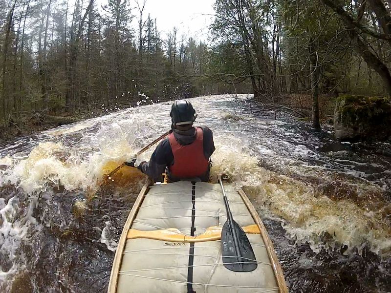
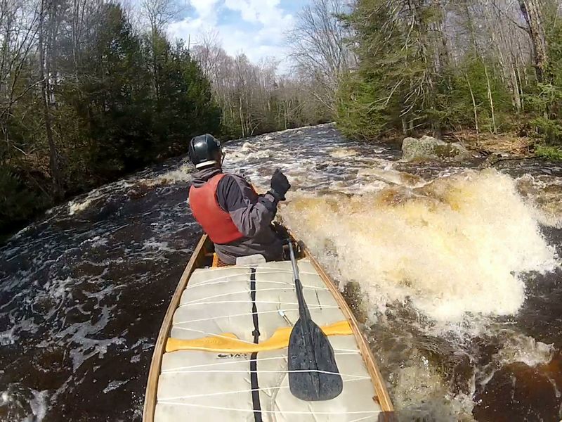
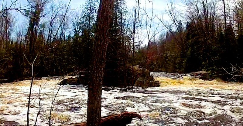
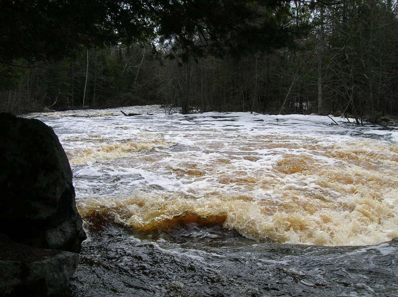
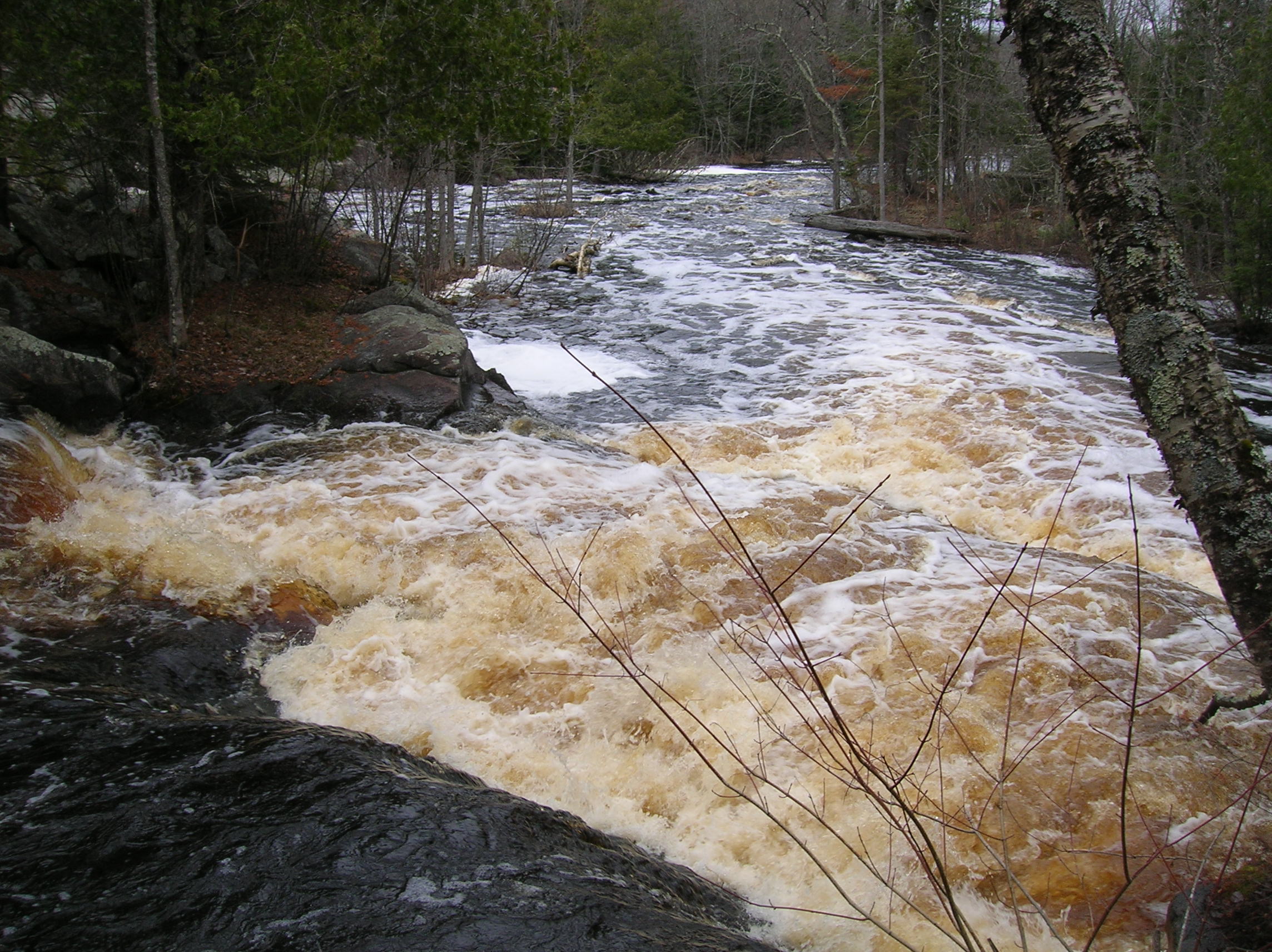
5/11/2018 374cfs Good Run. Plenty of fluid to clear rocks but some morphology (not all pushy and big waves). Ice is gone and pathways were clear of trees or logs
Mar 3, 2018
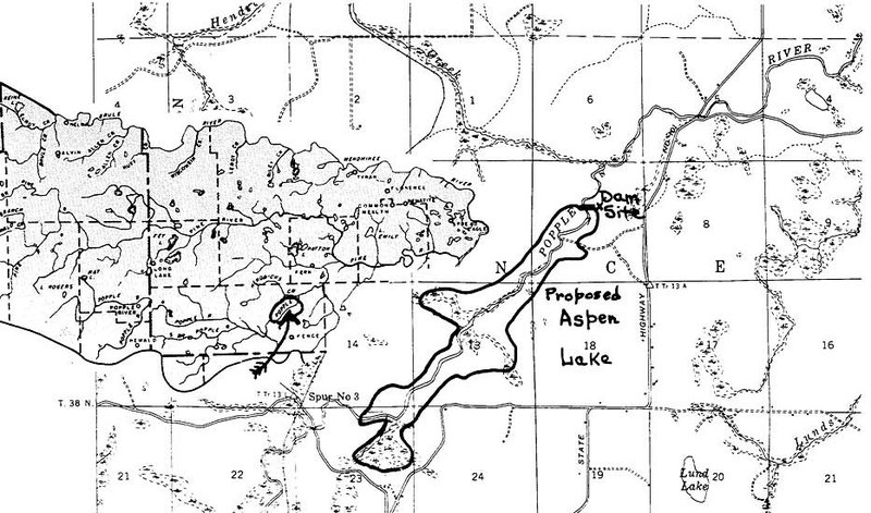
Had Aspen Dam been built just above Hendrick’s Creek. Nine Day Rapids, Murphy Rapids, and the river all the way to Little Bull Falls would have been obliterated. The 35 foot high structure would have blotted out over half the vertical drop from bridge to bridge.
Feb 11, 2018
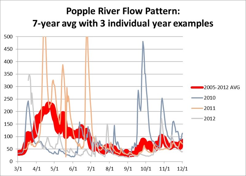
Little input (30cfs) to flow from groundwater (springs) is a limiting factor for this river. The best water levels are usually not from snowmelt. They are from early spring rains that come when the ground is still frozen until trees fully leaf-out (April-May). A rain of 1” at this time will provide excellent water levels while from summer through fall it may take a 3” rain.
May 1, 2013
Upper part is tight, wide around the bend, then another run of waves, before exiting (on far left at lower flows)
May 1, 2013
Tight with big waves to start then it opens up around the bend
May 1, 2013
Upriver view of both channels. At this flow the river-left channel becomes available and perhaps more desirable
May 9, 2011
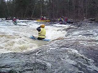
In this center run, opposing currents turned the canoe broadside in the hole, bow to the right, but the run was finished successfully by exiting directly to river-right into eddy where other paddlers are.
Apr 25, 2009
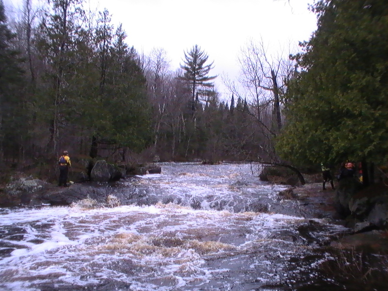
Upstream view of Little bull, the little tongue on River right was the prefered path. If you miss that tongue towards the middle of the river, make sure you have a rescue rope ready!
Looking back up on the RH channel at Big Bull. Right down the middle was our path this day...
Jul 28, 2008
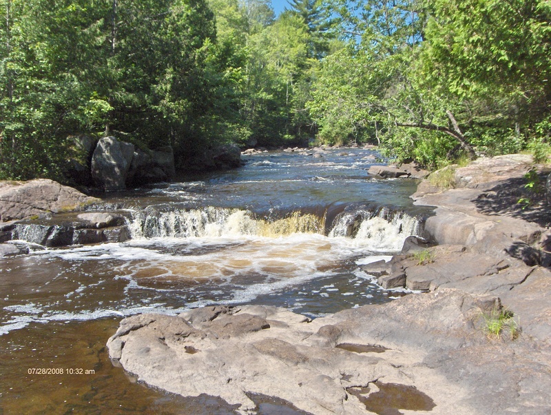
Submerged, cross-river, flow-stopping bedrock wall, 10-feet downriver from the drop, at normal flows, produces a hole that gets REAL retentive! It is NOT recommended as a playspot. This hidden feature pushes almost the entire outflow from the hole from left to right. Just above the drop, deflected current is running right to left. This combo of opposing tail-push and bow-push tends to spin boats broadside in the hole. Contrary to previous details on this page, it is not possible to touch bottom and stand up in the hole (I have tried at low water). Rescue rope extraction from the hole (by experience paddlers) has occasionally proved to be difficult, nearly fatal.
Jul 28, 2008
Submerged, cross-river, flow-stopping bedrock wall, 10-feet downriver from the drop, at normal flows, produces a hole that gets REAL retentive! It is NOT recommended as a playspot. This hidden feature pushes almost the entire outflow from the hole from left to right. Just above the drop, deflected current is running right to left. This combo of opposing tail-push and bow-push tends to spin boats broadside in the hole. Contrary to previous details on this page, it is not possible to touch bottom and stand up in the hole (I have tried at low water). Rescue rope extraction from the hole (by experience paddlers) has occasionally proved to be difficult, nearly fatal.
Apr 28, 2008
As of 4/26/2008, the Popple was running great this last weekend. Carefull of a large tree on the left side of Washburn Falls. Safer routes on the right sides of Little and Big Bull falls.
Apr 26, 2008
Left stream bank view down from Little bull falls. At this level the group went far right or far left hand side to partially avoid the large hole here. The river is one big wooptie do wave train at this level.
This was the right side channel from the right hand stream bank. The right channel was our groups choice at this water level...
May 22, 2006
As of 5/13/06 there was a large limb hanging down into the chute through Big Bull Falls. Check before you run this or bring a saw.