Wolf
F) Sec.4: Otter Slide to Big Smokey Falls (5.96 miles) ** Access Fee **
| Difficulty | II-III(IV) |
| Length | 5.9 mi |
| Avg Gradient | 16 fpm |
| Gauge | Wolf River at Langlade, Wi |
| Flow Rate as of 1 hour | 467 cfsmedium runnable |
| Reach Info Last Updated | September 26, 2022 |
This is the most challenging segment on the Wolf River. The character of the river changes dramatically ... from (generally) longer boulder-garden style rapids (upstream of the reservation and the upper/prior stretch in the reservation) to shorter but steeper drops in this section. In all cases, fairly long flatwater pools separate the main rapids.
Access is controlled by the Menominee Indian Tribe, and permits are required. As of 2019, its $45 up front (with $5 back when you return your wristband at the end of the run), which covers your 'trespass fee' and includes a shuttle to the put-in (so all your vehicles await you at the end of your run).
Permits may be purchased from Big Smoky Falls Rafting (715-799-3359) located at the take-out, and are generally available from Memorial Day through Labor Day. Trips perhaps a month before or a couple months after this time frame can usually can be arranged by calling the outfitter in advance. ( Outfitters are generally NOT on-site outside the summer season unless they have confirmed bookings, so always call ahead for non-summer permits.)
By local ordinance, all cars must now remain in the upper parking area (at Big Smokey), to leave lower lot clear. You may drive down to park only briefly, to load boats, if you don't want to carry up to upper parking lot upon arrival at the end of your run.
Permits are also sometimes available at Shotgun Eddy Campground and Rafting (715-882-4461), but this lacks the convenience of leaving your car at the take-out.
Most trips start at the Otter Slide access, on Highway 55 south of County Highway B (though you may be able to request other options when you arrange your shuttle, particularly in non-summer or slack days).
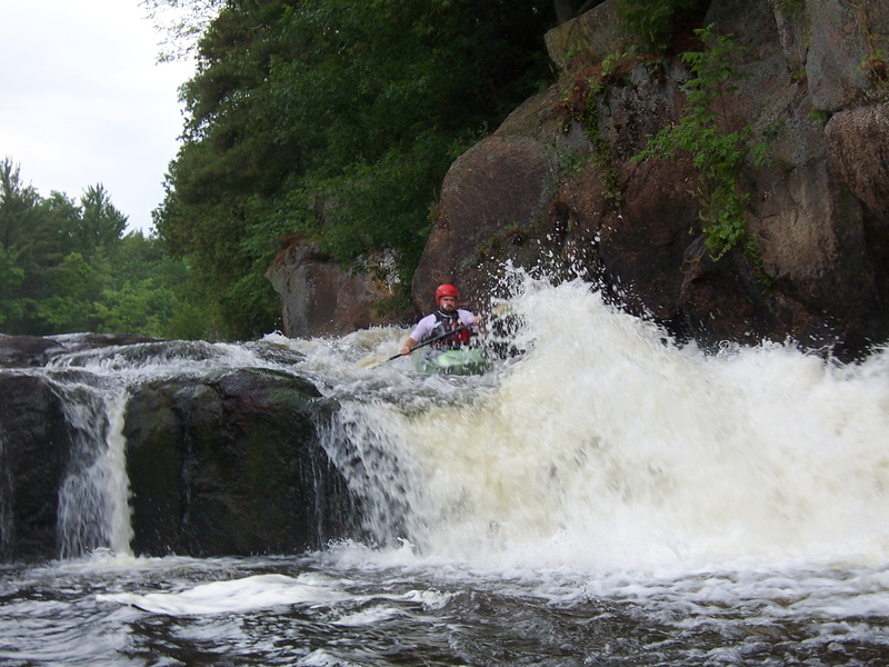
The first rapid is Sullivan Falls, a 7-foot tall, river-wide falls. You can sc
...
This is the usual put-in for a run on 'Section 4' of the Wolf. While the name sounds like it should be a rapids, there is none here. The put-in lies in the middle of a long stretch of flat water, so any 'otter slide' is merely from the shore of the river into the water.
Drainage area at our listed put-in is approximately 501 sq.mi. (as calculated via USGS StreamStats Beta software).
That suggests flow here *could* be 1.082 * gauge reading (generally not a significant enough difference to merit a separate 'virtual gauge').
Topo maps show a 'Trip Rapids' at this point in the river. Most boaters will barely notice it, as it is a single simple ledge/wave and lies so close to Sullivan Falls.
MOST boaters will stay in the main channel (to the left of an island) to head to Sullivan Falls. Usual preferred route is just left of center, to hit a 'flake' on the lip of the (~3-4-5') falls for an 'auto-boof'. Current mostly sheets off to the right (toward a wall of rock) and wraps back to the left. A crease/wave in the pool below allows fine surfs and spins at most flows.
An alternative route down the right channel at the island avoids Sullivan Falls. Proceed with caution, as this drop often holds wood. Again, most boaters will want to do the left channel (Sullivan Falls), but may wish to carry up (after their runs and playing there) to check out the right channel. Generally it is doubtful too many boaters will bother doing this more than once, just to say they've seen/done it.
At healthy flows, a couple of large rocks create substantial pourover/holes toward river-right midway down this drop. If in doubt, sneak by staying center-to-left. There is a final wave/hole (before the pool at the base of the rapids) which can be played. A brief pool precedes the next rapids, but at high flows, Upper and Lower tend to merge into one long rapids.
A significant rock outcropping river-left, as the flow trips though numerous waves, diagonals, and holes, finishing up with 'Dave's Wave'. Below this wave the flow spreads out across a massive field of shallow rocks which will be brutal on anyone who flips and misses their first roll attempt or who is out of their boat. (Best line of egress is usually to stay far right.)
A handy spot to get out, stretch your legs, catch some rays, have a snack, ..., and watch boaters challenge the sucking/whirlpool/crease of a hole which exists here.
I believe some people call this Teakettle, while others call it Upper Dells. A couple early smooth waves lead to a ledge/hole within the dells. (This can be sticky at some flows, but is often played. At good flows it has strong eddies drawing you back upstream river-left.) Coming out of this dells, river-left spills across a spline of rock mostly parallel to the flow, while the main (center/right) current slides off into a large rock forming a wave/hole to river-right.
An island splits the flow. Head right, and enjoy a fine little ledge and surf spot. (The left of the island drops the same gradient, but manages to have almost no play.)
Most boaters will take out (river-left) above this area to scout. A somewhat complex entrance leads into the dells. The crux move comes early. A hump of rock center-river with (usually) a somewhat aggressive hole to the left, and rather grungy alternative to river-right. Almost immediately downstream, as the canyon walls rise overhead, advanced boaters may try to catch a near river-wide wave/hole which allows some play. The heart of the dells is little more than splishy-splash, but you will trip across one final short ledge before you exit the dells into a wide pool below.
After nearly two miles of dead-flat water (the longest stretch of the run) you encounter an island. A very few people may plan to not run the grand finale, Big Smokey Falls, in which case you can take the left channel, and take out BEFORE passing under the footbridge.
The usual route is to head to the right at this island to a wonderful long sliding drop, through a series of waves and holes (a few are playable if you have the 'stones' to do so with what lies downstream), a couple of fine diagonal waves (especially at high water), and a final 'whoopie' off a ledge/drop (with a nice rooster-tail) into the BIG pool below.
The take-out is at the left of the pool below Big Smokey Falls. Your vehicle awaits you (since your trespass fee includes a shuttle to the put-in). Carry up to your vehicle(s) in the upper parking area, or ... you can drive down solely for the purpose of loading and departing.
Sep 23, 2021
We ran section IV August 27, 2021. Had a blast. Tried to secure permit by the number listed on this web page, 715-799-3359. This number belongs to the old owner, Ralph I believe. The new owner is Patrick O'Brien and his phone # is 715-799-4644 or text him at 715-851-4230. He was very helpful in getting us on the river. They inflated our shredders at the outpost, Cliff drove us to Sullivan Falls, had the truck and trailer at the takeout to load shedders and take back up hill to our cars. They had food to purchase, changing rooms, pit toilets. the charge is still $35 for the day, so get there early and run it twice. Look for the their sign on the left 10 miles North of Keshena, WI on Highway 55. Turn left on Wolf River Dells Road and follow dirt road to the river and the outpost. If you miss the sign and see the Wolf River on the left, you went about a mile too far up highway 55
Mogul Mike
Sep 7, 2003
The Lower Dells is the prettiest stretch on the Wolf and usually offers three lines getting more difficult as you go from river right to river left.
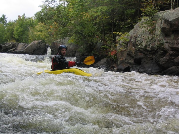
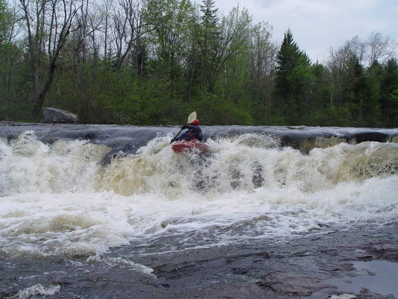
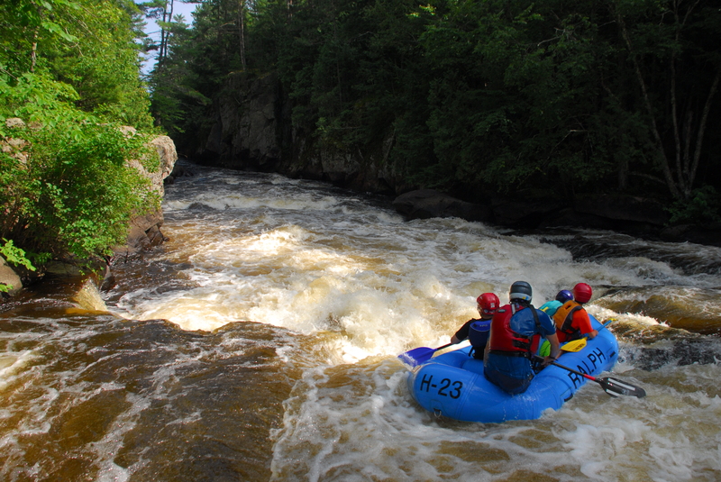
This shows the view after running the initial drop of the Lower Dells. Just after the little gorge many jump from the cliffs into the water on river left.
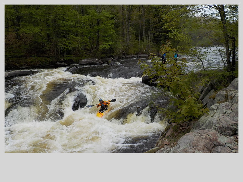
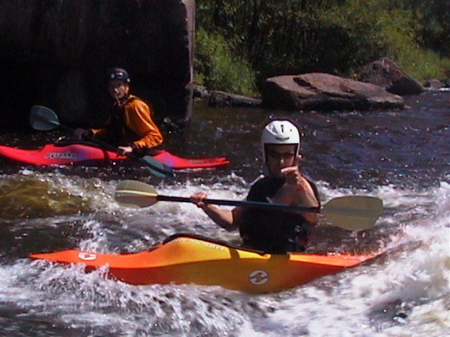
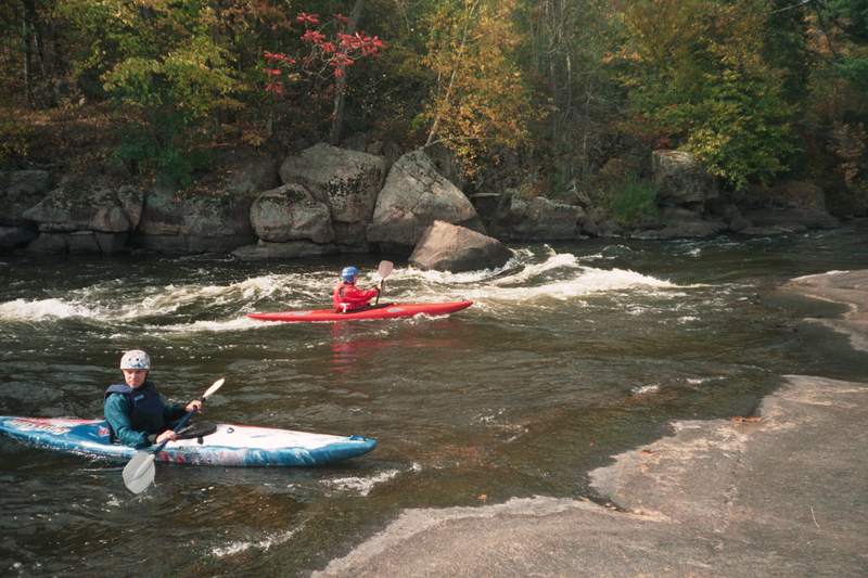
This hole at the base of Sullivan's is always a good place to practice flat spins.
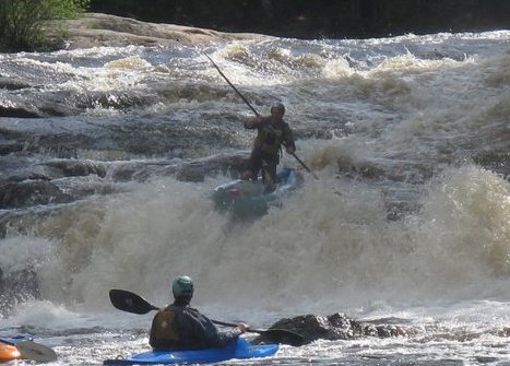
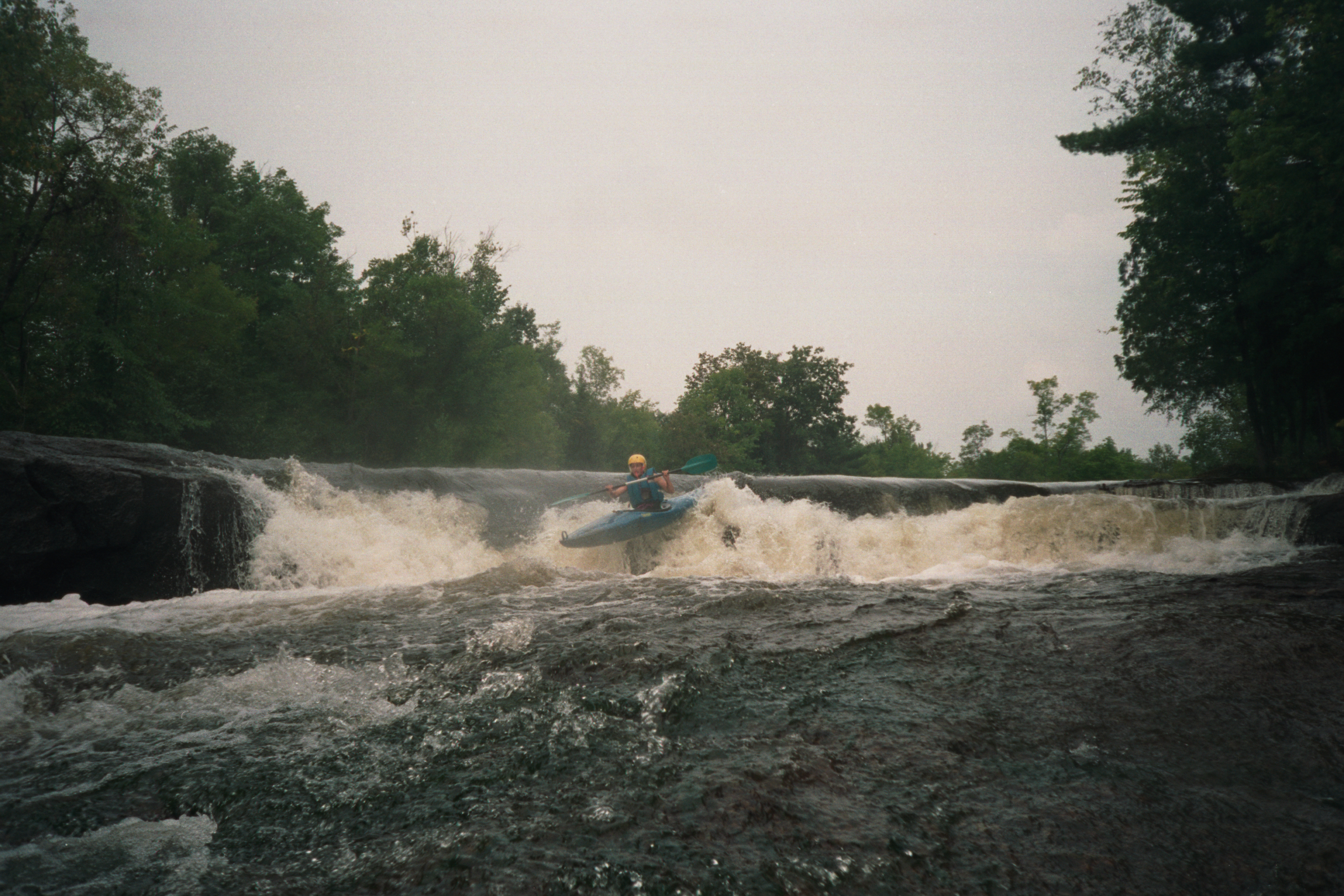
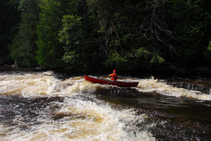
This is the last drop of the Upper Dells. Half way down on the river left is a classic ender spot. This is also a place where you can pull over in your kayak or raft and buy a beer in case you've already finished all the ones you brought.
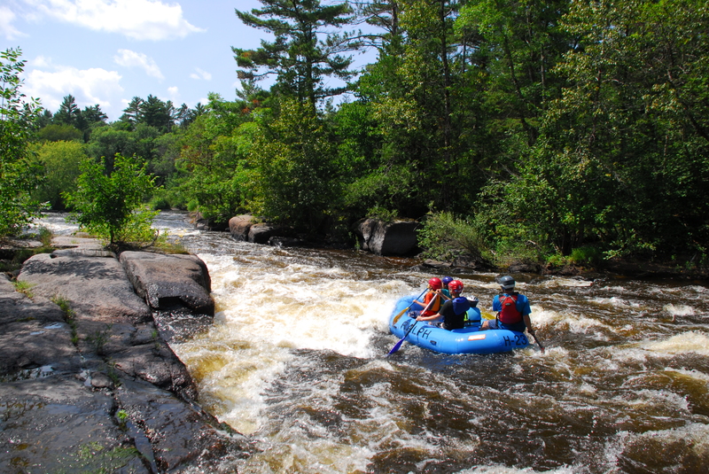
A river wide ledge, Sullivan's is generally best run river left of center. The play hole for flat spins is over on right right and can be attained from where the group is sitting.