Buckhannon
2. Tenmile to Sago
November 26, 2024
| Reporter | john wood |
| Gauge Reading | 10.5 ft at BUCKHANNON R AT BUCKHANNON, WV |
| Flow | Medium Runnable |
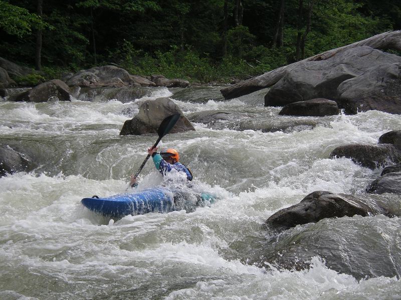
Ratings and rapid character:
This section will probably feel like class IV to paddlers new to creeking while experienced creekboaters will likely think the run should be rated III+. The major rapids are formed by large boulder piles blocking the river and have distinct horizon-lines and good pools above and below. Many rapids including some of the larger ones are formed where an island splits the river.
Flow:
I have only run this at 10.5, near the suggested cut-off of 11. At 10.5 things felt fluffy but there were plenty of eddies and still a lot of rocks hiding in the lines. I think running it above the cut-off would likely be fine, but I would say probably not on your first run. Use your judgment and scout.
Shuttle and parking
From the town of Sago drive upstream on route 30/7 Sago Rd. When the road leaves the river there is a large gravel lot. This seems like the best option for a takeout. The village of Sago does not have any public parking and the river is flat from Sago to the gravel lot so you are not missing anything by cutting off a mile from the run.
To get to Tenmile continue south on Sago rd. until you get to Big Bend Church (2.8 miles). At the Church stay left to take Big Bend Road. This is a small but well-maintained road. Any car should be able to use this route if it is not snow-covered. In 2.4 miles you will arrive in Tenmile.
Rapids in order:
Please Note- There is a lot of class II between some of the rapids listed. Also, I may have missed some rapids when I chose to go around one side of an island and not the other. I tried to align the rapid names with the photos on the AW page I have also named a few nameless rapids. I hope this description is helpful but I also hope people who know the river will add to it, and edit any mistakes.
Put in “Kamp Rippling Water,” Mile 0
In Tenmile, on river left, immediately upstream of the bridge, downstream of the church. This is a private vacation cabin. Previous trip reports say the owner allows access, but we did not speak to them on our visit. Be respectful.
Stairstep, class III, Mile 0.6
After some warm up class II you will see an obvious horizon line. The river is blocked by a pile of boulders and it splits into 2 channels. The left channel is a simple triple drop, the right channel leads to a large sieve. Scout on the left shore, the left channel sometimes holds wood and you can’t see the line from your boat.
Railroad, class III, Mile 1.2
A few nice small rapids follow before you get to Railroad, a long boulder garden with a ledge in the middle and a surf wave at the bottom just upstream of a railway bridge. At 10.5 feet this was the best wave on the river and had good eddy service. You will not be able to see the railroad bridge from the start of the rapid which is about ¼ mile long. At lower water, it will likely feel like 2 distinct rapids.
No name Boulder Garden, Class III, Mile 1.9
The next mile has plenty of fun class II-III boogie water. Nothing here warrants a scout, there is at least one class III boulder garden near the end that feels like a distinct rapid.
S turn, Class IV-, Mile 2
Another boulder pile rapid on the right side of an island, S turn will be obviously bigger than the rapids proceeding it, if no one in your group has run it you should probably scout. I believe the typical line is to enter on the left and S turn into the main flow at the bottom, at 10.5 feet we ran down the right side, a steep bouncy line that was probably harder than it needed to be.
The Wall, Class IV-, Mile 2.25
After a nice pool the river again splits around an island. The right channel has almost all the flow and holds The Wall rapid. Scout on the right. Enter in one of the slots river right and end on the extreme left next to a large boulder (the namesake wall). There is a pile of boulders in the bottom middle that looks like it has pin potential.
Cabin, Class II+, Mile 2.6
A read-and-run boulder garden. There is a cabin at the bottom on river left.
Pauls Ledge, Class III, Mile 3
You probably won’t know you're in this rapid until you realize you're about to drop off a river-wide ledge. It feels like much of the boogie water on the river but has a 3-foot drop into a hole at the bottom. At 10.5 the hole was fluffy, not a problem, just surprising.
Wash Board, Class III-, Mile 3.1
A rocky rapid run straight down the middle. Not much harder than the boogie water immediately upstream of it, but its horizon line marks it as a distinct rapid.
Broken Bridge, Mile 3.6
The rubble from an old bridge forms a small rapid. The drop is small and easy but use caution, there is a lot of rebar in the river here.
Lowhead Dam, Mile 4.1
The river splits around an island with the left side blocked by a small low-head dam. It's visible from upstream.
Take out, Mile 4.1
The upper take-out. River left.