Cacapon
2. US 50 at Capon Bridge to WV 127 (Bloomery) Bridge (Caudy's Castle Section [Classic Run])
| Difficulty | II |
| Length | 11.6 mi |
| Avg Gradient | 13 fpm |
| Gauge | Cacapon Rt 127 Calculated Gauge |
| Flow Rate as of 1 hour | 68 cfsbelow recommended |
| Reach Info Last Updated | May 24, 2026 |
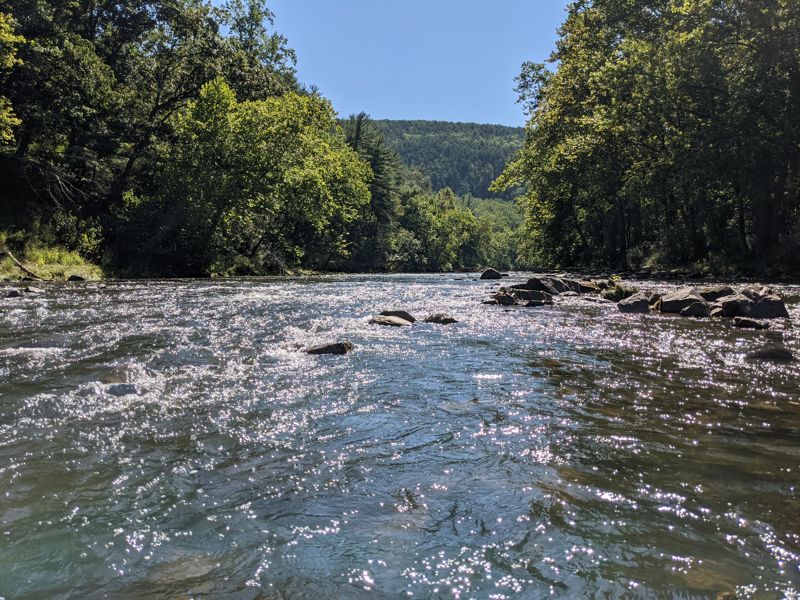
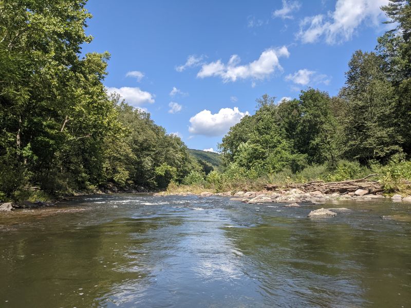
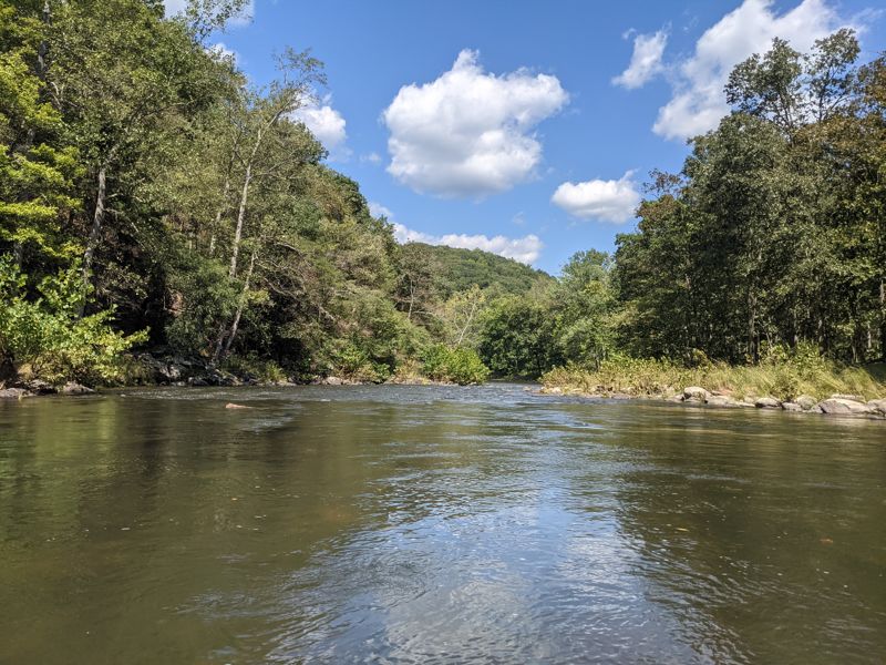
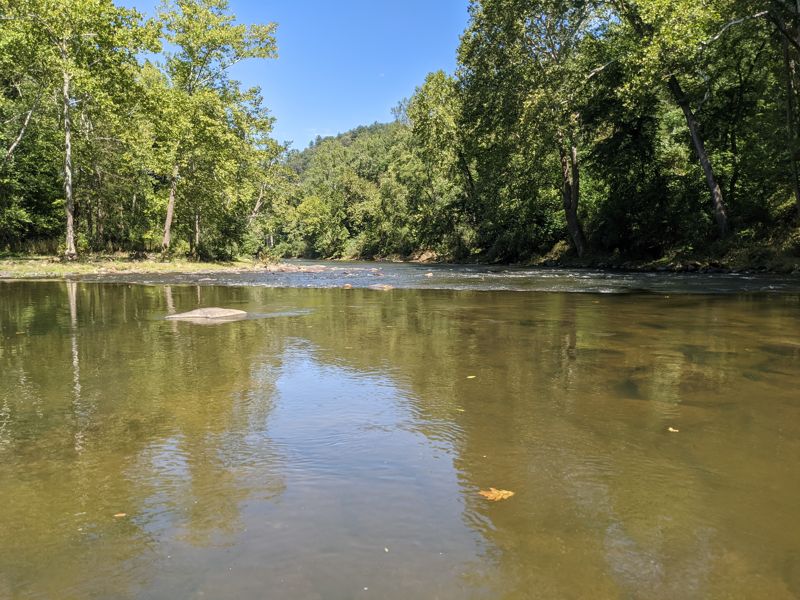
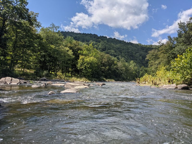
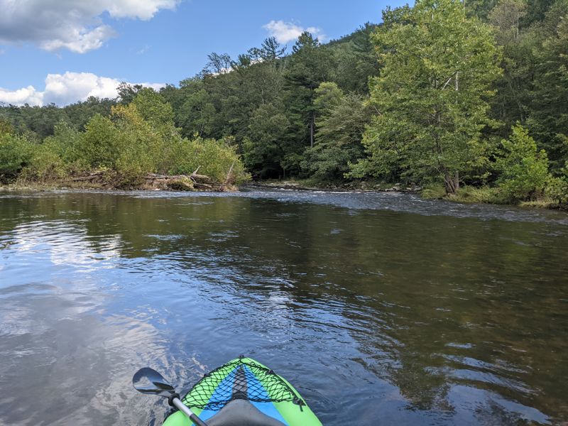
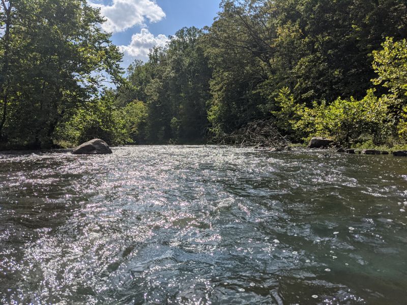
Summary: This is a beautiful run on the upper reaches of the Cacapon. The major rapids are riverwide ledges and fastwater in sharp bends. Usually up in the winter and spring, the Cacapon features unusual rock formations, especially Caudy's Castle, a sheer rock pinnacle that looms hundreds of feet over the river.
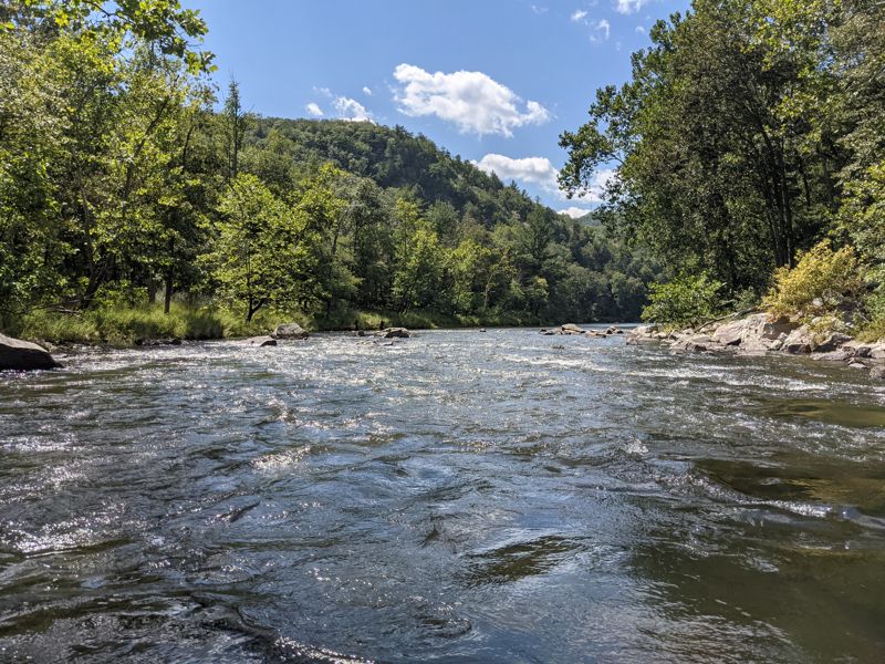
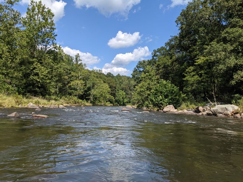
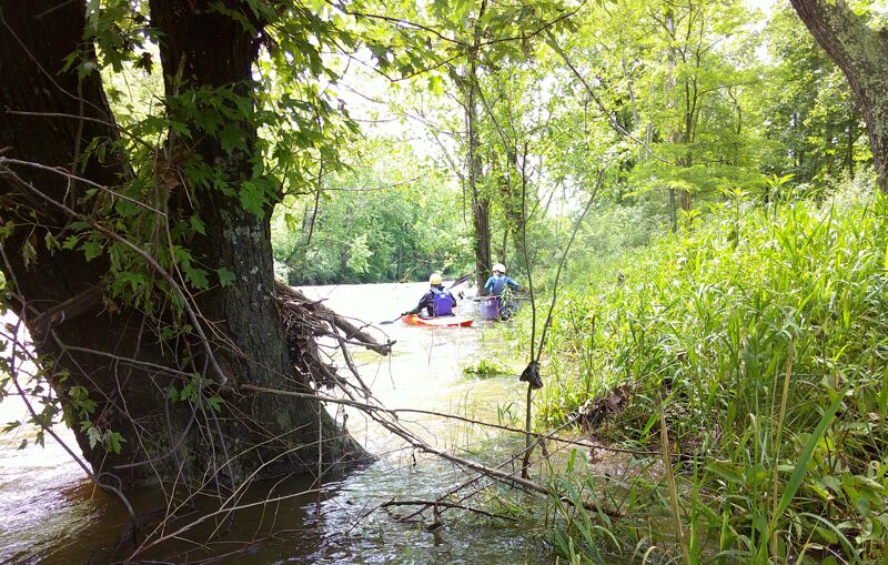
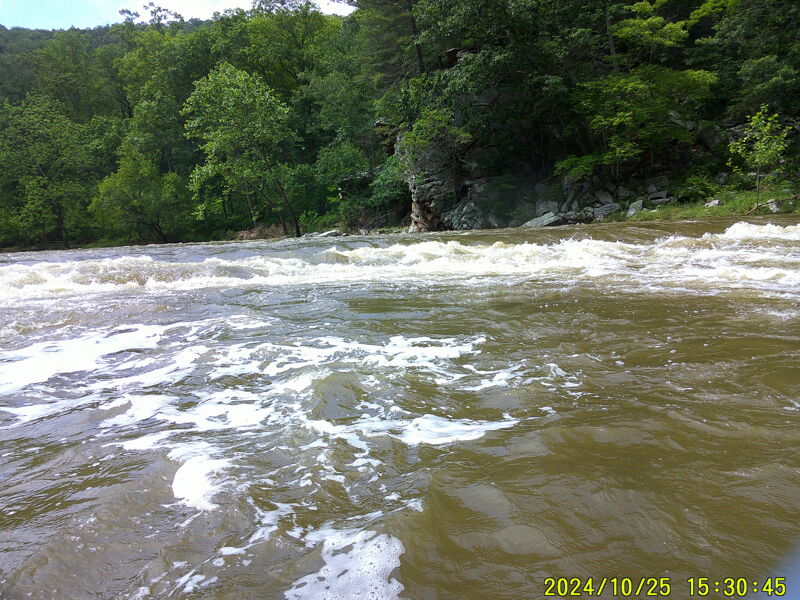
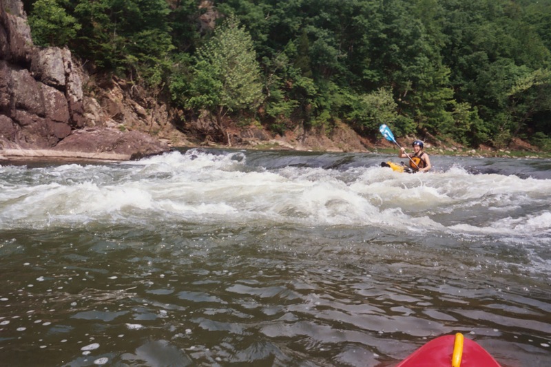
Rapids: There are three ledges, with the third perhaps warranting a Class II+/III- rating because it can be sticky. The first ledge can be snuck on the far right. The second has a clean line on the center left. The third is about a 4 ft. cascading drop, and is best run to the right. The remaining rapids are Class I-II rock gardens, gravel bars and fastwater in sharp bends.
Access:
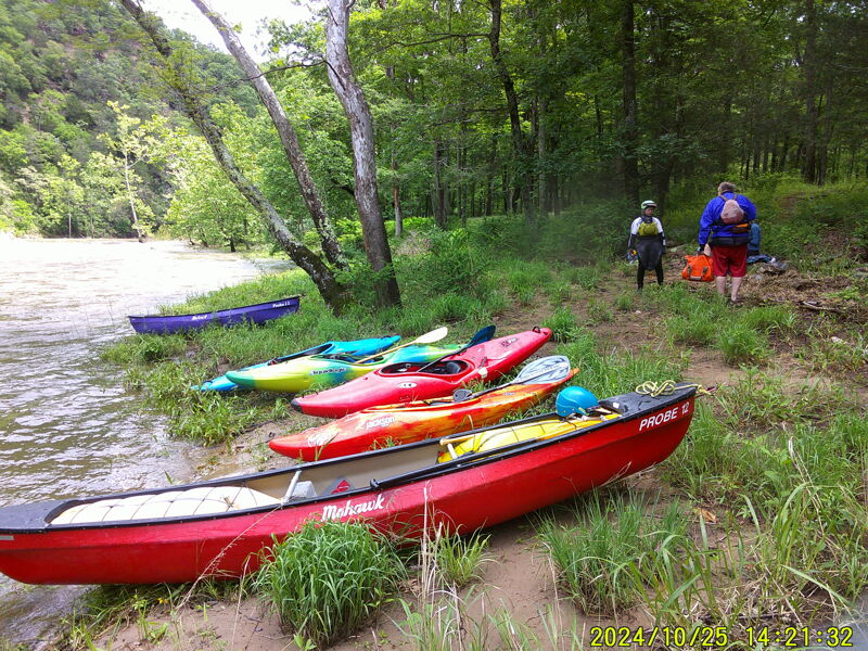
Capon Bridge put-in: The town of Capon Bridge just put in a public river access and parking lot right next to the water on Rt. 50. This put in adds about 4 miles of flat and Class I-II water meandering near private river properties. It's a nice stretch, but the best of this run (by far) is the stretch from Edwards Run onward.
Edwards Run put-in: For most paddlers, the Edwards Run/Cold Spring, WV put-in is the preferred put-in for the popular section of river down to the Rt. 127 take-out (Edwards Run to WV 127 is roughly seven and a half miles). It is located about four miles downstream (north) of Capon Bridge and avoids a section of mostly flatwater. The launch lies 0.6 miles upstream of the Edwards Run W.M.A. on the property of Mr. Sine, who owns the land on both sides of the road in this location. To get to the Edwards Run/Cold Spring put-in from the WV 127 take-out, take WV 127 west for 1.4 miles. WV 29 comes in from the right and the road becomes WV 29, but you continue straight. Stay on WV 29 for 4.9 additional miles (at total of 6.4), at the town of Slainsville, turn left onto Cold Stream Lane, go 8.7 miles until the road parallels the Cacapon (you cross the North River on the way -- don't confuse t
...
There used to be a $5 fee per boat for put-in and parking, but the building that was here burned in 2021 and the town converted the property into a public river access.
Small shoal just downstream of the confluence with Edwards Run.
Across the street from a house that burned down. There is a $5.00 per car fee for parking. Using this put-in shortens the run from 11.5 miles to a little over 7 miles with the loss of only some flatwater and shoals.
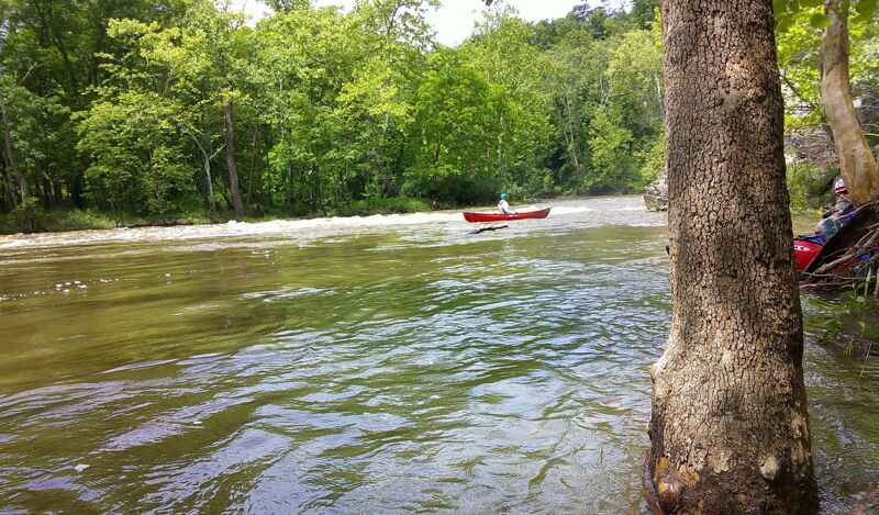
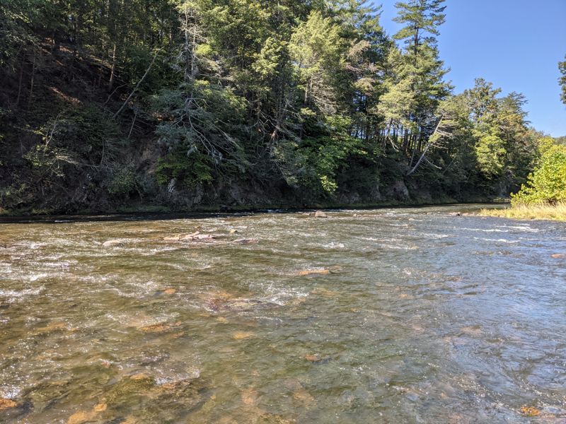
The first ledge ('Darby's Nose') can be run on the far right, where there is an easy runout. The rest of the ledge, particularly up against the rock wall on the far left, creates a hole that can be retentive at certain water levels. Despite this, the ledge can usually, without event, be punched on a center left line, as long as the paddler is lined up straight, takes the drop aggressively and stays away from the far left rock wall.
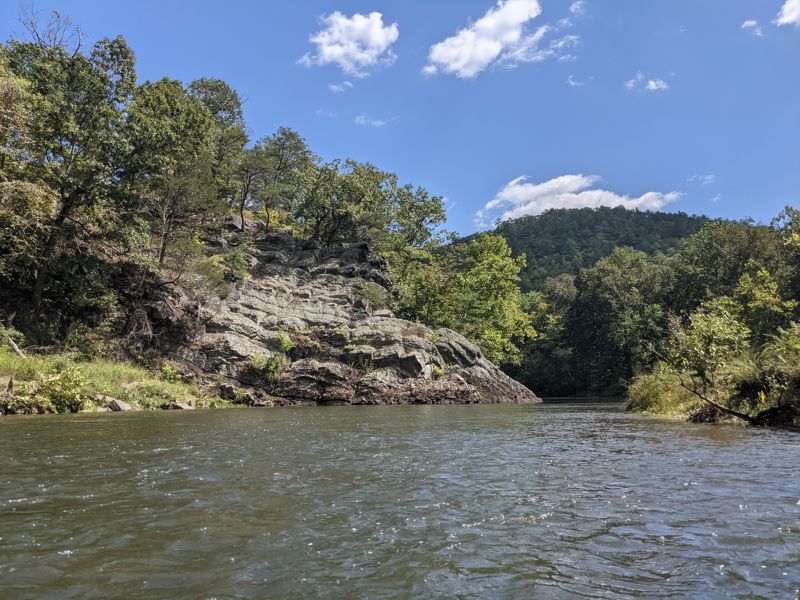
Large, sheer rock that turns the river to the right. There is a anticline fold on the reverse side of this rock that forms a small 'A' or chapel formation.
Favorite Lunch Stop of Dick Gramm - River Left. Dick Gramm lead this trip for many consecutive years through the 1990's.
Some larger rocks here warrant a Class II rating, especially when the water is high. Usually cleanest on the right.
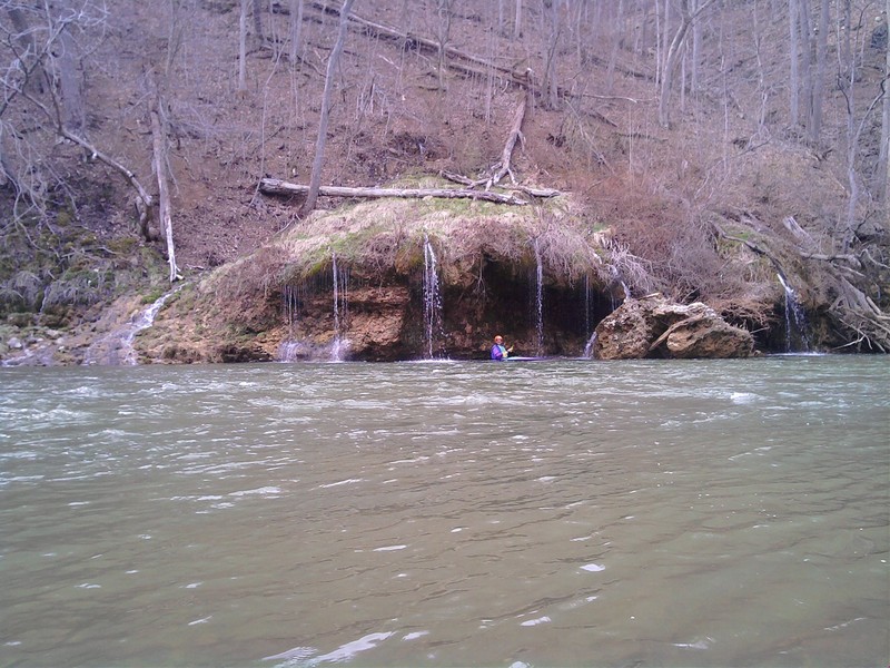
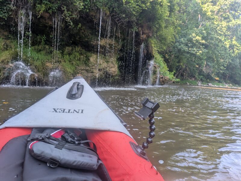
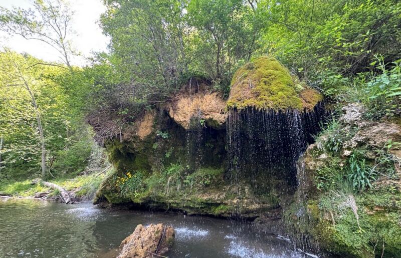
Trickling Springs emerges from a limestone formation resulting in a travertine overhang (known as Mushroom Rock) that releases underground water through a series of tiny waterfalls. AKA 'Fairy Falls'
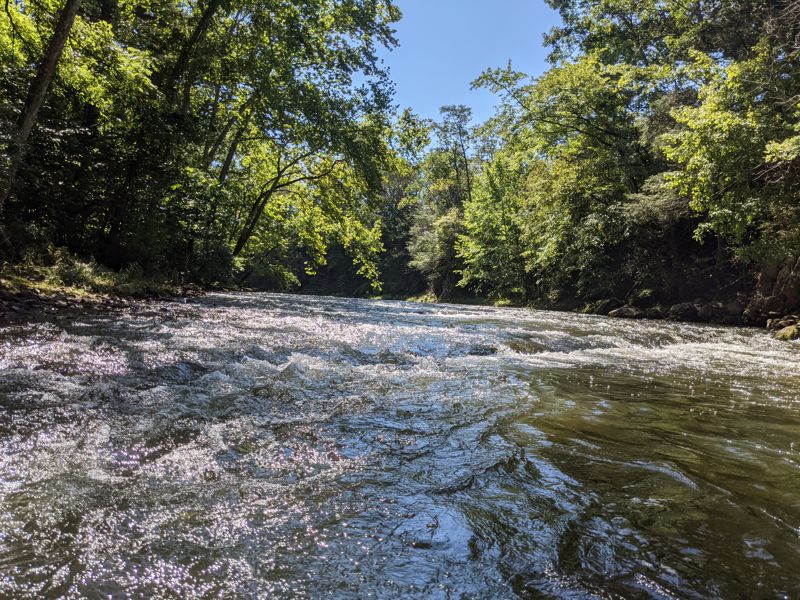
Second ledge ('Chapel Rock') has a clean line on the center left. Once again, line the boat downstream and paddle aggressively over the ledge. Eddy below.
The Third Ledge is usually cleanest in the center right. At usual water levels there is also a left to right slide that can avoid a stern thumping and that can set up a nice surf. It warrents a Class III- rating because it can be sticky.
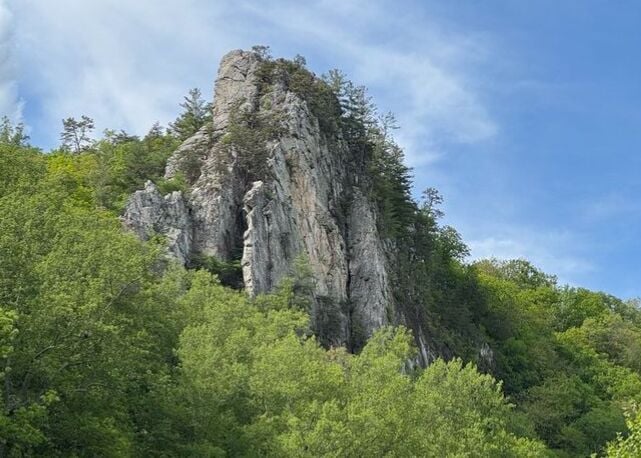
Caudy's Castle is a visible rock outcropping on river left about a quarter mile below the third ledge.
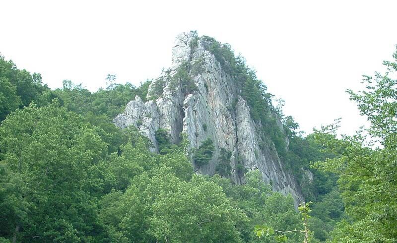
Caudy's Castle Rock is a sandstone tower that stands 1,070 feet (326 m) above sea level and towers over the river.
The rock formation is named after James Caudy, an early Hampshire County pioneer and settler who fought off an attack by fifteen Native Americans from the rock during the French and Indian War. The pillar lies on the southern end of Castle Mountain.
A very steep path leads up to the rock from the river -- however, the rock lies on private property, so please secure permission from the owners before visiting and treat the area gently.
Class II rapid. River splits into two channels. There is wood and pinning possibilities in the river right channel, so stay in the left channel.
Last shoal before a 3/4 mile stretch of flat water leading up to the take-out at the bridge.
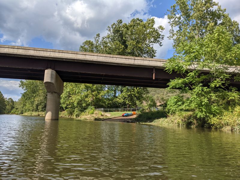
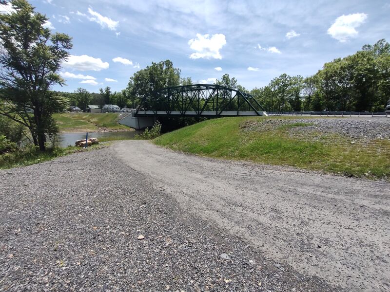
Just downstream of the bridge on the right (east) side of the river, there is a small parking lot with a boat ramp.
Jul 4, 2025
Ran it on the afternoon of the Fourth of July 2025. The gauge at Great Cacapon was at 3.0 feet and falling. The water was runnable, but a little low for my taste -- scraped the bottom a number of times, and the rapids were less fun. Still very runnable, beautiful, and fun though! Total trip lasted 4 hours, from the bridge in Capon Bridge to the bridge at Route 127.
May 29, 2025
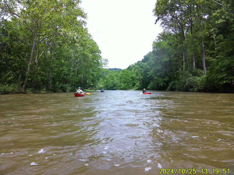
We ran the Cacapon on 5/29/2025. Great Cacapon gauge well downstream was 3,800 cfs or 6.62'. Estimated cfs for this upstream reach was 1,600 - 1,800 cfs
Aug 13, 2024
We ran this on 8/11/2024, two days after Hurricane Debby released a bunch of rain and the flood was subsiding. The water gauge at Great Cacapon was 3.6 and falling. Was a great, pleasant run. Water wasn't moving too fast, and the whole trip took 3.5 hours.
Saw lots of green herons, a few kingfishers, an osprey, and loads of turtles.
Darby's Nose Rapids at this water level: Drone footage
River gauge: https://www.weather.gov/erh/mmefs\_marfc?id=GCPW2&model=NAEFS