Cacapon
2. US 50 at Capon Bridge to WV 127 (Bloomery) Bridge (Caudy's Castle Section [Classic Run])
Jul 4, 2025
Ran it on the afternoon of the Fourth of July 2025. The gauge at Great Cacapon was at 3.0 feet and falling. The water was runnable, but a little low for my taste -- scraped the bottom a number of times, and the rapids were less fun. Still very runnable, beautiful, and fun though! Total trip lasted 4 hours, from the bridge in Capon Bridge to the bridge at Route 127.
May 29, 2025
We ran the Cacapon on 5/29/2025. Great Cacapon gauge well downstream was 3,800 cfs or 6.62'. Estimated cfs for this upstream reach was 1,600 - 1,800 cfs
May 8, 2025
Had an amazing trip on this stretch of the Cacapon (Great Cacapon gauge at 2.2 ft.). It was low, but I did minimal scraping. Anything lower than two feet, expect to get out of your boat and drag. The town of Capon Bridge demolished the old building that caught on fire and turned it into a gravel lot for public boat access! Really great move, and a really cute town. There are only three major rapids which were all super manageable at this level in my open face canoe (no float bags). The third is the largest with about a 4 ft cascading drop. Keep right and you'll be fine; I didn't even take on water! The scenery, the quiet, and the wildlife are all unbeatable. This is a true hidden gem and someplace I'll go again and again.
Aug 13, 2024
We ran this on 8/11/2024, two days after Hurricane Debby released a bunch of rain and the flood was subsiding. The water gauge at Great Cacapon was 3.6 and falling. Was a great, pleasant run. Water wasn't moving too fast, and the whole trip took 3.5 hours.
Saw lots of green herons, a few kingfishers, an osprey, and loads of turtles.
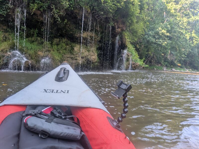
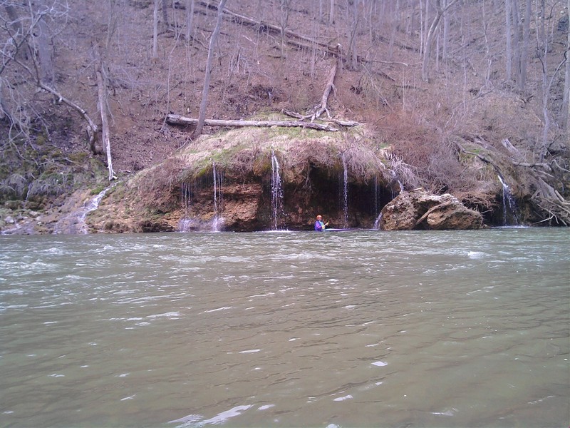
Darby's Nose Rapids at this water level: Drone footage
River gauge: https://www.weather.gov/erh/mmefs\_marfc?id=GCPW2&model=NAEFS
May 27, 2022
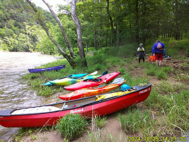
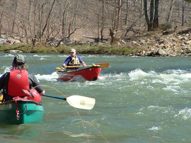
Ran this stretch on 5-20-22. The business at the usual put in at Rt.50 is indeed burned out, and the stairs and ramp are no longer maintained. A local gentleman took our picture for the community Facebook page, and directed us to the town parking lot a few blocks away to park our car for the weekend. The local police were gracious, and had no issue with us leaving our vehicle for the weekend. A new public access site with parking is being built by the state to the South and is supposed to open soon.. The river was at 3.3' and the drops and rock gardens were a breeze compared to when I had last run it at 2.5'. We stretched the trip to 2 nights for the sake of camping and hiking up Caudy's Castle, but it could easily be done in one day or a single night at 3'. Only 1 other group on the river that we saw, but there must have been more behind us because the lot at the take out was packed when we arrived Sunday morning. LOTS of wildlife, along with the feeling of being in the middle of nowhere for most of the trip. This is by far my favorite 'camping float'.
May 27, 2022
Mar 13, 2022
Ran it on 9/3/21, when the water gauge at Great Cacapon was at 3.9 feet and falling. Nice easy run.
Ran it again on 9/6/21 when the water gauge was at 2.1 feet and falling. Kept scraping the bottom.
May 12, 2016
Ran this stretch at 5-5.5 (river was rising while we were on it) back on 05/07/2016. Perfect level to run it. It makes the 4 miles of flatwater downstream from Capon Bridge a breeze and the ledges a lot of fun. Depending on how you run the ledges at this level, you can easily swamp an open boat (rec kayak or canoe) so I'd recommend a spray skirt/deck or bow and stern bags for the adventurous. Otherwise, some quick scouting can help you skirt the biggest holes and waves.
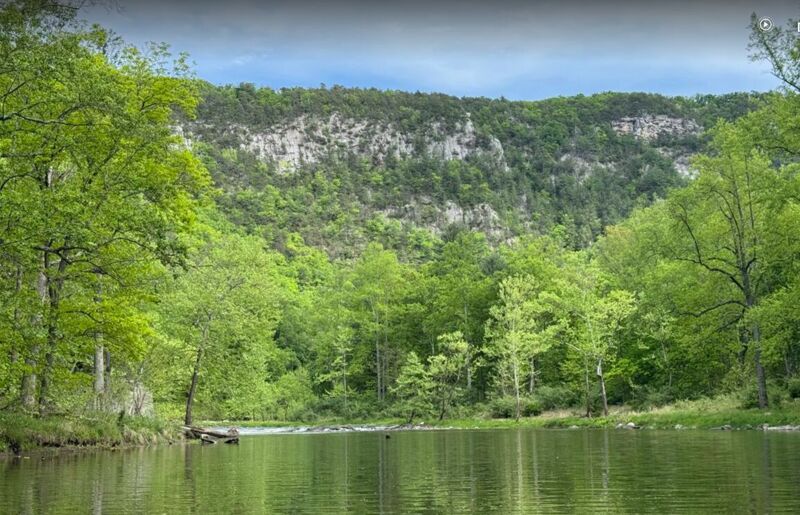
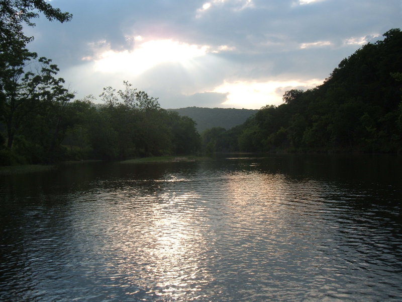
The descriptions of the beauty of this section don't do it justice. It's the most breathtaking trip I've had in WV and even beats out the famous 'Trough' of the S. Branch Potomac for just how beautiful it can be. It's not as secluded, so there is intrusion from vacation homes and cabins from time to time, but the mountains and rock formations more than make up for this.
No wood or other obstacles to report. Clean, fun, and beautiful run.
Apr 28, 2016
Has anyone run this stretch recently? I tried calling the store that has taken the place of the Red Rooster and the listed number is disconnected. WV DNR lists the Coldstream access, but it's an old site from 2003, so I don't know if that is correct anymore either. Looking to find out what a good put-in solution is for this run.
Jun 14, 2013
I run this whenever its up. except i put in on sandy hollow rd, its a bit back there...but cuts out the 4 miles of flat before the canyon. This a beautiful section and fun if its running. don't try it if its low, unless you have alot of patience and a beater boat, and sturdy shoes...and headlamps. Some locals and weekend cabiners fish it in canoes, but you gotta hate your boat to bring it here when its low.. start this run early and take your time admiring the geology and wildlife.
Apr 23, 2013
on April 14th 2013 my boyfriend , his 11 year old son and I dropped our kayaks in at Capon Bridge. we were kayaking to route 127 bridge. The water gauge was at 5.25
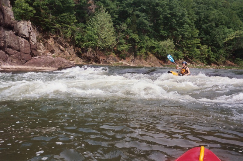
peak at this time, because of the rain the day before. I was nervous since the 11 yr. old only kayaked in a small lake, yet he picked up the paddling technique real quick. The river was moving fast, and it was muddy. I enjoyed the whitewater rapids, churning and twisting every which way. when we came to the first ledge, the current pushed my kayak to the rightside in the middle. I tipped over headfirst, and boy was my body in for a cold shock. I tumbled around and then popped up, holding my kayak and paddle with my right hand. swimming sidestroke with my left arm. All i could think about was hypothermia and getting to land. the current was strong, as my friend was screaming for me to get to land. I finally grabbed some tree roots and held on in one place, until I had enough strength to pull my body on land. All the kayaks had water in them. the 11 year old tried to save me too. I had clothes in a dry sack and immediately changed. We rested for an hour eating our lunch. Two more ledges down river to go over. Once my breathing became normal, and I felt like kayaking again, it was back on the river. The rapids were high and fun to go through. We had another snag, when the 11 year old got his kayak caught sideways against a down tree. It must have taken his Dad 40 minutes to get his son and the kayak out of that pocket. The current was pushing the kayak under the tree. The Dad threw a rope to his son and pulled him out.
Once we were all together, we continued down river. going over the next two ledges were easy. The views of the caves, cliffs, caudy's castle, mushroom springs were just beautiful. More rapids to come and boy they were like a washing machine. The final stretch before the boat ramp, somehow I tipped over, and this time in two feet of water. I could feel the rock bottom and standup. I am five feet nine inches tall. I laughed at myself. Once at the boat ramp the slanesville volunteer fire company was getting water from the river. the hoses were blocking our exist. Those young boys saw us and they probably wondered what happened to me! I was a wet puppy! needless to say with everything that happened I had a great time, and was proud of the 11 year old making that whole river. it was a slap me five, ya we did it! I've had seven surgeries for breast cancer, and doing 12.6 miles of the river in high water was such a rush and challenge, I'd do it again!
Jul 12, 2011
For more recent information on put-in option, see
http://www.monocacycanoe.org/pan/cacapon-edrun.htm
Apr 4, 2010
Nice series of tiny waterfalls next to Jim Armbruster
Mar 18, 2010
Bridge at 127 is definitely back open now, as of about a month ago.
Jan 30, 2006
LOL, I know what you mean. MY first experience with that section of the river was quite thrilling. It was early April and the river running pretty good. My son and I decided we would try out our new fiberglass canoe. At the end of our trip all we could say was WOW!! The end results was seven holes in the canoe and several good, cold soakings.
Aug 1, 2005
According to the Paddler's Access Network, a Washington region organization working to resolve regional river access issues, the putin situation at the Cacapon has changed do to a change in ownership at the property boaters have been using to putin. Access info, current to Aug. 1, 2005, is copied below. Please check this link for any changes:
http://www.monocacycanoe.org/pan/cacapon-caponbridge\_july05.htm
'Access to the Cacapon River, from US 50 in Capon Bridge. This adds about 4 miles of flatwater to the traditional Cacapon whitewater run.
The former arrangements with Mr. Wolford, owner of the Red Rooster store, are obsolete. Mr. Wolford has sold the store.
The store is now Flower Creations and Gifts. The new owners allow put-in and take-out on the property, at $5 per boat. The store is located at the end of the west-bound side of the US 50 bridge at Capon Bridge, or downstream river left.
We THINK parking privileges are included, at the prior location. Immediately at the west end of the bridge and BEFORE the store, turn downstream / north onto a gravel driveway. The put-in is about 25 yards downstream, at a grassy slope. Park vehicles on the river side of the driveway, NOT alongside the store.
No advance notice is required, and you can launch / land after hours. Your payment goes into a self-service box that
Jul 19, 2005
Enjoying a hot summer day on the river with friends.
Having a little fun on a hot July day.
Apr 16, 2005
Dick Gramm leads a huge group from MCC on the Cacapon, as only he could do.
Aug 23, 2004
Thank You for the info John. I was unaware of the construction that was going on in the Lost River. I haven
Aug 20, 2004
Harold, another comment from a Cacapon Lover.
He has seen an extreme amount of mud this year on the river..
Do you know of anything other than the lost river construction goin on that could be the problem ?
Aug 1, 2004
Thank You for the info John. I gave the river a try yesterday and the Moorefield gauge was reading 1.9, witch is low. I started at Yellow Springs and attempted to go to Capon Bridge at rout 50. Let me just say, I did more walking the paddling. After a few hour walk, it started to storm. About half way, I and a few others decided to call it quits. I must say though, all and all I still had a great day on the river.
Jul 26, 2004
Harold, the gauge reading at moorefield is not accurate at this time,due to construction.
the gauge is showing the river running when it is WAY to low
May 24, 2004
I remember running this stretch in the fall of 1971, on a CCA trip. There must have been >100 boats on the river, on a rainy warm fall day, with the sodden smell of decaying leaves and a river running full and turbid. I have never forgotten that trip--the last time I paddled with my father before he died--and though I live far far away now, I hope someday to run it again--perhaps with my son.
May 5, 2004
The end of a perfect day on the river.
Apr 30, 2004
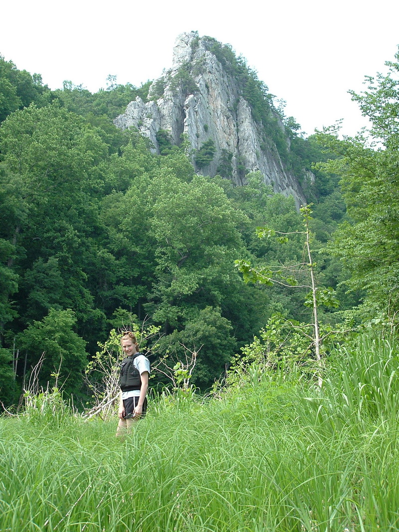
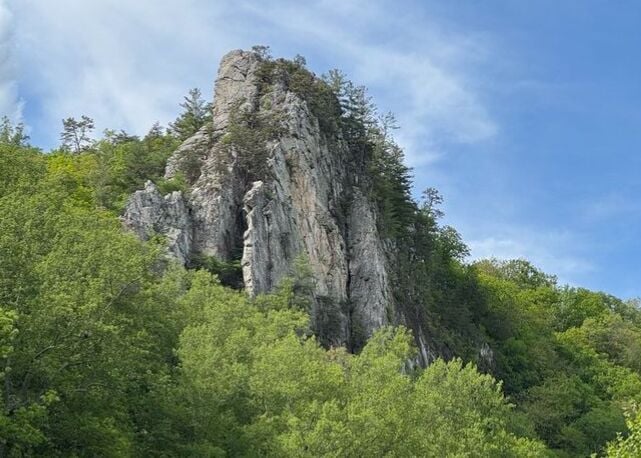
Caudy's Castle in May. It looks somewhat more stunning with the leaves off the trees and more geology exposed. You can hike to the top from a trailhead upstream on river left.
Sep 27, 2003
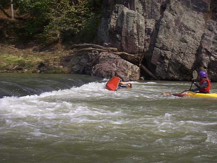
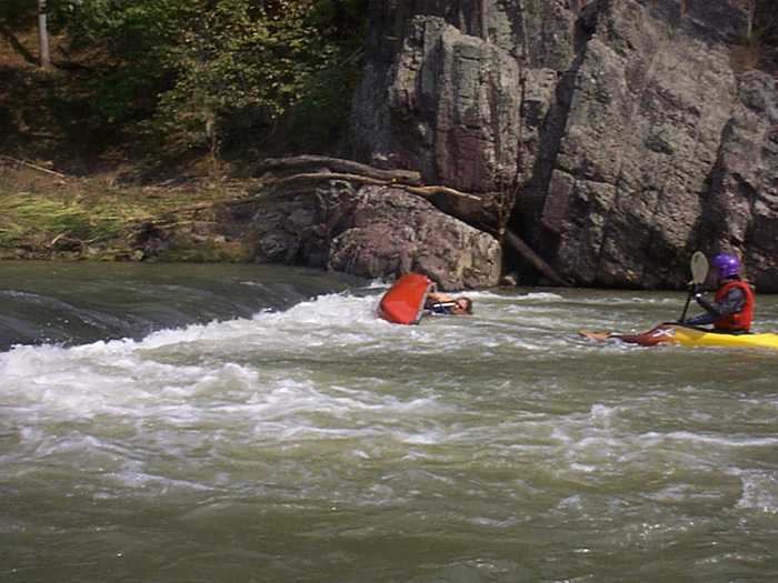
Steve's getin ready to roll that OC-1?
Sep 27, 2003
Steve's gettin' ready to roll that OC-1?
Apr 20, 2002
This is a great level
0.7 on the rt. 127 bridge