Potomac, S.Fk. of the S.Br.
4. Fort Seybert (CR 3 bridge) to Milam (CR 7/3 bridge)(Moorefield Canyon)
| Difficulty | II-IV |
| Length | 12 mi |
| Avg Gradient | 20 fpm |
| Gauge | S F South Branch Potomac River at Brandywine, Wv |
| Flow Rate as of 1 hour | 1.59 ftbelow recommended |
| Reach Info Last Updated | January 26, 2024 |
Lat/longitude coords are approximate, from TopoZone.
Put-in - Fort Seybert (CR 3 bridge)
Take out - Milam (CR 7/3 bridge)
Sep 24, 2018
Paddled this section of the Potomac 9/22/2018 at about 2.2'. This is a hidden gem. Flat water to start out and the finish but the middle section is quite busy and merits a bit of respect and attention. We had to pick our lines carefully through some of the boulder gardens to avoid strainers and/or downed trees. Quite fun and It is definitely worthy of the II-IV rating.
May 4, 2014
Run on 4 May 2014 @ 200cfs (Brandywine). A couple more inches would have been good, but still a nice run.
There is a log entirely across at chest height in the first significant rapid, above the Corner Rd bridge. Near the end of the gorge a log blocks the frequently-run center slot. There is a lot of dead wood washed up on boulders without entirely blocking channels. New timber cutting has taken place on both left and right banks, with lot of slash left laying, in the vicinity of the Corner Rd bridge, so wood in the river is likely to be a problem for some time. Tom McCloud
May 25, 2011
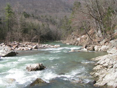
Ran this section on 5/21/11 at around 475 cfs. Really nice level and somewhat surprisingly plenty of water even in the larger rapids. Put in off a county road (turn left if coming from Brandywine direction) about 2 miles downstream from bridge on river right (parked off sideof road in grassy area just upstream from island in river, house on hill across road). First couple miles were easy class 1-2 rock gardens and small ledges. River then calmed down some for a few miles but scenery was always good to excellent and good current. Saw some bald eagles and maybe an otter or two. Scenery and rapids then began to pick up as we entered the canyon section with good drop-pool rapids with lots of boulders and some nice ledges all mixed in. We scouted TS#1 mostly for wood but scouting also let us pick the best slot which was left of river center and then cut left around a large boulder just below. Class 3 for sure but no where near class 4, at least at this level. TS #2 was next with the entry around a right bend in the river. Had to quickly pick a slot between boulders and then down thru lots of action around a left hand turn. Great fun and another solid class 3. Lots of good class 2 rapids in the canyon with maybe 1 or 2 others approaching low class 3. A really great run. Took a little over 2 hours with little play but not pushing hard at all. We took out at low water bridge which was on the right side of the road (river left) about a mile past the bridge at Milam. Much better takeout. Just be courteous as the parking area is private land and ask somewhere if OK if you see anyone. Might be good idea not to try and run the low water bridge if enough water going over it.
May 21, 2011
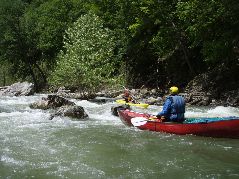
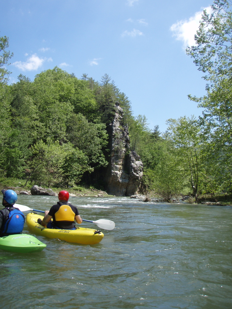
Another shot of a paddler coming down TS #1.
May 21, 2011
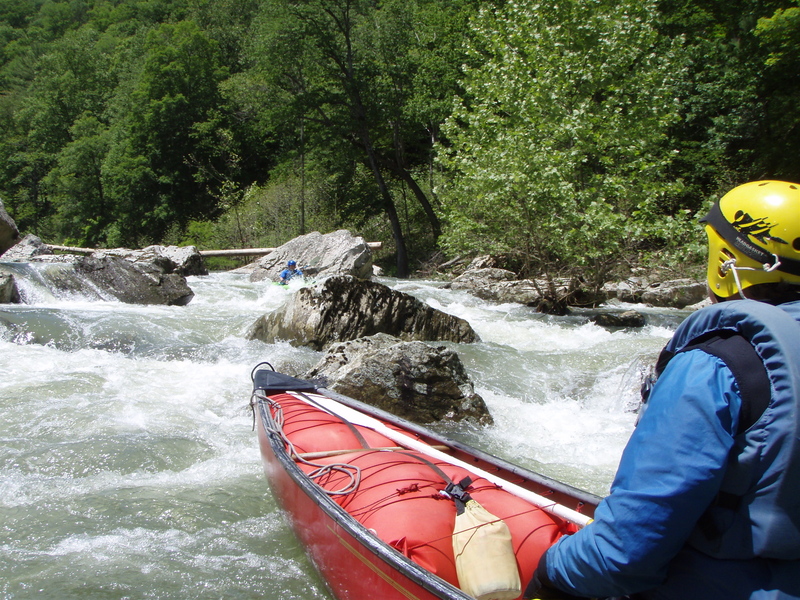
Steve running the lower portion of TS #1. Looking good on his Torrent.
May 21, 2011
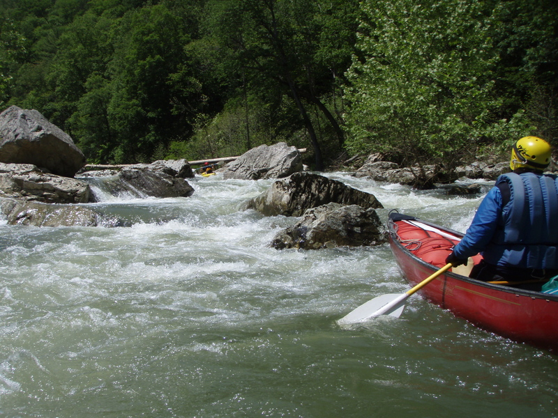
Tight Squeeze #1 on the South Fork of South Branch of Potomac. Had to limbo under log to hit the good narrow slot at the top.
May 21, 2011
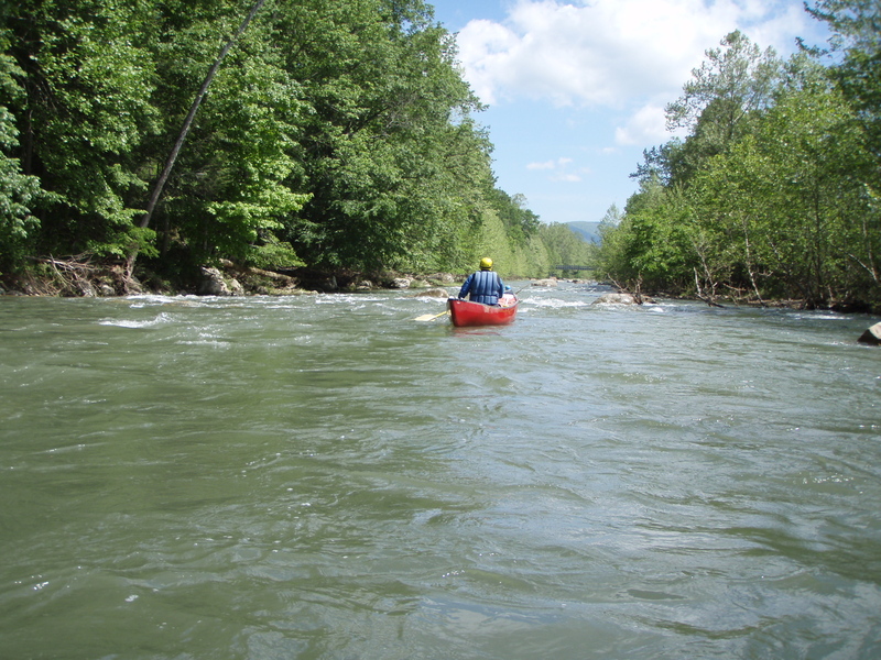
Within first mile or two from put-in. Put in a couple of miles downstream from bridge at Ft. Seybert. Typical rapids in this stretch.
May 21, 2011
More beautiful scenery on the South Fork.
Apr 15, 2009
I have run this at several levels,and think the class 4 rating is and should be a class 3 rating
Jul 21, 2006
Four of us ran this in July 2006, at 600 cfs (1 foot on the Milam bridge). This was a delightful level -- not pushy but with plenty of water and alternative routes through the main rapids. There are three particularly interesting rapids, all in the final 2 miles. Tight Squeeze #1, which is class III and requires scouting to find the cleanest route through the boulders, and then precise maneuvering. TS #2, a class III+ a few rapids later, where we all scouted from the right bank. At this level, there were 3 reasonable routes -- (a) the direct shot on the left, but cross currents make the entry tricky; (b) a narrow right to left chute, and (c) taking the first drop on the far right and then ferrying across to the left for the second drop -- which I chose as being the safest alternative. Finally, the rapid right below TS #2 is class II on the right, but a much more fun class III on the left, where you run between the boulders -- sort of a TS #3.
This is a great trip for wildlife. We saw two bald eagles and four deer along the river, a flock of turkeys and a red fox on the shuttle.