Piney Creek
Beckley to the New River at McCreery
May 15, 2016
Slide with undercut on left.
May 15, 2016
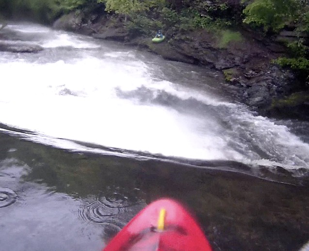
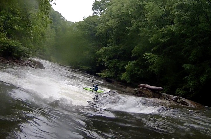
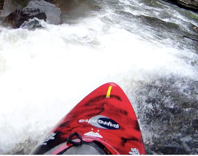
1st major rapid, nice book on the right, well padded at 2.9
May 15, 2016
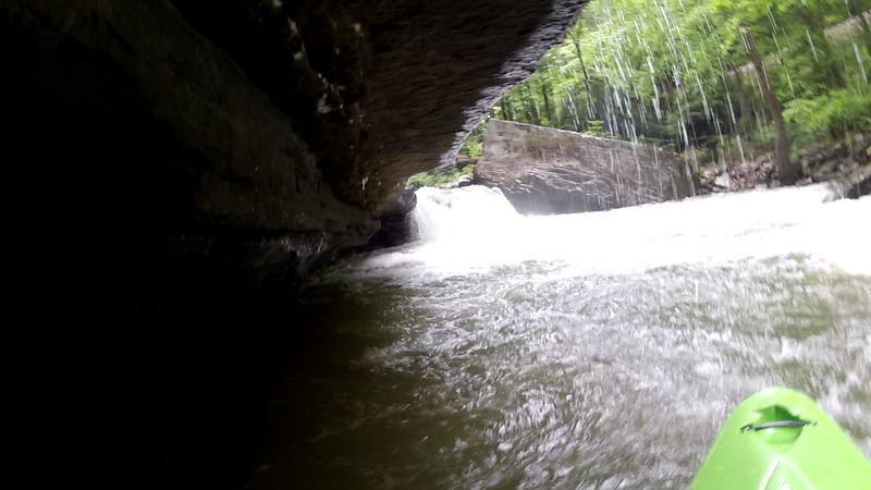
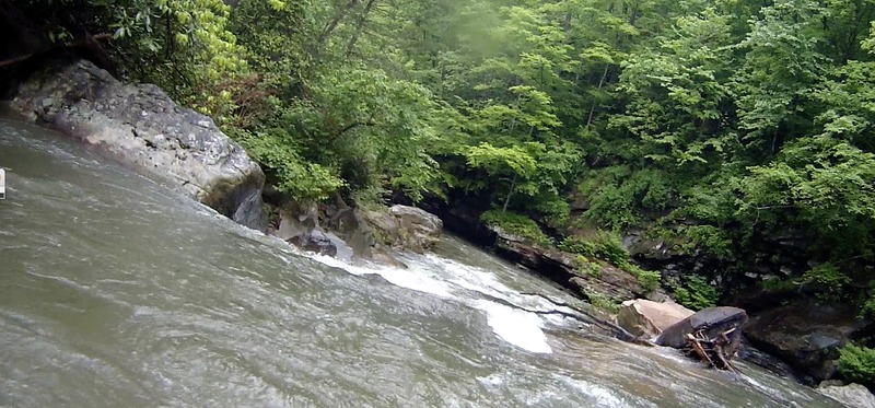
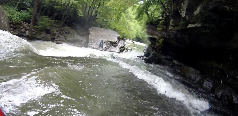
There is a cool overhanging ledge on the river right side after the big ledge. Be careful because water pushes into it.
May 15, 2016
The Piney drops for 12 miles, and has a mile that is in the class 4 range
May 15, 2016
Typical of rapids in the steep section, there are hazards throughout the run
May 15, 2016
Can run this left or right, if left, have right angle to avoid undercut shelf
May 15, 2016
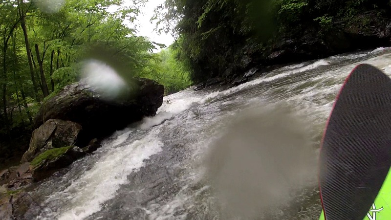
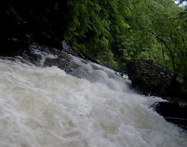
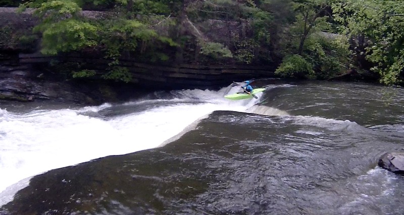
This is part of the mile that is steepest, this 8 footer immediately feeds into the largest falls on the run
May 15, 2016
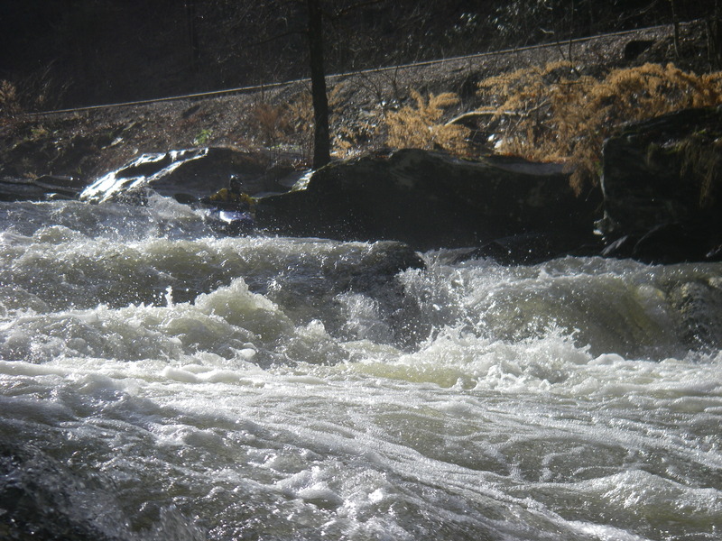
Lots of ledges, quite a few blind, anywhere from 2 to 9 feet high
May 15, 2016
Carson looks on as Mike probes the right side of the drop
May 15, 2016
Ran the notch and went deep
May 15, 2016
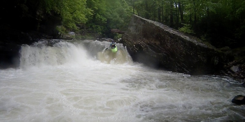
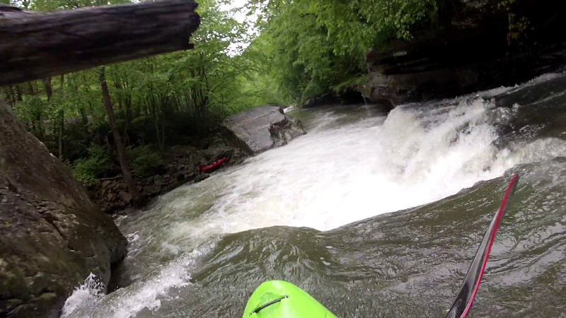
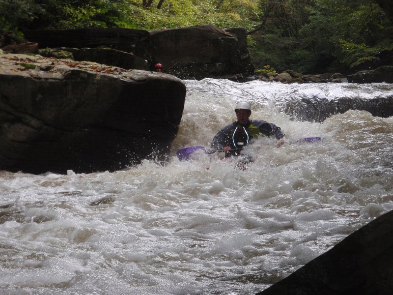
Mike dropping the river right side of the big ledge. You can see the ominous cave on the river left side of the drop.
May 15, 2016
Left side of the big ledge. Duck the log and angle straight/right. There is an ominous cave underneath the huge boulder to the left of this drop.
May 15, 2016
Ran Piney on May 14, 2016, 166 cfs, or 2.9 on the gauge. Plenty of water at this level, as is evidenced by the photos on this site. I think this creek has been unfairly maligned, there was no odor , the water was relatively clear, and there was no discharge apparent from the sanitation plant. Hardly any slack water on the entire run, we did it in under 3 hours, stopping to look at the big ledge, and the old mill ledge. While there is an approximately 1 mile pretty steep section, the whole run requires paying attention, and starts to feel a little fatiguing towards the end. Easy shuttle, remote canyon and great rapids, I'd recommend strong boaters put this ' hidden' gem on their list
May 15, 2016
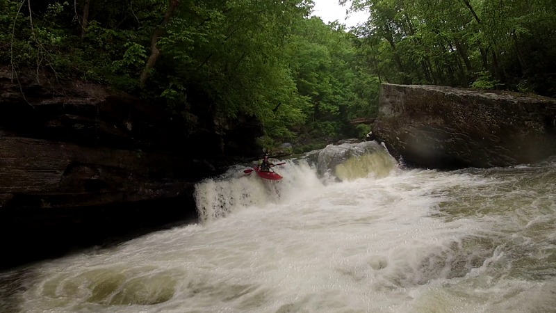
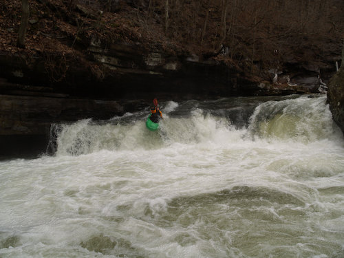
Right side run of the falls
May 15, 2016
Ran Piney on May 14, 2016, 166 cfs, or 2.9 on the gauge. Plenty of water at this level, as is evidenced by the photos on this site. I think this creek has been unfairly maligned, there was no odor , the water was relatively clear, and there was no discharge apparent from the sanitation plant. Hardly any slack water on the entire run, we did it in under 3 hours, stopping to look at the big ledge, and the old mill ledge. While there is an approximately 1 mile pretty steep section, the whole run requires paying attention, and starts to feel a little fatiguing towards the end. Easy shuttle, remote canyon and great rapids, I'd recommend strong boaters put this ' hidden' gem on their list
May 15, 2016
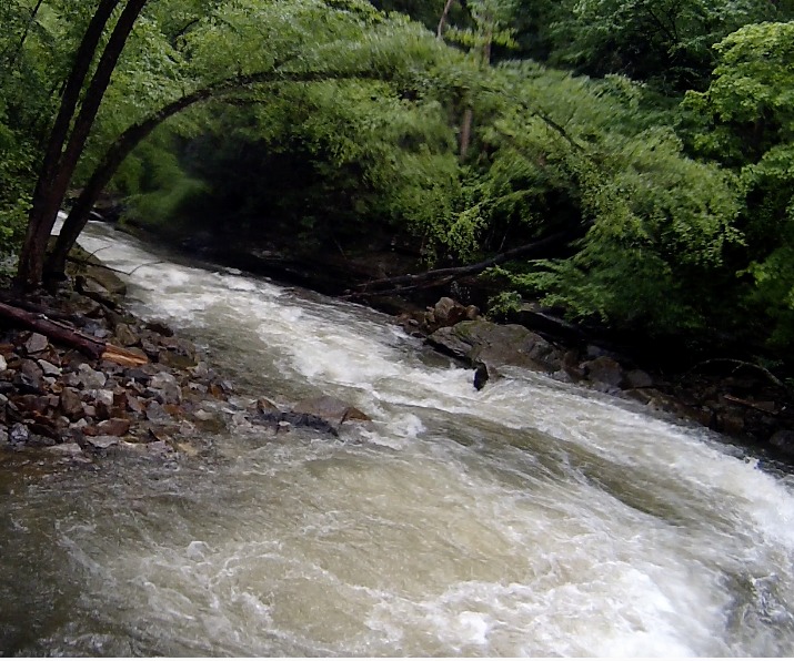
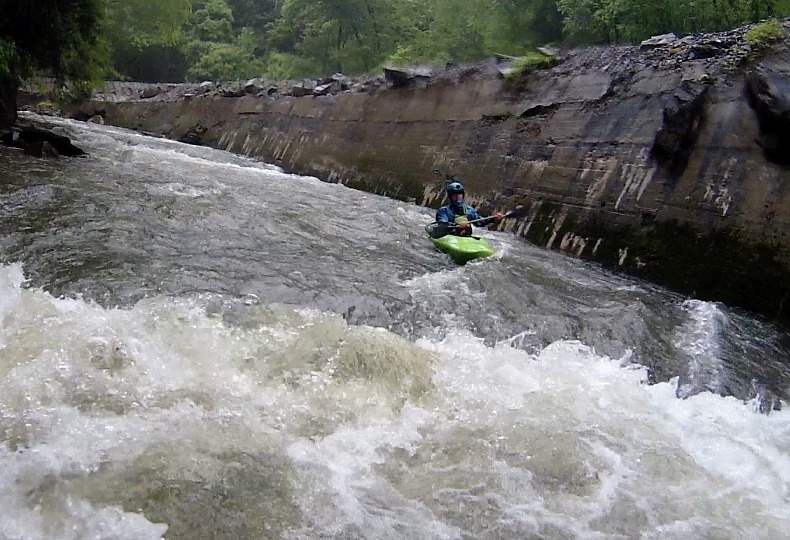
Site of an old mill, landing was soft at this level for Carson
May 15, 2016
This is the rapid immediately before the big ledge, and is reminiscence of big splat on the Sandy, you boof to the right to avoid pitoning on the rock in the run out
May 14, 2016
Ran Piney on May 14, 2016, 166 cfs, or 2.9 on the gauge. Plenty of water at this level, as is evidenced by the photos on this site. I think this creek has been unfairly maligned, there was no odor , the water was relatively clear, and there was no discharge apparent from the sanitation plant. Hardly any slack water on the entire run, we did it in under 3 hours, stopping to look at the big ledge, and the old mill ledge. While there is an approximately 1 mile pretty steep section, the whole run requires paying attention, and starts to feel a little fatiguing towards the end. Easy shuttle, remote canyon and great rapids, I'd recommend strong boaters put this ' hidden' gem on their list
Dec 11, 2011
Ran Piney on 10 Dec 2011. Gauge was 3.1 (~240 cfs). This is about the low end of good. 3.0 may be the minimum. The rapids are good, however, the pools are very shallow at 3.1. Fallen trees are prevalent, especially in the last third of the run. We portaged at least five times due to fallen trees. Be on the lookout for trees!
May 25, 2010
2.9 is as low as you can run Piney now . Any lower and you will do alot of dragging .
May 21, 2010
Had a good run at 3.7. Lots of river level scouring from the flood. Still tons of evidence from downed trees and log jams. Most of the major rapids were the same, but the boogie made from small boulders will be different. Portaged 3 times for wood either completely across the river or in bad places, as well as twice more 1 person got out to clear wood out of the way.
River is tons of fun at higher water, but there are some good sized holes.
Sep 27, 2009
The whole run is scrapey at this level. I wouldn't go back unless it's at least 2.6 or 2.7.
Jan 14, 2009
A large group of us ran this last weekend and the water did not seem TOO bad though the smell near the doo doo plant was still strong. Good fun - many in the group compared it to Glade Creek.
Dec 27, 2008
This is a great rapid. just watch out for the cave on the left
Jan 28, 2006
The water may smell bad, but I drank some and was ok--although I can't recommend that. This is a great run! Constant gradient with big drops interspersed. I think of it as a scaled-down Lower Big Sandy, which is pretty much as good as it gets! I put on at 3:30 one day when the 8:00am level (Raleigh) was 2.75 and dropping. When I got to the put-in, the level was an absolute minimum---abusive at the top, but good farther downstream. At the put-in, the riverbed is smooth, solid bedrock, giving the appearance of there being more water than what it really has. More fun than Glade Creek, and definitely worth doing!