| Difficulty | IV |
| Length | 6.6 mi |
| Avg Gradient | n/a |
| Gauge | Tygart Valley River at Philippi, Wv |
| Flow Rate as of 27 minutes | 373 cfsbelow recommended |
| Reach Info Last Updated | September 26, 2003 |
Bridge rapid in Moatsville is a good indicator of runnable flow below Rt 92.
Run is class II (III) from Nestorville to Rt 92 (2 miles), Class III Rt 92 to Moatsville, Class IV Moatsville to confluence with Tygart. Upper section nicely runnable when Moats bridge rapid looks slightly high. The rapid of note in middle section is recognized by 20 ft square rock block middle of creek. Nasty pourover bottom center. Start right, move diagonal to left above the hole and end up bottom left.
Bridge rapid is a sweet III/IV tumbledown easily scouted from bridge. Lower section Class IV rapid of note (suckpop) can be hazardous and can be scouted from island in creek. The rapid has wood at times and is located next after long shallow slide. Be very comfortable with this if thinking about Laurel (confluences 2 1/2 miles upstream of Teeter confluence). Emergency exit (steep) at the top of slide rapid, river left and climb up hill. Eliminates last 3 rapids.
Another Description:
Teeter Creek has 2 distinct sections. From Nestorville on Rt 92 to the bridge in Moatsville is primarily a Class II run with one Class III about 1/8 of a mile above the bridge. This rapid is best run on diagonal from right to left to avoid the ragged pourover and hole in the bottom middle and recognized by the 15 sq ft block of rock visible from upstream. The rapid above the bridge is tight, technical Class III/IV depending on level. When there are no clean chutes thru here without going all the way left the creek is too low.
Below the bridge the run tilts downhill at 120 fpm or so for 2/3 mile to the Tygart confluence. This section contains solid Class III/IV action commencing with several winding rapids. These top drops have good eddies and are easily boat-scouted.
Halfway down this lower section, when you can see a house up high on the left, you'll arrive at a large boulder blockin up the creek. The left is full of heavy, tight slalom drops. The right
...Jul 11, 2016
The correlation with the Philippi (Arden) gauge here is not very reliable. I ran Teter about 5500 over the max and it was high but very runable (and a blast). My friend ran it a week later at 500 over the max and said it was barely runable.
It may be hard to pin down a good runnable range from the the flow at Philippi because the level there is highly influenced by inflow from the Middle Fork and Buckhannon. These large tributaries' drainages are south of Teter's and can therefore get much different amounts of rain in a storm.
Feb 2, 2008
Just ran this two days in a row. Really sweet creek, lots of fun drops, couple of sick boofs, etc. Second day the water level was probably about perfect, with the Tygart gauge at 7,000 (meaning Teter's was in the blue), so I'd highly suggest modifying the recommended maximum.
Apr 19, 2006
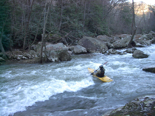
This is what happens when you miss your boof and lose your paddle at suckpop.
Rhett with a better line at suckpop.