McCloud
McCloud Dam to Shasta Reservoir(Lower McCloud)
October 30, 2022
| Reporter | Scott Harding |
| Gauge Reading | 575 cfs at MCCLOUD R AT AH-DI-NA |
| Flow | Low Runnable |
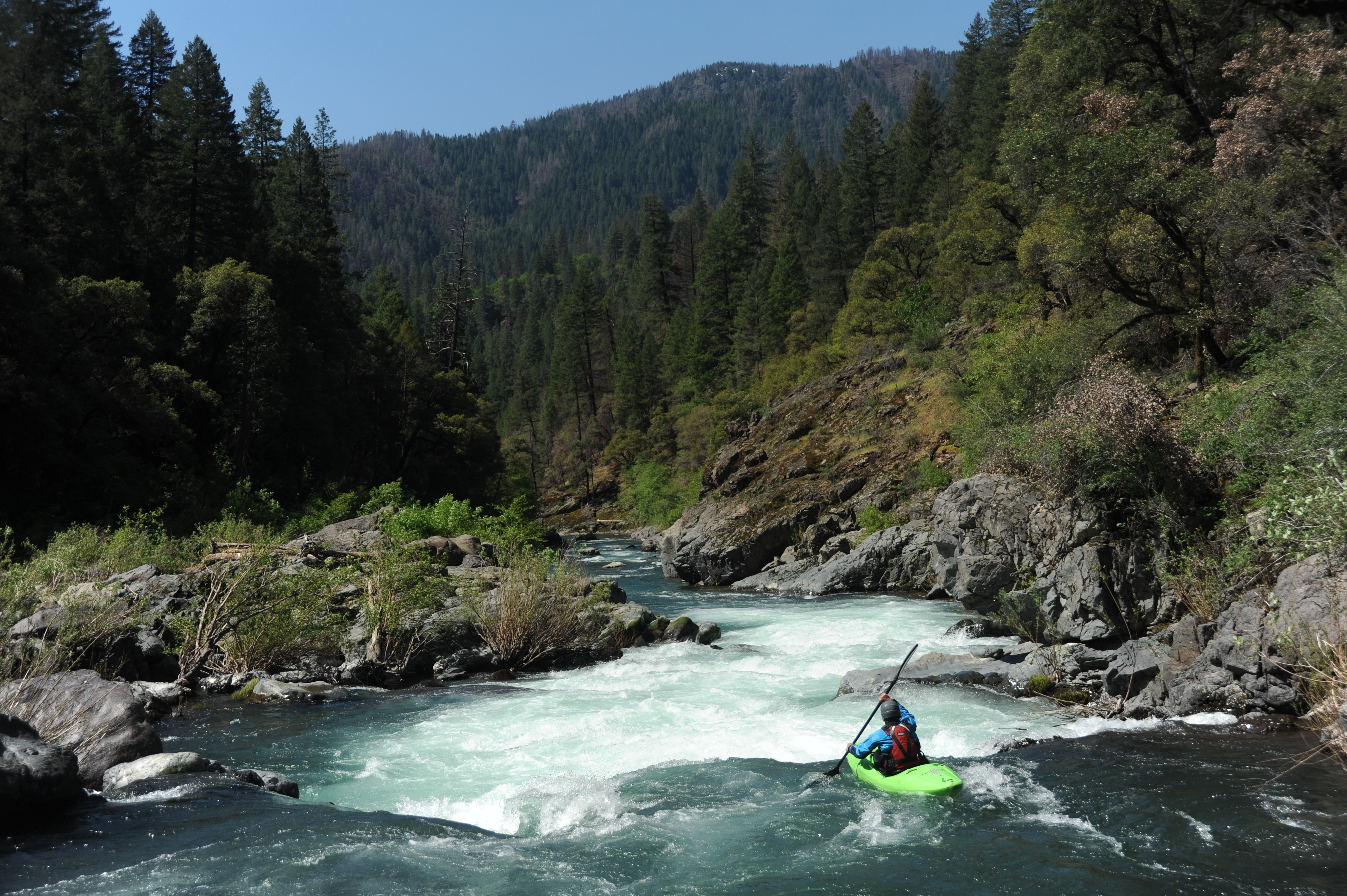
The lower McCloud hadn't run since the big flows of early 2019 so when PG\&E's powerhouse maintenance meant they weren't diverting 2/3 of the flow out of the river for a couple weeks, five of us immediately jumped on the opportunity to paddle it on a glorious fall weekend (10/29 - 10/30/2022) at approximately 530 cfs (Ah-Di-Nah gage). Unfortunately, we found out that PG\&E was also doing road maintenance below McCloud Dam where their spillway has been eroding the hillside. Tipped off by security cameras, their security patrol showed up minutes after we arrived at the dam and told us we wouldn't be allowed to walk past their barricade to get to the river. The only reason for this was because they were concerned, somewhat rightly, that their road work posed a risk of rocks falling into the river below. Easy to fix, we said, all you have to do is give us a five minute pause on the road work and we'll paddle by and be gone. Nope, they said, 'go paddle the North Fork Feather if you want whitewater.' That's like being told to go to McDonald's when you're at the doorstep of a steakhouse; they don't get it or care. So we drove another 45 minutes to put in at Ah-Di-Nah Campground and missed four miles of some of the best whitewater on the river. So it went. We had sunny fall skies, a shady canyon, and a warm fire at the only campsite in the river canyon. At the end of October, expect the river to be in shade more often than in sun. Turns out that the entire canyon is private land, except one tiny sliver of national forest, is owned by a handful of wealthy fishing clubs and one nature preserve. Because the California constitution guarantees your right to travel down a river, a boat is the only legal means by which to see the whole canyon. We camped at the only camp spot on public land on the entire run, located at the mouth of Claiborne Creek on river left just downstream of the bridge to the McCloud River Club. A couple guides from the club paid us a friendly visit after dark, two visits, actually. The first was to ask us to put out our campfire due to the national forest fire restrictions. Those restrictions had actually just been lifted and fires were allowed and conditions safe, so we let them know that and referred them to the [Shasta-Trinity National Forest website](https://www.fs.usda.gov/detailfull/stnf/alerts-notices) to see the proof. They left but returned a half hour later. We were sure they were coming back about the fire but, instead, they thanked us for being informed about the status of fire restrictions and brought us some cold beer and a bucket. Thanks, guys! The McCloud is famous for being electric turquoise and super clear, but now it is a silty green/brown and you can't see into the water at all. This is its climate change color and the silt comes from mudslides on Mount Shasta that are triggering as its glaciers surge and collapse (up aptly named Mud Creek). It's been this color for two years and is possibly just its new hue for the era. Still good for boating, maybe not so good for angling. This part of the McCloud is also different from its upstream sections because rather than flowing through the Cascade Range with its sharp basaltic rock, it flows through the older Klamath Mountains with its smooth metasedimentary rock that is much more boat friendly. By another quirk, there isn't gold in this far eastern edge of the Klamath Mountains, so the river hasn't been mined like most of the the others. A true gem! The rapids were great and we all agreed that we wouldn't want much lower flows than we had. There was some pinballing involved in kayaking the run but it wasn't enough to detract from the enjoyment of the river. Even small rafts should expect to get hung up and stuck in places at these lower flows, and it would be a challenge to get a medium or large raft down the run; pack light in any raft. There were a couple obstructions to be aware of. We encountered two river-wide trees on the first half of our first day between Ah-Di-Nah and the Claiborne Creek camp. The first can be paddled around on river left by kayaks but not anything larger. I recall the second tree had some sharp staubs that would make it harder to get an inflatable boat over and a portage may be necessary. We paddled over a tree in swift current on the second day not far below the Claiborne Creek camp. It had just enough water to scrape a kayak over without much worry at 575 cfs. On the lower reach of the second day we also encountered a rope across the river at chest level (easy to lift and paddle under) and a temporary bridge that was placed just a bit higher than kayaker head level; this could be problematic for rafts and tall boats, especially if the water is comes up from the 575-600 cfs we had but there's a good line of sight to it from above. See the photos in this report. Clearly at these lower flows, the river is best suited to kayak-size crafts and only the smallest rafts. A mini cat R2 setup might be the best raft to take.