McCloud
McCloud Dam to Shasta Reservoir(Lower McCloud)
| Difficulty | III-IV |
| Length | 24 mi |
| Avg Gradient | n/a |
| Gauge | Mccloud R at Ah-di-na |
| Flow Rate as of 21 days | 201 cfsstale data |
| Reach Info Last Updated | May 19, 2026 |
The McCloud River’s spring-fed headwaters begin along the western slopes of the Cascade Range in Northern California. The river flows 59 miles through the Shasta Trinity National Forest until it joins with the Sacramento and Pit Rivers at Shasta Lake near Redding. Well known for its scenic waterfalls, unique [...]Read More
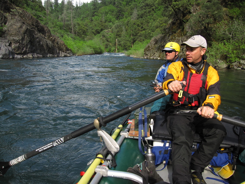
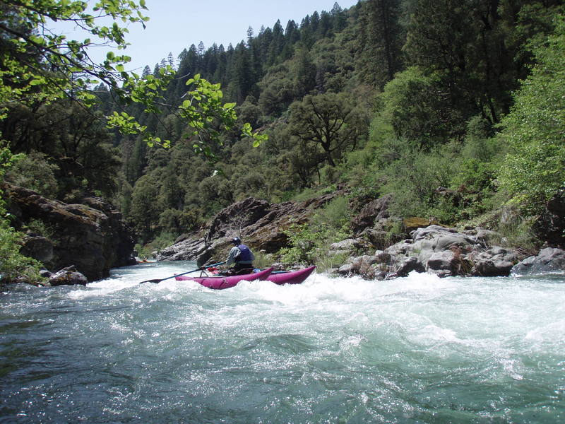
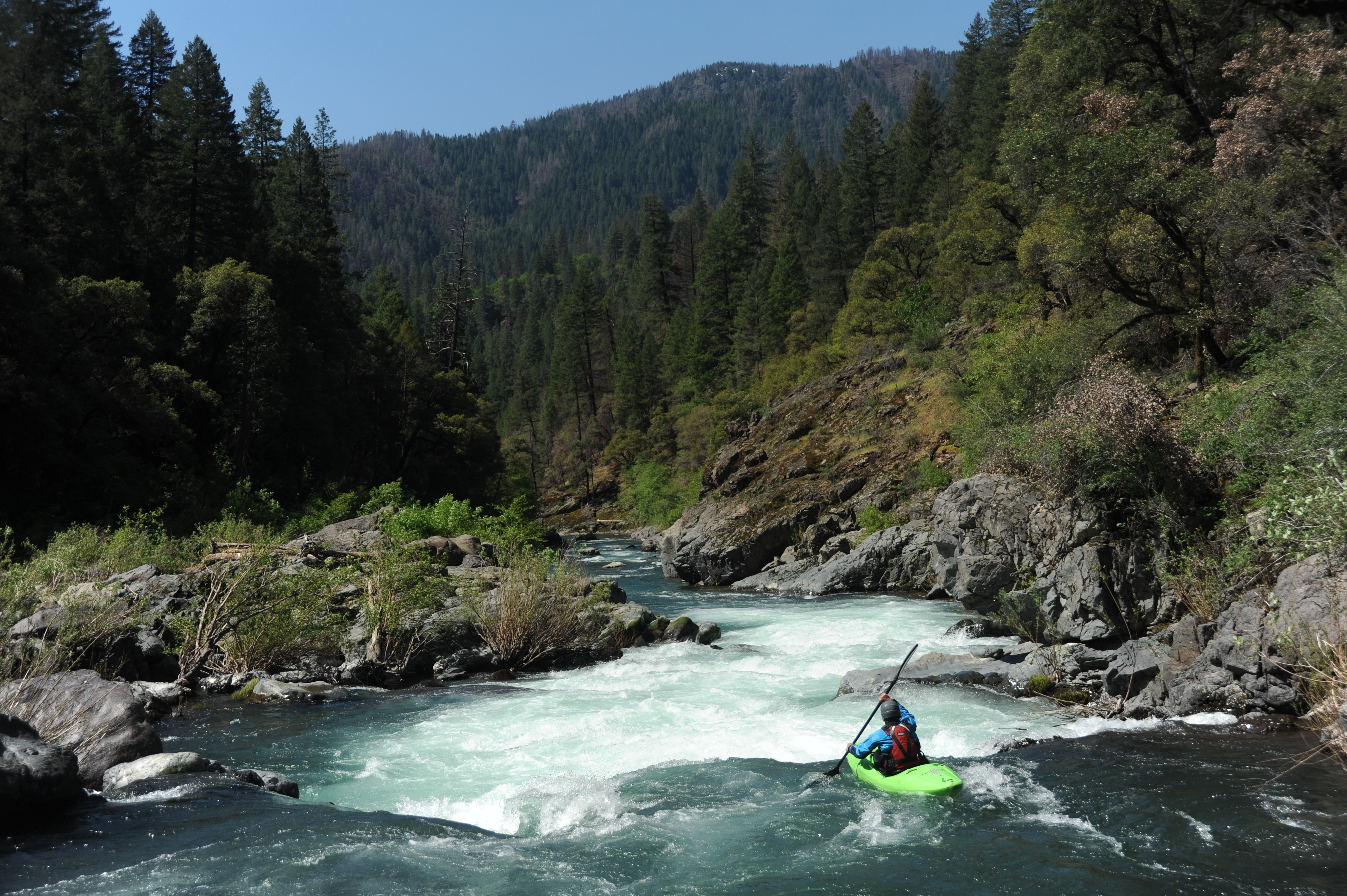
The Lower McCloud is one of the best class IV overnight trips on the West Coast suitable for self-support kayaks and their inflatable brethren as well as small rafts. The river flows through the traditional homeland of the Winnemem Wintu people (the 'middle water people'), and they maintain an active presence on the river and are fighting for the restoration of its salmon runs that were blocked when Shasta Dam was constructed downstream in the 1940s.
Early in the 20th century, the river attracted wealthy San Fransisco families to waters that remain among the most exclusive fly fishing destinations in the West. Dean Witter, Ed Gillette, Levi Strauss, William Randolph Hearst, the Fisher Family, and Hills Family are among those who have been attracted to this river and its storied fishing waters. As a result, unlike nearly all other rivers in the region, the land along the lower McCloud is almost entirely privately owned.
The McCloud River’s spring-fed headwaters begin at Mt. Shasta in the Cascade Range. The river flows 59 miles through the Shasta-Trinity National Forest, although much of the shoreline is privately owned, until it joins with the Sacramento and Pit Rivers at Shasta Reservoir near Redding. Although upper portions of the river flow through the Cascade Range and its volcanic rocks, the Lower McCloud cuts through the easternmost portion of the Klamath Mountains on much smoother and harder metasedimentary rock that is more boat-friendly.
The Lower McCloud section begins at the base of McCloud Dam, constructed in 1960, where more than two-thirds of the river is diverted to the Pit River drainage as part of the McCloud-Pit Hydroelectric Project. While historic summer base flows on the Lower McCloud were 800 cfs, a flow that would have provided whitewater boating opportunities throughout the summer, today the river flows at 200 cfs except during spill events in spring or the during infrequent powerhouse or dam maintenance. While we won’t be
...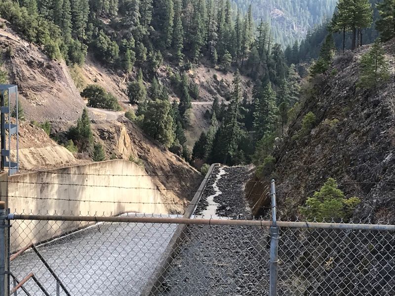
From the dam down to Ash Camp the river is mostly class 2-3. Dam owner, PG&E, sometimes blocks access to the dam so check on current status before heading here.

This is a good put-in if the water is high enough and you want to run the hardest rapids of the whole run. There are about six steep class 4 rapids between Ash Camp and Ah-Di-Nah. The Pacific Crest Trail conencts the Ah-Di-Nah access road to Ash Camp with a fairly level three-mile hike.
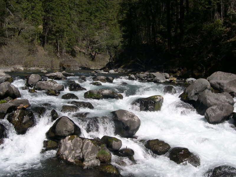
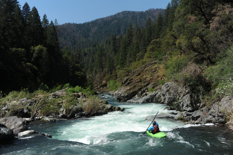
Amphitheater, class V-. This is the first major rapid below Ash Camp, and might be described as a “rock pile” just upstream of a curving river right wall that inspires the rapid’s name. The rapid requires an in-channel portage around the steepest, boulder-choked section at low flows, but is run at higher flows on the left.
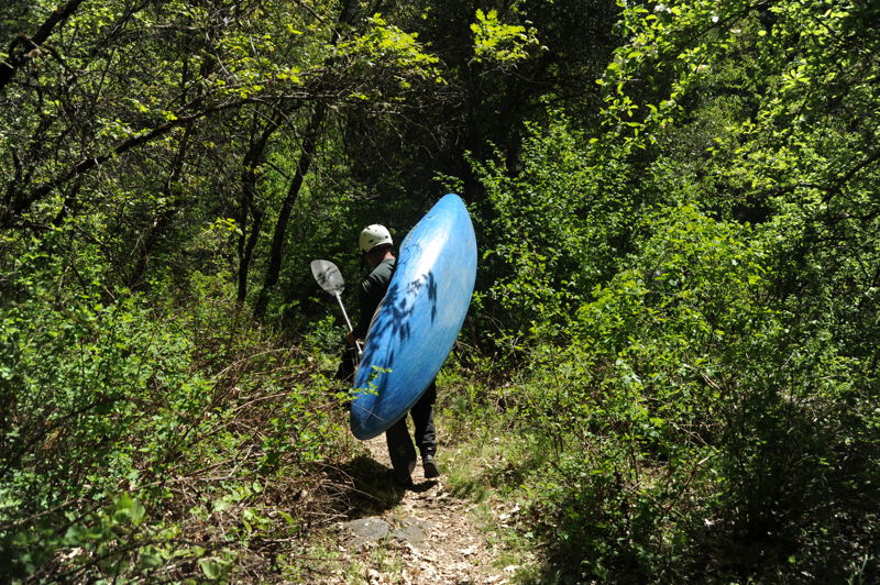
This remote Forest Service campground is at an elevation of 2300' and has 16 sites with tables and fire rings, flush toilets, and drinking water. The dirt access road from McCloud Reservoir is rough and rocky; low clearance vehicles, trailers, and RVs are not advised. The campground is typically open May through November and has a fee. The put-in is down a short trail to the river in the campground. Secure your vehicle not only from humans but also bears, which have been known to damage vehicles left here with food inside them.
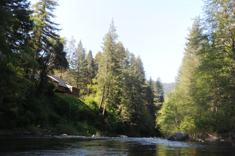
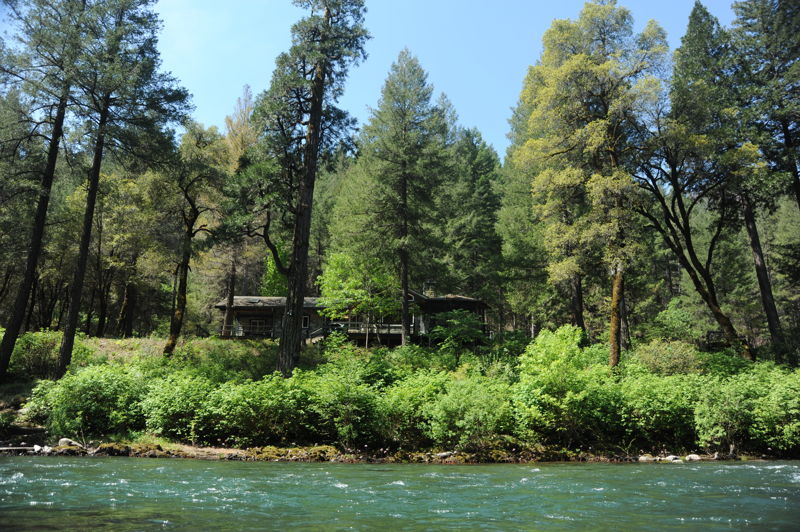
This private fishing club is located on river left of the McCloud River. You will know you are getting close when you start to see the plaques along the river naming indivdual fishing holes. Prominent San Fransisco business leaders including August Schilling, George Volkmann, Dean Witter, Ed Gillette, and others were members in the exclusive McCloud River Club founded in 1092 along 9 miles of the prime trout fishing water of the McCloud River. Around 2005, Bob and John Fisher of the Gap bought the McCloud River Club. This fishing club remains in private ownership.
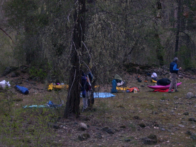
While much of the McCloud River shoreline is in private ownership, legal camping is available on a parcel of Forest Service-managed public land at the mouth of Claiborne Creek. It is easily found because the camping spot is approximately 200-250 yards below the vehicle bridge at the McCloud River Club's private compound. Claiborne Creek, a sizable tributary approximately 20 feet wide, comes in on river left. Pull into the mouth and take the short path up to the grassy bench on creek left. The camping area is on the downstream side of the creek, up on a level bench. You will find a well-worn foot path above the camp on public land, constructed by McCloud River Club connecting their land on either side of the public land. They also have a little foot bridge over Claiborne Creek, that is probably on Forest Service land. The upstream (along McCloud) boundary of public land is just on the other side of Claiborne Creek. McCloud River Club's full-time caretaker will come visit you. Be polite but firm in your knowledge that this is your public land that you are camping on. Bid him a nice day, and ask if he could spare some extra G&Ts or beer (it has worked before). ;-)~
The river right side of the McCloud River holds the brass cap, surveyed, corner monument of the Forest Service land and marking a sizable triangle-shaped portion of the public land on river right. The scribing on the cap shows the approximate (very close) orientation of the two diverging boundary lines extending away from the corner cap and crossing the river. We recommend that paddlers do not camp on river right of the McCloud River at this location. A McCloud River Club''No Trespassing' sign is posted about 100 feet on the Forest Service side of the property line. This large flat is easily accessible by McCloud River Club vehicles from their nearby road and any extended boater visit could become unnecessarily contentious.
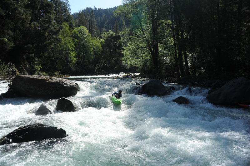
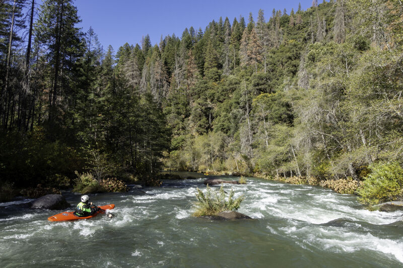
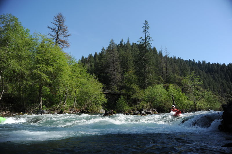
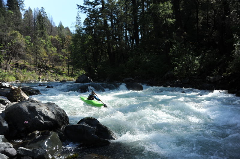
McCloud Swim Club is the first of the class IV rapids on this section and extends approximately 1/4 mile from river mile 11.7 to 11.9. This rapid has a long complex boulder garden at the top (most boaters run a right channel route), followed by a steep drop with a strong hydraulic.
Yét Atwam Creek comes in from river right and can add a big boost in flow during the rainy season. This creek is an excellent class III-IV run in its own right.
Two distinct drops, the second with more signficiant hydraulics. The rapid was named for a lost paddle in 1995.
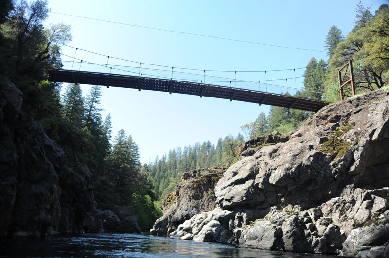
The private suspension bridge maintained by the McCloud River Club is used by fishermen to cross the river and serves as a good reference point on the run.
Double Drop Falls, also known as Double Falls and Blizzard, is a class IV rapid. The rapid has two steeper drops along its length that are not readily apparent from above, hence the name. The first falls has a strong river-wide hydraulic, which appears more retentive at medium-low flows. Depending on flows, you can punch it in the middle or take the sneak down the left. You can scout or portage this rapid on the left.
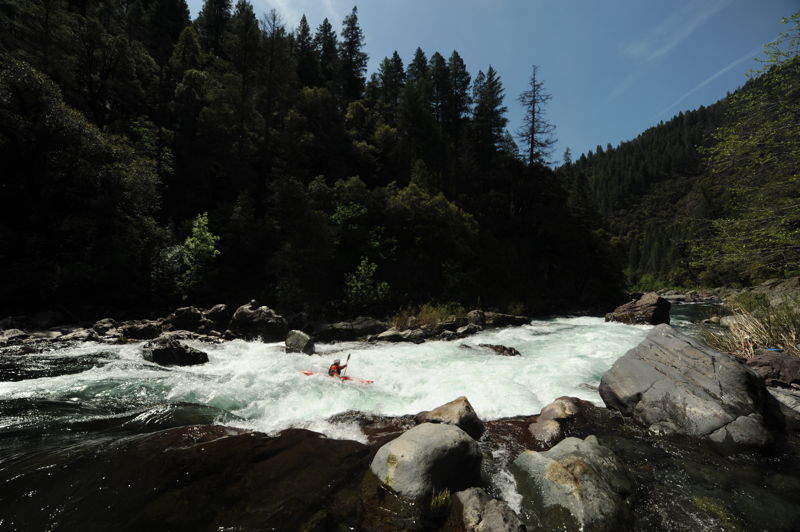
Tuna Creek Falls is class IV+ and generally the most challenging drop on this lower section. This rapid has a steep drop and hydraulic at the top, then a twisting channel that wraps around a house-sized boulder. The standard line is around the right of this boulder but check for wood; the low-water line is to the left. The boulder is undercut requiring paddlers to be on their game in the lead in drop. At lower flows, many boaters portage the top drop on the right. The standard scout for this drop is on the right.
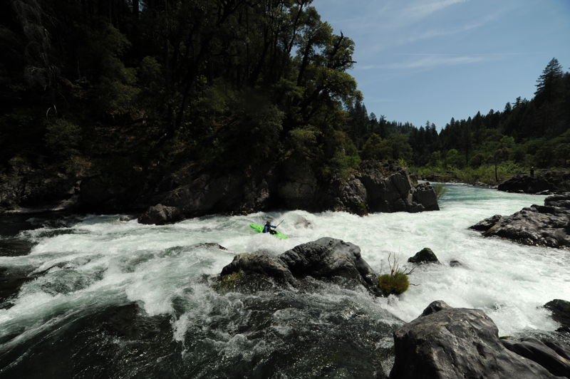
Valhalla Falls, also known as Thunderhead, or--most commonly--The Reagan Years, is the last big class IV rapid on the run. The rapid is a steep, steady decline in a constricted chute with some boulders in the left channel that create challenging hydraulics at medium-low flows. You can scout this rapid from the right.
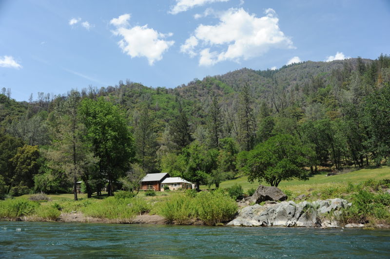
The Bollibokka Fishing Club was built in 1904 by the founders of Hills Brothers Coffee. In 2007 Westland Water District spent nearly $35 million to purchase the club from the Hills family and 3,000 acres of land to eliminate possible club resistance to the raising of Shasta Dam. The Nature Consercany made a market value offer of $30 million to purchase the land to conserve it, only to be outbid by Westlands who wanted it only to flood it beneath an expanded reservoir. The club is managed by The Fly Shop in Redding and is open to the public.
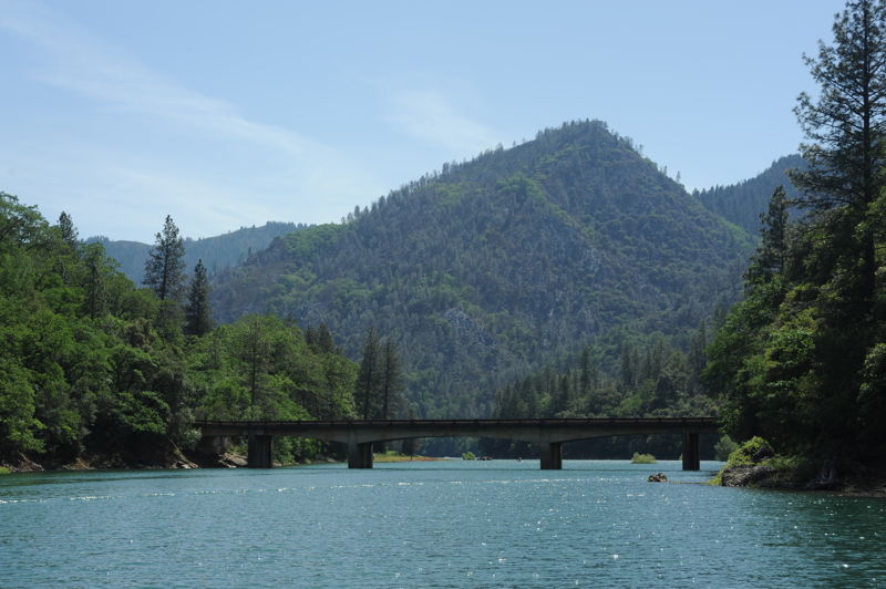
Take-out on the reservoir (which may still be a river, depending upon reservoir levels) at the McCloud Bridge where a road crosses over the McCloud arm of the reservoir/river. Depending on the elevation of the reservoir, it is a relatively short paddle out to the bridge or the river may continue for several more miles.
Oct 30, 2022
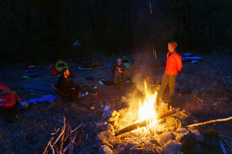
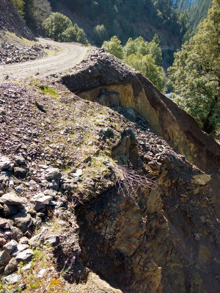
The lower McCloud hadn't run since the big flows of early 2019 so when PG\&E's powerhouse maintenance meant they weren't diverting 2/3 of the flow out of the river for a couple weeks, five of us immediately jumped on the opportunity to paddle it on a glorious fall weekend (10/29 - 10/30/2022) at approximately 530 cfs (Ah-Di-Nah gage). Unfortunately, we found out that PG\&E was also doing road maintenance below McCloud Dam where their spillway has been eroding the hillside. Tipped off by security cameras, their security patrol showed up minutes after we arrived at the dam and told us we wouldn't be allowed to walk past their barricade to get to the river. The only reason for this was because they were concerned, somewhat rightly, that their road work posed a risk of rocks falling into the river below. Easy to fix, we said, all you have to do is give us a five minute pause on the road work and we'll paddle by and be gone. Nope, they said, 'go paddle the North Fork Feather if you want whitewater.' That's like being told to go to McDonald's when you're at the doorstep of a steakhouse; they don't get it or care. So we drove another 45 minutes to put in at Ah-Di-Nah Campground and missed four miles of some of the best whitewater on the river. So it went. We had sunny fall skies, a shady canyon, and a warm fire at the only campsite in the river canyon. At the end of October, expect the river to be in shade more often than in sun. Turns out that the entire canyon is private land, except one tiny sliver of national forest, is owned by a handful of wealthy fishing clubs and one nature preserve. Because the California constitution guarantees your right to travel down a river, a boat is the only legal means by which to see the whole canyon. We camped at the only camp spot on public land on the entire run, located at the mouth of Claiborne Creek on river left just downstream of the bridge to the McCloud River Club. A couple guides from the club paid us a friendly visit after dark, two visits, actually. The first was to ask us to put out our campfire due to the national forest fire restrictions. Those restrictions had actually just been lifted and fires were allowed and conditions safe, so we let them know that and referred them to the [Shasta-Trinity National Forest website](https://www.fs.usda.gov/detailfull/stnf/alerts-notices) to see the proof. They left but returned a half hour later. We were sure they were coming back about the fire but, instead, they thanked us for being informed about the status of fire restrictions and brought us some cold beer and a bucket. Thanks, guys! The McCloud is famous for being electric turquoise and super clear, but now it is a silty green/brown and you can't see into the water at all. This is its climate change color and the silt comes from mudslides on Mount Shasta that are triggering as its glaciers surge and collapse (up aptly named Mud Creek). It's been this color for two years and is possibly just its new hue for the era. Still good for boating, maybe not so good for angling. This part of the McCloud is also different from its upstream sections because rather than flowing through the Cascade Range with its sharp basaltic rock, it flows through the older Klamath Mountains with its smooth metasedimentary rock that is much more boat friendly. By another quirk, there isn't gold in this far eastern edge of the Klamath Mountains, so the river hasn't been mined like most of the the others. A true gem! The rapids were great and we all agreed that we wouldn't want much lower flows than we had. There was some pinballing involved in kayaking the run but it wasn't enough to detract from the enjoyment of the river. Even small rafts should expect to get hung up and stuck in places at these lower flows, and it would be a challenge to get a medium or large raft down the run; pack light in any raft. There were a couple obstructions to be aware of. We encountered two river-wide trees on the first half of our first day between Ah-Di-Nah and the Claiborne Creek camp. The first can be paddled around on river left by kayaks but not anything larger. I recall the second tree had some sharp staubs that would make it harder to get an inflatable boat over and a portage may be necessary. We paddled over a tree in swift current on the second day not far below the Claiborne Creek camp. It had just enough water to scrape a kayak over without much worry at 575 cfs. On the lower reach of the second day we also encountered a rope across the river at chest level (easy to lift and paddle under) and a temporary bridge that was placed just a bit higher than kayaker head level; this could be problematic for rafts and tall boats, especially if the water is comes up from the 575-600 cfs we had but there's a good line of sight to it from above. See the photos in this report. Clearly at these lower flows, the river is best suited to kayak-size crafts and only the smallest rafts. A mini cat R2 setup might be the best raft to take.