Laramie
4- Tunnel Road to Palmer Canyon Road (Lower Laramie Canyon)(Laramigo Canyon)

| Difficulty | IV-V |
| Length | 23.6 mi |
| Avg Gradient | 100 fpm |
| Gauge | Laramie River Near Fort Laramie, Wy |
| Flow Rate as of 39 minutes | 2.22 ftrunnable |
| Reach Info Last Updated | October 12, 2011 |
First pioneered by Minnesotan original gangster, Jim Rada during a fluke release in 1983. This run remained dewatered and unrun since. Read Jim's write up in AW Journal Nov./Dec.1985 issue on pg. 20.
Fast forward to the banner water year of 2011, reports of a once again full canyon enticed a crew of Colorado bros to join me for a little exploration.
Run is 16 miles in length, consistent gradient average of about 100 fpm, with 70 for the lowest and 130 for the steepest. 13 miles plus on the run is consistent, continuous fun class IV with a good handful of moderate class V moves to keep things interesting.
I was able to run it twice this season, once at an estimated 500 cfs. and once at an estimated 1000. Quality is definitely in the five star range, especially at 1000.
Public access exists for both put in and take out.
Read Evan Stafford's in depth report at: Boofington Heights Here's to hoping it runs more often!
Austin Woody, 2011
Other Information Sources:
AW Journal Nov./Dec.1985 issue Jim Rada's write up of his 1983 descent.
Boofington Heights Evan Stafford's in depth report of a 2011 descent.
Apr 4, 2017
UPDATED FLOW INFORMATION: The upstream NOAA HADS gauge titled LRTW4, Laramie River Below Wheatland Tunnel, went into error early last season (resulting in a presumable record for lowest ever run.)
The newer, more accurate gauge is located downstream near the mouth of the canyon, it is also a NOAA HADS gauge but it is titled LRDW4, Laramie River Above the Cramer Ditch. This gauge is located downstream of the tributaries of Duck and Cherry Creek, both significant low elevation drainages. So if considering a run, know that if significant low elevation snowmelt is occuring that this LRDW4 gauge may have more water than what the canyon actually does (probably not much more than ~100 cfs.
Here are some rough correlations for the new LRDW4 gauge based on runs last season (2016):
4.66 feet- 678 cfs releasing from Wheatland Res. #2. Fun, lowish medium level. Plenty of water to boof and have fun.
5.47 feet- Highish medium, Prime levels right here. Maximum number of boofs, worth interstate driving for the run at this level for sure. Here's a gopro video from this specific run: https://www.youtube.com/watch?v=NzoPKCe\_toY&t=13s
5.98 feet- 1850 cfs releasing from Wheatland Res. # 2 in addition to spillway overflow. Highest known descent. Super fun, continuous nature. Very much in the Class V range at these levels. Use caution, knowing where some of the portages/sieves are at this level is pretty critical.
Anyone wanting to get in there looking for more info feel free to give me a call, 3 oh 7- 690-zero48zero.
Austin Woody
Sep 13, 2011
First pioneered by Minnesotan original gangster, Jim Rada in 1983 during a fluke release (write up here in Nov./Dec. issue on pg. 20: http://www.americanwhitewater.org/content/Journal/browse/year/1985/) this run has remain dewatered and unrun since. Fast forward to the banner water year of 2011, reports of a once again full canyon enticed a crew of Coloradobros to join me for a little exploration. Run is 16 miles in length, consistent gradient average of about 100 fpm, with 70 for the lowest and 130 for the steepest. 13 miles plus on the run is consistent, continuous fun class IV with a good handful of moderate class V moves to keep things interesting. I was able to run it twice this season, once at an estimated 500 cfs. and once at an estimated 1000. Quality is definitely in the five star range, especially at 1000. Public access exists for put in and take out. Read Evan Stafford's more in depth report at: http://boofingtonheights.wordpress.com/2011/07/04/laramie-river-canyon-with-water-in-it/
Here's to hoping it runs more often!
Austin Woody
Jul 17, 2011
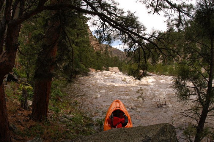
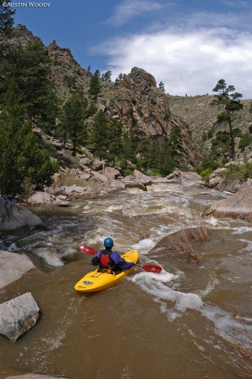
Lunch in the middle of the action. 10 miles plus of this. 3.1 ft. on gauge.
Jul 17, 2011
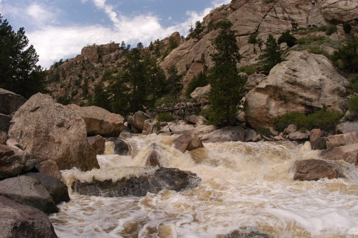
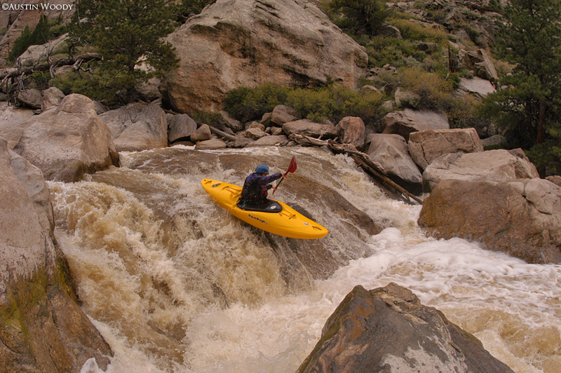
Big drop of the run. Estimated 1000 cfs.
Jul 17, 2011
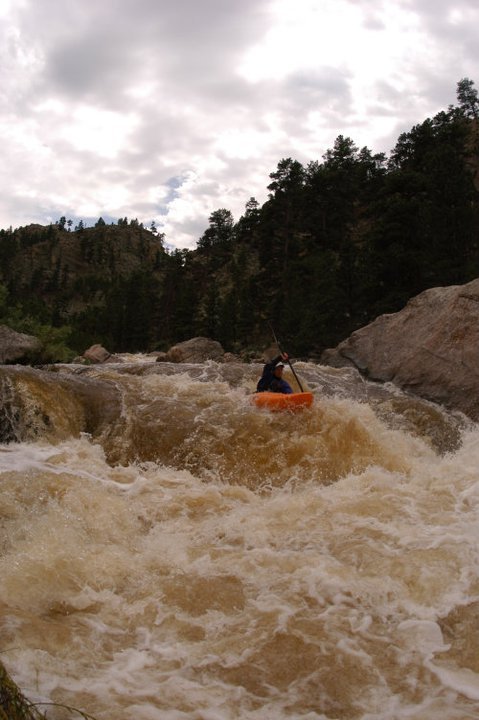
Randy Ramirez boofing some fun in between action. Estimated flows around 1000 cfs or 3.1 on gauge.
Jun 11, 2011
Again, around 500 cfs.
Jun 11, 2011
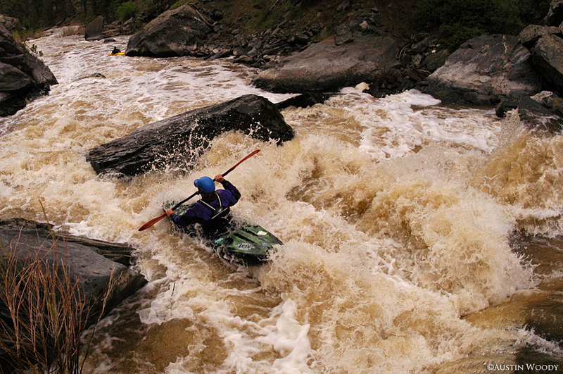
The big one of the run. Sieve central to the right, pin spot to the left. Estimated 500 cfs in this picture
Jun 11, 2011
Wigston approaching the finale of the canyon. This rapid is a nasty looking sieve pile directly above the confluence with Duck Creek and Cherry Creek. A small left channel goes at these flows (appx. 500 cfs) and was pretty exciting at around 1000.