Hulahula
Grasser's Airstrip to Arey Island (Arctic Ocean)

| Difficulty | III |
| Length | 77 mi |
| Avg Gradient | n/a |
| Reach Info Last Updated | January 22, 2021 |
This is one of the more well-known river trips through the [Arctic National Wildlife Refuge](http://
arctic.fws.gov/) on a river recommended by the Fish and Wildlife Service for designation under the Wild and Scenic Rivers Act. The Refuge was established to preserve the wildlife, wilderness, subsistence use, and recreational opportunities and is contiguous with protected lands in Canada. Many species of wildlife and birds are found along the coastal plain and fantastic wildflower displays are the foreground to the spectacular mountain and valley scenery. Every year thousands of caribou make the trek across the river.
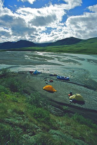
A trip on the Hulahula typically lasts about 10 days and offers great opportunities for hiking and exploring the landscape. Actual float time is typically 25-35 hours depending on flows so take your time and enjoy the first several miles which offer some of the best hikes. Temperatures between 30 to 80 degrees are possible at any time during the summer season. Aufeis can be a hazard early in the season while mosquitos can be relentless during warmer days of summer.
The river starts out in the Romanzof Mountains of the Brooks Range and flows north across the coastal plain to the Beaufort Sea. Most trips on the Hulahula start at Grasser's Airstrip just upstream of East and West Patuk Creeks. Those with pack rafts often spend a day hiking further upstream and even if you're not planning to boat this section it's well worth a day of hiking to check out the upper drainage. Bring the binoculars to scan the mountains for Dall sheep which are nearly always present.
The river starts out with fairly continuous class II rapids that weave through ever shifting gravel bar rapids that wind their way through braided channels. You may encounter the occassional easy class III move over the first several miles but that tends to be the exception. Be sure to pace yourself and spend plenty of time exploring though as the moutains offer some great v
...Jul 15, 2005
The upper river flows between the peaks of the
Romanzof Mountains and is characterized by class II
gravel bar rapids.
Most of the rapids are class II in the upper section but
therer are a couple places that may require a class III
move such as this one where most of the current
slammed into some boulders on river right.
This canyon did not contain any significant rapids and
it was relatively short.
There are a couple places where aufeis can persist into
the summer.
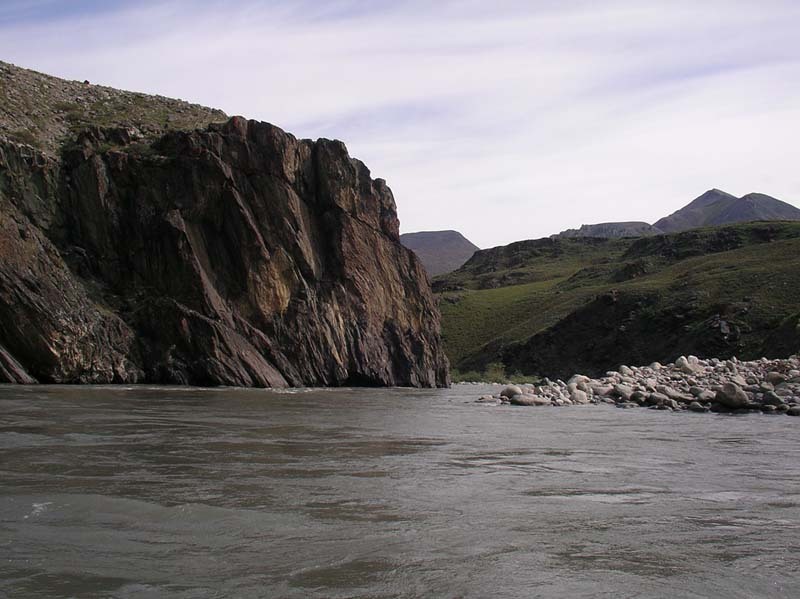
Before the river opens up onto the coastal plain it
passes through the most challenging rapids on the
run, a series of about a dozen class III headwall rapids
contained within a bedrock canyon.
This rapid is characteristic of those in the canyon
which are headwall rapids formed as the current
slams up against bedrock walls. Most of the dozen
or so rapids have a hole or two to dodge. Skilled
paddlers will be able to boat scout these drops but
you can also hike along the canyon to view them or
hope out to scout them from river level as needed.
As the river leaves the mountains and emerges from
the canyon it continues for several more miles as a
relatively constrained channel with fun class II rapids.
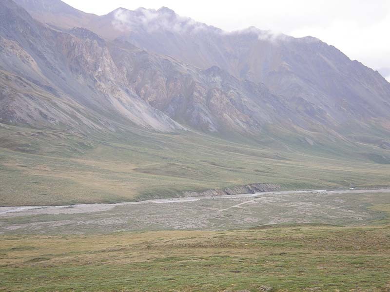
The wide open expanse of the coastal plain provides
amazing views for hundreds of miles. This is the heart
of the 1002 area that could be tapped for oil.
While the channel is relatively constrained for much of
the journey across the coastal plain it begins to spread
out as multiple threads. At medium flows you should
still be able to find a channel with plenty of water.
A short distance upstream from the mouth of the
Hulahula.
Standing at the mouth of the Hulahula and looking
back upstream.
If your boat and gear are not too heavy a popular
option is to portage across this tundra pond
(70.05197N, 144.02497W, WGS84) near the mouth
of the Hulahula where you can cross over to the
Okpilak and take the channel that heads out to Arey
Island.
The crossing to Arey Island may include as much
walking as paddling. At the mouth the Hulahula and
Okpilak dump a large load of fine sediment resulting
in many shallow channels.
Arey Island is the pickup point for trips that continue
out to the mouth. This approximately 10 mile barrier
island is a narrow strip about a mile offshore that
extends from the mouth of the Hulahula to Kaktovik.
This village on Barter Island is the place where most
trips to ANWR start and end.