Silver
B) Upper Silver: Silver Rd to Arvon Rd (2.3 miles)
| Difficulty | III-V |
| Length | 2.2 mi |
| Avg Gradient | 150 fpm |
| Gauge | Silver River Near L'anse, Mi |
| Flow Rate as of 1 hour | 6.76 ftbelow recommended |
| Reach Info Last Updated | March 1, 2022 |
This is one of the definitive South Shore creek runs. First paddled in the seventies, the Silver has long had an annual pilgrimage of faithfuls, hoping to catch this beauty when the snow melts and the ice goes out.
The run begins with Hail Mary (a great challenging rapids in three pitches) and ends with the Cabin Section (an even more demanding stretch which most boaters will enjoy from shore, and even well seasoned boaters will likely appreciate having good safety support in a few key locations). At low-to-moderate flows, this section can easily be parsed into three sequential pitches. At higher flows, the drops tend to 'run together', creating many opportunities for epic tales to be told later around the bar or campfire. And, between these two sequences, you'll find a plentiful assortment of good drops to keep you on your toes.
Many boaters will continue downriver to do the 'Lower Silver' run for a good, full day. And, if they've planned well, will add a run on the Falls River (in L'Anse) as either a warm-up or a 'chaser' to end the day.
Click here for Part 1 of an article from the AW Journal, way back in 1981!
Click here for Part 2 of the article.
The article describes the following: Michigan's, Upper Presque Isle, Lower Presque Isle, Middle Black, Lower Black, Upper Silver,
...
USGS lists a sampling site at Arvon Road (take-out for this section) showing drainage area at that point as 34.5 square miles, which is just more than half the drainage at the active gauge at Skanee Road. Thus, flows in this upper section will approach half the flow shown on gauge.
This is NOT a comprehensive list of the rapids on this reach. We could use some help here. If you know names, have locations (coordinates), or can provide more detailed descriptions for any of the rapids on this reach, we would appreciate your input! Add a comment or report, or email the StreamTeam member for this reach.
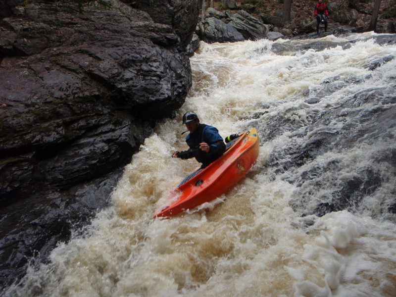
'Hail Mary' is broken down into three pitches. The first pitch starts with a jumbled slide into a nearly 90-degree left turn, followed by a sequence of holes and waves.
A short pool brings you to the second pitch: A rocky protuberance separates the flow (at low-to-moderate levels, anyway). To the right, water flows over a shallow shelf and dumps into a wrapping hole (the current from the left line). To the left, a sweet slide accelerates you into the flow dropping in from the right, then (with little pause) accelerates you toward a pretty good sized hole, with diagonal 'feeder waves' funneling you into the maw. Punch the hole hard, angled left to catch the left eddy, or you will be fed (by the outflow) right into an undercut wall.
A longer let-up precedes the final pitch. The jagged rock of the riverbed 'humps' down the middle of this pitch. To the left, water spills into a nasty, narrow crease. (You DON'T want to be anywhere near this!) With adequate water, the most opted for route is more-or-less down the center, but more often when I've been there (with low-to-moderate flows), the preferred route has been well to the right. A short initial ledge drops you into a short pool. Sliding out of there, you grunge down toward a wall of rock (right shore), to be diverted sharply to your left. You do your best to avoid banging paddle or right elbow on the wall (or worse, being flipped) as you head toward the hole formed where currents converge (from the left-side slot) as they (hopefully) spit you out downstream.
A great combo drop comes as the river swings to the left. The entrance slides and trips across some ledge/waves, runs headlong toward a large boulder (river-left), then pools briefly before sliding down more medium-angle slides, through a few good wave/holes, before calming a bit below. Don't let up too soon! There is another good combo which follows!
(Map location very approximate)
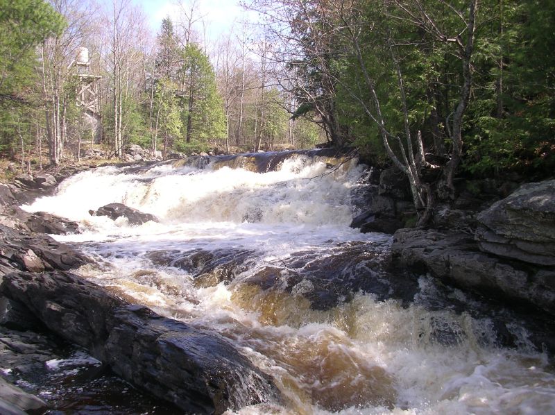
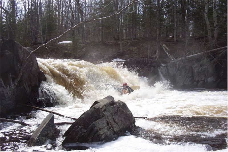
After a pretty fair relatively flat stretch (maybe a half-mile), this single ledge drop is encountered. The approach is generally quite straight-forward, and there is a good pool below, so this may be a simple drop. However, at good flows, the hole at the base can be quite aggressive, so the recommended line is often a boof on river-right.
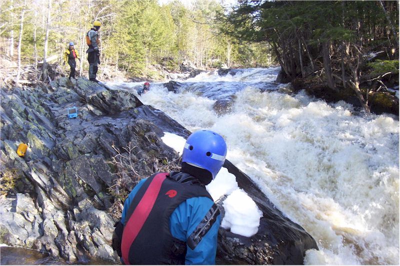
This is some serious gradient that you will want to take a good look at. As soon as you see the first 'cabin' (house) on the right, get out to scout the whole section. At low-to-moderate flows, you can easily break it down into three or more distinct pitches, each of which is not that difficult. However, taking the whole sequence together (as will be the case at higher flows), it is a huge chunk of gradient to navigate.
Sep 4, 2022
I ran this section with Fred Young and Bob Obst in spring 1980 or close to then, probably the second descent. It's included in my article in AWA journal that's cited in the main writeup. The descriptions here are accurate and it's good to see that this has become a popular, resonably difficult, creek run.
Apr 26, 2022
I ran this on 4-16 and 4-17-2022. There is a log stuck against the face of Bubble Bath waterfall on the right side. You can't see it from the top. We couldn't run the right side line, but the center was good to go.
Sep 12, 2016
Ran this river yesterday @ 8.0 with a buddy and fellow whitewater rafting guide in our inflatable NRS Outlaws. We were incredibly impressed with this river and found ourselves out classed for the inflatable type boats we were using a few times. We ran the first two pitches of Hail Mary but decided to portage around the final pitch (thanks to the landowners for letting us use their property!). The sections between the bottom of Hail Mary and the top of the Cabin section were incredible and challenging. We spent plenty of time scouting the class four sections in the middle. Those rapids were intense, exciting, and very worthy of good names! Bubblebath does have a large tree down on the river right as you approach the falls, but it is easy to avoid by keeping towards the middle. By the time we reached the cabin section, we were just about out of daylight due to our late start so we chose not to push our luck and portaged using the road behind the cabin. Overall, an absolutely gorgeous portion of white water nestled into the U.P.!
Apr 20, 2009
http://www.miningjournal.net/page/content.detail/id/526038.html?nav=5006
The Mining Journal, Marquette, MI
POSTED: April 19, 2009
L'ANSE - A Houghton man is dead after a kayaking accident that occurred on the Silver River in Baraga County Friday evening.
Richard Honrath Jr., 47, was pronounced dead at Baraga Memorial Hospital.
Baraga County Sheriff's deputies went to the Silver River in L'Anse Township, shortly after 8:20 p.m. to assist a kayaker who was reportedly 'pinned against a tree.'
Deputies found Honrath pinned under a tree in fast-moving rapids. He was pulled from the water and taken to the hospital.
Honrath and his partner, Dave Bullock, 38, of downstate St. Johns had entered the Silver River about two miles upstream from where the incident occurred.
Bullock told police that Honrath had rolled and was separated from his kayak. Bullock attempted a rescue with a throw rope, but all attempts failed.
According to Bullock, he and Honrath had been kayaking together for about 15 years and were familiar with the Silver River.
The L'Anse Fire Department, Bay Ambulance, Keweenaw Bay Tribal Police and the L'Anse and Baraga village police departments assisted with the incident.