Carp (Marquette)
C) 'Lower': CR553 (Marquette Mtn.) to Hwy.41 (2.0 miles)
| Difficulty | II-III |
| Length | 1.7 mi |
| Avg Gradient | 82 fpm |
| Gauge | Middle Branch Escanaba River at Humboldt, Mi |
| Flow Rate as of 28 minutes | 47 cfsbelow recommended |
| Reach Info Last Updated | March 16, 2026 |
This is a wonderful, fairly continuous stretch. At low to moderate flows, it may be suitable for novice paddlers. At higher flows, it may be best reserved for aggressive intermediate-to-advanced paddlers (with appropriate caution and safety). There are no significant (named) drops which stand out, but the whole section is a rush if you catch it at high water! Due to fast current, narrow and winding stream, small to non-existent eddies, and high potential for strainers, the subjective rating of this section (at high water) is somewhat higher than the actual rapids would otherwise merit. (That is, the rapids still only rate class II-III, but you better have class III-IV skills and safety awareness.)
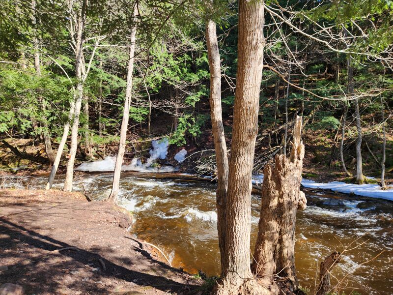
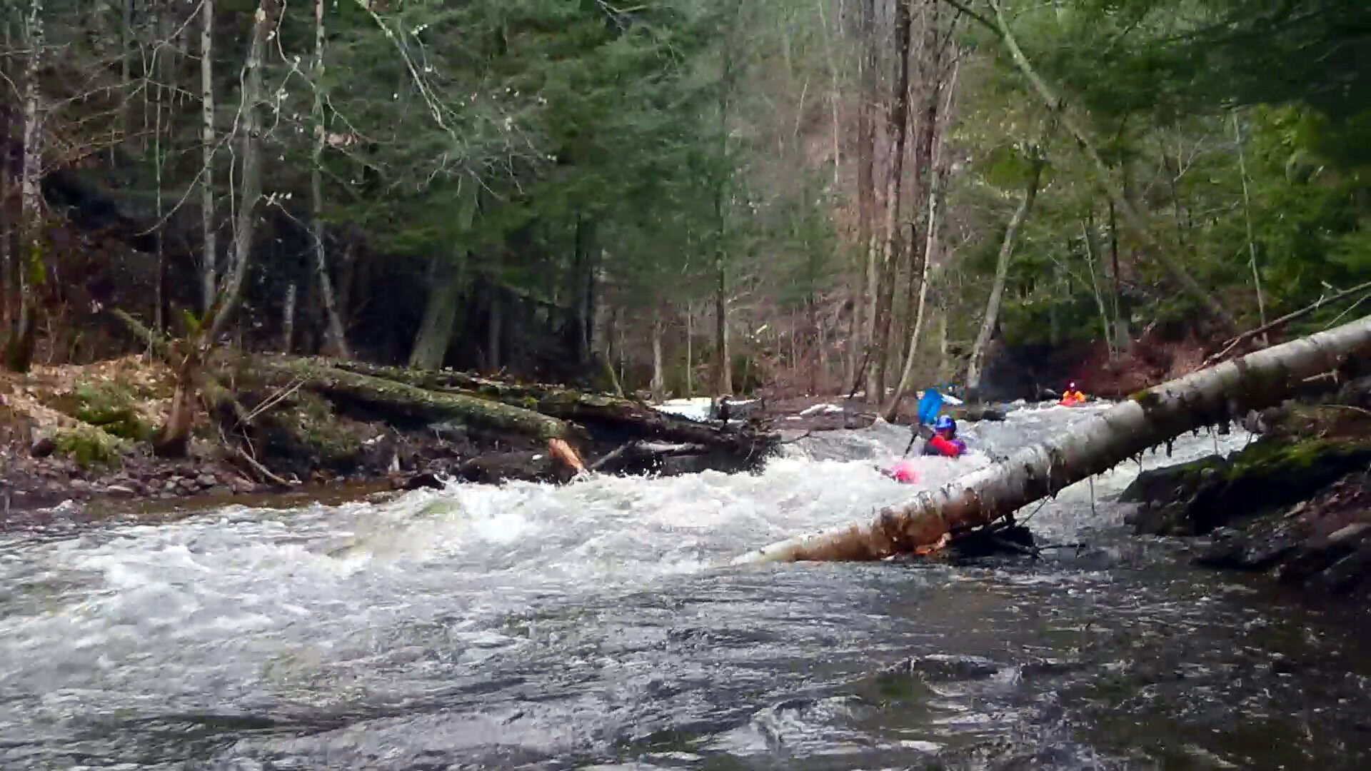
Hike the trail on river left (north bank) before running. The Carp is more of a creek than a river: it is narrow with few eddies. A single tree can easily block the channel. This is no place to round a bend and come across a river wide strainer. The trail is a combination hiking/biking trail that does not always follow the shore because of the steep terrain. You'll need to jump off the trail, at points, to get down to the river, then hop back up when the valley becomes to steep and narrow.
From CR553, there is at least 1.5 miles of fairly consistent gradient at 114 FPM before things peter out for the flat-but-flowing paddle to the take-out. If the dirt road at the take-out is passable, it is possible to drive upstream to its cul-de-sac, thus cutting out most of the flatwater. At present there is a tree in the river and bright plastic tape tied around tree trunks at this point on the river, providing excellent markers for this spot. The parking is a short carry up a good path from the river.
Many boaters will combine this reach with a run on the (more challenging) upper. See Upper Carp for description of that reach.
Apr 26, 2025
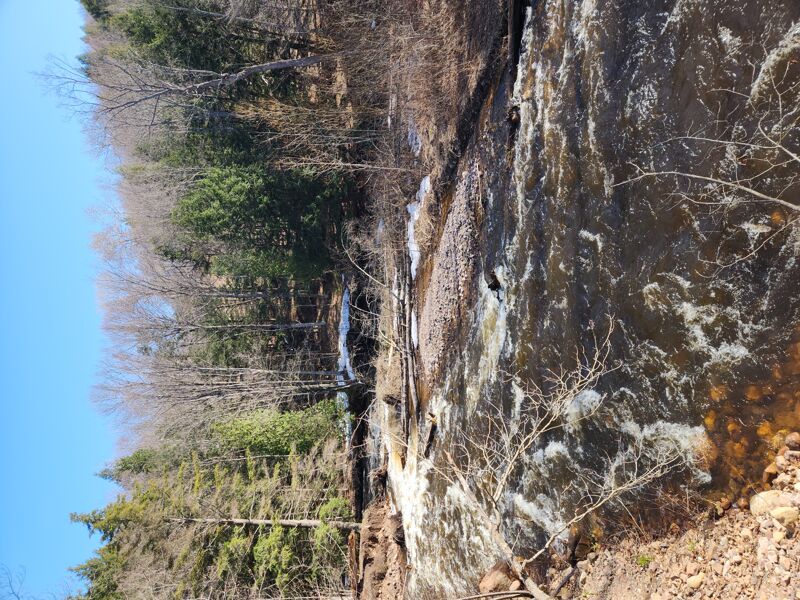
Scouting trip. The gauge was 450 cfs at the Middle Branch of the Escanabe. It looked paddlable, but there was too much wood. We hiked down about half-way from the campground and there were 4 locations with a tree across the creek. With the narrow channel and fast flow, it would have been difficult, if not impossible, to land above each tree and portage. Cutting the trees out would be a good summer project when the water is low and you could walk to the other side.
May 6, 2019
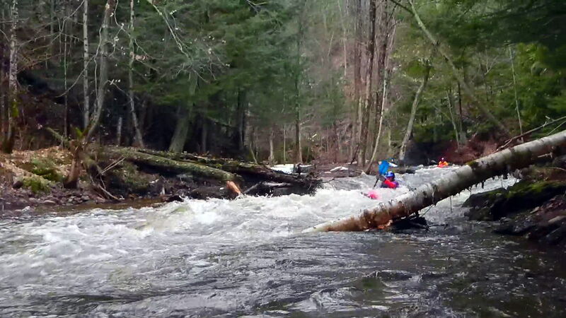
Ran this stretch from Rippling River Resort (too many strainers upstream to put-in higher) to the cul-de-sac mentioned above on May 2, 2019. The level was 221 cfs on the Middle Branch of the Escanaba at Humboldt. Our friends hiked to scout the entire stretch the day before along the trail on river left. The hike takes about an hour or two. Highly recommended due to the potential for strainers and the shortage of eddies. Super fun short stretch. Easy to run multiple laps. Short shuttle. The current was fast at this level, requiring quick moves. The river starts out easier and builds to the end. Completely agree with the description of Cl II-III rapids requiring Cl III/IV moves to avoid strainers. I would not recommend this level for novices. This is a very narrow, small stream but big fun, just be sure to scout for strainers first.
Jun 3, 2011
Paddled this today for the first time. It was a lot of fun! I'm fairly new to whitewater though I've been paddling most of my life. This section challenged me. The water was relatively low too. I can't imagine this at high water; it would be sick!
There were several river-wide strainers (trees) that I had to portage around which required eddy turns to avoid them. Also I'd recommend pulling out of the river when you reach the mountain bike bridge. There's not much more excitement downstream from there and there are a couple of portages required; I just don't think the river action is worth the portages. Unless Lake Superior is making good waves; then it may be worth it. Enjoy; it's a lot of fun and beautiful scenery if you have time to look between strokes.
Apr 28, 2002
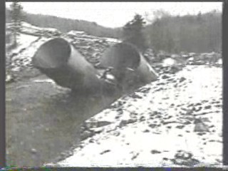
Massive flooding a few weeks earlier washed out the road (near the ski area) and bent up the ends of the culvert. It was awesome to see the results of the force of the unusual flows in this reach.
A wider-angle and downstream view of the damage done to the road and culvert (near the ski area outside of Marquette, MI) in the unusual high water flooding of a couple weeks prior.