Stonelick Creek
1. St. Rt. 131 to St. Rt. 132
Oct 31, 2006
The last rapid has evolved now into something special. The hole at the bottom now will hold boats and boaters for extended periods of time, even at medium-low flows. Get RIGHT!
Oct 23, 2006
Ran this run a few days ago after all the rain. Put on with Matt Bodecker at what we thought was a moderate level. The gauge said 4.5 feet at the bridge. Once we started it felt like 7.5 to 8.5 with river wide (HUGE) holes and screaming speed! Just a warning to anyone who wants a less exciting run! Wood free at the moment.
Sep 18, 2006
Ran on JAN-5-07 at around 3' and last rapid was mainly a series of HUGE waves with the exception of a minor breaking wave/hole midway down,BIG FUN. Ran again following day at around 1.7 or so and the last rapid was a much more technical series of continuis ledges and holes. A buddy of mine new to the sport flipped in this rapid(was in a recreational old town rush!!!) he swam a good deal of it and flushed through all the holes.
Mar 14, 2006
From an Email from Bernie Farley received 3/14/06:
We paddled Stonelick on Sunday 3/12 and there were two trees down all the way across the creek, approximately 1.5 miles downstream of the put-in. This is where the creek narrows at a bend in the river.
This can be a very dangerous situation for a group of four or more due to the lack of eddies. We had to portage 100 yards to re-enter the creek due to a cattle fence
Feb 29, 2004
A new ledge has appeared on Stonelick Creek. The last big drop on the run.
What a wild ride!
Apr 15, 2003
From an Email from Karl Whipp, received 4/15/93:
Three of us ran Stonelick at 9.5' and still rising about 2 years ago. All I can say is the following:
1. Be prepared for Mach 3 speeds as soon as you peel out of the put-in eddy and it remains that way to the take-out.
2. Good luck finding any eddys along the way. Most all eddys are moving and the vast majority of those are found behind standing trees that would normally be up on the banks.
3. Whenever you see a horizon line, HAUL ASS FOR THE EDGE OF THE RIVER. These horizon lines are uniform broken limestone ledges that form MONSTEROUS holes...comparable to Greyhound on the New at 4'+...no kidding... but they extend bank to bank. You will have about 3-4' on each side of the ledges to sneak your way past, but you will deal with another hazard within the sneaks...standing trees. We were using our hands on trees to weave our way through the forest at a couple of the ledges and at one of them, we were in such 'scramble mode' that we were grabbing at roots hanging off a high water bank to stop ourselves so we could get out with ropes for the rescue mentioned below.
After watching two guys lose their paddles and boats and after rope rescuing both of them from multiple recirculations in firgid water, we decided to walk off. This creek has SERIOUS flush drowing, strainer drowning possibilities at very high levels. It should only be run by parties of very strong boaters at these high levels.
Oct 18, 2000
runnable level on Stonelick Creek is 1.5 ft to 7 ft or maybe more. length of the run is 6 miles. the first 3 miles gradient is 30 fpm, and the second 3 miles, Stonelick Gorge, is 55 fpm. There is a description in Canoeing and Kayaking Ohio's Streams / Combs & Gillen
Jan 1, 1900
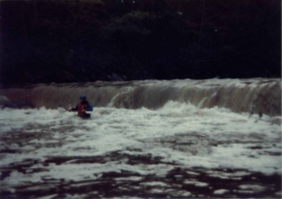
Bud Chavez drops over Johnson Falls at low water during 1984 'Rediscovery' trip on Stonelick Creek.
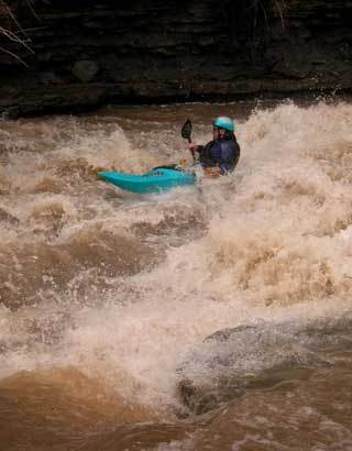
Nelson plays below one of the many ledges below Belfast bridge at low water during the 'Rediscovery' run
Jan 1, 1900
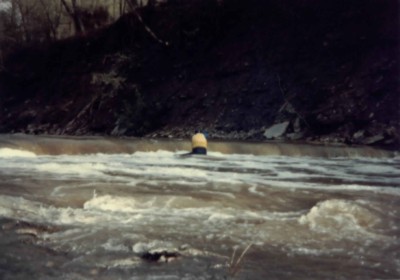
'I don't think you can get to the chute all the way across the river from here'
'Sure, no problem'
'Whoops, that current is a lot stronger than it looks!'
'Oh Crap!'
'Whew...'