Root
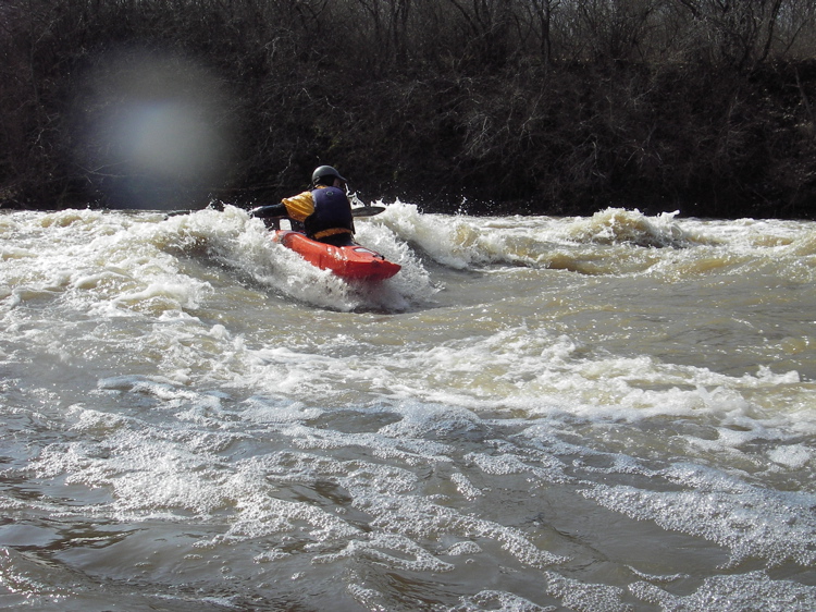
B) Horlick Dam to Quarry Park (0.2 - 0.6 mile)
Contributors
Revision Comment: replace featured image
Revision Comment: remove alert
Revision Comment: minor edit
Revision Comment: revise flow data
Revision Comment: add flow data
Revision Comment: park closed until further notice
Revision Comment: minor reformat
Revision Comment: reformat spacing broken by demotion of html formatting
Revision Comment: Minor revision
Revision Comment: updates to Description
Revision Comment: minor reformat desc
Revision Comment: updates to length,ploc,tloc,revision_comment,geom,bbox,plat,plon,tlat,tlon
Revision Comment: updates to length,skid,ploc,tloc,revision_comment,geom,bbox,plat,plon,tlat,tlon
Revision Comment: updated image position
Revision Comment: updated image position
Revision Comment: updated image position
Revision Comment: updated image position
Revision Comment: updated image position
Revision Comment: updated description
Revision Comment: updated description
Revision Comment: updated description
Revision Comment: updated stats
Revision Comment: updated image position
Revision Comment: remove table from gauge description, putting info into simple statement/paragraph form.
Revision Comment: cleanup some typos.
Revision Comment: Additional gauge analysis.
Revision Comment: Minor format changes; add recalc for CPM.
Revision Comment: Remove flood info; redo/enhance a few features descriptions.
Revision Comment: Minor changes to description.
Revision Comment: Add warning about new fence and increased trespass enforcement.
Revision Comment: Fix/remove broken links.
Revision Comment: Adjust features lat/lng coords
Revision Comment: Bring min/max and text into agreement.