Menomonee
C) MenTosa: Hart Park Lane to W.Monarch Place or 4198 W.St.Paul Avenue (2.7 or 3.7 miles)
Construction (affecting the river downstream of Hawley Road for most of 2025) seems to be proceeding awfully slowly. All river-right work is done, but river-left work continues in the lower parts of this area.
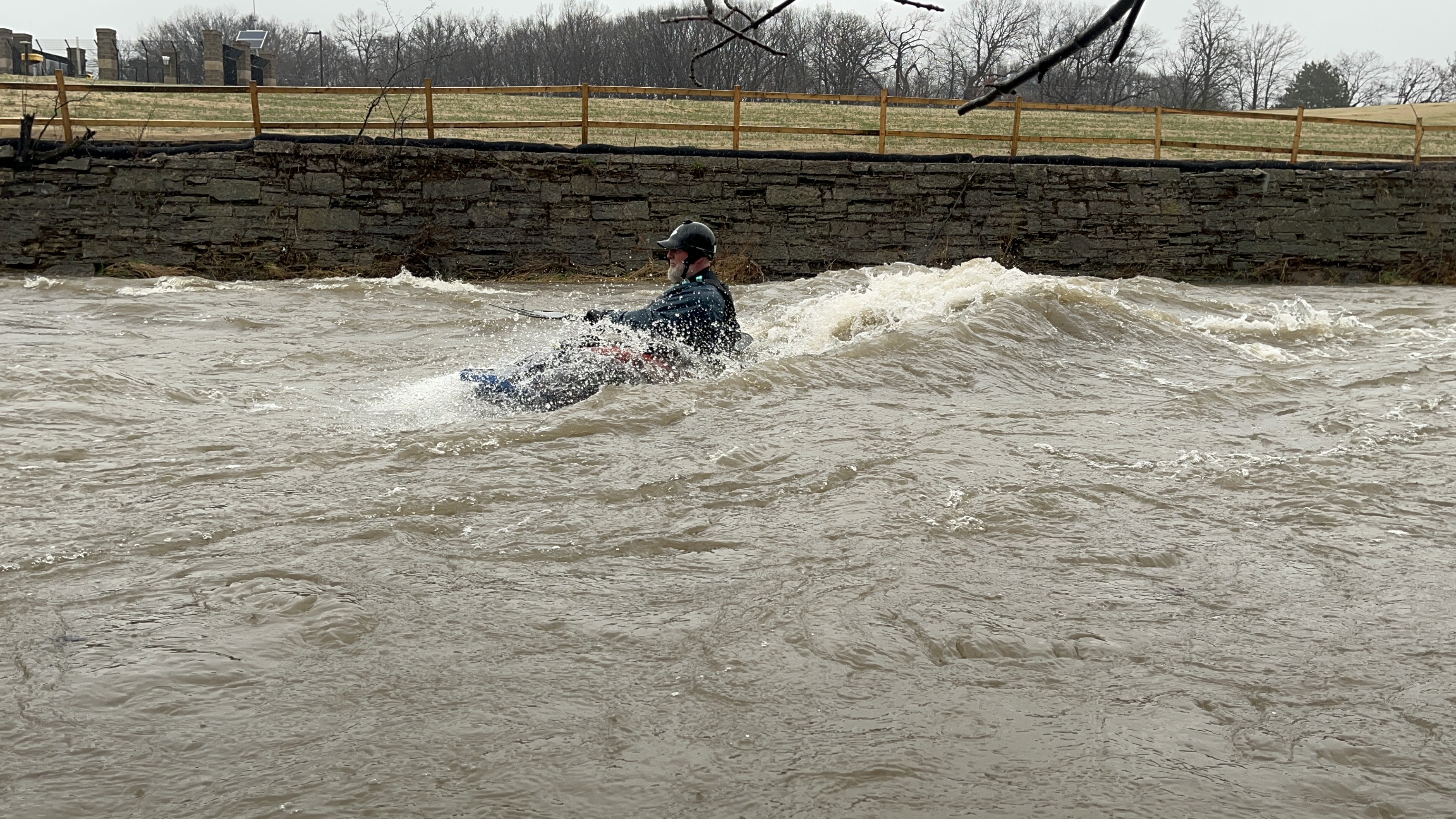
Cement barriers form a temporary diversion at river-left, narrowing the stream for about 0.1 mile, and creating a few features which are likely to exist only while those temporary barriers are in place. The construction has not interfered with boatability, and this section now retains playability as low as 120 cfs!
IMPORTANT NOTE: If doing the full listed run, there is presently a HUGE tree blocking the whole width of the channel just around the first bend in Hart Park. At low flows, it is easy to pass under the trunk (to the left). At moderate to high flows (until this gets swept aside), it is likely to require a portage! OR, better choice (at higher flows) may be to put in below it, using Hart Park access instead of the Red Store Lot access.
Construction is likely to affect the main stretch of this river for most of 2025.
In addition to the 'upshore' work to create a berm and levee along State Street (largely complete as of spring, 2025), there is ongoing shoreline work.
To facilitate this work, starting immediately downstream of Hawley Road, cement barriers form a temporary diversion at river-left, narrowing the stream for about 0.2 miles. Nearly as soon as that ends, a similar barrier river-right narrows the stream again where the vertical stonework walls are being replaced by huge quarried blocks to create a stepped shore river-right.
The river has remained boatable through here (when flows allow), but features are considerably changed during this construction.
Downstream, as you approach the Stadium Freeway (Hwy.175) high overhead, piles of gravel and rubble flank the flow (and are being eroded each highwater event), changing the area of gravel bar which has long existed here.
There are two spots on this run which are highly prone to catching LARGE trees and branches, forming strainers which can span most (or all) of the river. I believe county or municipality crews (or private individuals?) may periodically clear major snags, but new snags are likely during and after every high-water event. Caution (and scouting while setting shuttle) is always advised.
\\\**************************************************************************************************************************************************************
The first common location for snags is against a midstream pier for the pedestrian bridge in 'downtown' Wauwatosa (the bridge used to be part of Harwood Avenue before it was converted to pedestrian use only).
\\\**************************************************************************************************************************************************************
The second location is at Jacobus Park where (for years) two bridge piers split the river into three channels. HOWEVER, in May of 2020, with a major accumulation of wood on them, a high-water event ripped the right pier off its footing! Some of footing remains in place, causing a minor disturbance at levels under 700 cfs. The (mostly intact) pier lies in the pool just below where it once stood. As with the footing, this will be visible at low flows, but will be covered at flows above 700-1000 cfs.
The left pier has a gravel-bar island (with trees) upstream of it, so it is considerably less likely to catch and hold any wood. It is still worth a look at this spot to see whether a good wave exists (at the flows you will have when you paddle the river) and to see how the current is ripping through the pool (thus what sort of swirls, boils, and eddies exist).
\\\**************************************************************************************************************************************************************
Current heading into both of these areas will be fairly swift (at best boatable flows) so you will have to be looking well downstream and planning ahead to safely navigate these area if snags are present.
\\\**************************************************************************************************************************************************************
Again, the best advice is to scout both of these locations while driving shuttle, before putting on upstream! Make certain you have adequate passage (and adequate skills) to get safely around (and to know which direction you can get around) or get safely ashore before these locations if need be.
As mentioned in the full write-up, at times of unusually heavy rains, this section of river may suffer from Combined Sewer Overflow (CSO). It is recommended that you check the MMSD website *****************************************************************************************************************************************************************
https://www.mmsd.com/about-us/weather-center *****************************************************************************************************************************************************************
for conditions before running this reach when there have been heavy rains, then decide for yourself if you wish to risk boating in the (diluted) sewage affecting this river. Areas affected should generally be clear (of the bulk of that specific contamination) a day or so after the CSO ends. After such time passes, however, this reach will be either at moderate flows or perhaps even too low to bother to run!
NOTICE: this alert does not affect this specific stretch of river, but affects the next stretch upstream. Anyone extending their run (by doing 'MenWesTosa' or doing Underwood Creek into the Menomonee River) will be affected. *****************************************************************************************************************************************************************
There is a bridge for the golf course just downstream of the confluence of Underwood Creek and the Menomonee River (just downstream of North Avenue, just east of Mayfair Mall). At low-to-moderate flows (perhaps up to 1,000 cfs), this will easily allow passage under. Around 1500 to maybe 1800 cfs, limber boaters (laying against the deck of a small kayak) can get under -- canoes will likely not pass! There is a river-right eddy (perilously close to the bridge) to get out to portage At high flows (somewhere over 2000-3000 cfs) water will flow over the bridge, but some flows may create a wicked pourover/hole. The bridge deck is flat concrete with a short 'lip' on either edge and no side-rails).
No articles