| Difficulty | V |
| Length | 21 mi |
| Avg Gradient | 110 fpm |
| Permit | No permit needed. |
| Gauge | Rubicon River Above Ellicott's Crossing |
| Flow Rate as of 189 days | 241 cfsstale data |
| Reach Info Last Updated | July 13, 2026 |
Summary:
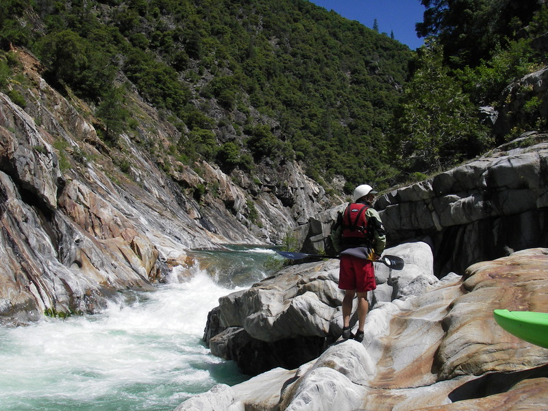
The Rubicon is a World Class Overnight Wilderness Run. It only runs in high water years when Hell Hole dam spills water (AW currently in negotiations w/ PCWA Relicensing). On top of that the put-in road is typically snowed in when there is water in the riverbed. It takes a well above average snowpack year to find both the road open and water n the river. This doesn’t happen often so when it does, prioritize it- it’s worth it. There is a bit of warm up but then the action doesn’t stop until the take-out, 20 miles later. In the last decade the river has gotten more challenge as willows have grown on the banks, blocking both eddies and boat scouting.
Character:
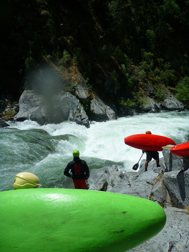
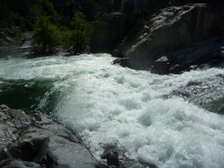
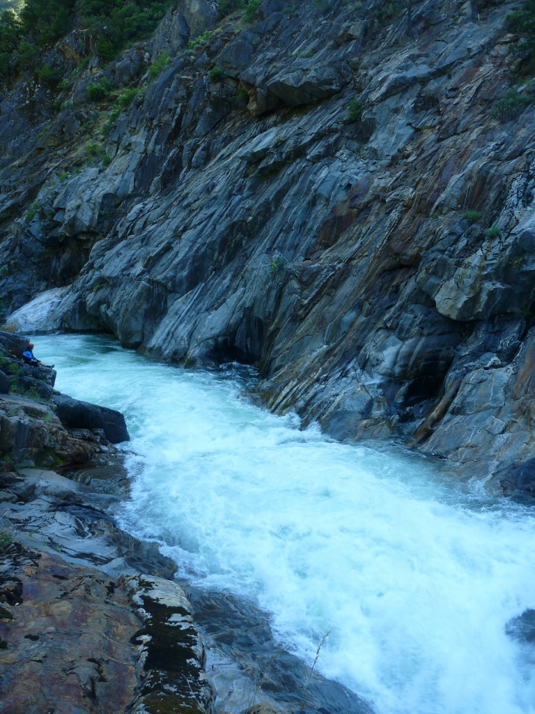
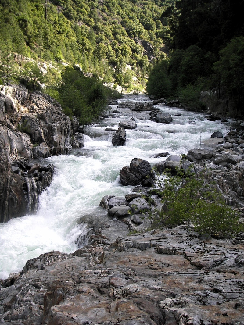
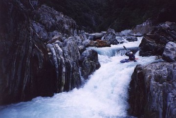
Miles upon miles of countless IV+/V multi-move boulder gardens, interspersed with some quality bedrock. Most all of the rapids are long and continuous but most can be boat scouted and have decent recovery pools.
If you would be comfortable leading yourself down 49-bridgeport on the S Yuba at or Middle Fork Feather for the first time with one showing you the lines, at similar difficulty flows, you should like the Rubicon.
Average gradient of 108 FPM, Max of 150 -- Surprisingly and pleasantly consistent.
A solid crew of class V boaters should budget ~6-8 hours of moving time on the water for each day, ~4-6 hours a day if someone knows the run.
Flows: (see gauge description for great detail)
The Rubicon seldom has boatable flows because there are several different reservoirs belonging to different projects that each take water out of the Rubicon basin and send it to the SF or MF American rivers.
As estimated at takeout:
600-1000: V-. Optimum flows for V- boaters = 800
1000-1500: V. Optimum flows for V boaters =1100
1500+: V+
Note 1: Two significant tributaries (Pilot Creek and Longs Creek) join the Rubicon ~4-5 miles upstream of the takeout and can significantly add to flow i
...
This is the usual put in spot. PCWA now has a flow gauge at this bridge, but it is not yet online. Boaters could also put in 8.6 river miles upstream at the dam.
Depending on flows, portage right, or sneak right, or go big on the left.
Pilot creek enters from the left and may have a good flow in the winter and early spring.
Topo maps show a trail coming a short ways from a road down to the Rubicon here. This could provide access for a short 4.7 mile boating trip from Pilot Creek to Ralston.
Long Canyon Creek comes in from the right and can bring increased flow, especially in the winter.
The road comes close to the river just upstream of a powerhouse.
Jul 6, 2011
Slide w/ Hole + Ledge w/ hole. Intimidating and hard to portage. Most groups find that running this rapid is much better than the portage. Right/Right is the recommended line.