Tuckasegee, East Fork
1. Greenland/Panthertown Creek confluence to Rock Bridge Rd.(Panthertown)
| Difficulty | IV-V |
| Length | 4.3 mi |
| Avg Gradient | n/a |
| Reach Info Last Updated | January 12, 2026 |
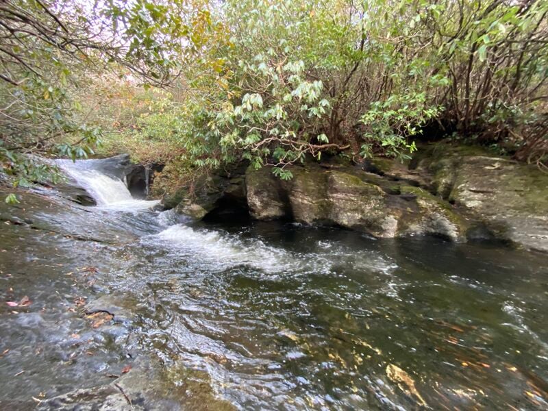
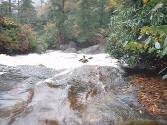
The East Fork of the Tuckasegee or more commonly known as Panthertown is often overlooked, simply because of the fact that it is located amidst such a plethora of whitewater options. Combined with the run being of an easier nature than the nearby Jocassee runs & having a winding maze of trails makes for complicated access, this is a hidden gem you won’t want to miss.
This makes for a pristine ride through one of the most unique areas in the south. Starting at around 3700 feet, the river winds through a high altitude marsh land, which is surrounded by massive granite domes. The water quality is a superb & tannic bronze. The flora is delicate, impressive & endangered.
It is highly recommended that you study a trail map before embarking from the car as there are many winding trails.
There is no gauge for this river but expect around 2in the night before to get this running. The river at the takeout should look a little scrappy. If it is high here then the main portion will be roaring upstream. If the NFFB is in then Panthertown is likely to be in as well.
Access
There are two ways to start this run. The first & less common option is to put in on Panthertown Creek. The more common put in is on Greenland Creek. Both of these creeks eventually form the East Fork of the Tuckasegee River. Both routes involve a hike in of approximately .80-1.4 miles. Expect a shuttle of 30-40 minutes. The take out situation is a little complicated. It is small with only enough room for 2-3 cars at best & near private property. The takeout is off of Canada Rd as it turns over the river to Rock Bridge Rd. Make sure you don’t block the bridge & there shouldn’t be issues. However there are more pull offs further down the road but you’ll have to carry your boat to them. Please note that the rapid desciptions below reflect the Greenland Creek to Tuckasegee run. The only true rapid of significance on the Panthertown Creek
...
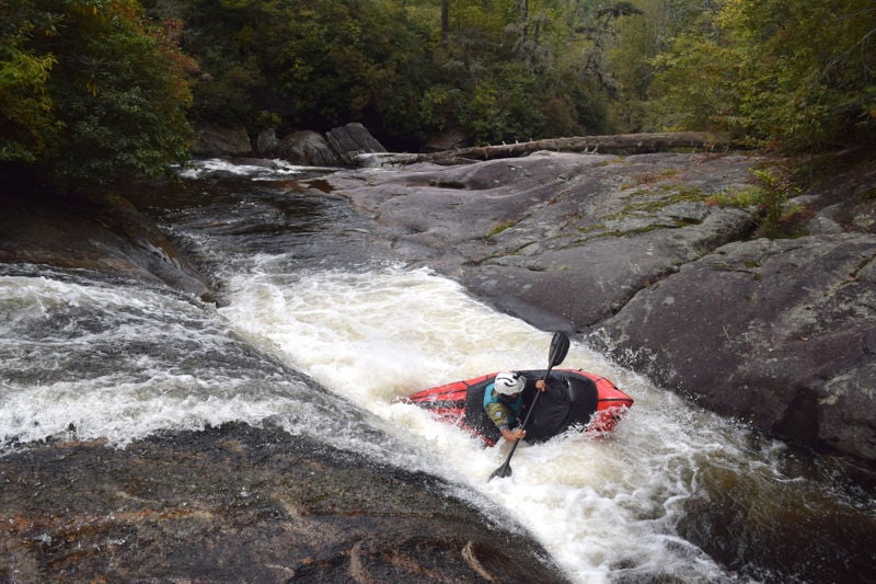
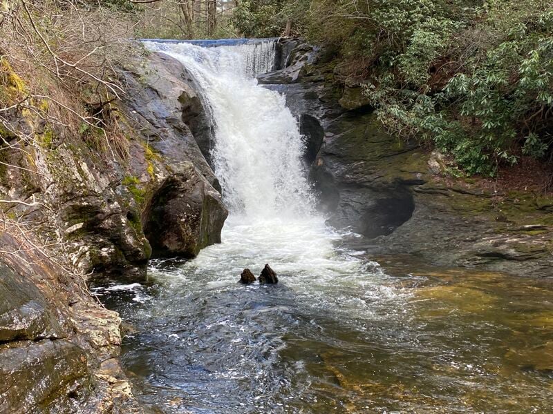
About a 6ft drop of a waterfall. Can run center with a good boof.
Get far right & ride the flow. As you near the drop center up & take a good boof.
A 20-25ft drop onto a shelf. Make sure the landing is padded out before running. If you are able to run this then you will know how to pick the right line. Can be scouted or portaged on river right.
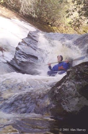
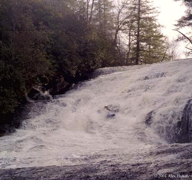
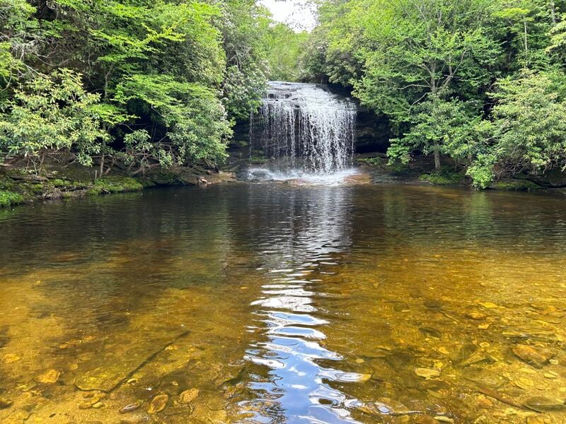
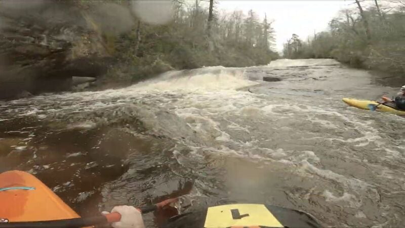
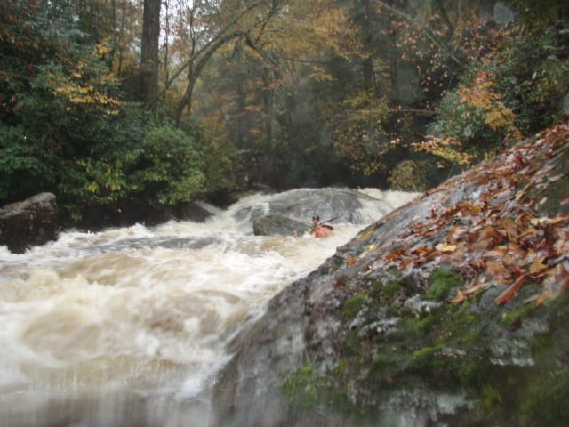
After some flat water paddle you should spot a large horizon line. This is Wardens Falls which is a 45-50ft slide with lots of speed. Slide down middle right, about 3-5ft off the right wall. Not much danger unless you are too far left which is more vertical & lands on a shelf.
This one is pretty straightforward, but at higher water levels a nasty hole develops. A few small sloping ledges start at the top of the falls. Near the bottom there is a kicker you can aim for. Easy to run laps on, hike up on river left to reset.
Smallest of the slides. Can start either left or right. Left side has a hole at higher flows that should be boofed. Near the bottom the river will turn to the left. Just choose to go either left or right of the rock in the middle. Scout river right.
This is a simple sliding drop of 6 feet into a wall and then turning 90 degrees to the left. The wall creates a terminal hydraulic at moderate and higher flows. Can start right driving left & then take a good boof to avoid getting stuck in the hole.
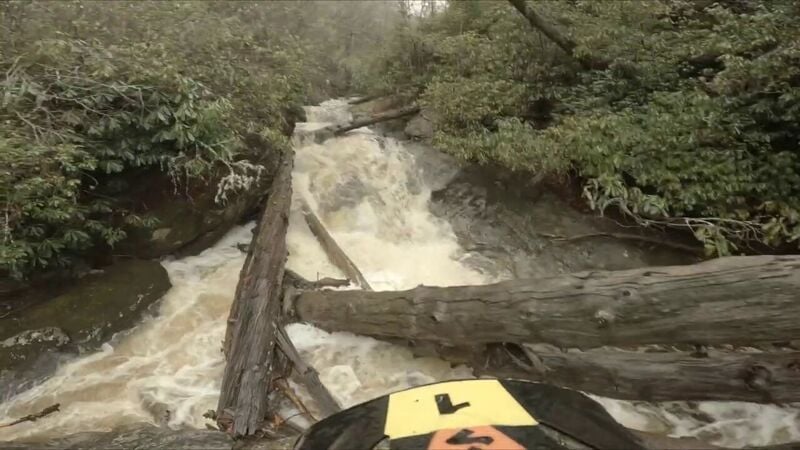
As of 2025 there is a river wide strainer across this rapid. Portage on the right.
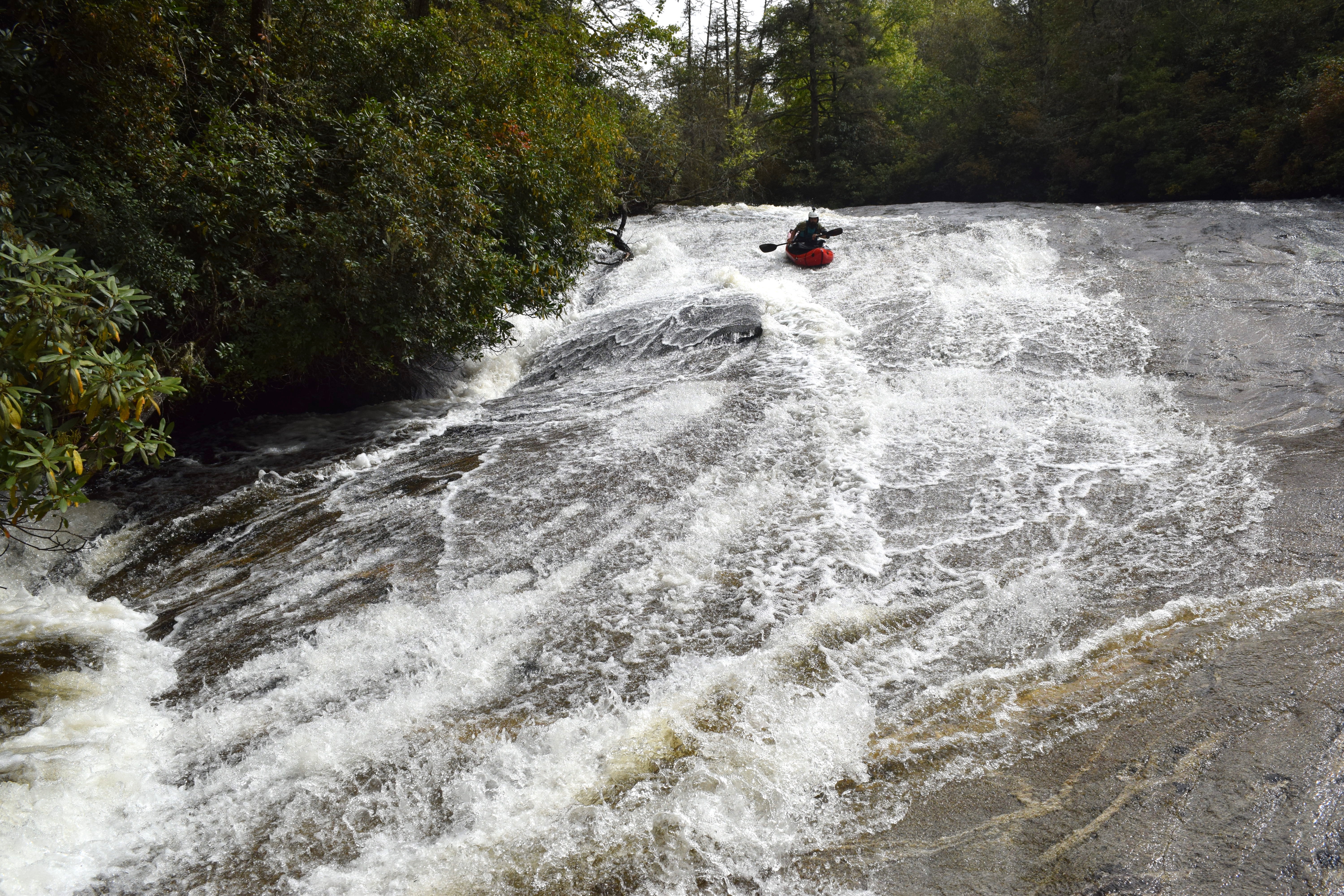
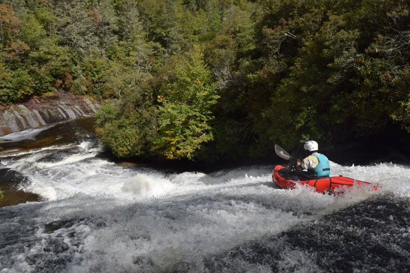
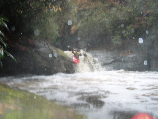
Dumping the boater into the rugged Devil's Elbow stretch of the river, this is the longest slide and is alot of fun. The top is low angle but builds into a second drop of 10 feet sliding into a monster hole at high water. Use the curlers to drive to the left side at the bottom.
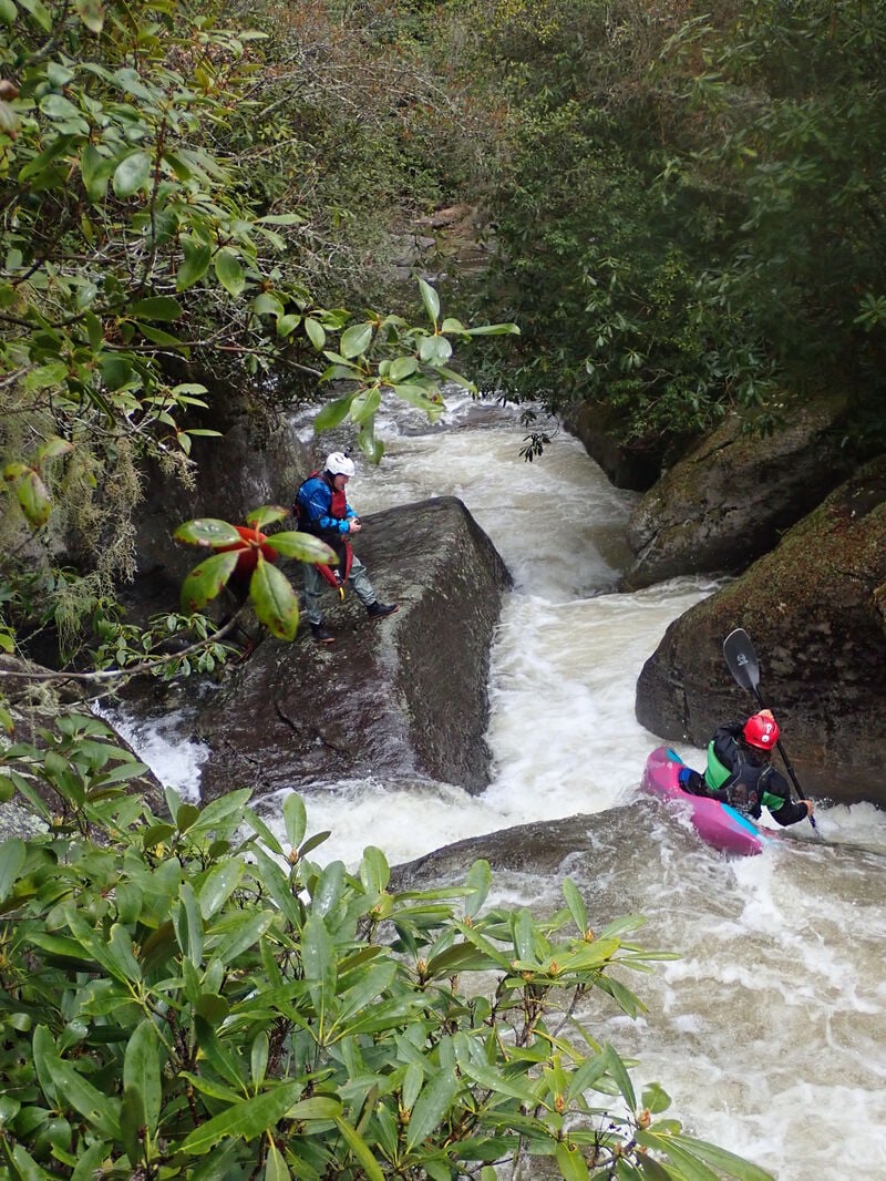
This rapid marks the beginning of boulders that have fallen from high. A tight undercut slot move leads into a tricky approach to a drop with a nasty boxed in hole on the right & a tight sneak on the left. Right at the crux is a cascade called Lichen Falls comes in on the left, increasing the aesthetics of the rapid. Easy portage on river left if needed as wood is often gathered here.
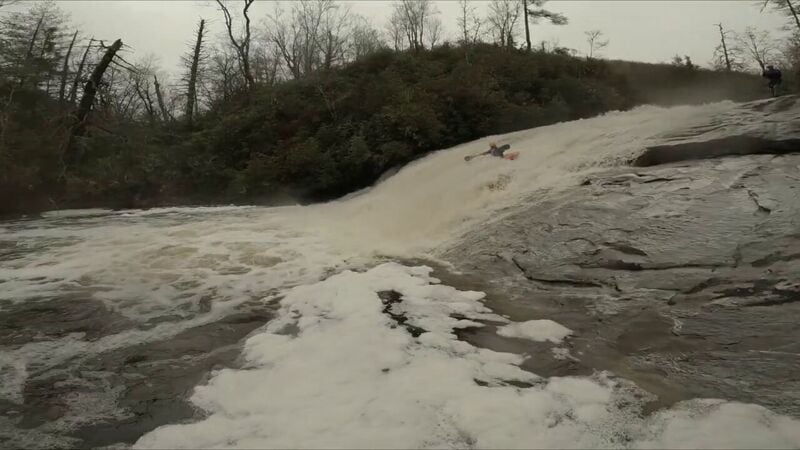
The river will turn & go over some domed bedrock. A powerful hole that has been known to carwheel creek boats develops on the left. Either stay high on the dome in the center or right. Eddy out as soon as you can because Plinko is just downstream.
Plinko itself is a death trap full of logs & sieves. Some of the upper drops can be run safely but you need to know where your eddy service is to portage the lower half. I'd guess the upper ledges are class IV but with class VI consequences.
Several portage 'trails' are here. Easiest seems to be on river left. You should be in eye shot of the river...if you aren't you've gone up too high.
NOTE: The river corridor is private property below Plinko. Enjoy the river accordingly and respect private lands.
Boof right through the slot dropping around 6 feet. The slot & pool level have risen due to numberous logs clogging the slot. Keep the bow up, speed up & momentum forward. Smile.
Park along Canada Rd just upstream of Rock Bridge Rd & take out on river right. There is a 60 foot NCDOT easement on both roads that paddlers should stay within, as this area is posted private property. Other pull outs are further down the road.
If you know where to find this then you'll probably know how to run it. A double boof of about 20-25ft.
Dec 10, 2023
The online Toxaway/Rosman gauge was reading 4.42ft. Burrell's Ford was 981cfs. Had a pretty solid rain in the days leading up so the region was primed. All the falls went great. Warden Falls more bark than bite, really fast. After we got to Plinko we portaged on a goat trail river left. If you can find the path its pretty clean. Alot of fun to be had on this one & hope to do it again someday.
Mar 29, 2021
Ran on 3/27/21 No idea the level because the gauge at rock bridge is out but I'd say it was the low side of good. All the slides are tons of fun! The cascade section has manageable drops but I wouldn't want to mess them up, sieve central in there. we portaged I think 4 times. All rapids and wood were noticeable. All the slides and the first cascade section where Lichen Falls come in from the left had no wood on this day. We portage right around the big log jam I believe is known as 'Plinko'. Scouting and portaging on this section is a workout. Eat your Wheaties!