| Difficulty | II(III) |
| Length | 5.6 mi |
| Avg Gradient | n/a |
| Gauge | Fall Creek Blw Winberry Creek, Near Fall Creek, or |
| Flow Rate as of 25 minutes | 235 cfsbelow recommended |
| Reach Info Last Updated | October 26, 2022 |
River Description
Background
Pacific lamprey have been translocated to Upper Fall Creek for several years in a partnership with the Confederated Tribes of Grand Ronde and ODFW. When the juvenile lamprey, called ammocetes, leave the spawning beds they work their way downstream to fall creek reservoir and bury themselves in the mud for several years. When they emerge from the mud coinciding with the fall rains, they’re developed into a stage called macrothalmia, and are ready to head to the ocean. To facilitate the out-migration of these juvenile lamprey on their way to the ocean, the Army Corps provides high flow releases as part of their fall draw down of the reservoir to help flush the lamprey out of the reservoir and down to the willamette. These high flow rates provide a few days, to a week or two, of paddling each fall for the Lower Fall Creek reach. This often happens before other watersheds have filled in with fall rains. Fall Creek will also run with heavy rains, although since the run begins below the dam, it is highly dependent upon the Army Corps operations to hold or release water during rain events. The gauge is very accurate.
Put-In & Takeout
Put-in: There are a few different spots to put in near the base of Fall Creek Dam. You can park in a highly visible spot and put in below where big fall creek road crosses the river. Or, you can cross the river on Big Fall Creek road, take the first right and park at the USACE park. There are bathroom facilities here and a nice parking area, and you get another 100 yards of good whitewater. But the parking is secluded. Park at your own risk.
Take-out: You can run Lower Fall Creek all the way to the confluence with the Middle Fork Willamette and take out at a number of locations downstream depending on what kind of day you're looking to have. Jasper is a popular spot. If you're looking for a shorter run, take out under the Pengra Road Bridge a
...River Features
Put In
Access PointDistance: 0 mi
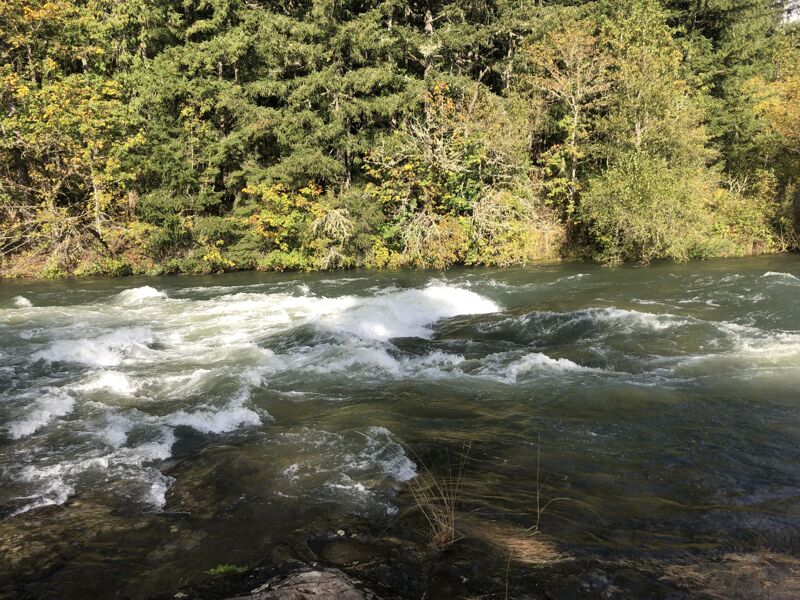
This surf wave/ ledge is visible on your shuttle. Just 0.5 miles downstream of the put-in
Take Out
Access PointDistance: 5 mi
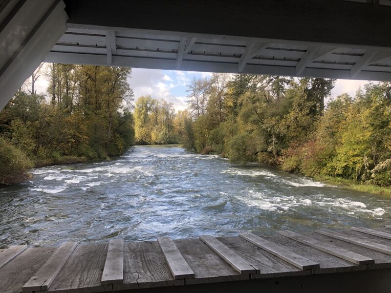
The last rapid before the takeout you can scout on your shuttle up by looking out the window on the covered bridge above it.