Potato
A) Upson Falls to Foster Falls (Sullivan Rd) (2.5 or 7.2 miles)
| Difficulty | II-III(IV) |
| Length | 6.9 mi |
| Avg Gradient | 27 fpm |
| Gauge | Potato@hwy.169 |
| Flow Rate as of 54 minutes | 14 cfsbelow recommended |
| Reach Info Last Updated | May 18, 2022 |
Boaters may wish to split this run into a short run of the upper 2.5 miles, then shuttle down to 'park-and-huck' the final listed sequence (about 0.5-0.7 mile).
Bryan Foster provides (2014-04-29):
Ran this on 4/27/2014. Level was 742cfs and falling on the Hwy.169 virtual gauge. The level was measured at 76.5' on the put in culvert at Hwy.77. Levels in the range of 742cfs to 830 cfs were perfect for running Hwy.77 to Upson Lake Road. I would guess that below 400 or 500cfs would make this run too low.
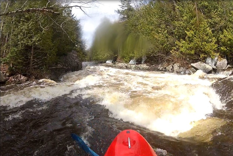
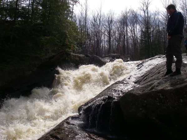
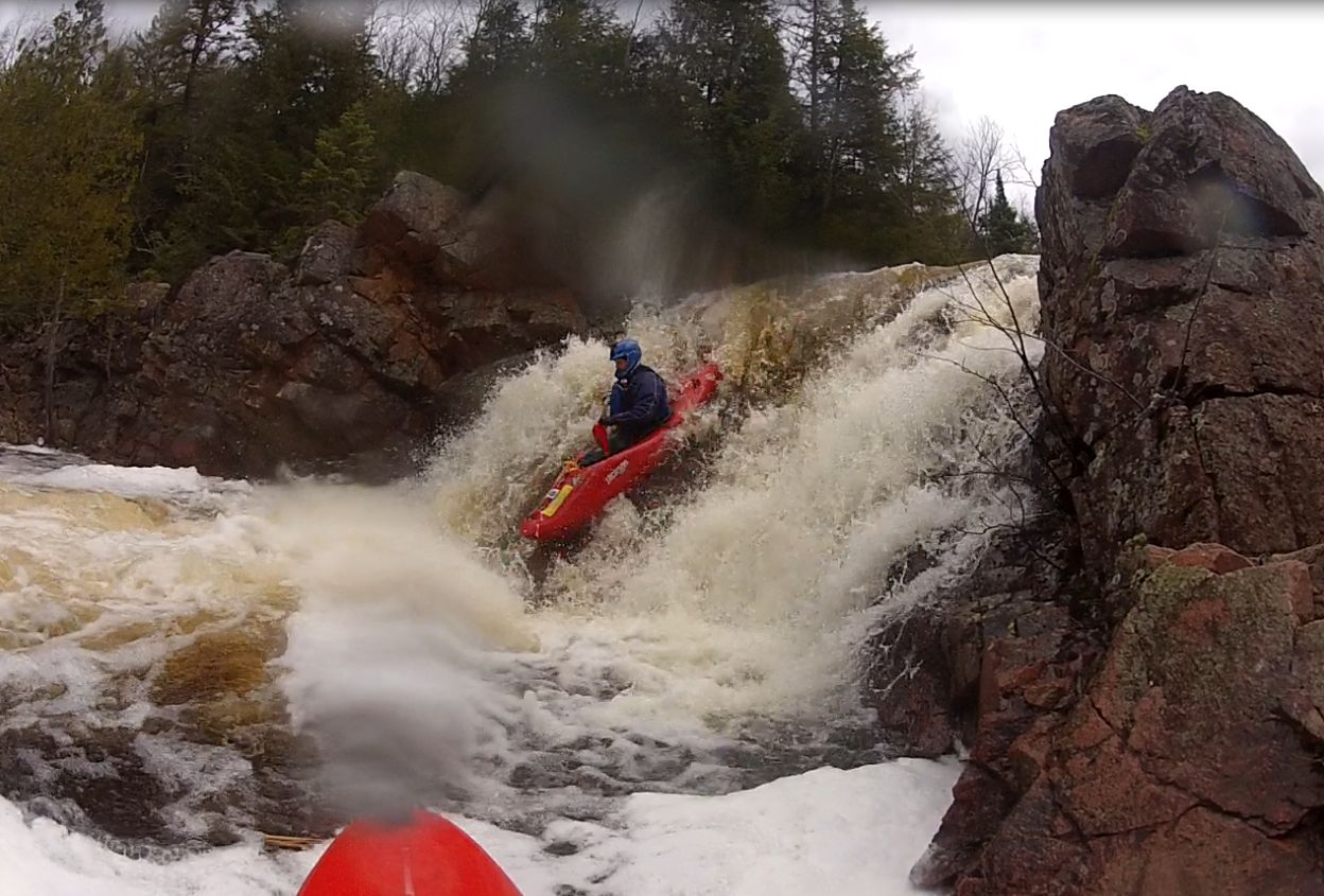
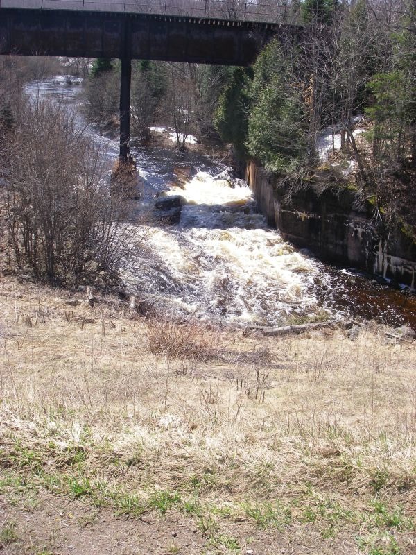
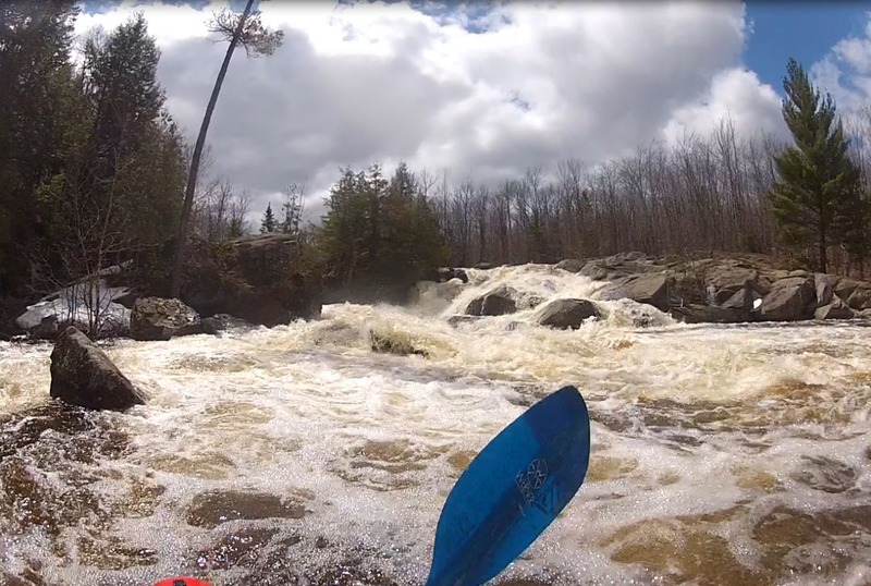
The first main rapid is Upson Falls. You can scout this from the Park along trails in the woods. If you decided to run the falls, put in at Hwy.77, otherwise you can put in at the park. The falls consists of three drops. The first drop is about 5 to 6 feet and has a stair step in it. The river right side formed a decent hole at our level, so we ran a seam in the center. Scott pitoned on a line that went down one of the stair steps. The 2nd drop is larger, at about 10ft. We ran this on river right (you can see the line in the photo). The 3rd drop is only a few feet and has a few lines.
After Upson Park Road, the river has a nice class II Brunsweiler feel until a first ledge of about 4ft. There is a large rock in the middle and either side was runnable. Shortly after is the second ledge of about 4ft. We were able to run this anywhere, but some holes will most likely form at higher levels. River right is a safe slide.
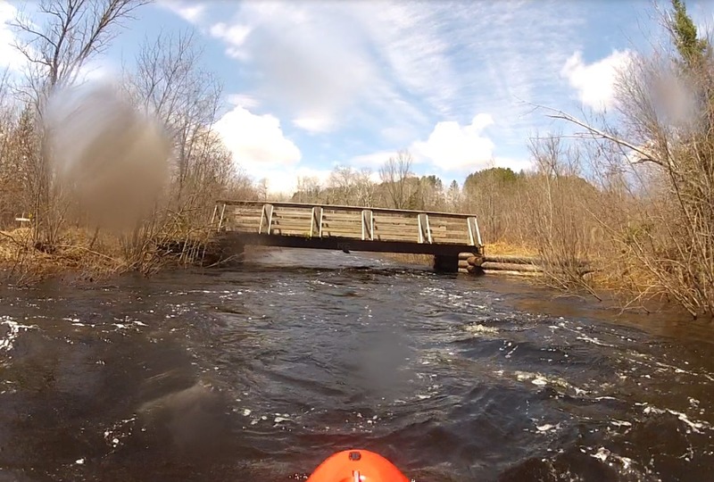
At about 1.1 miles there's a rapid with a curving wave train down the left side of the river. This and the rest of the rapids down to the ATV bridge at Upson Lake Road were 'read-and-run'. We took out at the ATV bridge on Upson Lake Road, where there is a parking for about 2 cars. Sullivan Road was still snowed in (being a fire lane, it is not plowed in the winter).
Bryan Foster further provided (2014-05-09):
Ran again on 5-3-2014. Level was 830cfs and falling on the Hwy.169 virtual gauge. The level was measured at
...
Some boaters may wish to carry upstream of Hwy.77 to run a rapids under the railroad trestle, and then head through one of the two box-culverts under Hwy.77. Reportedly the put-in to do so is 'not ideal'.

USGS lists a sampling site right at our listed put-in citing drainage area of 22 square miles. USGS gauge lists drainage area of 91.46 square miles. Thus, flow here might be about 1/4th that gauge reading. (Gauge will almost certainly lag both on rise and fall.)
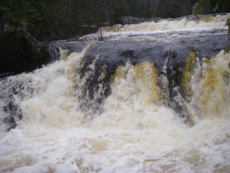
Upson Falls consists of three drops. The first drop is about 5 to 6 feet and has a stair step in it (which has piton potential). The river-right side may form a decent hole, so look for a seam in the center. The 2nd drop is larger, at about 10ft. The 3rd drop is small at only a few feet.
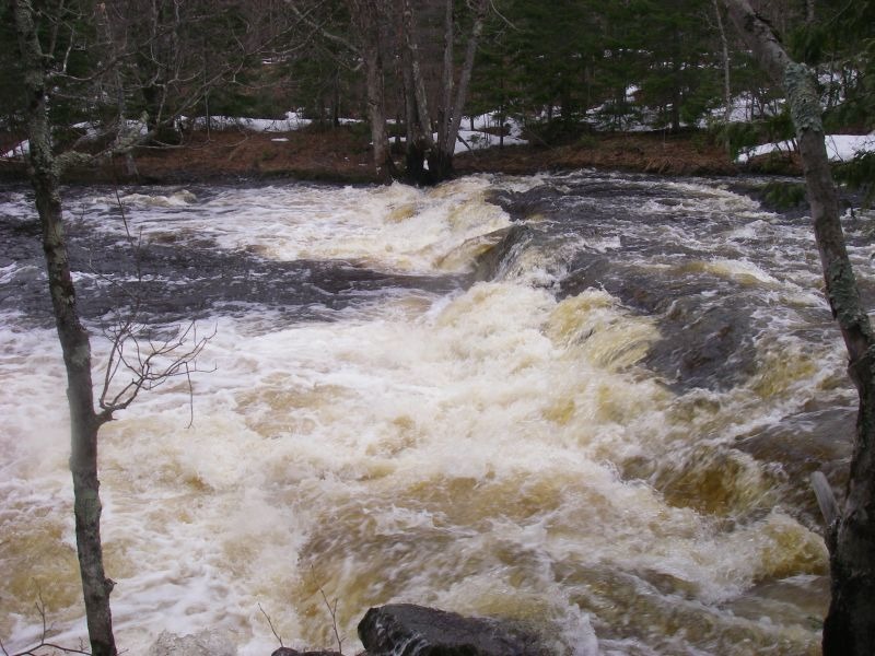
After Upson Park Road, the river has a nice class II Brunsweiler feel until the first ledge after Upson Falls of about 4'. There is a large rock in the middle and either side is runnable.
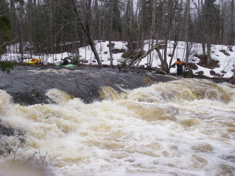
A second ledge of about 4' can be run anywhere, but some holes will most likely form at higher levels. River right is a safe slide.
There are only 2 class II boulder beds from Upson Lake Road to Foster Falls, so boaters may wish to skip nearly four miles of uninteresting water by taking out here, and driving down to run the final stretch of rapids as a separate 'park-and-huck' sequence.
Most will likely portage this at most flows!
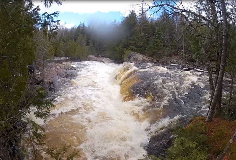
There is a second set of falls below Foster Falls. This is the upper with the drop of about 8ft onto a perpendicular current.

A split drop with a nice drop/steep slide on the left and drop with a hole on the right.
Apr 7, 2020
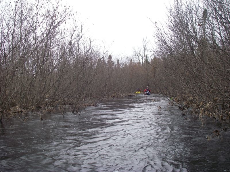
Paddled on 4/4/20 with a gauge reading of 900cfs. A fun creeky ricer without too much wood currently. Note that below the posted 'TREE COVERED LEDGE?' and after the cabin RL it is hard to find the main river channel. We got a bit lost NE of the main river after it swings West with the confluence of Alder Creek. Had to tromp around in alders and ended up attaining back up to the cabin to find the main flow.
May 23, 2014
I ran Foster Falls at 246cfs on the virtual gauge. There were a few concerns for us. The right side of the main drop had a spine of rocks down the slide and an undercut at the bottom. Middle/left offered a bumpy ride into a flushy hole at the bottom. The main part starts with a spine wave on a rocky lip that drops about 5 ft onto a slide of about 20ft long into a final hole at the bottom.
The far right of foster falls was a double drop, did not inspect the landings.
May 17, 2014
Ran Foster falls when gauge was at 246cfs